|
SEASON WILL END WITHOUT ANY ISSUES FROM THE TROPICS We are almost done with the 2008 Atlantic hurricane season. After 16 named storms, half of which became hurricanes, it has been very busy to say the least. Cuba and Hispaniola took the brunt of this season's activity with much destruction and loss of life- especially in Haiti. Ike was the big news for the United States and folks in SW Louisiana and the upper Texas coast will be dealing with the aftermath for years to come. I am working on the seasonal DVD which will reflect back on the season's activity as seen from our point of view. For those of who have ordered a copy, it will ship on December 10th. If you are looking for a different and unique Christmas present, we will have not only the 2008 DVD but a special package with all three of our DVDs dating back to 2004. The "Tracking the Hurricanes Trilogy" will consist of the 2004, 2005 and 2008 DVD sets with a bonus disk to boot! That disk will contain special features such as early video from our work- even back before I began HurricaneTrack.com. This special 4-disk collection will be available for shipping also on December 10th and will be in limited supply. I'll post a link and an advertisement soon for this special edition. After another long season with much uncertainty weaved in among the hurricane threats (economy, gas prices, etc.) I am glad it is all wrapping up. Once I am done with the DVD, I'll take some time to begin thinking about plans for 2009. Our work will continue thanks in large part to our wonderful members who invested their time and money in to our Premium Services content. We still have improvements to make and look forward to being back next season with the best hurricane news and information that we can provide. As always, remember that we are only one portal of info on the Internet. There are many excellent sites for learning about hurricanes and gaining the most up to date information possible. We try to make sure we promote these sites as often as possible since the end result should always be a better educated audience. Next year, we turn 10 years old. It all began in 1999 and we will continue to forge ahead with our little corner of the weather world on the 'Net. During the months ahead, I will post news and updates concerning hurricanes and what may lie ahead for 2009. In the meantime, have a safe and wonderful Thanksgiving. I'll post more here next week including a link to the new 4-disk DVD collection. UPDATED: 9:00 am EST, November 24, 2008 INTERESTING SYSTEM IN EXTREME SW CARIBBEAN With only days remaining in the hurricane season we are watching an interesting area of showers and thunderstorms tucked way down in the SW Caribbean Sea. The NHC is obviously monitoring it too and gives it a medium chance of development on their scale. The computer models seem split on whether or not this will develop further- some show it doing so, others do not. A lot will depend on whether it can stay out over water as right now, it is situated quite close to Central America. As is typical with these types of systems, heavy rains will be the big concern for the region and the slow moving nature of this one could lead to quite a bit of rain fall. We'll watch it and will discuss it during tomorrow night's program- our last HurricaneTrack News/Talk for 2008. More on that below... UPDATED: 8:55 am EST, November 24, 2008 TOMORROW NIGHT: OUR LAST HURRICANETRACK NEWS/TALK PROGRAM FOR THE SEASON Before you hit the road to do some Thanksgiving traveling, join us at 9pm ET for one last edition of HurricaneTrack News/Talk for 2008. We will do a brief re-cap of the 2008 hurricane season and look ahead to what we might expect for 2009 (not a prediction but more of an overview of conditions to look for before the season begins). We will then have a very special guest on with us. His name is Mark Garcia. He lives in Galveston, Texas and we interviewed him right after hurricane Ike impacted the city. In fact, Mark helped us to change out a tire on our cargo trailer- that's how we met him. It turns out he did everything that he should have done to prepare for Ike and his house was flooded with 6 feet of water. He has flood insurance and was prepared with food, water and had a plan as to where to go, etc. Since Ike, he has dealt with the frustrations of gaining temporary housing and has some excellent points to bring up with us during the program. For anyone who has been through a disaster like this, they know all too well how long the process of recovery can take. It changes everything and for Mark and his family, life will not be the same again for a long, long time. We'll talk to him LIVE during the show and hope that you will tune in for a very personal perspective from someone who is still very much living the aftermath of Ike. We'll also answer emails- so if you have a question or comment ahead of time, send it to: newstalk@hurricanetrack.com and we'll do our best to answer during the program. That's tomorrow night, 9pm ET right here on the homepage. All you have to do is visit the page and the show will play automatically. UPDATED: 9:30 am EST, November 18, 2008 JOIN US NEXT WEEK FOR OUR LAST HURRICANETRACK NEWS/TALK PROGRAM FOR THE YEAR Next Tuesday night we will have one last edition of HurricaneTrack News/Talk for 2008. We began the program back in March and have had several episodes since then with many great guests. Next week, we will conclude the 2008 hurricane season with a final program beginning at 9pm ET right here on the homepage. Mike, Jesse and I will re-cap the season and have a very special guest on with us as well. We will also answer emails from you so if you have a question for us, feel free to send it to newstalk@hurricanetrack.com and we'll do our best to get to it during next week's program. I'll go over more details of the show later in the week. The tropics, of course, are not an issue right now with only limited areas of deep thunderstorms mainly over the SW Caribbean Sea. UPDATED: 11:55 am EST, November 11, 2008 REMNANTS OF PALOMA STILL SEEN IN SATELLITE IMAGES What was once a record-setting category four hurricane is now just a swirl of low clouds. You can see the remnants of Paloma by clicking here. The low level circulation is moving back inland over southeast Cuba and even though it is easy to spot, there is virtually no chance of it making any significant comeback. This should just about do it for this hurricane season in terms of threats to land areas. I would not be surprised to see another sub-tropical storm form somewhere over the open Atlantic between now and the end of December, even though the hurricane season officially ends at the end of this month. It has been a very busy season and I believe that if it weren't for the economic woes or the election that hurricanes would have once again dominated the headlines- a lot longer than they did. Between Gustav and Ike, Fay's relentless rains over Florida and Dolly's impact on south Texas, this has been a deadly and destructive season for the U.S. and even more so for areas such as Haiti and Cuba. With our busy lives and fast moving news cycles, hurricanes seem to fade from our memories fairly quickly- except for those who have had to endure them personally. For now, all is quiet again in the tropics and it looks to remain that way for a long time to come. I'll post more here throughout the coming days and weeks regarding the season and what we learned and observed as well as our plans for 2009. UPDATED: 8:50 pm EST, November 8, 2008 PALOMA NOW INLAND OVER CUBA- SO WHAT'S NEXT? We will not know for a day or more how the towns and villages along the coast of Cuba dealt with hurricane Paloma. It was a record-setting hurricane that capped off another extraordinary season. So now that the hurricane has made landfall, what happens next? Most of the computer models show the remnants of Paloma drifting around within 300 miles of where it is now for the next few days. What we may see happen is that the strong upper level winds come in and whisk the deep thunderstorms away, exposing the low level "skeleton" of the cyclone. This feature could be tracked via satellite, etc. for quite a few more days as it gets bumped around by the low level flow of the sub-tropics. It is so hard to tell what, if any, impact the remnants of Paloma will have on areas like the Bahamas and even Florida. Look at the last 30 hours or so- no one made the call that Paloma would reach 145mph but it sure did. Only hurricane Lenny in 1999 was stronger than Paloma in November. Odds are though that this system has seen its better days (day) and will slowly fizzle out as the time of the year does not allow for such tropical animals to live too long. No one is complaining. We have had enough this season and Cuba can certainly raise the white flag- their nation has been battered the most this year. At least it is November and this should do it for any significant threats from the tropics. We are watching a non-tropical low pressure area way out in the northeast Atlantic that has some potential of becoming a sub-tropical storm. It will be of no consequence except to shipping lanes. I'll post more concerning Paloma tomorrow. UPDATED: 10:10 am EST, November 8, 2008 LACK OF FORECAST SKILL IN INTENSITY PREDICTION EXPOSED AGAIN AS PALOMA REACHES HISTORIC INTENSITY The National Hurricane Center readily admits to their lack of understanding just how hurricanes intensify the way Paloma has done in the last couple of days. They make it very clear that intensity prediction is far tougher than track prediction and Paloma shows us that quite clearly. The hurricane intensified to 140 mph, perhaps even stronger than that, over the last 24 hours. To make matters worse, it happened as the hurricane was passing over the Cayman Islands though Grand Cayman was spared the worst. Little Cayman and Cayman Brac likely took a direct hit from an intensifying category four hurricane. It will be interesting to hear of the damage that such incredible forces caused. However, the next land mass that Paloma will encounter is in serious trouble from wind but more importantly this time, storm surge. Because of the location of where Paloma is expected to make landfall, in the Cuban Gulf of Guacanayabo, a tremendous amount of sea water could pile up in the closed in area of the Gulf, inundating towns and villages with more than 20 feet of water. This has the makings of a very terrible situation for the people in the path of the hurricane. News reports from the region in the coming days will be highly anticipated as this kind of event is extremely rare- even for November. Paloma proves that once again the hurricane season is 6 months long for a reason and that we need to get a grip on intensity forecasting before something like this happens with a huge population center in the path of such a hurricane. We will hope for the best for the people of the Caymans and Cuba. I'll have more here early this evening. UPDATED: 10:05 pm EST, November 7, 2008 GRAND CAYMAN WILL NOT SEE PALOMA'S EYE AS THE CAT-3 HURRICANE MOVES NORTHEAST Hurricane Paloma, now a category three, is moving away from Grand Cayman and towards Little Cayman and Cayman Brac. It is possible that the eye will pass over or very near to those islands later tonight. Top winds are 115 mph with a pressure that just keeps on falling. It is now down to 962mb. For the Cayman Islands, tonight will be rough but tomorrow should be quite a spectacular day once Paloma moves on. Next in line will be Cuba although it is hard to say how strong the hurricane will be. There is a chance that strong upper level winds will begin to tear away at the organized, deep thunderstorms surrounding the hurricane's core and this would lead to weakening. There is also a chance too that Paloma will not weaken and hit Cuba quite strong. They have had more than enough hurricane activity this season and Paloma is going to add more to the damage already seen in the region. The forecast beyond the next two or three days is interesting since now the system is likely to be left behind and not race out to sea as originally thought. However, the NHC is quite confident that Paloma will be merely a shadow of its former self once the shear and land interaction with Cuba take their toll. I'll post more here concerning Paloma throughout the weekend ahead. Special thanks to Peter in Grand Cayman for his reports tonight! Looking forward to some photos from him tomorrow if possible. UPDATED: 7:25 pm EST, November 7, 2008 HURRICANE PALOMA NOW A CATEGORY THREE- FLOODING RAINS POUNDING GRAND CAYMAN The NHC reports that Paloma is now a category three hurricane with winds near 115 mph and higher in gusts. The pressure continues to fall and is now down to 962 mb. I received another email from Peter who is on Grand Cayman. He sends along a photo taken by a friend. Here is the latest from Peter: Yeah, it has already picked up quite a bit just in the last hour or so, heavy down poors and very strong and persistent winds. Flooding is becoming a problem as you can see from the attached picture taken by a friend in central George Town. 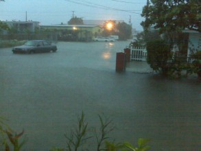 I'll continue to post reports as they come in. Thanks again to Peter- the worst is just about on you! Hang in there and stay safe. A category three, intensifying hurricane is very dangerous and the possibility of extreme winds in downbursts is significant. Again, I will post another update here within the next couple of hours. UPDATED: 6:00 pm EST, November 7, 2008 PALOMA GETTING STRONGER AS IT HEADS FOR GRAND CAYMAN I received a report from Grand Cayman a few hours ago and wanted to post it for you all to read. It comes from Peter who writes: Hello Big fan of your website, been an avid reader for the past two years since moving to the Cayman Islands. Anyway, right now, steady rainfall, occasional �whiteouts� with strong rain and heavy gusts of winds, but also moments with relatively calmness and very little rain. I think rain will be our biggest concern here as the past couple of weeks have provided lots of rain already so flooding will be an issue in this very flat terrain. I believe there is a curfew in place and people seem to have taken good precautions even though this hurricane threat came very sudden. Will submit another update and some pictures later tonight if possible. Peter He describes perfectly what an intensifying hurricane is like as it passes over a location. Conditions will only worsen, obviously, and I suspect there will be some very strong down bursts of wind and rain with this hurricane. The Caymans certainly are used to such events but they are never easy, not ever. I will post more info as it comes in. For Peter, stay safe! Thanks for the info- and we'll post anything you can send in. I'll have more here around 11pm ET if not sooner. UPDATED: 11:15 am EST, November 7, 2008 AS PALOMA CLOSES IN ON THE CAYMANS, THERE IS SOME UNCERTAINTY AS TO ITS FUTURE TRACK November hurricanes can be tricky to predict. Steering currents are different than they are in August and September and Paloma may turn in to quite a challenge over the next few days. Right now, the hurricane is heading towards the Cayman Islands and should pass through there later tonight and through tomorrow. Paloma has slowed down its forward speed some and is certainly not racing through the Caribbean Sea. Once past the Caymans, it should cross Cuba and emerge in to the southwest Atlantic. However, there is some doubt now, at least among the computer models, as to whether or not this will actually happen. It is possible that very strong upper level winds could separate the hurricane in to a low level circulation while the mid and upper levels of the cyclone get whisked off to the northeast. This could potentially leave an exposed but intact low pressure area behind. I am not sure what would result from such a scenario and it will be interesting to see how all of this plays out. The most important issue at the moment is the impact of Paloma to the Cayman Islands and then Cuba. There is opportunity for the hurricane to get stronger and even a chance it becomes a category two or three. As I mentioned last night, if anyone reading this is located in the Caymans and you can safely email reports, etc., I'll be glad to post them here. We did this during hurricane Omar and it was much appreciated by folks outside of the affected areas. I'll keep updating the information here and will post more early this evening. UPDATED: 10:30 pm EST, November 6, 2008 CAYMAN ISLANDS GET READY- HURRICANE PALOMA IS HEADED YOUR WAY- CUBA IS NEXT It is not often that we see a rapidly intensifying hurricane in early November but it does happen. Indeed, Paloma, now a category one hurricane, has proved the global models right in their prediction that a strong tropical cyclone would form in the NW Caribbean. Now the question is: how strong will Paloma get? The official forecast calls for it to reach category three strength near the Cayman Islands or perhaps just after- it is so hard to know how the inner core will react with each passing hour. People in the Caymans need to spend tomorrow getting ready for this hurricane- there is no shortage of experience in that region. After passing through the Caymans, Paloma will make landfall in Cuba and then probably cross the island and in to the southwest Atlantic. From that point, it is possible that the Bahamas will have to deal with it but it is still too soon to know what will be left of the cyclone at that point. We'll take it one day at a time and tomorrow, the hurricane closes in on the Cayman Islands. If you're down there, we would be glad to post any reports that you send us just as long as you can do so safely. I'll post more here throughout the day on Friday. UPDATED: 8:00 am EST, November 6, 2008 TS PALOMA FORECAST TO BECOME SIGNIFICANT HURRICANE AND AFFECT THE CAYMANS AND CUBA TD 17 was upgraded to TS Paloma this morning with winds of 40 mph right now. The forecast from the NHC calls for Paloma to become a hurricane tomorrow and peak at around 105 mph. There is a chance, and a fairly good chance, that the storm could become a major hurricane over the warm waters of the Caribbean Sea. Folks in the Cayman Islands and Cuba need to be ready for this system. Already, clouds and some showers and squally weather is impacting the Cayman Islands extending north and east in to Cuba. The best hope for this not being another nasty blow to Cuba will be the possibility of strong upper level winds impacting Paloma before it reaches land. We'll have to wait and see about that but will certainly hope for the best. As I have mentioned, there appears to be no threat to south Florida from Paloma as the steering currents are not in favor of it this time around. If there was more high pressure sitting over the western Atlantic, acting like a large water balloon in the way of this smaller one, then we might have some concerns of a more northerly track. Such is not the case and Paloma should turn fairly sharply to the northeast with time and pass over Cuba and then the Bahamas. It is too soon to know how strong the system will be in the Bahamas- we'll have to wait on that. I'll have more info here later this afternoon. UPDATED: 10:00 pm EST, November 5, 2008 TD17 FORECAST TO BECOME STRONG HURRICANE OVER THE CARIBBEAN SEA At this time tomorrow night, we should have quite a strong tropical storm to track in the NW Caribbean Sea. Soon after, it should be a hurricane- at least that is the forecast from the National Hurricane Center this evening. Right now, the depression is fairly close to the Central American coastline and the risk of heavy rains will continue there until the system moves away. The models are still showing a slow movement towards the northwest with a gradual turn back to the east-northeast over the next few days. This would put what is forecast to be a hurricane very near the Cayman Islands and then over Cuba. After the Cuban landfall, the forecast shows the cyclone moving through the Bahamas in a much weakened state. There is still no evidence to suggest that this will threaten Florida. However, for those in the path of this system, let us hope that it does not get anywhere near as strong as we know it could given the right conditions. We have seen very intense hurricanes come from this region even at this time of year (Michelle in 2001 and Wilma in 2005) and people should prepare as best they can. I will post more info here tomorrow on what should be TS Paloma. UPDATED: 4:25 pm EST, November 5, 2008 RECON PLANE FINDS NEW DEPRESSION HAS FORMED IN THE WESTERN CARIBBEAN- FORECAST TO BECOME A HURRICANE We will have one more named storm to track before the official end of the hurricane season. The NHC is now issuing advisories on TD17 in the western Caribbean Sea. The computer models were hinting at such development for several days and now it has come to fruition. The depression is hugging the coast of Honduras and Nicaragua for the time being but should turn to the north and east with time. The NHC makes mention of the fact that late season tropical storms and hurricanes can move slowly- more so than some of the models can really handle. Odds are that this system does eventually get out of the Caribbean by way of crossing Cuba but we will certainly watch it closely to make sure there are no surprises. The intensity forecast calls for TD17 to become TS Paloma rather soon and then go on to be a hurricane as it approaches Cuba. The folks there have dealt with several hits this season and this latest system will likely add more insult to injury. Also of note- the Cayman Islands lie in the path of this weather as well so anyone planning a trip to the region- be aware of the latest info. I will post regular updates on the depression with the next one coming later tonight. The rest of the Atlantic is quiet as far as tropical cyclones go- although there is quite the non-tropical storm blasting portions of the mid-Atlantic states. It has been a busy season for storms and hurricanes in the Atlantic and we're not done yet. As I mentioned, I'll post more here later tonight. UPDATED: 11:15 am EST, November 5, 2008 TROPICAL DEPRESSION LIKELY FORMING IN THE WESTERN CARIBBEAN It is rare but we do get November tropical storms and hurricanes. The western Caribbean Sea is really the only area of the Atlantic Basin that can regularly sustain such development and we are likely seeing that take place now. We have been tracking a large but generally disorganized system in the region over the last few days. This morning, it looks like it is starting to come together and may be on its way to strengthening in to a tropical depression. The NHC mentions that a Hurricane Hunter crew will investigate the system later today and if that does take place, we will learn more about what is going on. The feature is probably going to move quite slowly over the coming days and most computer models indicate that it will become at least a tropical storm. Water temps are very warm in this portion of the Caribbean and upper level conditions will favor steady development. I do not think this will impact Florida directly but Central America, the Caymans and Cuba should all be watching this weather system closely. It will most likely move northward at first and then turn northeast and head out in to the Atlantic, crossing Cuba in the process. Obviously, we do not want ignore the slim chance that it does not make the connection with the trough that would pull it out of the Caribbean but that seems to be the most logical path that it will follow as of now. If it does get named, it will be Paloma. I'll post more here early this evening. UPDATED: 9:10 pm EST, November 4, 2008 NHC SAYS TROPICAL DEPRESSION POSSIBLE IN THE CARIBBEAN SEA We have been talking about the potential for development in the climatologically favored NW Caribbean Sea and now it looks like that might actually take place. A slowly organizing area of low pressure is situated in the western Caribbean Sea and it looks like it could become a tropical depression over the next day or so. Most of the computer models continue to indicate a slow northward or northwestward drift near the coast of Central America. The main threat will be the typical heavy rains that we see from developing systems like this. It is tough to call what kind of intensity we might see from this system as it could go either way- a weak, poorly organized feature or perhaps we see a hurricane form out of it. The NW Caribbean is a prime region for tropical cyclones this time of year so we will want to watch it closely. There is currently little reason at all to believe this would be a threat to Florida but Cuba, Jamaica, the Caymans and perhaps the Bahamas should keep aware of what develops in the area over the next several days. I'll post more here on Weds morning. UPDATED: 7:45 am EST, November 4, 2008 93L IN WESTERN CARIBBEAN HAS POTENTIAL FOR DEVELOPMENT Even though it is November, the hurricane season is still active and we have 93L in the western Caribbean to prove that. Most computer models are still rather bullish on this system eventually developing in to a tropical cyclone. Whether or not that means a weak depression or a hurricane remains to be seen. For now, the system, known as 93L, is slowly organizing as it drifts around to the east of Central America. It could take a couple of days for it to develop in to a named storm but this seems typical for this time of year in this region. The early computer guidance suggests that what ever does fire up will move slowly. There is plenty of time to see how things evolve and as of now, this poses no threat to the U.S. but could be a factor for Central America and other areas in the Caribbean over the coming days. I'll post more about this feature tonight. UPDATED: 6:30 am EST, November 3, 2008 WITH LESS THAN A MONTH TO GO IN THE OFFICIAL HURRICANE SEASON, THE WESTERN CARIBBEAN REMAINS THE AREA TO WATCH It is hard to believe we are already in to early November. Tomorrow is perhaps one of the biggest elections of our time and Thanksgiving is only a few weeks away. Wow, where did the time go? At least for the hurricane season, it means we are almost done. The official end to the season occurs at the end of the month although we have had plenty of seasons lately with activity lasting or taking place in to December. For now, we will be watching the western Caribbean Sea which is climatologically favored this time of year. Add to this the fact that most major computer models develop some type of system there. At the moment, only scattered showers and thunderstorms exist with nothing organized seen in satellite pictures. It may take a few more days but the global models have been extremely persistent in their development of low pressure and perhaps even a tropical storm in the region. The rest of the Atlantic is quiet as we would expect for this time of year. In the east Pacific, we have TS Polo which is well off the coast of western Mexico and moving away from land. I'll post an update on the potential Caribbean system tomorrow and then more frequently should something get going. UPDATED: 10:20 am EDT, October 30, 2008 WESTERN CARIBBEAN LIKELY THE LAST PLACE TO EXPECT SIGNIFICANT ACTIVITY THIS SEASON Even as cold and snow grip much of the East, it is still hurricane season and there is something to keep an eye on over the next week or so. At least this is what several of the longer range computer models suggest. The region is the western Caribbean where some disturbed weather exists today but certainly nothing organized. Some of the computer models suggest that low pressure will develop in this region over the course of the next week or so. This would not be entirely unexpected since the western Caribbean remains the real hot-spot for development at this late stage of the hurricane season. We'll keep an eye on the region and since we know a lot of people begin to take cruises and travel to the Caribbean at this time of year, it is certainly important to keep aware of any possible development. Keep in mind that we are not just worried about hurricanes- any prolonged period of tropical rain associated with large areas of convection in the tropics can lead to life-threatening floods or wash out vacations that have been planned for months. The rest of the Atlantic Basin is mostly quiet with only a weak area of low pressure situated in the central tropical Atlantic where water temps are still warm and actually above normal. Strong upper level winds are going to win the battle against this system and not allow it to develop. I'll post more here over the coming days concerning any potential development in the Caribbean. UPDATED: 9:25 am EDT, October 27, 2008 NOTHING IN THE CARDS FROM THE TROPICS As we get ready to end the month of October, I see nothing in the long range computer models to suggest that we will have any problems from the tropics anytime soon. We may be just about done with any and all threats to the United States but of course, we never say never. November hurricanes are rare but they do happen. The Caribbean islands would have the best chance of seeing something like that but even their chances are slim. After a very active season with significant impact to land areas, it is nice to see things quiet. I'll post more later in the week. UPDATED: 6:00 pm EDT, October 24, 2008 TROPICS QUIET THIS WEEKEND- ALSO, I WILL MAKE TV APPEARANCE ON CNN'S HEADLINE NEWS This time three years ago the power was out and people were beginning to pick up the pieces after major hurricane Wilma ran over the southern portion of the Florida peninsula. It capped off an incredible, deadly and historic 2005 hurricane season. There will be no such event this time around, at least not today, as the tropics are not looking to produce anything significant anytime soon. In fact, even with the amount of landfalling activity this season, Wilma remains the last major hurricane to hit the United States- more than three years ago now. Ike was very, very close and its surge caused extreme damage to portions of the Texas and Louisiana coasts but we did at least manage to escape the 2008 season without any category three hurricanes hitting the U.S. coast- so far. I see no reason to believe that will change before the end of the month and probably the end of the season. Let's hope! I rarely post announcements about my TV appearances and since most are live, there is no time to make such announcements. However, this weekend, I invite you to tune in to CNN Headline News for their show "News to Me". I am going to be featured in one of their segments talking about the remote camera project, how we do the work we do and what other people seem to think about it. There should be some footage from this season's hurricane activity in the piece although I have not seen the final production. The show airs tomorrow night at 7:30pm ET, 9:30pm ET and then at 12:30am ET Sunday morning. It was really neat how I did the interview- it was just one of my video cameras set up in my office while I talked to the producer in Atlanta. We did a lot with CNN this hurricane season and brought some cutting edge live video to their network during hurricanes Gustav and Ike. I hope you can catch one of the shows tomorrow night. I'll post more here on Monday. 
UPDATED: 7:15 am EDT, October 23, 2008 UNSETTLED WEATHER PERSISTS IN THE WESTERN CARIBBEAN As we get towards the end of October, the only area to watch right now continues to be the western Caribbean Sea. A large but disorganized area of showers and thunderstorms persists in that region as it has done for several days. None of the global computer models indicate that this will develop in to much as it appears that the dynamics needed to spark such growth are not in place. The models do show a weak low pressure area forming in the Gulf of Mexico and then quickly scooting off to the northeast- bringing rain and some wind to the Southeast this weekend. Other than that, the tropics are mostly quiet. This should remain the rule for at least the next week. I'll post more here tomorrow. UPDATED: 4:40 pm EDT, October 20, 2008 91L IN NORTHWEST CARIBBEAN THE ONLY AREA OF INTEREST With the hurricane season slowing down now as we get towards the end of October, we see only one area of interest and that is 91L in the northwest Caribbean Sea. The pattern is not too favorable for development right now and it will likely not amount to much more than rain and squally weather for the region. There is a small window of opportunity for this to develop but none of the computer models are too robust in their development of this system. If you are planning a trip to Cancun or the surrounding area, just keep in mind that this disturbance is there and may bring off and on showers for the next couple of days. It is hard to tell for sure when the system will move on but at least it is not too well organized and nothing compared to what was in the region just three years ago (Wilma). The rest of the Atlantic, Gulf and even the east Pacific look great as we start the week. Note- I have added a poster to our online store. It is a montage of the five recent tropical cyclones that have affected Texas. It is similar to the "Hurricane Coast" poster I did for North Carolina after the hurricanes of the late 1990s. You can learn more about it by clicking on the store links found on this page. I will also be offering up a 2004, 2005 and 2008 "trilogy" DVD set once the 2008 DVD is complete. I have had several requests for a set of the three "Tracking the Hurricanes" DVDs and will be proud to offer such in December. I will post more info on the DVD set once it becomes available for purchase. UPDATED: 8:00 am EDT, October 20, 2008 WATCHING THE CARIBBEAN FOR POSSIBLE DEVELOPMENT The lone area of interest is now the northwest Caribbean Sea. A disorganized area of showers and thunderstorms exists and in fact has been designated as "91L" since it does have some potential for additional development. Most of the computer models show it milling around near the Yucatan for a couple of days and then lifting it out, turning it north and east towards Florida. The good news is that none of the intensity models suggest that it will get too strong. It appears that the main impact from this system will be unsettled weather for portions of the northwest Caribbean and then perhaps Florida later in the week. We'll keep a close eye on it just to be sure nothing unexpected happens but the pattern does not look ripe for any significant development. The rest of the tropics are nice and tranquil as we would expect them to be towards the end of October. I'll post more on "91L" later today. UPDATED: 1:00 pm EDT, October 17, 2008 TROPICS STILL ACTIVE BUT NO THREATS TO LAND EXIST RIGHT NOW I have heard from several folks in the northern Leeward Islands, especially from the U.S. and British Virgin Islands, and it appears that Omar had little significant impact in the region. Sure, there are trees down, some power outages and minor damage to clean up but the brunt of the category four intensity missed the islands- which is excellent news. I am sure there are many people who are resting a lot easier now knowing that the core of the once very dangerous hurricane threaded the needle, so to speak, and spared the area of possible devastating effects. Omar is now well out to sea and will soon transition in to a large extra-tropical storm and race out in to the North Atlantic. Elsewhere, I see nothing to suggest any development for the next few days. The GFS model wants to spin up a system near the Yucatan in the area where we would expect to look this time of year. Other models are not as bullish on this idea and the more likely scenario is that we will see disturbed weather persist in that region with any development being slow. The weekend looks nice for the coastal areas- enjoy it. I have completed a trip back to Texas where I did some research and documenting the aftermath of hurricane Ike. I visited the Bolivar peninsula and Gavleston Island where I worked with my frield Lew Fincher- a hurricane historian and consultant from that area. Even he was shocked to see downtown Galveston, mainly along the Strand, so vacant and empty. I will include much of my time spent with Lew in the 2008 DVD that is in production now. I have posted a video clip showing the area from Pleasure Island, near Port Arthur, through the Bolivar. The storm surge affected an immense area and I will get more in to this next week on future commentary postings. A lot of things bother me about what happened there and there is much to be examined. For now, check out the very real situation that exists along the Texas coast via the link below. UPDATED: 7:00 pm EDT, October 15, 2008 NORTHERN LEEWARD ISLANDS IN FOR A ROUGH NIGHT AS OMAR DRAWS CLOSER Omar is getting closr and closer to the northern Leeward Islands. You can clearly see the eye of the hurricane on this radar link out of San Juan. It won't be too long now before the winds pick up and the rains come down at a blistering pace. A hurricane in the Caribbean is something to behold, I am told, but they come with a price, obviously. The people of this region should be prepared and we will await news reports come tomorrow as to what the damage and effects were. The NHC is forecasting Omar to reach 105mph as it passes through the Leewards and I can tell you from first-hand experience that an intensifying hurricane is much more dramatic than one that is holding its own or weakening. Indeed, the islands in Omar's path are in for a long and wild night. I did receive an email from St. Croix from a visitor to our site. Here is what he wrote a few hours ago: Hi, My name is Adam ***** - I live on St. Croix in the USVI. I have been using your website ever since I moved here a year ago when I started work at the refinery. Just to let you know current status: - rain has been steady since Tuesday afternoon, with very heavy rain earlier today (mid-day) - some roads are flooded on the island and a 6pm local curfew is in effect (until 6am) - no significant wind has been observed yet - the refinery is in the process of shutting down in advance of the storm According to forecast - this will hit us dead on. Our island is only 26 or so miles long by 8 or so miles wide - so either way - we are going to get it good. Hopefully my house doesn't sustain too much damage!! Regards, Adam I am hoping to hear more from Adam later tonight but it won't surprise me if he loses power before too long. I appreciate the report and we'll all look forward to hearing some good news later on (hopefully!!!). Elsewhere, TD16 is dumping a lot of rain on portions of Central America. The depression will soon dissipate as a remnant low over the region but it might take several days to squeeze all of the moisture out of the system. The rest of the tropics are mostly quiet. I'll post more here later tonight and will talk about my current trip to coastal Texas. It is beyond any words to try and describe the scene along the Bolivar peninsula so I'll let a few video clips do the work for me later tonight. UPDATED: 9:05 am EDT, October 15, 2008 OMAR TAKES AIM ON THE NORTHERN LEEWARD ISLANDS Hurricane Omar has strengthened some overnight and now has winds of 80mph. The good news is that the rapid intensification that we saw yesterday appears to have ceased. Of course, the bad news is that we still have a hurricane heading for land areas. The forecast track takes Omar across the northern Leeward Islands with a majority of the right-front quadrant affecting that region. It is difficult at best to know where the eye will pass and people in the region need to focus on the overall effects from this hurricane- not just where the eye might track. The intensity forecast suggests that Omar could reach category two strength and thus this needs to be taken seriously. One interesting aspect of this hurricane is the low storm surge value predicted- only 1 to 2 feet. This is common for the island areas but the downside is the possibility of huge waves crashing ashore and causing damage as they run up the beaches. With Omar approaching from the south and west, exposed areas of the islands not used to dealing with hurricanes could have trouble. You can track Omar's progress via radar out of Puerto Rico by clicking here. You will notice the rain bands are moving through and we might be able to see the center or eye later today and tomorrow. TD16 is mostly a non-issue except for its heavy rains. For portions of the Central American coast, especially Honduras, these rains could cause flooding, mud slides and a rise in local rivers that can have terrible consequences. We saw this with Mitch in 1998 and with other hurricanes and tropical storms across the Caribbean even this season. So while we are not looking at a hurricane out of this system, it is yet another reminder that tropical cyclones have more than one deadly effect that can exact quite a toll on a region. The depression is expected to move inland and dissipate over the next few days. I am en-route to coastal Texas where I will be studying the effects of huricane Ike- now just a little over a month old. I hope to learn more about the storm surge along the Bolivar peninsula and will visit Galveston again where Mike Watkins and I dealt with Ike face to face. Some of this work will be incorporated in to the 2008 DVD we are producing. For more info on that, check out the graphic below. I'll post more here this evening. UPDATED: 12:50 am EDT, October 15, 2008 ISLANDS OF THE NORTHEAST CARIBBEAN BRACE FOR HURRICANE OMAR Omar has made it to hurricane strength and is forecast to reach nearly category three intensity. I cannot recall seeing so much in the way of deep convection, or thunderstorm activity, in any tropical cyclone. The amount of extremely cold cloud tops covering Omar for the last 12 hours or so is impressive and represents a tremendous amount of heat being released by this hurricane. As scientifically interesting as it is, the bad news is that Omar is going to impact the islands of the northeast Caribbean Sea over the next few days. Exactly where the eye crosses is impossible to predict and we will just have to watch via local radars starting later tomorrow. Folks in the region from the Virgin Islands and points east and south need to be ready for this serious hurricane threat. Not since Lenny in 1999 has something of this magnitude threatened the region. Puerto Rico is not expected to take a direct hit from Omar but the rain bands will affect that island with the possibility of mud slides and flash floods. Mountains and tropical storms/hurricanes do not mix well at all. We'll see just how strong Omar becomes throughout the day Wednesday as recon flights will serve to give us data from the center of the hurricane. We will obviously be hoping for the best for the people visiting and living in the areas affected. I am in Mississippi tonight and will be traveling to coastal Texas tomorrow for a continuation of my post-Ike work. There is much to be learned and documented from this hurricane that seems to have all but vanished from the news as of late. I think that if it were not for the economy, the election process and the rash of hurricanes just three years ago that Ike would be making headlines still. I will get a closer look at the damage along the Bolivar peninsula tomorrow afternoon and will travel to Galveston on Thursday. I will continue to post reports on the tropics along the way... UPDATED: 7:35 pm EDT, October 14, 2008 OMAR A BIG THREAT TO THE NORTHEAST CARIBBEAN SEA AS IT RAPIDLY INTENSIFIES TODAY- TD16 NOT MUCH MORE THAN A RAIN MAKER FOR NOW TS Omar has shown us once again that intensity forecasting is tricky at best. The storm went from a mere depression to just about hurricane strength in just a matter of hours. If this trend continues, then we may be dealing with a fairly strong hurricane affecting the islands of the northeast Caribbean Sea. So far, the storm has dumped heavy rains and brought squally weather to portions of the ABC Islands just to the north of the South American coast. Water temps in this region of the Caribbean are very warm and so it is not much surprise to see Omar strengthen like it has. The forecast track keeps the center off of Puerto Rico but passes close enough that heavy rain and strong winds are possible over the next few days. For the Virgin Islands and areas east of there, a direct hit by Omar looks possible and we will have to just hope that this thing does not get out of hand. Although rare, a hurricane passing through the region from the southwest is different than those that typically move from the east. I believe it was hurricane Lenny in 1999 that last cut through from the southwest like we are seeing with Omar this week. It will be interesting to see how this system evolves and more importantly, people need to be preparing for a possible strengthening hurricane in the region. TD16 is not doing too much this evening. The close interaction with land has kept this one at bay- which is obviously great news. Still, it is a rain maker and we have seen it time and again that too much rain from even weak systems can cause problems. It does not appear that TD16 will make its way in to the Gulf of Mexico and should actually dissipate over Central America before the weekend. The only other item of note is a disturbance in the western Gulf of Mexico but it is not expected to develop and should move inland over Texas tomorrow and Thursday. I will be there for that- as I am on my way back to coastal Texas for follow up work on hurricane Ike. I'll post more here late tonight and then again tomorrow morning. UPDATED: 8:40 am EDT, October 14, 2008 TD 15 THE MAIN ISSUE THIS WEEK BUT 99L SLOWLY GETTING BETTER ORGANIZED TD 15 is still milling around in the southeast Caribbean, not moving much at all- drifting to the southeast. The forecast calls for it to become a tropical storm and then a hurricane as it moves generally towards the northeast Caribbean Sea and then in to the Atlantic Ocean. It is still possible that the system could pass over or very near Puerto Rico and the Virgin Islands. Already, we are seeing heavy rains across portions of the ABC Islands in the southern Caribbean, not too far off the coast of South America. This will persist until the depression finally gets itself moving. As mentioned yesterday and last night, folks in Puerto Rico, Hispaniola and the Virgin Islands need to be ready for what ever weather heads their way. It could be quite a rough few days ahead, depending upon how strong this system gets. Another recon plane will investigate the depression later today and we'll know more about its strength at that point. Meanwhile, over in the western Caribbean, 99L is continuing to exhibit signs of getting better organized. It won't surprise me to see this too become a depression and eventually a tropical storm. It is not clear as to where this will end up. Odds favor it getting inland over Central America over the next few days but we'll have to watch and see if it moves farther north than that as some of the models have shown off and on. The bottom line continues to be that we are in an active pattern in the tropics this week with many land areas, not necessarily within the mainland United States, at risk for being affected by tropical cyclones. I'll post more on all of these feautres later today. UPDATED: 11:20 pm EDT, October 13, 2008 UNCERTAIN TIMES AHEAD FOR THE SYSTEMS IN THE CARIBBEAN It is not often that we have two fairly well developed tropical systems in the Caribbean Sea at the same time. We do now. TD15 is still not moving much, if at all, but should start a slow trek towards Puerto Rico and the Virgin Islands as the week wears on. However, this is not a guarantee and I sense a little uncertainty in the latest NHC forecast disucssion that the depression might not get yanked out of the Caribbean as the models indicated earlier. For now, they are sticking with that scenario and people from Hispaniola to Puerto Rico and the Virgin Islands need to be aware of the developing situation to their south and west. As I mentioned earlier, the main threat right now is rain. Too much rain from these slow moving systems is just as bad as a powerful hurricane in terms of impact on a local area. So far, there has not been too much to contend with but as the system draws closer, assuming it actually does, that rain threat will increase. Meanwhile, we are also watching 99L to the west of TD15 and it looks to be getting better organized. The NHC mentioned on their latest outlook that the upper level winds were "very favorable" for development. The only logical limiting factor for such development right now appears to be land interaction. It looks to me that perhaps the center is forming or re-forming a little farther away from the Central American coast- if this is the case, we might see this go on to develop rather quickly tomorrow. For what it's worth, the latest run of the ECMWF model shows this system growing quite strong and making its way north-northwest with time to near the tip of the Yucatan over the next week or more. This is just one model solution, others bury the system quickly in to Central America. We'll just have to wait and see how it all plays out. The one certainty is that like with TD15, we are dealing with a slow moving weather feature and the main threat initially will be heavy rain. I am traveling back to Texas during the day Tuesday through Wednesday and will post updates along the way. I'll have another post here early Tuesday morning... UPDATED: 4:45 pm EDT, October 13, 2008 BUSY WEEK AHEAD IN THE ATLANTIC, CARIBBEAN The forecast for October was for it to be a busy month in the Atlantic Basin- it is turning out to be just that. We have TD #15 which is forecast to become a hurricane, TD Nana which is all but a remnant low now, another area of low pressure near Central America (99L) and yet another disturbance near the remnants of Nana out in the central Atlantic. Let's break them down... TD #15 is not moving much at all right now. The forecast shows it eventually picking up some steam and moving towards and then over eastern Puerto Rico and/or the Virgin Islands. The question is, will it become a hurricane before hand? Right now, it is still in its early stages of development and rain is the biggest issue. None the less, the NHC does forecast the depression to become a tropical storm and then a hurricane- but after it passes Puerto Rico. We shall see- people in the region need to be ready for lots and lots of heavy rain and then the possibility of a hurricane threat later in the week. Farther west we have 99L, an area of low pressure forming near Nicaragua. This is a classic breeding ground for some monster hurricanes of the past and in fact, the latest ECMWF model shows what looks to be just that on its long range charts. If 99L does not get buried in to Central America, it could be something to deal with down the road for places like the Yucatan or even western Cuba. A recon plane will investigate the system tomorrow if needed and we'll know more at that point. For now, it too will be a rain maker for portions of Central America. We are also watching the remnants of TS Nana and another weak area of low pressure nearby- neither should amount to much and will not affect land. I'll post more here later tonight. Tomorrow, I begin a trip back to coastal Texas to continue research and documentation of hurricane Ike. I'll post more as I travel. UPDATED: 10:45 am EDT, October 13, 2008 TD #15 FORMS IN THE CARIBBEAN- COULD BECOME A HURRICANE AND IMPACT PUERTO RICO, VIRGIN ISLANDS 98L is now TD #15 with top winds of 35 mph. The NHC made the upgrade just a little while ago. The forecast shows modest strengthening and the depression could become a hurricane before all is said and done. Most of the model guidance, as well as the official forecast from the NHC, shows the cyclone moving northwest for a short period of time and then hooking back to the north and northeast with a possible crossing of Puerto Rico later this week. Before any of the stronger winds arrive, the main threat will be extremely heavy rains and this will almost certainly lead to significant problems for islands such as Hispaniola, Puerto Rico and the Virgin Islands. This is a slow moving weather feature and it will have time to dump copious amounts of rain- people need to be aware of this and prepare accordingly. A recon plane will be in the area later today to provide more info on the depression and determine whether or not it has become a tropical storm. If/when it does, the name will be "Omar". We are also watching newly designated 99L in the western Caribbean- something (the potential for development) we have been talking about here for almost a week. The pattern is ripe and this is all completely in line with the busy hurricane season we are experiencing. It is going to be a busy week ahead for sure. I'll post more here later this afternoon. UPDATED: 6:10 am EDT, October 13, 2008 TS NANA RUNNING OUT OF TIME AS NEW DEPRESSION LIKELY FORMING IN THE CARIBBEAN The NHC began issuing advisories on TS Nana yesterday afternoon and may cease those advisories later today. The reason? Strong upper level winds are tearing the clouds away from the center of the storm- which is located well out in the middle of the Atlantic Ocean. It is a concern for shipping interests only and should dissipate over the next day or so. In the Caribbean Sea, we have a much larger issue to deal with. There appears to be a new tropical depression forming in the eastern Caribbean and we should know more about it later today as a Hurricane Hunter crew is scheduled to fly in to investigate the system. Most of the computer models indicate that this will develop and move off towards either Hispaniola or Puerto Rico on its way out to sea. This is a major concern because of its slow moving nature and its ability to dump excessive rain. The islands of the Caribbean have received more than enough rain this hurricane season and more, especiall from a slow moving system, is bad news. This could end up being a big news maker not for the wind and surge but once again for the rain and flooding. People in the region need to take every precaution they can for this developing situation. As I mentioned, we'll know more about the structure of the disturbance later today once recon gets in there. To the west, in the western Caribbean, there is also a flare-up of showers and thunderstorms that could organize in to something worth watching. The models have been trying to develop something here off and on for the last week. This is all quite expected and part of the overall favorable pattern for this portion of the current hurricane season. Plus, these regions are favored this time of year in any hurricane season. While there are no threats to the United States as of now, the main issues will be to some of the land areas of the eastern Caribbean Sea for now and possibly the western Caribbean later in the week. I'll post another update here as soon as the info from the recon plane becomes available. UPDATED: 1:50 pm EDT, October 12, 2008 ATLANTIC AND CARIBBEAN NOW THE FOCUS AS EAST PACIFIC ACTIVITY WINDS DOWN Now that Norbert and Odile are no longer of any concern, the focus will shift to the Atlantic and Caribbean. We have two distinct areas to monitor this coming week- one of which will affect land areas. First off- we have 97L out in the central Atlantic. This system is likely a tropical cyclone already and it may be named later today. It should be short-lived and will not affect land areas. The name would be Nana if indeed it does get the upgrade later today. In the southeast Caribbean we have a developing area of low pressure that could become a tropical depression before too long. In fact, it is possible that a recon crew will fly in to the system tomorrow to investigate further. The NHC makes mention of the fact that unsettled weather could be an issue for Puerto Rico and the Virgin Islands over the next few days. The movement of the system is rather slow right now, which is typical for this time of year. None of the major computer models really "see" this system and so it will be interesting if it develops to see where it ends up. Odds favor a turn out to sea but with a large area of high pressure over the eastern United States, and a warm week ahead at that, this may get pushed westward for a few days. The main issue right now will be heavy rains and overall squally weather for portions of the land masses of the eastern Caribbean. We'll know more tomorrow assuming the Hurricane Hunter plane does fly in to the system. Elsewhere, the Gulf of Mexico is generally quiet with no issues brewing there. I am heading back to Texas next week for some post-Ike research and work on the DVD project. The tropics will be busy and I'll post regular updates over the coming days. Next post- tonight around 11pm ET. UPDATED: 11:00 pm EDT, October 10, 2008 HURRICANE NORBERT TO MAKE LANDFALL TOMORROW ALONG BAJA AS NEW DEPRESSION POSSIBLY FORMING IN CENTRAL ATLANTIC The recon plane scheduled to check Norbert today had mechanical issues and did not make the trip. Thus all of the info concerning hurricane Norbert is gained from satellite pictures and perhaps a few ship reports and land observations. Based on satellite, Norbert is a category two hurricane with 105 mph winds. The outer rainbands are approaching the Baja peninsula and conditions will quickly worsen as the center of the hurricane draws closer with an increase in forward speed. The worst conditions will likely be felt just south of Puerto Magdalena but well north of Cabo San Lucas. Once Norbert crosses over the Baja, it will make a second landfall along the coast of Mexico and quickly dissipate over the rugged terrain- although the heavy, tropical rains will no doubt be an issue. TS Odile is slowly moving along just offshore of the Mexican coast farther southeast of where Norbert is expected to make landfall. Odile should turn more west with time and increase the distance between it and Mexico. The forecast as of now has backed off Odile becoming a hurricane. In the Atlantic, we have 97L, a well defined tropical wave and low pressure center located between 30 and 40 west longitude. It could become a tropical depression over the weekend but is likely to remain well out to sea and bother no land areas. We will also be watching the Caribbean Sea for possible development over the next 5 to 10 days as this region is the prime area for development anyway this time of year. Otherwise there are no tropical issues to be concerned with in the Atlantic Basin. I'll post more here over the next couple of days. UPDATED: 12:20 pm EDT, October 10, 2008 NORBERT TAKES AIM ON THE BAJA AS OTHER ACTION STIRS ELSEWHERE IN PACIFIC AND ATLANTC Hurricane Norbert has made an attempt at getting better organized today and as such, winds have increased to near 100mph. A Hurricane Hunter crew will be in the area soon to give a more accurate reading as to how strong Norbert is. The forecast calls for the hurricane to weaken some before crossing the Baja peninsula but it could still be quite formidable. The southern resort areas of the Baja should be spared the worst of the conditions but an onshore flow of wind could make for a rather unsettled Saturday with heavy rains, rough seas and gusty winds possible. Once it has passed over the peninsula, Norbert will then make a final landfall along mainland Mexico where it will likely dissipate quickly over the terrain there. However, it is possible that moisture will be streamed north and east in to the United States and lead to enhanced rain fall for some locations in Texas and New Mexico. Meanwhile, TS Odile is still paralleling the Mexican coastline on its way generally WNW with slowly increasing intensity. The NHC forecasts Odile to reach hurricane strength over the weekend with a track away from Mexico. Odile should weaken early next week as it heads in to less favorable conditions. Right now, the threat of rain, heavy at times, continues for portions of the Pacific coast of Mexico. This should diminish over the course of the next couple of days. On the Atlantic side, we have newly designated 97L, a well organized tropical wave in the central Atlantic, that could strengthen further. It is currently in its formative stages and has a long way to go before becoming a depression but we'll watch it closely as it travels generally towards the west-northwest. The next area to monitor will be the western Caribbean Sea. Almost all of the longer range models develop a tropical cyclone here in about a week. Beyond that, there is not much more to say as any speculation on where such development might track is just that, purely speculation. Conditions appear favorable and it is certainly that time of the year to be expecting such things in that region. It will be an active several days ahead for both the east Pacific and the Atlantic. I'll post more here tonight. UPDATED: 11:40 pm EDT, October 9, 2008 HURRICANE WATCH ISSUED FOR THE SOUTHERN BAJA AS NORBERT CLOSES IN Norbert is a classic-looking hurricane with a solid eye and well established outflow. It is a marvel of nature but unfortunately, it does have a dark side. With that in mind, a hurricane watch has been posted for a good deal of the southern Baja peninsula. It is now just a matter of time and we will begin to see the rain, wind and rough surf pick up along this east Pacifc coastal area. It is still rather tough to know just how strong Norbert will be at landfall and it could just as easily be strengthening as it could be weakening. There is that much spread in the intensity models and thus it really is tough to nail this down. I suppose that the odds favor Norbert weakening before landfall due to an expected increase in southwesterly winds that should act to tear the hurricane apart somewhat. However, water temps are warm enough and we just don't know that much about the cores of hurricanes to make a really solid guess even this close to landfall- not with a system like Norbert. The best defense is for people to simply be prepared. Hopefully the resort areas of the Baja, most of which are in the extreme southern portion, are taking this seriously and their guests are informed as to what to expect, both from the hurricane and from the resort. It looks as if Cabo San Lucas and surround areas along the southern tip will be spared the worst of the conditions but it could still be a rough Saturday there. I'll post more concerning Norbert in the morning as we watch with great interest what the final play of this Pacific hurricane turns out to be. I will also talk more about Odile and the possibility of western Caribbean development as well. UPDATED: 4:50 pm EDT, October 9, 2008 NORBERT NOW A CATEGORY ONE HURRICANE- STILL FORECAST TO IMPACT THE SOUTHERN BAJA AS WE CLOSELY WATCH TS ODILE AND THE WESTERN CARIBBEAN The Hurricane Hunters have been out investigating hurricane Norbert in the east Pacific and have found that winds are now down to 90 mph. While this is still a considerable hurricane, it is also great news for people living along or visiting the southern Baja peninsula. The offical track takes Norbert over the region Saturday and in to mainland Mexico there after. It is possible that Norbert could continue weakening throughout the next few days and this would obviously help the situation greatly. For people visiting or planning to visit the Baja, don't cancel, just be aware of the hurricane and be flexible in case there are last minute issues that delay your travel. The extreme southern tip of the Baja looks to be in good shape as that area is not even within the forecast error cone right now. Things are looking much better this afternoon. In addition to Norbert, we are also tracking TS Odile which is situated fairly well offshore of the Pacific Mexican coastline. Odile is forecast to become a hurricane and it too could threaten the southern Baja after about five days from now. The forecast shows Odile weakening at that point, so that is a plus. Currently, the main threat is the typical heavy rains that fall with these systems and the mountainous areas of coastal Mexico are at the most risk. In the Atlantic Basin all is quiet for now. I do suspect that within the next five to seven days that we will see a tropical storm develop in the western Caribbean. This is not at all unexpected for this time of year and I would not be some kind of guru if this comes to pass. There are several computer models that indicate this and the pattern fits the development potential. I am concerned only because history shows us that some nasty hurricanes have come from the western Caribbean this time of year and many land areas could be impacted depending on where exactly something gets going. It's not a sure thing either, but right now, odds favor development in this region before too long. I'll post another update here late tonight. UPDATED: 4:45 pm EDT, October 8, 2008 NORBERT NOW A CATEGORY FOUR HURRICANE- INTERESTS ALONG THE SOUTHERN BAJA AND MAINLAND MEXICO NEED TO BE ALERT The latest from the NHC concerning Norbert indicates that the hurricane is now a powerful category four. Top winds are now near 135 mph and could go higher. If Norbert were forecast to remain over the open Pacific, this would not be an issue but the forecast in fact calls for the hurricane to impact the Baja Peninsula and then mainland Mexico. Exactly when, where and how strong all remain to be seen. Right now, the NHC is showing Norbert making landfall along the southern Baja as a strong cat-2 hurricane but it could be quite a bit weaker or, unfortunately, stronger. There are too many complicated factors involved with the dynamics of the hurricane that make it very difficult to know with any certainty what kind of hurricane will have to be dealt with. Again, my best advice for people with interests in the area is to simply keep up to date on Norbert's progress. This sounds all too obvious but there really isn't much more to do right now. We all certainly hope that the hurricane will encounter stronger upper level winds and cooler SSTs that would allow it to weaken substantially. What we have in the here and now is a lethal category four hurricane and a forecast that strongly suggests a threat to the Baja and Mexico within a few days. I'll post more late tonight. UPDATED: 7:25 am EDT, October 8, 2008 TENSE DAYS AHEAD FOR PEOPLE ALONG THE BAJA, MAINLAND MEXICO Hurricane Norbert, in the east Pacific, is now at category three intensity and is forecast to reach category four. Most east Pacific tropical storms and hurricanes move westward and away from land areas, it looks like Norbert will not do that. The official forecast from the NHC indicates that Norbert could make landfall along the Baja Peninsula late Friday night. Norbert should then cross over and then make a final landfall in mainland Mexico. How strong it is when it reaches the Baja is in question as there are a couple of computer models that suggest it will be substantially weakened and may even stall somewhere near the Baja- hard to say which side. This is going to be a tricky situation and people in the region need to be ready for a possible hurricane impact. If you have plans to visit the Baja, and I have already heard from some folks who are, my best advice is to keep those plans but be aware of the situation and expect possible delays depending upon where and how strong Norbert is by the time you would arrive. Obviously, the hope is that the hurricane weakens and races through the area, leaving little time for significant impact. We shall see. I'll post more about Norbert later this afternoon. UPDATED: 6:30 pm EDT, October 7, 2008 GOT PLANS ALONG THE SOUTHERN BAJA THIS WEEKEND? LOOKOUT FOR NORBERT The main story over the next few days will be hurricane Norbert in the eastern Pacific. Top winds are now around 85 mph but are forecast to become considerably higher. It is possible that Norbert could approach category three intensity. The forecast track takes the hurricane on a track that would curve it back to the north and east near the weekend with a possible passage over the southern Baja Peninsula. People with plans to visit or who live there should be keeping a close eye on this hurricane. It is still early enough in the evolution of this system that a lot can happen to change things in dramatic fashion. For now, the emphasis for the folks along the Baja, and then mainland Mexico, will be to keep on top of what Norbert is up to over the next few days. I'll post updates a couple of times per day with the latest info that I have. As for the Atlantic Basin, TS Marco made landfall today in Mexico and is all but gone now- the result of it being such a small tropical cyclone. Elsewhere, I do not see anything in particular to get worried about although we are seeing deeper and more concentrated convection fire up in the western portions of the Basin- a part of the current favorable MJO pattern that is transitioning across the hemisphere. So far, nothing seems imminent as terms of development. I'll have more here concerning Norbert in the morning. UPDATED: 6:45 am EDT, October 7, 2008 TS MARCO NEARING MEXICAN COAST AS REMAINDER OF ATLANTIC IS QUIET- NOT SO IN THE EAST PACIFIC TS Marco is a tiny storm. Reading the latest from the NHC, they indicate that the extent of tropical storm force winds is only 10 miles or so from the center. That is amazing. It is also hard to believe that Marco is only a few hundred miles south of where very large hurricane Ike, with hurricane force winds extending outward over 100 miles at one time, made landfall. The two extremes once again show us the fickle nature of tropical cyclones- you just never know what you are going to get. Marco should make landfall later today and may become a hurricane before doing so. The effects will be confined quite literally to a small area where the center comes ashore. Rain is the biggest threat but even that is not as bad as it could be since the storm is in fact so small. Elsewhere in the Atlantic, things are nice and quiet. I do not see much in the way of development within the computer models for at least the next five days or so. In the east Pacific, Norbert is now a hurricane is poses a threat to the Baja Peninsula over the next few days as it looks like the hurricane will curve back to towards the north and northeast. Folks with travel plans to that region need to be alert of this situation. I have placed a link to the NHC's tracking map for Norbert below and will post updates on the system often. UPDATED: 5:00 pm EDT, October 6, 2008 TD 13 NOW T.S MARCO- HURRICANE WATCH POSTED FOR MEXICO If you read below, you will see where I mentioned that small systems like TD 13 was (is) can ramp up really quickly- they can also lose intensity very quickly too. In this case, TD 13 is now a strong tropical storm- name is Marco. It is moving to the WNW towards the Mexican coastline and it could become a category one hurricane before final landfall tomorrow. Thus, a hurricane watch has been posted for a portion of the Mexican coast. Marco is tiny compared to TS Norbert which is located in the east Pacific, not too far from Marco (click here to see satellite photo of TS Marco). The small size of the storm means that it will not affect a large area of coastline and that it will weaken very quickly once inland later tomorrow. While the rain threat will be the biggest concern, it should be countered some by the fact that Marco is such a small storm. I'll post more on this developing story later tonight. UPDATED: 11:55 am EDT, October 6, 2008 TD 13 FORMS IN THE SOUTHERN BAY OF CAMPECHE We have a new tropical depression this morning located in the southern Bay of Campeche. The NHC upgraded what was "96L" to "TD13". It is forecast to become a tropical storm as it moves WNW towards the mainland of Mexico. The main threat from this system will be the heavy rain that accompanies such storms. The depression poses no threat to the U.S. and should have minimal impact on Mexico as long as the rain does not get out of hand. I will post another update on this system early this evening. UPDATED: 9:55 am EDT, October 6, 2008 TROPICS ACTIVE BUT NO MAJOR ISSUES LOOM The east Pacific and the Atlantic Basin are both fairly active as we begin the week. We have two tropical storms in the east Pacific, Marie and Norbert. Marie is on its last leg and will soon be nothing more than a remnant low pressure area. Norbert is still on the up-swing and could become a hurricane as it moves northward and eventually towards the Baja Peninsula (click for Norbert track map from the NHC). It is likely that Norbert will weaken to a tropical storm before approaching the Baja but folks there should still pay close attention and be ready for potentially rough weather. In the Atlantic Basin, we have two areas that the NHC has outlined as being "suspect". One is located over the extreme southern portion of the Bay of Campeche. It is designated as 96L and has some potential to become a tropical depression before moving inland over mainland Mexico over the next couple of days. The NHC highlights the fact that this disturbance could bring with it heavy rains and the usual threat of mudslides and flash floods. This system poses no threat to the United States. Farther out in the eastern Atlantic, there is an area of showers and thunderstorms that is trying to organize just southwest of the Cape Verde Islands. It is getting a little late in the season to be seeing any development that far east but it is not impossible. The operational GFS model has been suggesting tropical storm formation out in the east-central Atlantic for several days now. Whether or not that actually happens remains to be seen. The bottom line this week is that there are no major concerns for land areas from any tropical systems- at least no hurricane threats. I will post an update on 96L early this evening, sooner if the NHC upgrades it. UPDATED: 10:15 pm EDT, October 5, 2008 96L BRINGS QUIET TIMES TO AN END We now have a small but quite virgorous low pressure area that has festered on and off from the Caribbean Sea and now over the Yucatan and almost in to the southern Bay of Campeche. The NHC is obviously keeping a close eye on it and in fact, it has been designated 96L, which begins the official "let's see if this develops" mode. I believe this was 96L a couple of days ago while over the western portions of the Caribbean Sea- but in any case, it looks rather well ogranized tonight and could be a depression tomorrow over the Bay of Campeche. These small systems can ramp up very quickly and die off just as fast too. It looks as though most models take it across the Bay and in to mainland Mexico. It's part of the overall favorable pattern that has set up in the Atlantic Basin with a focus of deep thunderstorm activity in this region and another well out in the east-central Atlantic. We just might get another named storm out of this little system and do not be surprised too if we see something develop in the central Atlantic next week. I see nothing in the pattern to suggest a major threat to land areas, at least not from any strong hurricanes. We'll keep close tabs on 96L with the hope that it cannot get too much stronger before getting over mainland Mexico over the next few days. I'll post more about this feature and the rest of the tropics tomorrow morning. UPDATED: 7:55 am EDT, October 3, 2008 TROPICS NICE AND QUIET As we finish the week, there are no areas of concern brewing in the Atlantic, Gulf or Caribbean. Taking a look at the long range computer models, I really do not see much indication of anything threatening over the next week to 10 days. We are in a favorable pattern for development and water temps are still plenty warm in most locations of the Basin. Just goes to show that you never know what the tropics will do- or not do. For now, we can enjoy the peace and quiet after another very devastating season for many land areas of the western Atlantic. I am working on the 2008 DVD project and will be heading back to Texas later this month. I would like to talk with people who had/have homes on the Bolivar Peninsula. If you know of anyone or you yourself would be willing to participate in the documentary, send me an email please. I want to tell the story of the storm surge and make sure that it is done right with the science and not just the devastation. So if you or someone you know would be willing to tell their story of Ike along the Bolivar (Gilchrist, Caplen, Crystal Beach), get in touch with me please. I will be returning towards the end of the month. UPDATED: 6:50 am EDT, September 30, 2008 STS-LAURA FORECAST TO MOVE ACROSS THE ATLANTIC TOWARDS IRELAND The only item of note in the Atlantic Basin this last day of September is sub-tropical storm Laura. There is not much to report on the open-ocean storm system except to say that it is forecast to become entirely extra-tropical, meaning that it loses all of its tropical characteristics, and heads over towards Ireland. With the relative warmth of the North Atlantic across that region, it is possible that Ireland and then the United Kingdom could experience rather stormy conditions from this system. Other than that, there are no other areas in the Atlantic to worry about and it looks to remain that way for at least the next five days. This Thursday night we will resume our weekly Internet talk show, HurricaneTrack News/Talk. Mike Watkins, Jesse Bass and I will take a look back at the hurricane season to date and will discuss our work in the various storms and hurricanes that have affected the United States. We'll also share some very detailed and interesting data that was collected during hurricanes Fay, Gustav and Ike. The show begins at 8pm ET and will last for about an hour- just in time for the VP debate later that evening. So tune in right here to the homepage this Thursday night- 8pm ET. If you have any questions for us ahead of time for the show, email them to: newstalk@hurricanetrack.com. UPDATED: 10:40 am EDT, September 29, 2008 KYLE GONE SO ENTER LAURA, THE SUB-TROPICAL STORM With Kyle now out of the picture things remain somewhat busy as the NHC has begun issuing advisories on sub-tropical storm Laura. Baiscally we have a storm system that has some tropical characteristics and some non-tropical characteristics. The forecast for Laura takes it up and out in to the far reaches of the North Atlantic with no issues at all for any land areas. There is not much more that can be said about that- just another name for the 2008 season, no big deal. As for the rest of the tropics, things are calming down for the most part with only scattered areas of thunderstorms lurking about the Atlantic Basin. I do not see anything significant developing in the long range computer models that warrants discussion just yet. We are in a somewhat favorable pattern and October could very well be quite busy- especially with systems trying to brew in the western Caribbean Sea. For now, however, we get to enjoy several quiet days ahead. I will post another update here later tonight. UPDATED: 3:30 am EDT, September 29, 2008 KYLE OVER AND DONE WITH AS THE TROPICS ARE MOSTLY QUIET WITH ONLY ONE EXCEPTION- IN THE SUB-TROPICS Ok, so I drove almost 1200 miles and measured a wind gust to 1 mile per hour. And I saw waves of 2 feet, tops. And withstood pouring, straight down rain for almost all of the 1200 miles. It is always worth it to try and get in front of a tropical storm or hurricane and observe it, report on it and gather what data I can. Sometimes it works out (most of the time), sometimes it does not and I get something like Kyle that was just out of reach. I missed Dolly this past July due to a judgement call and regret that. I was not going to have Kyle possibly run over Cape Cod or hit Maine and me not be there. The up-side to this miss: no damage to New England to speak of- just a lot of rain. Hopefully the news out of Nova Scotia and New Brunswick will be positive. Kyle is now gone and that's that. The remainder of the tropics are mostly quiet but the sub-tropics are quite active with a storm system up in the north-central Atlantic that could become our next named storm. The non-tropical low pressure area is quite large and could become more warm-core and tropical than the current status is now. Sometimes we get these hybrid systems, like the recent no-named storm that battered the Carolinas before Kyle passed by well to the east. These systems are not purely tropical and they are not purely extra-tropical but a blend of the two- and sometimes none of the criteria fit. None the less, the NHC may upgrade the storm system to one of being sub-tropical or even purely tropical in nature. It is moving generally west to west-northwest and should remain away from land areas. Otherwise, things are mostly quiet now and October should start out that way. Let's see how it ends up- we do have some hurricane season left and it has been a busy one- especially for impacts to land. I'll post more here later on Monday. For a look at what Bar Harbor was like earlier on Sunday afternoon- check out my video clip below. You'll see- it was simply a nice, rainy fall day. UPDATED: 3:15 pm EDT, September 28, 2008 MY REPORT FROM BAR HARBOR: RAIN AND NOT A BREATH OF WIND BUT WOW! WHAT A GORGEOUS PART OF THE COUNTRY I am in Bar Harbor, Maine where if you did not know anything about the hurricane season, you would just think it was just an ordianry rainy day in Autumn. Kyle is a good distance offshore from here and so far, the only effect is steady, cool rain. I am right down by the water and the look of it is as flat as could be. Only a few rolling waves come in every few minutes but that's it. I am absolutely overwhlemed by the shear beauty of the place with the brilliant fall colors and quaint charm of the towns through here. It is a good thing Kyle will have little impact on this region. Farther east, closer to Nova Scotia and points east and north, the weather is likely a little more interesting though I am not there to confirm that. The official forecast from the NHC shows Kyle making landfall later tonight over the SW portion of Nova Scotia- this will put strong winds and some storm surge in to the region but it should not be as severe as hurricanes from the recent past. This is good news for sure but people still need to be serious about this hurricane as it does have some power with it- just not as far west as where I am. I will remain in the area of Bar Harbor for a few more hours and then begin the long trip back to North Carolina. Out of 12 years of doing this, I have only had a couple of "busts" where the event did not turn out to be much more than rain...however, it is always worth the effort and I get to meet some great people and see some amazing sights along the way. It's more than just about the thrill of being in a hurricane. Afterall it has been 17 years since the last significant threat to this region. I have talked to a lot of people today and they remember that threat- hurricane Bob in 1991. Although Kyle has the attention of the people here, it will not be too bad when all is said and done. Elsewhere in the tropics- we are watching a slowly organizing area of low pressure in the vicinity of the Yucatan that could develop more in the coming days. The NHC is obviously monitoring it and says that once it gets free of the land mass of the Yucatan that indeed further development is possible. Other than that, there is a large non-tropical low out in the north-central Atlantic that could get a name but should not bother any land areas. I'll post more here on all of the goings on in the tropics later tonight. UPDATED: 11:25 pm EDT, September 27, 2008 BETWEEN MAINE AND NOVA SCOTIA IS WHERE KYLE SHOULD MAKE LANDFALL TOMORROW NIGHT The latest from the NHC regarding Kyle tells us that the hurricane is not any stronger and in fact, it should begin to weaken some tomorrow. This spells relatively good news for people living along the coasts of Maine, New Brnuswick and Nova Scotia. Kyle is expected to make landfall sometime tomorrow night near Saint John in New Brunswick- right between Maine and Nova Scotia. Of course, there could be some changes to the track and therefore it is hard to say exactly where the center will cross the coast. As it looks now, the brunt of the onshore flow of wind and surge will be felt in Nova Scotia but even these effects will likely not be as bad as hurricanes of the recent past. Kyle is not very large and is certainly not very strong. None the less, it is a significant weather event and people in the region should be preparing accordingly. With these situations, common sense is the rule to live by. This is not a terrible hurricane that is coming to ravage the coast but it is worthy of respect and preparation to protect life and property. I am located in Plymouth, MA tonight where the rain is steady and accumulating. That is going to be the bigger story for most of New England- the relentless rains. I am planning to drive to Bar Harbor, ME tomorrow morning to get in to position to capture what data and video that I can of Kyle's effects. If all goes well, I will set up the 5-meter wind tower for several hours of continuous wind and other meteorological data. I imagine there will be some large waves crashing against the rocky coastline- I guess I will find out soon enough. It is strange being up here this far north for a hurricane threat- I am so used to being where there are palm trees and white sandy beaches. The coast of Maine will be quite different but it is spectacular country especially this time of year. I am glad that Kyle is not looking like a major disaster for the region- we have had enough of that with other storms/hurricanes this season. I'll report as much as I can tomorrow and will upload video clips to the site as well- it may be tomorrow night late before I can really get to that, but I will do my best. I'll talk about other potential issues in the tropics tomorrow as well. UPDATED: 7:25 pm EDT, September 27, 2008 HURRICANE KYLE TAKING AIM ON EASTERN NEW ENGLAND AND THE CANADIAN MARITIMES I am currently in Plymouth, Mass. where the rain is coming down steady and relentless. The streets are beginning to flood and as I took route 44 east in to the city from Providence, there were areas that had almost a foot of standing water. This is only the beginning and even though Kyle will not make landfall here, its rains will have a huge impact on the region. As I checked in to my hotel, I noticed a large wedding party and a basketball team with all of their families, friends, coaches, etc. going about their normal routines of a late September Saturday night. I am not sure they even realize the amount of rain that is heading for this area and what it could mean for their plans. Farther north in Maine, the story will be wind in addition to the heavy rain. Kyle is expected to make landfall somewhere close to Eastport tomorrow evening but the center could be farther east in to Nova Scotia or farther west along the Maine coastline. Areas that are in fact to the east of Kyle's center will likely experience the strongest winds and highest tides. Right now, this looks to be the case for Nova Scotia as most of eastern New England would be on the west side of the circulation. I plan to get up early tomorrow morning and head in to Maine where I will try to set up the wind tower and one of my remote camera units. It is going to be difficult since I am completely unfamiliair with this region and the elements will be against me from the get-go. This will be unlike anything I have ever attempted before and there is much room for error here. At the very least, I will have on-vehicle wind readings and other reports that I can post to the site at regular intervals. Hopefully I can go all the way and set up the tower- that would be great. I will post more about Kyle later this evening. The rest of the tropics are somewhat active with a few areas to watch over the coming days. The GFS operational model in particular is persistent in developing a tropical storm in the Gulf of Mexico and taking it northeast towards Florida. This has shown up run after run lately and will need to be watched. There is an area of disturbed weather in the region now but it remains disorganized and any development will be slow-going. I'll keep this information updated as well throughout the weekend here in the far reaches of the Northeast United States. You should see the fall foliage- absolutely spectacular! We'll see how it holds up to strong winds in some areas come tomorrow. UPDATED: 11:00 am EDT, September 27, 2008 KYLE PROMPTS HURRICANE WATCH FOR PORTIONS OF THE MAINE COASTLINE TS Kyle is slowly getting better organized and should be a hurricane later today. The official forecast calls for it to reach a peak intensity of around 80mph before losing its warm-core, tropical characteristics. The storm is close to hurricane strength now and it won't take much to put it over the top. Thus, a hurricane watch has been posted for a portion of the coast of Maine from Stonington to Eastport. West of there, including the Portland area, a tropical storm watch is in effect. This means that it is possible for hurricane/tropical storm conditions to affect the region within 36 hours. As Kyle moves farther north, it will begin to pick up forward speed and is likely to race across the coast, somewhere in either extreme eastern Maine or just across the Canadian border. From the looks of things, another night-time landfall is in store so people need to get ready now for the potential loss of power across the region. I will post storm surge information once the NHC releases that in later advisories. The other big story will be the excessive rain that will fall across a good deal of New England. This is not going to be some minor event- we are talking several inches of rain possible and as such, flood watches have been posted. I highly recommend that people in the area visit Weather.gov and enter your Zip Code. From there, you can access local forecast information and special statements to help you stay ahead of this storm system. I am en route to Maine and will stay in Plymouth, MA tonight before heading over to Eastport tomorrow. This will be quite a mission as I have never dealt with anything like this before in this region. If time permits, I will set up my 5 meter wind tower right at the coast to provide us all with up to the minute information as Kyle makes landfall. I will also upload video clips as often as possible from the area as well. If the track shifts west enough, which I do not see it doing at this time, then I will locate myself along Cape Cod. That would sure help with the enormous amount of miles I am driving but so be it. If I have to be in eastern Maine, then I will make the best of it. I'll post more here later this afternoon. If you are a Premium Serives member, log in and join me live through the streaming video feed. If you're not a member yet, your support is certainly appreciated and if you sign up now, your subscription is good until this time next year- it is not only for the hurricane season but an annual subscription. For more info, click the Premium Services graphic below. UPDATED: 2:30 am EDT, September 27, 2008 KYLE SHOULD BE A HURRICANE LATER IN THE DAY AS IT CLOSES IN ON THE NORTHWEST ATLANTIC (NEW ENGLAND AND NOVA SCOTIA) At this very early hour of Saturday morning the latest info from the NHC suggests that Kyle will be a hurricane before too long. The shear seems to have relaxed enough to allow the storm to organize and intensify. This trend should continue until Kyle reaches colder water and feels the effects of stronger winds aloft. It may be too late though and it is possible that Kyle makes landfall somewhere along the northwest Atlantic coast, either in extreme eastern New England or more likely, Nova Scotia, as a hurricane. Watches/warnings will be posted tomorrow by the NHC and the Canadian Hurricane Center- one would assume anyway. It is going to be a close call for Cape Cod and eastern Maine and it will really depend on how strong Kyle gets and how large its western circulation becomes in dertmining what effects will be felt. For areas in Nova Scotia, it looks like a direct hit from Kyle is all but inevitable. Folks there remember Juan all too well and should be preparing for the onset of Kyle- no matter what the intensity forecast. I am in northern New Jersey on my way to the extreme eastern coast of New England to provide on-site reports of Kyle's effects. It may be for nothing if the system tracks farther east than forecast- but I felt that I had to be on location and can provide valuable data, information and reports here, for the media and to the National Hurricane Center. I do not know exactly where I will end up on Sunday but Cape Cod to Eastport are likely target areas. I will try to set up my wind tower- the 5 meter one- and place one remote camera unit out near the point of the worst effects. I have never dealt with a New England storm of any kind, much less a potential tropical cyclone. I have heard from many people who live in the region and appreciate deeply their support and encouragement. Hopefully Kyle will not be too serious but people really need to heed any warnings that go up later today. I will report more from Plymouth, MA tonight and will have the live streaming video going 24 hours a day for our Premium Services members. I will also post video clips here as often as possible. My next update will be around Noon ET Saturday. UPDATED: 4:00 pm EDT, September 26, 2008 KEY TO WHERE KYLE ENDS UP: HIGH PRESSURE TS Kyle is struggling against wind shear at the moment. This has obviously not allowed the storm to strengthen. However, there may be a window of opportunity for Kyle to take advantage of a more favorable upper level wind pattern and warm sea surface temperatures. The intensity models continue to indicate that Kyle will in fact strengthen and become a hurricane. Whether or not Kyle become a hurricane it will likely be a significant weather event for the areas that it impacts. Regarding which areas could see the worst effect, it is still too soon to pinpoint a landfall location. There is enough uncertainty remaining in the track forecast models so that people from eastern New England to Nova Scotia and points north and east should be ready to take action as if a category 1 hurricane were coming your way. This will enable you to be prepared no matter what happens with Kyle. It appears the key player in the forecast is the large area of high pressure over the North Atlantic and how strong an influence it exerts on Kyle. If the high is strong enough it could force Kyle more westward with a direct impact on New England. Conversely a weaker high would allow Kyle to turn east and avoid the United States. We will not know for sure how things will play out until probably the last 12 to 18 hours before landfall. It will be important for people within the cone of uncertainty to simply stay aware of Kyle's progress this weekend. I am currently en route to eastern New England in anticipation of Kyle coming close enough for me to observe and report during the storm/hurricane. I do not know exactly where I will position myself but I'm thinking Cape Cod would be a good general area- although it could be as far east and north as Maine. I will post reports and updates along the way and invite our premium service subscribers to join me live throughout the weekend. I will have another update later tonight. UPDATED: 8:05 am EDT, September 26, 2008 THREAT TO NEW ENGLAND INCREASES FROM KYLE This is exactly why I write what I write. I put a line in last night's commentary about people in New England not ignoring Kyle even though the official forecast track placed the center east of Maine for landfall. Now it seems that Kyle could come west enough to become a threat to New England and this was outlined in this morning's NHC discussion on the storm. It appears that a stronger area of high pressure over the Atlantic will act to shove Kyle a little west of due north for a time and the degree to which this happens will ultimately shape what happens with Kyle. If you live in New England, pay close attention to this storm- it will eventually turn to the northeast and if that happens later than forecast, then it is possible that a strong tropical storm or category one hurricane will impact the region. I noticed now on the 8am ET intermediate advisory that Kyle is moving west of north and will thus gain longitude for a while- not lose it. In fact, I am now making preparations to head to New England to intercept Kyle Saturday night or early Sunday. I am hoping to be joined by Jesse Bass but this has come about rather suddenly and so we are planning things right now. None the less, I will be on the road later today, heading north for the first time in my career, to intercept a possible hurricane in New England. Trust me, even if this does not reach the coast as a hurricane, it will have rather pronounced effects and will be worthy of close study and observation. For our Premium Serivces members, log in later today as our LIVE coverage of the Kyle field mission begins. If you are not a member yet, click on the banner graphic below to learn more about our live streaming video coverage. In the meantime, people along the coast of New England and the Canadian Maritimes should be thinking about their plans for dealing with Kyle. I'll post another update here this afternoon. UPDATED: 11:10 pm EDT, September 25, 2008 KYLE FORECAST TO BECOME 80 MPH HURRICANE AS IT RACES TOWARDS THE CANADIAN MARITIMES TS Kyle is gaining strength and could easily become a hurricane before leaving the warm waters that gave it life in the first place. The track forecast from the NHC suggests a landfall in Nova Scotia late this weekend and people there need to be thinking about preparing for this event. It is hard to say whether or not Kyle will lose its tropical characteristics before reaching the Maritimes but hopefully the cooler waters of the North Atlantic will do the trick. In any case, a large and powerful storm system looks likely to be heading for the region and folks should prepare accordingly. There is only a slight chance now that Kyle will affect Bermuda to the east of its track and/or New England to the west of the forecast track. It is amazing to watch the track guidance evolve through time as only a few days ago, there was great concern that a strong hurricane could impact the mid-Atlantic, Long Island or New England. This just goes to show how things change with time and that the weather truly is dynamic. What equates to not having to deal with a hurricane in the Northeast this weekend will probably mean that people in Nova Scotia will- or at least the remnants of a hurricane. Always fascinating the weather is. Along those lines- we are still dealing with the not-named storm off the NC/SC coast. It has brought copious amounts of rain to the area along with some downed trees, power outages, rough seas, major beach erosion, tidal flooding and even lightning and thunder. All of this from a non-tropical storm that will have professional meteorologists studying the how's and why's of it for years to come. The good news is that the low pressure area is now almost on shore and will be inland tomorrow with diminishing effects for the coastal areas. The rest of the tropics also look quiet for now and I do not anticipate any new development for the next five days or so. We'll watch Kyle closely and make sure our friends in the Canadian Maritimes are up on the latest info. People in New England should not ignore the storm but the odds are starting to favor more and more a non-event for the U.S. I will post more here in the morning. UPDATED: 6:50 pm EDT, September 25, 2008 T.S. KYLE FORMS FROM 93L AS NO-NAMED STORM BRINGS HEAVY RAINS AND WINDS TO THE CAROLINAS It took what seemed like a week, and it was close to that actually, but 93L has finally become a named tropical storm: Kyle. It is fairly weak right now and not very well organized. The NHC forecasts Kyle to become a hurricane as it moves generally northward with a fade towards the east and a landfall in Nova Scotia. This is the first forecast and it is subject to change. People in New England and Bermuda before that should pay attention to the progress of Kyle. The forecast error is enough so that it is possible for Kyle to directly impact the U.S. before turning more to the east. In any case, the storm is likely to become a hurricane and people along the forecast track should take it seriously. The other item of note is our coastal no-named storm just off of Cape Fear, NC. I was out in the storm earlier today, along with colleague Jesse Bass, and it was unlike any tropical storm we have ever been in. The air temp was cool- in the lower 60s. Winds were gusty but the storm lacked that punch that a true tropical cyclone would have. This storm has fallen between the cracks of a winter-type Nor'easter and a summer-type tropical storm. The bottom line remains similar: heavy rain, strong winds at times and certainly rough surf conditions. The storm will move inland over the Carolinas late tonight and move slowly northward tomorrow. How quickly it gets out of the way could have an influence on how far west Kyle makes it- and thus what impact Kyle may have on New England. The pattern is still quite complicated and will remain that way for a few days longer. Just keep aware of the latest for your area as heavy rains and possible flooding conditions spread northward with this storm system. I'll post another update late tonight. UPDATED: 2:10 pm EDT, September 25, 2008 NO-NAME STORM LEAVING LASTING IMPRESSION ON THE CAROLINAS AND VIRGINIA Jesse Bass and I have been out all night doing what amounts to ground recon across the Outer Banks and extreme eastern North Carolina. Jesse handled the northern Outer Banks where power outages, small fires and significant beach erosion capped off a night of tracking the no-named storm off the coast. I was in Cedar Island and surrounding areas where storm surge flooding overtook parts of Highway 12 and flooded mainly streets in Cedar Island. I have never seen the Pamlico Sound so alive and active with large waves. I shot video of the event and will digitize it and post online later this afternoon. All of this was in association with a strong non-tropical area of low pressure that is now just off the Cape Fear area of North Carolina. I am now in Southport where winds are blowing at no more than 25 to 30 mph with off and on heavy rains. The air temp is quite cool- in the low 60s and the river in front of me is hardly disturbed - quite a contrast to what I saw with the Pamlico Sound just a few hours ago. The low should move inland near the NC/SC border later tonight and spread wind and rain along with it. There is a chance it becomes tropical enough to get a name but it matters little at this point. The major beach erosion and rough seas have done their dirty work- hopefully there will be no more hurricane threats for a while to come. As for the tenacious 93L, it is gradually becoming better organized and could become a tropical storm before moving over cooler waters and becoming involved with the westerly winds of the northern latitudes. Chances are that this misses the U.S. coast but folks in the Canadian Maritimes could be impacted. As usual, we'll watch it closely but it looks far less threatening now than it did a fw days ago. The pattern has been able to change around the system and this has made a big difference in its ability to grow very strong. The remainder of the tropics are nice and quiet today. I'll post more, including some raw video from the Cedar Island, NC area, later this afternoon.
STORM OFF NORTH CAROLINA COAST GETTING BETTER ORGANIZED- I AM IN CEDAR ISLAND, JESSE IS IN KITTY HAWK The storm system off the North Carolina coast is trying to get better organized as deeper thunderstorms form and help to release heat and possibly allowing the system to become more tropical. Heavy rains, strong winds, coastal flooding and even power outages are occuring along portions of the North Carolina coast. I am in Cedar Island near the ferry terminal but I cannot get to that location due to flooding from the Pamlico Sound. Even highway 12 coming out here from the mainland was flooded in several places- barely allowing the Tahoe to pass. I will be stuck out here for a few hours as high tide is still an hour away. Jesse Bass is in Kitty Hawk along the NC Outer Banks and reports that power has been out in the area for a couple of hours now. There is even a power pole that caught fire in front of him. He also reports the ocean is pushing up higher and higher and threatens to spill in to the streets. It is a wild early morning for the coastal Carolinas and things are likely to get worse before they get better. If the storm strengthens and becomes more tropical in nature, then we may see an increase in winds nearer to the center. Most models show the storm making landfall somewhere between Myrtle Beach and Wilmington within the next 24 hours or less. Widespread rain and wind will move in to the southeast portion of the state and northeast SC through the morning. Be careful during those commutes! 93L is also looking better organized this morning and could be upgraded to a tropical depression later today. After struggling over Hispaniola and bringing deadly and destructive rains to Puerto Rico, the tropical wave is finally pulling away but it could now go ahead and intensify. It is hard to say if this will impact New England as some models suggest this while others show a landfall farther east or a miss all-together. Needless to say, we'll monitor it closely and if the NHC upgrades it later today, we'll add it to our Java tracking maps. I'll post another update here around 7:30am ET with current conditions from extreme eastern North Carolina. UPDATED: 4:50 pm EDT, September 24, 2008 OCEAN STORM BATTERING VIRGINIA BEACHES SOUTHWARD TO THE CAROLINAS Jesse Bass is on the scene along the Outer Banks of North Carolina and reports extreme beach erosion, some overwash and high winds. This is the scene across a good deal of the beach areas from Virginia southward across the Carolinas. Obviously, the exposed Outer Banks will take a stronger beating but the wind and rough seas are impacting a large area. The NHC is awaiting info from the recon plane currently investigating the intensifying low pressure area south and east of Wilmington, NC. As soon as I know more, I will post an update here. We may be dealing with a named sub-tropical storm or it could transition over to purely tropical characteristics. The one certainty is the strong north to northeast winds will continue throughout the next 24 to 48 hours until the system makes landfall along the Carolina coast. Flooding from the sounds and overwash from the Atlantic will continue to be concerns. I'll post more here shortly. UPDATED: 9:30 am EDT, September 24, 2008 TROPICAL STORM AND EVEN HURRICANE THREAT FOR CAROLINA COAST AS LOW PRESSURE AREA DEEPENS QUICKLY The NHC notes on their latest outlook that the low pressure area now developing quickly to the southeast of Wilmington, NC could become a tropical or sub-tropical storm. The latest from the computer models for intensity shows this already at 55 knots or near 65 mph as a strong non-tropical gale center. Just by looking at the latest satellite animations for the area, you can clearly see the low pressure area tighten up and wrap deep convection around itself. With it being situated over the very warm Gulf Stream, it won't take much for it to become a full-fledged tropical storm or even a category one hurricane. Already the winds along the coast are up and seas are getting higher and higher. The low is expected to move towards the west today and tomorrow and should make landfall in North or South Carolina later tomorrow. I'll monitor info from the NHC and if they issue advisories, I'll post an update and fire up the tracking maps. If this gets named, watches and warnings could go up quickly and people will have little time to react. As I mention quite a bit here, I encourage you to use weather.gov and its local information sources for getting detailed updates and info concerning your community. As for 93L, it does not look too healthy this morning which is great news for the time being. None the less, the NHC gives it a high probablilty of becoming a tropical depression or tropical storm as it moves away from Hispaniola. We will want to monitor this closely as many of the computer models have shifted back to the west enough to pose a threat to New England this weekend. There is a lot going on and even though no major systems exist right now, the localized effects from what we do have out there can be serious. I'll post more here early this afternoon- sooner if need be. UPDATED: 9:40 pm EDT, September 23, 2008 CAROLINA COAST: BE READY FOR LASHING FROM OCEAN STORM While we wait for 93L to make up its mind as to what it wants to do (they really do seem like they have personalities sometimes) the big story that is developing right now is the coastal storm and its impacts on the Carolina coast. While it is hard to detect now, low pressure is taking shape off to the east of Cape Hatteras over water that is in the low to mid 80s. There should be quite an impressive low level center that develops and when this gets coupled with the massive surface high coming out over the northwest Atlantic, look out! Rough seas, coastal overwash, beach erosion, strong winds and heavy rains are likely. Just read any of the local area forecast discussions from the local NWS offices and you'll see- things are going to turn ugly for the coastal Carolinas and even as far north as the SE coast of Virginia. Whether or not this system has enough tropical characteristics to get a name remains to be seen. I am sure that the staff of the NHC will monitor things very close and if conditions warrant, they will issue advisories. That is their call and not mine but the bottom line is that a sizeable coastal storm is in its early stages and come this time tomorrow night, we should see conditions getting pretty wild along the NC beaches- progressing south and west. I will be out in the field tomorrow afternoon and evening to observe the effects and report back to the site. For our Premium Services members, be sure to log in and catch all the action LIVE as this all takes place almost literally in my back yard. I will be working with Jesse Bass since he too lives close by. I'll post more here in the morning about this system and what 93L is up to if it ever gets un-stuck from Hispaniola. The rest of the tropics are quiet for now and should remain that way for the next several days at least. UPDATED: 5:50 pm EDT, September 23, 2008 93L STILL AN OPEN WAVE OF LOW PRESSURE AS IT DUMPS HEAVY RAINS ON HISPANIOLA AND SURROUNDING LAND MASSES The NHC just issued another special statement regarding 93L and says that it remains an open wave of low pressure and has not become a depression. So for now we will just watch and wait as the system moves slowly away from the island. It is likely to become a tropical depression and perhaps a tropical storm once over the open waters of the Atlantic and from there, we will closely monitor where it is likely to track. I'll have another full update later tonight. UPDATED: 3:50 pm EDT, September 23, 2008 COASTAL STORM TAKING SHAPE AS WE AWAIT 93L AND ITS NEXT MOVE This is a complicated weather pattern for sure. If it were only that we had to watch 93L and its movements, that would be one thing, but throw in a developing coastal storm that may become tropical in nature, and you get the picture that the weather is going to be wild. So what is the latest? As far as I can tell, we do not yet have a tropical depression out of 93L but it is close. A recon plane is in the area investigating now and we should know something definitive soon. Most of the major computer models have shifted east with the eventual track of this system and lessens the threat to the East Coast and the Northeast. Until we see something actually develop and get a true track forecast, it is too soon to know if this trend is a lock or just a phase within the evolution of the system. None the less, we will want to monitor the progress of 93L and what ever it becomes down the road- water temps are fairly warm coming off the seasonal peak and it is possible to have hurricane conditions far to the north of the mid-Atlantic states. Just keep up to date on the latest info and be ready to act if needed. As for the other storm developing- the models definitely show a low pressure area taking shape east of Cape Hatteras and drive it west and even south of west inland over the Southeast. This storm system is even portrayed as being tropical in nature by the UKMET hurricane model guidance so it would not surprise me to see this get named before all is said and done. It looks like a certainty that high winds, rough seas and beach erosion will be wide spread with this storm. If 93L develops and makes its way towards the coast, it will only add to the problems and so it is important to keep aware of the situation off the East Coast over the next three to five days. Remember, it does not take some monster hurricane to cause significant problems along our coastal areas. Look at ex-hurricane Noel last November- it washed away homes along Cape Cod and creased massive beach erosion up and down the U.S. East Coast. Sometimes I wonder if people react properly to weather even though it is not headline making cataclysm from the get-go. For people along the NC coast and points south, the next few days will be quite rough. I strongly advise you to use weather.gov and find your local information and read up on what to expect from this storm system. Whether or not the other, 93L, gets involved remains to be seen. I believe we will have our hands full enough with Mr. No Name first. I'll post another update here later this evening. UPDATED: 7:30 am EDT, September 23, 2008 COASTAL FLOODING, HIGH WINDS, ROUGH SEAS AND THIS IS JUST THE BEGINNING Before 93L ever gets a chance to develop, assuming that it does, there will be other problems for the Southeast coast to deal with in association with a developing low pressure area in the western Atlantic. Already, local NWS offices are issuing hazardous weather outlooks detailing the possibilities of coastal flooding and high winds. The low is forecast by the computer models to move west and then south towards the Carolina coast or even farther south. It is a complicated pattern and one that is made more so by the developing tropical cyclone near Hispaniola. All of these features, thrown in with a huge area of high pressure over the NW Atlantic will mean rough days ahead for almost the entire East Coast- all the way down to Florida. It will be important for people heading to the water to monitor their local NWS products- remember- weather.gov is an excellent resource- use it and be aware. As for 93L, it is looking a little better organized this morning but is still stuck near Hispaniola. Most computer models show this moving away and northward in to the open Atlantic waters in about 24 hours. Once that happens, we should see this develop in to a tropical storm and possibly even a hurricane. Track guidance is fairly clustered on taking the system west of north and in to the coastal areas of the Northeast. It is possible though not predicted by any official source that a hurricane could impact the Northeast. I bring this up because A) there is computer model support and B) people need to be ready in places where hurricanes are extremely rare. This is not hype or screaming "fire" in a movie theater. If a hurricane threat looms for the Northeast, then people need to be aware and be ready to take action. It's different in a place like Florida where it is expected this time of year. As the evolution of this system progresses, we will certainly know more about the future of this system. One thing seems certain- and that is the next three to five days will feature coastal beach erosion, high tides and strong rip currents along with heavy rains and strong winds for most of the East Coast. I will post more on this developing situation later today. UPDATED: 4:00 pm EDT, September 22, 2008 ROUGH RIDE AHEAD FOR CAROLINAS AND EAST COAST IN GENERAL AS TWO OCEAN-BORN SYSTEMS LOOM LARGE The weather pattern for the East Coast will be complicated over the next few days to say the least. We have two systems to watch and both could turn out to be quite nasty. First we have 93L which is somewhat tangled up along the coast of Hispaniola. The NHC indicates on their latest outlook that it has become a little better organized today but still lacks sufficient convection to be classified as a tropical depression. There is a recon plane heading in to the area now and we will know more about what is taking place at the surface shortly. Most of the global computer models show this developing and heading northward and then hooking back to the west with an impact along the East Coast of the U.S.- well north of Florida. I want to make this clear- that Florida does not appear to be threatened directly by this system although swells and rough seas may result as the low pressure passes by well to the east. The trouble likely lies farther north along the Carolina coast and points north. Of course, we have to see something even develop before worrying too much about what may happen later on. Before all of this happens, we might have to deal with another not-so-tropical system first... In addition to the potential from 93L, we also have to monitor the possible development of a sub-tropical storm off the Southeast coast later this week. It appears from looking at the models that another low pressure will develop and move inland towards the Carolina coastline. With a huge area of high pressure building from Canada off the Northeast, the pressure gradient will be tight and squeeze strong easterly winds onshore across the region. Heavy rain, strong winds and rough seas are all likely as this non-tropical low takes shape. It is possible that it could gain enough tropical characteristics to be given a name, but name or not, it appears to me that the Southeast coast to perhaps the mid-Atlantic will have to deal with coastal storm before what ever effects 93L brings. Complicated enough for you? It is interesting to say the least and will be something to keep a close eye on. Strong onshore winds from the fetch that will set up could lead to tidal flooding and major beach erosion. My advice is to monitor the NWS for local information on these developing events. That site is weather.gov- your tax dollars pay for it and there is excellent localized info if you will just enter your Zip Code and follow the links that matter the most to you. The next several days will be quite rough for coastal areas of much of the East Coast- stay aware and on top of the situation. I'll post more on this later tonight. Now for some other business. I hear from the guy who sent the email below at least once per year. I just had to share it with everyone here to point out the need for more education about weather in general and hurricanes in particular. First, read the email, I posted it word for word but left out the person's name out of respect: Still trying your best to scare the sh** out of people, huh? You and the bald headed ape Cantore make a nice pair. I have seen old folks in the small towns around here darn near scared to death because of Cantore and his cohorts waving their arms and yelling 21 foot surge (Like I believe YOU said too..??). Most of these small town people are not well educated, and they dont know what to believe and to cast aside. You should be ashamed... Scare more people, get more ads, make more money...... Hell, you are PROBABLY even a RightWing Republican too. Yechhhhhh! Now, down to the main reason I emailed you: Only the GFS shows 93 curving out to sea, huh? No, you are incorrect. The BAMS, BAMD and BAMM all show a curve out to sea. No different than you have ever been are you??? I wanted to post this to get a feel for what everyone else thinks. The email refers to my morning post concerning 93L and the fact that I said that only the GFS still shows the system developing and turning out to sea. I also get blamed for scaring people in small towns and hyping up the 20+ feet of storm surge from what I assume was Ike. I also somehow get lumped in with TWC's Jim Cantore- I cannot comment about him and people are entitled to their opinions. I am sure Jim can hold his own though. Anyhow, let's look at this email a little deeper, shall we? Line 1: Still trying your best to scare the sh** out of people, huh? My response: Yes. People need to be scared of hurricanes. Plain and simple. What I write is not scary. "Certain death" as written in the official NWS local statement concerning Ike was scary. Me telling people about potential threats is not scary, not to me anyway. If it scares people, then they need to either learn more about hurricanes, stop reading my site or move to Iowa or Alaska. No hurricanes there to be scared of. Line 2: You and the bald headed ape Cantore make a nice pair. My response: Jim is a professional and works for another company than do I. No comment except that I know Jim personally and can confirm that he is in fact not an ape. Line 3: I have seen old folks in the small towns around here darn near scared to death because of Cantore and his cohorts waving their arms and yelling 21 foot surge (Like I believe YOU said too..??). My response: re-read my first response about being more educated. The more you know about something that scares you, the less scared you have to be. I cite the quote of "The only thing we have to fear is fear itself". Look it up, makes a lot of sense. Line 4: You should be ashamed... Scare more people, get more ads, make more money...... Hell, you are PROBABLY even a RightWing Republican too. Yechhhhhh! My response: I am worried that too many people think like this and that everyone is out to get them. Perhaps these are the people who stay behind in single-story homes when "certain death" is hours away. I do not know as I am not a behavioral scientist. But I am not ashamed of myself for telling it like it is. If I had more funding, I would go out and talk to a million people a year about why they should be scared of hurricanes and how to mitigate the losses associated with them. I learned about hurricanes as a child and now get the privilege of helping others to better understand what they are up against. I am proud, not ashamed. None of my team is in the business of scare tactics- though we ought to be considering the amount of people who remained in the barrier islands during Ike. However, Mike Watkins and I ran in to a couple in Bermuda Beach the morning of September 12 who said when confronted about why they were staying: "The worst thing that could happen is that we die". As far as making money, nope. We barely have enough to pay the bills of our missions. No one is getting rich off of this except when I receive emails of thanks and praise that my (and my team) made someone feel safe or better educated about some aspect of a hurricane or hurricanes in general. You cannot buy those feelings- those are real and we appreciate that. And I am a registered Democrat though I am a little confused as to what our political system is really about. Lines 5 & 6: Now, down to the main reason I emailed you: Only the GFS shows 93 curving out to sea, huh? No, you are incorrect. The BAMS, BAMD and BAMM all show a curve out to sea. No different than you have ever been are you??? Wrong. I did not say the GFS was the only model showing a curve out to sea. I said it was the only model among the global models that still holds on to 93L turning out to sea. Read it. It's in my commentary archive- I leave the posts there just for this reason. The Baroclinic models show 93L turning away but those are not global models per se. One must understand what they are talking about before casting stones- at least in my humble opinion. I never said what the emailer accusses me of. And no, I am no different than I ever have been. Only a little heavier with time since I do not exercise like I should. Otherwise I am the same old me, writing my thoughts about the tropics based on what I can prove and point out with evidence- not gut feelings or wish-casting. I am indeed the same old me, no different and yet I still get an email or two from this guy each year. Not sure why since I am apparently such a horrible person. I suppose if 100s of these emails showed up, I would be worried but I get one or two each year- that's it. Just thought I would share it with you all in hopes that more people will speak out if they truly feel scared of what I write. I am not looking for emails of praise- those come often and we read every one of them and appreciate them immensely. While there is some sarcasm in my responses, I take this work seriously and hope that people get it and understand what we are trying to do. You can never know too much about the weather- especially when that weather sometimes tries to kill you. Ok. That's enough of that. I'll have more here later tonight. UPDATED: 8:50 am EDT, September 22, 2008 IF COMPUTER MODELS ARE TO BE BELIEVED, THEN THE EAST COAST OF THE U.S. IS IN FOR A ROUGH WEEKEND The only area of interest right now continues to be 93L- the well developed tropical wave currently situated near Puerto Rico and Hispaniola. The NHC tells us that the system continues to lack a well defined surface low and is thus not a tropical depression as of yet. However, all of the intensity models that I have seen show this slowly getting better organized as upper level winds become more favorable. As usual, it seems, the GFDL is the most aggressive and makes the system a strong hurricane over the open Atlantic. Other models also suggest hurricane strength to varying degrees. What sticks out the most to me is the track guidance. Only the operational GFS shows this system curving out to sea- among the major global models. Most others take the system northward and then turn it back in to the mid-Atlantic and East Coast areas of the U.S. This would be a rare event but it does happen and people along the East Coast should stay up to date concerning the progress of this developing weather system. Water temps are plenty warm along its potential path and if it gets organized as the models suggest, we could have some major issues to deal with towards the weekend. In the immediate future, it is the islands of the northern Caribbean, the Turks/Caicos and even the SE Bahamas that could be impacted (or continue to be) as the wave moves slowly to the north or just slightly west of north. Already very heavy rains have fallen in Puerto Rico and more is likely. The impact to land from tropical cyclones this season has been significant and deadly. This latest system shows us once again that it need not be named, per se, to cause life-threatening conditions. As we move through the week ahead, it will be important for people along the U.S. East Coast to remain alert and ready to act if needed. It has been a long, long time since a hurricane of any magnitude has made landfall north of Cape Hatteras. While it is too soon to say that this is in the cards for 93L, there is evidence to suggest that we at least take notice and be aware of the situation. I will post regular updates on this system throughout the week- several times per day. Next post will be around 2pm ET. The rest of the tropics are nice and quiet. UPDATED: 6:05 pm EDT, September 21, 2008 RECON CHECKED 93L AND AS IS TYPICAL THIS SEASON- NO CLOSED LOW- YET The strong tropical wave that we have been watching for the past couple of days, also known as 93L, has become quite impressive throughout the day today. The NHC sent a Hurricane Hunter crew in to invesitgate further and while they found winds strong enough to be classified as a dpression, they did not yet observe a complete closed low level center. Until this happens, it cannot be termed a true tropical cyclone. This seems to have been the norm this season with several systems doing something similar in their early development stages. None the less, most computer models agree that this system will go on to become a depression and quite likely a tropical storm. There is even some evidence to suggest it will reach hurricane strength over the western Atlantic. The track of this system is going to raise a few eye-brows this coming week. The general look to the computer models suggests that we will see it move northward with a bend back towards the East Coast in a few days. When and if this happens will determine what impacts it may have on our weather later next week. These "short-cut" type events are not that rare and residents from Puerto Rico and the Virgin Islands, where the disturbance is located now, all the way up the entire U.S. East Coast should closely monitor the progress of this system. Unfortunately we are going to have to wait until it gets a name (depression or otherwise) before we see any official advisories from the NHC. Over the course of the next couple of days, I expect an increase in ocean swells for the East Coast and if this makes it to hurricane strength, these swells will only increase. Surfers- get ready! This will likely be a great opportunity for you but be careful out there. For the rest of us coastal dwellers, be on the lookout, a late September storm or hurricane appears to be in the making. Stay aware of the situation through a variety of sources- I will post more here late tonight. UPDATED: 9:00 am EDT, September 21, 2008 BUSY WEEK AHEAD IN THE TROPICS AS 93L BEGINS TO DEVELOP Things are likely to be very busy here over the next several days as it looks fairly certain that 93L will develop in to at least a tropical depression or tropical storm. The NHC gives it a high chance of doing just that and is sending a recon plane in to the system later today. Latest satellite images show that the tropical wave has increased in ogranization and could be on its way to becoming a depression. If it does get named, it will be "Kyle". Most of the computer models suggest that the system will move northward and impact the islands of the northeast Caribbean Sea- including Puerto Rico. Remember, only heavy rains from a developing tropical cyclone can be enough to have dramatic effects on any given area. With Puerto Rico's mountains, too much rain too fast can spell disaster. Once out of the Caribbean, it is tough to say with any certainty where this feature will track. It is likely to move erratically but generally northward or perhaps northwest until a large high pressure area moves out over the Atlantic from Canada. This would tend to block the system and turn it back to the west. Several of the models show this scenario and it will be interesting to see how close to the coast it gets. Coastal residents from the Carolinas northward to New England should check in every once in a while to see what is going on with this developing situation. The rest of the tropics are fairly quiet for now. I'll post another update here later this afternoon. UPDATED: 8:40 pm EDT, September 20, 2008 IS 93L DESTINED FOR EAST COAST? WE WILL SEE The next several days are likely to get quite interesting for us once again after a short break in the post-Ike period. We are watching 93L, which is the designated "name" given to the suspect area of disturbed weather in the northeast Caribbean Sea. Looking at the latest satellite images, it appears that the system is slowly getting better organized. The NHC suggests that it could become a tropical depression before too long as it moves generally to the northwest. Folks in Puerto and the Dominican Republic should be on the look out for squally weather over the next couple of days. Beyond that time, the southeast Bahamas and eventually the Carolinas could potentially have to deal with this if it ever develops. The evidence for this possibility lies within several of the global computer models which show a nice sized storm or hurricane somewhere off the Southeast coast within a week or so. Other models show very little and until we see something truly consolidate at the surface, it is just something to watch. Water temps are plenty warm along the Southeast coast and it is still very much hurricane season and I hope that people do not let their guard down. While it is just an area to monitor right now, we know how late September hurricanes can be. I'll keep updating the site with the latest info as this system evolves. There is a chance that the Hurricane Hunters will investidate the region tomorrow afternoon- if they do, we'll know a lot more, if not, then that's good news all around. I'll have more here in the morning. Work begins on 2008 DVD Now that I am back home in North Carolina after a marathon parade of hurricanes and storms, I have begun work on the continuation of our popular Tracking the Hurricanes DVD series. I produced a 2004 and 2005 edition but have been without enough material to produce any from then on (obviously great news for coastal residents). While there was some activity along U.S. waters in 2006 and 2007, I did not have the content needed to produce anything worth sharing with the masses. Again, this has meant two years of relative peace and quiet for most coastal areas of the U.S. with only a few exceptions. Now, since we are apparently back in to a high landfall cycle, I am beginning work on the resumption of the series. For those who own our previous editions, you know our style. I blend the video with music, time lapse sequences and first-hand stories of how each years' hurricanes have impacted our lives. It is not pure "money shot" entertainment but more of a documentary piece that tells the stories through our eyes and our instruments that measured these seasonal intrusions. I have put together a teaser trailer of the 2008 edition and invite you to take a look via the link below. The hurricane season is obviously still very much in progress but work must begin now in order to complete the project before Christmas. That being said, we are now taking pre-orders for the 2008 DVD and plan to have them ready to ship in early December. This will be accomplished as long as there are no November surprises lurking- if you know what I mean. I set the style of the teaser trailer to leave a lot to the imagination. Be sure to turn up the ole computer speakers and watch the preview in full screen mode if you know how. I love film making and even score my projects with my own music. Using video and photos from my awesome colleagues, I weave together the reality of the hurricane season as we lived it- and as so many others lived it around us. After watching the preview, be sure to check out my YouTube channel for selections from our past DVDs- it's easy to remember: youtube.com/hurricanetrack. UPDATED: 9:10 am EDT, September 20, 2008 93L IN THE CARIBBEAN IS THE ONLY CONCERN RIGHT NOW We are watching an active tropical wave as it flares up in the eastern Caribbean Sea. The wave, also designated as 93L, is currently being sheared and is not very organized. The NHC gives it a medium chance of development and some of the computer models do pick up on it but none seem to agressive with development. I do not yet see where a recon plane has been scheduled to investigate the area but that might not be too far off. for now, the tropical wave will produce showers and thunderstorms over portions of the eastern Caribbean and adjacent land areas. We'll keep a close watch on how this system progresses. The remainder of the tropics are fairly quiet and should remain that way for at least the next five days. I'll post more concerning 93L tonight. UPDATED: 9:00 am EDT, September 19, 2008 MODELS BEGINNING TO SENSE RETURN TO ACTIVE PERIOD OVER THE COMING DAYS Ike ended the recent burst of hurricane activity for the season as favorable conditions have all but left the Atlantic Basin. Sure, water temps are warm enough and there are several tropical disturbances here and there but the upper level winds are not favorable in most cases right now. However, this is about to change as another round of the MJO pulse comes through from west to east. This pulse of rising motion to the atmosphere allows for deep thunderstorms to develop in the tropics. When this occurs, we often see prolific storm and hurricane formation. I believe that some of the longer range models are seeing this turn to more favorable conditions and are now starting to suggest development within a week. Right now, it is too soon to know with any precision where such development will take place but I expect that we will see more of a concensus from several of the longer range models over the next couple of days. I do not want to needlessly alarm people about phantom storms and would rather wait until more agreement among the global models helps to shed light on what we might be seeing as the month comes to an end. It's still very much hurricane season and we are likely going to see more activity soon- so be aware of that and remain prepared. I will stay on top of it with daily updates. UPDATED: 2:00 am EDT, September 18, 2008 TROPICS ARE QUIET- WORK ON 2008 DVD BEGINS We went through an incredible burst of hurricane activity from late August until just a few days ago. Can you believe that Fay, Gustav, Hannah and Ike all hit the United States? Of course, other Atlantic Basin nations were also impacted by these tropical cyclones making these last several weeks some of the most active for landfalling cyclones in recent memory. Things are much more quiet now and it will not be until the end of the month that we will really have to worry again. The favorable portion of the MJO pulse is due to swing through the Basin in about a week and could set off another round of named storms. Between now and then, I am keeping an eye on the waters off North Carolina for possible hybrid development with a large high pressure area coming off the Northeast and lower pressures over the western Atlantic. The GFS model is fairly bullish on some type of storm forming off of Cape Hatteras or farther south and west in about five days to a week. We are getting towards that time of year when we see these semi-tropical systems take shape from time to time. At least for now, the deep tropics are not producing any viable threats and it should stay that way for another week or so. We still have plenty of hurricane season left and there have been a number of late September or early to mid-October hurricanes- keep aware and remain prepared. We have had a lot to deal with and may very well have more and remember please that it's not just the United States we're concerned with. So far, no trouble brewing- we'll see how long that lasts. UPDATED: 1:05 pm EDT, September 16, 2008 IKE REACHED FAR AND WIDE- THE IMPACT WILL BE FELT FOR YEARS Hurricane Ike is gone but the impacts to people from Texas and Louisiana to the Chicago area and the Ohio Valley will linger for days, weeks and even years. This so underscores the importance of dealing with hurricanes in our country. They are not just coastal events. The impacts on society, the economy, the natural environment and our way of life is often significant. After a relatively peaceful 2006 and 2007, it is painfully apparent that the 2008 hurricane season was one not to take lightly. Some have thought it was all hype and overblown, I have received only a few emails, honestly, less than three, that claimed we were trying to scare people. I wonder where those emailers are now? I wonder what they think of the thousands of Texans who will not return to their homes for many days to come- if not longer. Hurricanes are scary. They are not entertainment yet the media is often viewed as capitalizing on these events for profit. The reality is that information is power. Too much information can be poisonous if not understood but the idea that no one can escape knowing about hurricane threats is a good thing- we cannot be taken by surprise. Despite this wide reaching availability of up to the second information, data and reporting, some people still choose to ignore the problem and wish it away. As a friend of mine who is producing a documentary about controlling the weather states, we rarely interface with everyday weather except when we leave our homes for our vehicles and our vehicles for our offices. We see the weather not in person but out a window or on TV or on the Internet. Our awareness is perhaps less than ever yet we live in an age of instant weather news that can help us to prepare. It's not just about what to wear or whether or not an umbrella is needed. It is more about understanding the forces of nature that shape our lives. Hurricanes give us the chance to move out of their way and to move resources in to place ahead of time. We are doing better in the years following the largest screw-up in modern hurricane history but still have some work to do in order to mitigate the kinds of losses we are still seeing. One aspect that is bothersome to me is the fact that thousands of people chose to remain on Galveston Island despite the "certain death" attribute of the NWS statement issued in advance of Ike's wrath. What more can be said to motivate people to either leave or seek appropriate shelter? You may ask, "why were you out there on Galveston Island?" and my answer would be- I had a plan, a place to stay safe and 12 years experience doing this. I did not stay out beyond the seawall shooting video with a hand-held camera. I allowed technology to do that for me. My colleague and I, Mike Watkins, were as safe as possible at the San Luis hotel. Could our vehicle have been lost? Certainly. But our job is no different than that of a firefighter who runs in to a burning building to put the fire out and save lives. Thinking that "it will all be ok" is one thing, having a plan, instant access to information and having people watching your back is entirely different. Mike and I survived and got off the island without a scratch. How is this possible? How could others have not heeded the warnings and abandoned their homes beyond the seawall to seek shelter? I just do not understand. I might not ever understand. So now there is grief and pain and more of that to come. Texas is wounded but will rebound. Other states in the path of Ike are also in trouble but have less to deal with than Texas. The reach of Ike is yet another chapter in our long history book of hurricanes and how they have shaped the future of our nation. Hurricanes know no politics, economic boundaries or educational level. We all pay more in so many ways when these seasonal threats cross land. With several weeks remaining in this hurricane season, let us stand ready to act if and when the time comes. It may be hype or scare tactics but it's all in how you look at it. The weather is powerful and sometimes that power overwhelms us. It is our responsibility to be aware of the weather and when it turns against us, to be prepared for it. The alternative is happening now across several states. That is as real as reality gets. I will post more here tomorrow. UPDATED: 10:10 pm EDT, September 14, 2008 HELP IS HEADING TO TEXAS AND LOUISIANA Not much left to report as Mike and I make our way out of Texas and Louisiana. It is amazing to see storm surge flooding all the way to Lake Charles as we did earlier this evening. The good news is that thousands of relief vehicles are en route to the affected region and help will be coming soon. I know it is hard for people who are hot, tired, hungry and thirsty. This is an enormous disaster affecting a lot of people. We have seen the trucks, SUVs and other relief convoys coming in to disperse aid and restore power. Hopefully this will give some hope to those in need. I'll post more in the morning including fresh video shot from Texas earlier today. UPDATED: 5:00 pm EDT, September 14, 2008 OUT OF GALVESTON AND HEADED HOME AS WE PASS BY EXTENSIVE AREAS OF DAMAGE IN EAST TEXAS We are on our way back home now but of course, the mission is not over. There is considerable flood damage all along I-10 from Baytown towards Winnie in the areas that line the north end of Galveston Bay. The storm surge even crossed I-10 in some locations- but most of you probably knew that already. The debris piles are 8 feet high along the side of I-10 with dead pigs seen from time to time. Truly an incredible surge event. The wind damage is minimal along our route. Only scattered areas with power lines down and no major structural problems that we can see. As we passed Wallisville, it looked like stronger winds may have impacted that area and the surge seems major. Of course, this is only along our route out of the area and we have not driven around much off the highway. Gas is in short supply with lines almost a mile long in several places. It is getting desparate for people now and we saw folks shouting to get back to their homes near Galveston. Help is needed and is on the way- we have seen thousands of emergency vehicles, repair crews and gas trucks moving in to the region. People need to know that this was an epic event even though it was not as devastating as the potential suggested. It will take time for people to get home. In some cases, many more days to weeks. I will post more info here later tonight and will have some new video from the area as well. UPDATED: 12:45 pm EDT, September 14, 2008 WE RECOVERED OUR LAST REMOTE CAMERA UNIT IN BERMUDA BEACH- DAMAGE NOT AS BAD AS WE FEARED After an intense and grueling 120 hours of working the Ike mission, Mike and I are almost finished. We had an incredible stroke of good luck and found people to help us retrieve the last remaining remote camera unit that was placed at Bermuda Beach. The best news is that most homes in the area around Bermuda Beach are not bulldozed. Some are in shamlbes but at ground level, I did not see the total devastation that I witnessed in post-Katrina. I do not know about structures farther west along Galveston Island but we hope this bit of good news will give a little bit of hope for those wondering about Bermuda Beach and vicinity. Mike and I are now leaving Galveston which in and of itself will be yet another adventure. I will post more here later today. UPDATED: 9:45 pm EDT, September 13, 2008 STUCK ON GALVESTON STILL BUT READY TO LEAVE TOMORROW IF ALL GOES WELL MIke Watkins and I will spend one more night in Galveston as it is our understanding that no one can leave just yet. We continued to tour the island as much as possible today but there is so much in the way of search and rescue that we really needed to stay put at the hotel. Fires continued to rage from time to time in scattered areas of the island but for the most part, things are not as bad as they could have been. This may not be the case for the western portions of the island where we understand from local officials that many homes were lost. In fact, we placed a remote camera in the Bermuda Beach area and had hoped to pick it up today. No such luck. The officials say it is still too dangerous for us to be there and they need time to clear roads and make sure there are no people stranded- or worse. We will try again tomorrow for results but realize that we may have lost the box much like what happened during Katrina. I will keep everyone posted as to how this eventually works out. As for Ike, it has now moved on out of Texas and is bringing heavy rains, wind and the threat of severe weather to areas from Arkansas & Missouri to Indiana and Ohio. When all is said and done, Ike will have affected tens of millions of people from Texas to the Great Lakes and several nations in the Caribbean as well. What a legacy this hurricane has left. I cannot even begin to tell you what it was like to experience it in person. I am going to produce a 2008 edition of our Tracking the Hurricanes DVD to be released near Christmas and the Ike portion will take up a majority of the content. In addition, we do have excellent weather data and archived video from our remote cameras and we will be sharing all of this with our visitors as soon as we can. Please bear with us- it has been an extraordinary 96 hours and it is not over- not until I pull in to my drive way safe at home. We learned a lot and wish to share that with our audience to help you better understand how hurricanes do what they do. The rest of the tropics look quiet for the most part with only a couple of areas worth watching right now. Even though we are past the peak of the hurricane season, it is still likely to be active. With any luck, we can go until the end of November without seeing any more problems. We'll see, there is a lot of hurricane season left. I will post more here tomorrow once Mike and I are safely out of Galveston. Thanks for your support, your kind words of encouragement and the support of those who have become subscribers to our Premium Services. We have come a long way in 10 years and are able to do what we did during Ike due in large part to the support of everyday people who have taken a deeper interest in our work. We are not perfect and have improvements that need to be made. With continued hard work, additional funding and persistence on our part, we will only get better with our hurricane reporting. Thanks again! We appreciate it. UPDATED: 8:15 am EDT, September 13, 2008 FIRST LIGHT DAWNS AS GALVESTON AND MUCH OF UPPER TEXAS COAST PREPARE FOR THE AFTERMATH We are just now beginning to get some light here in Galveston. The eye of hurricane Ike has passed by and left the historic city in shambles. How much so remains to be seen and damage surveys will have to wait a few hours longer before commencing. We have no solid information on conditions throughout the area as we were pinned inside the San Luis hotel where quite a drama unfolded as pieces of the building broke apart and smashed windows on the higher floors. Mike and I will get out and about over the next few hours as the wind dies down to take a look at what the results of this immense hurricane are. I will post as much info as I can throughout the day. UPDATED: 3:20 am EDT, September 13, 2008 GALVESTON IN THE EYE OF IKE Ike is now over Galveston, Texas. This puts Mike and I inside the calm of the eye and it is just that- almost dead calm. Pressure right now is 957.81mb and steady. Wind is 5 mph with virtually no gust. The air is filled with salt and mist and we can hear insects chirping about. There is nothing like this anywhere else on earth. A truly amazing force and yet it can mean much devastation has occurred and that more is coming when the back side pushes through. So far, we have seen very little in the way of significant damage but then again, we are strictly confined to our hotel area. We are seeing surge now come across Seawall Blvd for the first time and spill in to the parking lot on the north side of the highway. Hopefully this will not continue and an offshore wind in a few hours can push the water out. For areas north and east of Galveston along the Texas coast, the wind has not quit and is in fact, onshore. It is within this right-front quadrant of the hurricane that the highest surge is likely being seen. Once the sun comes up in a few hours, we will know a lot more about what has happened here in Galveston. I'll post more later this morning. UPDATED: 9:15 pm EDT, September 12, 2008 POWER OUT HERE ON GALVESTON AS WIND PICKS UP We have lost power here at the San Luis hotel as the wind picks up to the 60mph range with higher gusts. There are a lot of people at this hotel, some are sheltering, others are with the media. It is like something out of an epic disaster movie- except that it is all real, very real. Mike and I are safe out of harm's way deep inside the hotel away from windows. Our wind tower is up but we are having issues with the site we mirrored it to. Hopefully that can get resolved before too long. We also have remotely operated cameras that we placed out around Galveston throughout the day- all of them are working but it is dark now and nothing can be seen. The sounds of breaking glass and boards penetrate the eerie wind blasts that rock this enormous structure. We are in a hurricane along with thousands of other people. Our work has been successful and the data we gather will be important for understanding how Ike did what it is about to do. As far as how the island is holding up? I can tell you that the Gulf has not yet come across Seawall Blvd but is close. The Bay is rising rapidly and has inundated most of downtown- I saw this with my own eyes hours ago; I can only imagine how things are there now. Again, we are safe, as safe as can be. Seen a lot of the usual weather celebs including Jim Cantore. Even the mayor is staying at our hotel from what I understand. Amazing. This is one of the most incredible events I have ever seen and it is not even at its peak yet. We will be right here hoping to provide as much info as possible later tonight and tomorrow. For our new subscribers, THANK YOU for supporting our work. It is dark now and our cams cannot see anything but at first light, a changed world awaits. UPDATED: 1:50 pm EDT, September 12, 2008 OUR WIND TOWER IS UP AND RUNNING IN GALVESTON- CHECK IT OUT! Mike and I have set up our 5 meter wind tower in Galveston at the College of Galveston in a wide open area. I have linked to it below for all to see. It should run for about 15 hours if all goes well. Special thanks to all of our member subscribers who have helped to fund this work- because of their support, we can make this important data available to the general public. I will post more later this afternoon as conditions warrant. UPDATED: 11:55 am EDT, September 12, 2008 NO WORDS TO DESCRIBE WHAT IS GOING ON HERE IN GALVESTON AND IT IS NOT EVEN RAINING YET It is almost impossible to describe what is going on here in Galveston and I am sure it is the same story elsewhere along the Texas coast. For those who did not believe this would be a big proble, they are about to see the brute force of Ike. Waves are crashing up against the sea wall here and homes and businesses are threatened along the west end of Galveston already. There is no rain to speak of yet and the wind is only in the 20s right now. We are up to our necks in work to do as we need to deploy our 5 meter wind tower soon. Once online, I will post a link to where you can view the data live right here on the site. We have also set up two remote cameras in Galveston that will stream back live video and archive it on tape to be analyzed later. We are hoping to set up two more elsewhere in the Galveston area which will allow even more study of how Ike does what it is about to do. For people off the coast along Texas and SW Louisiana, you are in for a lashing from this hurricane but it will not be as severe as the earlier projections of a category four. None the less, this needs to be taken seriously- the main issue will be surge and wide spread wind damage but the good news, if there is any to be found, is that the hurricane is not strengthening as of yet. Hang tight, hunker down and stay put. Once our work to set up our remote units is finished, we too will hunker down and be safe. I will post as much as possible but for best coverage, I encourage you to sign on as a member to our Premium Services. It is not a "get rich quick" gimmick but is exactly how we fund this important work. If you join, you will have live access to our video feeds throughout the duration of this incredible event. In either case, we will do our best to provide up to date info and live weather data for as long as possible. Thanks so much for the support we have received, it means so much to us! Video clips from our Ike field work:
BIG TROUBLE HEADED FOR THE NORTHWEST GULF OF MEXICO AS IKE CLOSES IN Mike Watkins and I are safely on Galveston Island tonight after an incredible day just getting here. The town is crawling with media and other hurricane researchers, storm chasers and freelance video shooters. It is quite a scene to say the least. All of this because of Ike. It is amazing to see the Gulf blasting against the sea wall and there is hardly a cloud in the sky. A growing moon shines overhead behind high cirrus clouds- the outflow of hurricane Ike. The air is heavy with moisture and salt with the deep rumble of the Gulf a constant reminder of what is to come. Already we have seen the water approaching homes on the west end of Galveston and that was several hours ago. Where the sea wall is, water blasts its way up and over the wall- spilling on to the empty streets. The energy that has been translated in to the water is hard to imagine and yet here it comes and this is only the beginning. Our work tonight consisted of scouting out locations for our 5 meter wind tower to be set up later in the day. We also found locations to put our remote camera units at point-blank range to the lethal storm surge. Long after the media and the veteran storm chasers have to flee, it is our hope that the cams we place out will stand tall and record what could be a catastrophic event. All of this using technology to accomplish what would otherwise be a deadly gamble to do in person. We will shoot video from our hand held units but when the time comes, we will flee to higher ground. We have a plan and will put it in to action when the time comes later in the day. Once we set up the wind tower, I will post a link to where you may view the live data and web cam image coming to the site. We hope to capture some very helpful wind data right off the Gulf with no obstructions- the trick will be to do it without getting the tower too close and it gets inundated by surge. That is the one aspect of this hurricane that could shock people when it's all said and done. More than 20 feet of water is possible in some locations. The thing is, Ike has to hit at just the right angle and location along the coast for this to happen. If the area gets lucky, the hurricane will change course enough to spare the region its worse disaster in decades. We are all about to find out. I want to say THANKS to all of those who have supported our work through emails of encouragement or by signing on as a subscriber to our Premium Serivices. This is our job and we have our members to thank for financially supporting what we do. We also have hundreds of thousands of visitors to the site from all over the world and appreciate their kind words through emails that come in hundreds a day. We are going to work hard to gather important data and a visual record of what this hurricane is all about. Later on Friday, it will begin to get rough but we are ready and have experience to tell us what the limits of our capabilities are. For Texans and everyone else along Ike's enormous path, good luck and God bless. Hang tough and we'll see you on the flip side when the sun comes out again...I'll have more here throughout the day Friday. UPDATED: 7:15 pm EDT, September 11, 2008 AS EVENING APPROACHES, SO DOES IKE The sun is beginning to set here in Houston. After a long trip down, we have arrived in the area, where things seem to be under control. Ike does not seem to be instilling much of a panic. Most of the businesses we have passed are shuttered, and there are few residents out and about. However, we just passed a long row of passenger busses getting residents out of harms way. Ike has changed little since the last update. A significant surge is expected to begin arriving tomorrow. It remains to be seen if Ike will intensify as currently forecast. Even if it does not get any stronger, as much as 20 feet of water could impact some portion of the upper Texas coast. UPDATED: 2:50 pm EDT, September 11, 2008 SURGE FORECAST FOR IKE SHOULD BE TAKEN VERY SERIOUSLY There is good news to report concerning Ike and that is that the hurricane is not getting stronger- at least not yet. The pressure has come up several millibars to around 952 now which is great to see. However, it still has some 36 hours to go over the very warm waters of the Gulf of Mexico and Ike could intensify further at any time. The main problem is going to be storm surge. While the wind should not be ignored by any means, it is the storm surge pushed ahead of the very large hurricane that could cause catastrpohic damage along the Texas and Louisiana coasts. The reason: Ike is putting in to motion a vast amount of Gulf water. The enormous wind field from the hurricane is literally pushing on the Gulf and will shove it on to shore near and to the north of where the eye makes landfall. We are already seeing water rises along a good deal of the northern Gulf Coast (see our recent Waveland, MS video clip linked below) and more is expected before all is said and done. The worst of conditions from the surge will likely be felt along the Texas coast with areas like Galveston, High Island and points north and east seeing as much as 20 feet of surge. I hope people realize this and do not choose to stay because Ike is "only" a category two hurricane wind-wise. It is larger than Katrina and its wind field is also larger. Ike is expected to produce an exceptional storm surge and people who live in harm's way need to evacuate now. Farther inland, the wind will be a factor but the area might get lucky and Ike may not be able to really ramp up its inner core- we'll have to see, it still has plenty of time to do just that. UPDATED: 1:45 pm EDT, September 11, 2008 STORM SURGE FROM IKE AFFECTING MISSISSIPPI COAST- VIDEO POSTED Mike Watkins and I just drove along Hwy 90 in Mississippi and observed a healthy rise in water along the Gulf. In fact, up near Waveland, along Hwy 604 towards I-10, there was substantial lowland flooding from the surge pushed out ahead of Ike. This is a preview of things to come in Texas and I hope people realize that. Just because Ike is a cat-2 wind-wise does not mean the surge will be of low value. I will post more about this in my afternoon update around 3pm ET. In the meantime, check out our video clip posted below. UPDATED: 10:40 am EDT, September 11, 2008 IKE GOING TO BE AN INLAND PROBLEM TOO- BE READY I wanted to post my thoughts on Ike as an inland problem so that aspect of the hurricane does not get overlooked. With Ike being so large, hurricane force winds extend out more than 100 miles from the center, it will affect people well away from the immediate coastline. For the people in Houston and its suburbs, this means the distinct possibility of seeing hurricane winds and thus significant damage in some areas. Remember, the winds in a hurricane blow in fits and starts. The term "maxium sustained wind" is not meant to say that the wind is blowing at X-speed all the time. In the case of Atlantic hurricanes, we are talking about a 1-minute average with that average being the sustained wind. Of course, there are higher gusts. It is complicated to explain how the Hurricane Hunter aircraft measure these winds but they do and these measurements help us to know what to expect. The other part of this is convection within the hurricane. If a strong burst of thunderstorms (convection) moves over your area then it is typical that the winds are stronger- sometimes sharply stronger. This is often seen more when a hurricane is intensifying or is convectively active. We saw this during hurricanes Alex and Charley in 2004 with Charley being an extreme event from a very small hurricane. My point here is that Ike is so large and spread out that no matter where it hits, towns, communities and cities within perhaps 100 miles of the eye could easily receive hurricane force winds and these winds will spread inland. I say it often and for good reason, check the hurricane local statements linked below or go to weather.gov and type in your Zip Code then look for special weather statements. Read them and be in the know about what to expect. There is a lot of great information out there with details to help you plan- use it. As for Ike itself, well, it is moving WNW now and heading for the Texas coast. Landfall should be sometime Saturday morning and hopefully during the day. I have not yet seen a storm surge prediction from the NHC but it will come out soon. People need to be preparing today and get it done by early tomorrow as the arrival of tropical storm conditions will not be too far away. Mike Watkins and I will be in Galveston tonight for one more solid night of sleep before our work begins tomorrow to deploy our 5 meter wind tower and series of remote cameras to capture the hurricane with data and video. Once the tower is set up, I will post a link to it here where anyone can view the data and a live image coming from the tower- free of charge. We are supported by our subscribing members, much like public radio, and are always glad to be able to provide real time weather data to the public without cost to them. If you would like to sign up and become a subscriber to our Premium Services, just click the graphic above. I will post another update here around 3pm ET. UPDATED: 3:15 am EDT, September 11, 2008 IKE POISED TO CAUSE MUCH CONCERN FOR HOUSTON/GALVESTON AND SURROUNDING AREAS The latest runs of the major computer models suggest that Ike could come quite close to the Houston/Galveston area on Saturday. Of course, the official forecast track is also uncomfortably close to these locations and naturally, people are concerned. The major problem with Ike is its sheer size. The hurricane covers a large area of the Gulf of Mexico and no matter how strong it becomes, it could easily spread hurricane conditions over a great deal of the Texas coastline as well as areas inland- perhaps 50 miles or more. This is where reading the hurricane local statements linked below can help you to understand what is expected for YOUR area. Since we are not forecasters and have not nearly the manpower to even attempt to forecast, we can offer up years of experience in how to learn about the potential impacts of a hurricane. The details of what to expect where can be found within the NWS hurricane local statements. Read the one that pertains to your location and try to make sense of it. If you do not understand something, try a search engine such as Google with the term or concept input in for an answer. The key here is education in a short amount of time- education about what to expect and when/where. Since Ike is so large, the impact will be spread over hundreds of miles- even to areas of Louisiana and the remainder of the entire Gulf of Mexico coastline from Mexico to the Florida Keys. While we are obviously concerned about where the center of Ike eventually makes landfall, it is perhaps equally important for people outside of the immediate landfall area to know and try to understand what they're up against. There are several excellent resources available, take advantage of them- it will help. I am in Mississippi now with Mike Watkins as we make our way to Galveston, TX later tomorrow. We went through several hours of rain from the outer fringes of Ike all the way up to the Florida panhandle. We outran this rain but it will catch up to us again tomorrow here in Mississippi. We will get moving around Noon ET and head to Texas to begin our work in planning on where to set up our wind tower and several remote camera systems to monitor Ike using technology instead of putting ourselves out there. The worse Ike is at landfall, the more valuable our remote cameras will be in capturing the effects of this potentially deadly hurricane. I will post video reports as often as possible and a link to the wind tower once we set it up. We are likely to do that early and take a chance that the battery will last through landfall seeing as how the wind field is so large that we cannot wait like we did during Gustav. There is a lot of work to be done not only by us but also by the local officials in Texas and Louisiana. Ike is coming and it could very well be an intense hurricane for the Texas coastline and to some extent, inland areas. With a couple of days still remaining until landfall, a lot can change and you will want to stay on top of the latest info from your usual reliable sources. Mike and I will post regular updates throughout the event with our next one coming around 11am ET. UPDATED: 8:20 pm EDT, September 10, 2008 PRESSURE IN IKE CONTINUES TO FALL- NOW DOWN TO 947MB AS TEXAS PREPARES Latest recon data shows the pressure in the center of hurricane Ike is now down to 947 millibars- that's an 11 mb drop since this morning. The forecast calls for Ike to become a very dangerous category four prior to landfall. If this turns out to be correct, then a world of hurt is coming for those in the path of this hurricane. Even areas far from the center will feel hurricane force winds and storm surge well ahead of the core itself. The reason for this is the immense size of the hurricane in the open Gulf. As I type this near Lake City, FL, rainbands from Ike are affecting the region. All of this weather will spread west and north along the northern Gulf Coast eventually reaching the western Gulf by Friday. Then, by early Saturday, perhaps later in the day if Ike slows down, it will be a day that will likely dawn like no other for the areas that take a direct hit from the core of this hurricane. I have not seen the projected storm surge values as of yet but I imagine they will be very high and lethal to those who ignore evacuation orders. It is time to be afraid of this hurricane and take the required action to keep your life safe. You may be asking, "what should I do?" and that is a good question. It all depends on where you live and what the local authorities advise. Some people will be asked to leave their homes- this includes folks on the barrier islands which makes perfect sense. Others who live near large bodies of water (Galveston Bay, Matadorda Bay) will also be asked to evacuate. Everyone living in mobile homes or other not-so-solid housing should take refuge elsewhere. You do not want to ride out a category four hurricane. So what if it is "only" a three? Same thing applies. Why chance it? You have the time now to act and do the things needed to keep you as safe as possible. I strongly encourage anyone with interests in the area to check out HurricaneIkeResources.org linked below. It contains a wealth of local information and resources for additional information coming out of the region. Also, check the hurricane local statements linked below as well. You need to be in the know about what is going on for your community and how they are handling the situation. These online tools can help. Mike Watkins and I are en route to Texas with an armada of modern technology to study this hurricane. We will measure wind, pressure, rain, dewpoint, temperature and humidity and send this data back to the site in near real time. We will also set out a series of remotely operated cameras that can be submerged under at least 30 feet of water and still send back live video. Our objective is to gather as much on-site data as possible all while being as safe as possible. We will be up against the clock the entire time as the arrival of hurricane winds could begin sometime on Friday afternoon or evening. If our mission succeeds the way we are planning it, then we just might provide the scientific community as well as the public with extraordinary data in both meteorological and video formats. We know the risks and understand fully what we are up against as we are reminded of Katrina just three years ago and the legacy it left along the Mississippi coast with its enormous storm surge. We have learned a lot from that hurricane and have prepared ever since for something just like hurricane Ike. This weekend, we will put all of that to a very real test. I'll post more here late tonight- probably after Midnight ET with more updates throughout tomorrow as we conitnue on to Texas. UPDATED: 4:50 pm EDT, September 10, 2008 NEW WATCH/WARNING INFO POSTED AT 4 PM CDT...2100 UTC...A TROPICAL STORM WARNING HAS BEEN ISSUED FROM THE MOUTH OF THE MISSISSIPPI RIVER WESTWARD TO CAMERON LOUISIANA. A TROPICAL STORM WARNING MEANS THAT TROPICAL STORM CONDITIONS ARE EXPECTED WITHIN THE WARNING AREA WITHIN THE NEXT 24 HOURS. AT 4 PM CDT...A HURRICANE WATCH HAS BEEN ISSUED FROM CAMERON WESTWARD TO PORT MANSFIELD TEXAS. HURRICANE CONDITIONS ARE POSSIBLE WITHIN THE WATCH AREA BY FRIDAY UPDATED: 3:00 pm EDT, September 10, 2008 IKE A CAT-2 NOW AS MOST MODELS SHIFT NORTH SOME AND MAKE IKE VERY STRONG I am near Savannah, GA now as I head south to Florida where I will meet up with Mike Watkins for the Ike field mission. So far, the hurricane has not rapidly intensified but this could occur at anytime as we are now seeing deeper convection or thunderstorm activity around the eye. Most of the computer models have shifted their tracks a little north and we may see the official forecast follow suit. That is not my call and we will have to wait for the NHC's next update near 5pm ET. Needless to say, people all along the Texas coast need to be thinking about how they will handle Ike. I have received several emails today asking about evacuations and I have to say that it is good that people are thinking about this but remember, it is a call that the local authorities in emergency management will have to make. You can leave if you want to at anytime to avoid the hurricane totally. But unless you live in poorly constructed housing or near water where surge could get you, then you should remain at home and prepared for up to a week without any outside help. I want to point out too that I have a link below to a great site produced by the OneStorm team in Florida just for hurricane Ike resource information. Utilize the site and you will find plenty of localized info there. The intensity forecast keeps going up as well and it may be that Ike eventually becomes a category four hurricane. With it being so large, its effects will reach well ahead of the core and in fact, people all along the entire Gulf of Mexico will see increased swells from the hurricane. Just how strong Ike becomes involves a lot of complicated factors but the overall thought is that upper level conditions are quite favorable and Ike will just get stronger with time. It cannot be said enough, people need to remember Katrina when thinking of Ike and not make mistakes based on past hurricane experiences. I will post more here early this evening and then again late tonight. UPDATED: 9:25 am EDT, September 10, 2008 AS IKE GATHERS STRENGTH, WE HEAD TO TEXAS Ike is slowly getting strong. The pressure is down to at least 959 mb and falling. The hurricane is large and could expand even more while it picks up intensity. It would not be at all surprising to see Ike reach category four strength before all is said and done. This will be a serious hurricane for the areas it impacts this weekend. That being said, people in Texas and even SW Louisiana need to be thinking about their hurricane plans. Ike could potentially push an enormous storm surge ahead of it and on to shore near and to the north of where the center makes landfall. If anyone is thinking about staying put because their home survived some other past major hurricane, think again. People made this mistake during Katrina along the Mississippi coast and paid dearly. One the call for evacuations comes, heed that call and go. Make no mistake, Ike is the real deal and a lot of trouble is on the way. Tap in to your local resources as best you can and follow the most reliable sources of local information. One such link is listed below from the folks at the OneStorm team in Florida. Check it out and be up to date. As Ike draws closer, I will address what to expect more especially once we know generally where Ike will make landfall. I am leaving North Carolina shortly to head over to Texas. I will be joined by colleague Mike Watkins for this mission. Our objectives are to set up our wind tower and deploy as many of our remote cams as possible to study the storm surge. We have pretty good experience doing this now dating back to 2005 with Katrina. This will not be easy work as it is expected that Ike will produce a surge over a large area of coastline. Our weather data will be sent back to this site for anyone to view at absolutely no cost. For our Premium Services members, you will have access to our live streaming video coverage as we do our work over the next several days. It is our members who fund our missions now and we thank them for making this important mission possible. If you are interested in learning more or signing up, just click the graphic above. Mike and I will practice what we preach and plan to be out of harm's way when Ike comes roaring ashore. This is not one to mess with and we are going to allow our technology to do the dirty work. I'll post more here this afternoon as I travel south and west towards Texas. UPDATED: 9:15 pm EDT, September 9, 2008 THIS IS IT- IKE NOW OVER THE SOUTHEAST GULF AND ALL EYES WILL BE WATCHING CLOSELY After many days of crossing the Atlantic, even while Gustav and Hanna were in the spotlight, Ike was there. It survived a trek across the northern Caribbean and over Cuba and is now in open country over the SW Gulf of Mexico. And thus, the countdown really begins. There is not much in the way of new or different information concerning Ike right now. The hurricane is steadily getting better organized and it should reach at least category three intensity before making landfall. The troublesome thing is that Ike is forecast to move over areas where the ocean heat content is very high. This means the water is not only warm, but warm to a rather deep layer of the Gulf. Ike can whip the water in to a frenzy and plenty of additional warm water will be there to replace it. This is the perfect set up for a mega-hurricane, it really is. How strong Ike gets is anyone's guess- at least we will have almost constant aircraft recon to tell us how things are going. We owe much to the men and women who fly these dangerous missions. People sometimes think I am crazy for going in to a hurricane when it hits land. Well, I must say that I would not ever fly a plane in to one, those people have my deepest respect as THAT seems crazy but it is certainly worth while. The forecast track for Ike has changed back towards the north today as indications are that the hurricane will simply come to the edge of the high pressure area over the Southeast and turn the corner. When that turn comes is the big question. This is why it was and will be so important to focus on the hurricane as a large scale weather problem and not a dot on the map. Folks from Brownsville to Lake Charles need to be ready for Ike and it may be even farther east in Louisiana before all is said and done. Ike is about four days away- the cone of uncertainty will narrow but people need to be ready to flee when to told to do so and prepare for a potential disaster. Your local authorities will help with this as they have plans in place that should work to keep you safe. I have also linked to a great web site for Ike resource information- it is run by the people of OneStorm- check it out. I will be heading out tomorrow morning to meet up with colleague Mike Watkins as we make our way to Texas. We will have our 5 meter wind tower with us and several remote cameras to place out in the worst of the conditions. This time around, we should be able to capture the storm surge using the remote cams. If you would like to join us LIVE throughout the entire mission, then I encourage you to sign on to our Premium Services area of the site. This is how we fund our work and it allows us to provide continuous LIVE reporting as if you were right there with us. We also have a really innovative tracking map system that allows you to see our position over a radar loop with a live video stream coming directly from the HIRT Chevy Tahoe. If you are interested in seeing what a hurricane field mission is like, then our Premium Services is designed for you. Of course, we will continue to provide up to date information and weather data on the free side of the site as we have done for almost 10 years now. We have a long trip ahead of us and hope to provide helpful information, data and reports from Texas during this important event. Next post tomorrow morning. UPDATED: 11:30 am EDT, September 9, 2008 HURRICANE IKE OVER CUBA NOW ABOUT TO EMERGE IN TO THE SOUTHEASTERN GULF AND HEAD FOR TEXAS Ike has made its last landfall in Cuba with the center coming inland just a little while ago. You can see the eye plainly on Key West long range radar and if you animate it, you can also detect the WNW motion towards the Gulf. It will only take a few hours and then Ike will clear the coast and be ready for some likely serious strengthening. The hurricane is large and has spread its wind and rain over portions of the Florida peninsula and the Keys. The weather here will slowly improve as Ike pulls away tonight. From there, the real anxiety begins. The official forecast track has been shifted ever so slightly to the north along the Texas coast to a point just south of Corpus Christi. I hesistate to mention this forecast point and want to make sure people understand that the hurricane is not a point on a map. Ike will have effects spreading north and south of its landfall location and anyone along the Texas and SW Louisiana coasts (as well as Mexico) should be ready for possible hurricane conditions this weekend. What we do need to watch closely is the evolution of the pattern over the next 3 days. There is a chance that Ike could turn sharply north before landfall and come much closer to Galveston and then Houston. This is why it is so important to understand the hurricane as a whole and not just a dot on the maps. There will be much work put in to refining the models over the coming days and this should help to pin-point just where Ike is headed. The next concern is obviously how strong Ike could get. Right now, it is forecast as a cat-3 making landfall but people need to plan on a category four. Why? Then you will not be taken by surprise. Prepare for a category higher than forecast and that will help. I would rather see people over-prepare for little reason in the end than to be taken by surprise and have their lives put in to jeopardy. This will be a serious hurricane for where ever it hits. Storm surge is going to be a major problem and people need to be ready to evacuate. Ike is coming - we just don't know exactly where it is going, not yet. UPDATED: 7:20 am EDT, September 9, 2008 IKE TO SPEND ONE MORE DAY NEAR CUBA THEN IT'S IN TO THE GULF It looks as if Ike will spend the rest of today near and over western Cuba before moving in to the southern Gulf of Mexico. The hurricane has a very small central core with a large overall wind field. Even the Florida Keys are getting their share of wind and rain this morning. The NHC reports that Havana, Cuba was seeing hurricane force wind gusts overnight. It won't be too long before Ike finally pulls away from the region and leaves them alone to recover from Gustav and now this hurricane. Once Ike moves in to the Gulf, it is still in question as to where the hurricane will end up. Most models shifted west and south with their tracks over the past 24 hours and it is not impossible that Ike could just go in to Mexico well south of Brownsville. The official forecast does not indicate this and still shows a landfall to the south of Corpus Christi very early Saturday morning. If this were to play out exactly as forecast it would mean some very rough weather for Corpus Christi and points north as Ike is and is expected to remain a large hurricane that should only get stronger. Any track shifts to the north as some models do indicate would put hurricane conditions closer to other large cities along the Texas coast. It is important for folks not to read too much in to the southern shift in track guidance just yet. With an upper level trough swinging through over the next few days, there is a chance it could erode the high that is forecast to send Ike west just enough to allow the hurricane to track more north. There will be very anxious days ahead to say the least for residents of the Texas Gulf Coast and even areas to the east in SW Louisiana. I will post another update here around Noon ET today. UPDATED: 1:45 am EDT, September 9, 2008 STILL SOME UNCERTAINTY ABOUT IKE AS MODELS SEEM SPLIT The latest runs of most of the global models shows a variance of solutions for the eventual landfall of Ike along the Gulf Coast. The UKMET model is seemingly the farthest north with a landfall along the upper Texas coast while the GFS, NOGAPS and GFDL all align nearly on top of each other for a landfall near or south of Brownsville. The time frame is still far enough out that there could be changes where the models all shift northward again. It is apparently all going to come down to how strong the high pressure area is over the northern Gulf Coast and how much a trough of low pressure will eat away at the high- if at all. This is just one cycle of the models and at this same time last night, the GFS was showing Ike turning and hitting near Pensacola. The ECMWF is not available until much later in the night so I will have to view it early in the day Tuesday. Its last run from 8am this morning showed a hit on the upper Texas coast and a general northward track along and near 95W longitude. So, this is far from set in stone and a lot can change over the coming days. Once we get in to the 72 and less time frame, confidence should increase as to where Ike eventually makes landfall. Of course now, Ike is pounding Cuba and it cannot get out of there a moment too soon. I'll post more here around 7am ET. UPDATED: 10:00 pm EDT, September 8, 2008 MODELS SHOW TREND TO THE SOUTH- IS THERE A WAY OUT FOR THE U.S. VIA MEXICO? Ike is holding its own over the warm waters just south of Cuba tonight. There is even some deeper convection trying to form near the center and at last check, pressure was around 966mb. Until Ike gets firmly over Cuba, it has a chance of staying a hurricane and perhaps even getting a tad stronger as the presentation on satellite is excellent for a tropical cyclone. The most notable news of the evening is the apparent shift south on some of the major models. The GFS and the models run off of it are showing what might be a way out for avoiding a U.S. landfall and that would be Mexico. While it is way too soon, and I mean that, it is WAY TOO SOON, to know if this is the final play, it is interesting to see such a southward shift. The only bothersome part of it is that some of these same models showed Ike hitting the Florida Panhandle in their runs from about 24 hours ago. Once again, this underscores the need to focus on the cone of uncertainty and not any one set of model runs or the exact forecast track this far out. Unless Ike were to go inland well south of Brownsville, its effects would be felt as far north as Corpus Christi. As it stands now, the NHC is putting their forecast on a hit near the central Texas coast- we have a long way to go before that track shifts south enough to breathe a little easier. I just wanted to point out the swings in the models that happen even day to day. I am sure we will see more and it won't surprise me if the trend heads back north again towards SW Louisiana. I will post another update in the wee hours of tomorrow morning. UPDATED: 4:55 pm EDT, September 8, 2008 NHC NOW FORECASTS IKE TO MAKE LANDFALL IN TEXAS ON SATURDAY BETWEEN CORPUS CHRISTI AND GALVESTON The new information on Ike is out now and the NHC is officially showing a landfall on Saturday along the Texas coast. Right now, that landfall is projected to be between Corpus Christi and Galveston but of course this could change and people should not focus on the exact lat/lon position for Saturday. Ike is expected to be a large hurricane (it already is) and could grow quite strong over the warm waters of the Gulf of Mexico. I will post a more complete update here around 8pm ET tonight. People in Texas need to begin thinking about their hurricane plan now. UPDATED: 9:20 am EDT, September 8, 2008 IKE HAMMERING CUBA BUT COULD BE OVER THE CARIBBEAN WATERS OFF AND ON LATER TODAY Hurricane Ike is giving our Cuban neighbors all they can handle this morning. Top winds are near 100mph with much higher gusts. Overall, the hurricane looks rather impressive for being over land. It has lost a lot of its deeper thunderstorms but the structure looks to remain fairly intact. With a movement of due west, Ike could briefly move over the Caribbean Sea just south of Cuba within the next few hours. In fact, some of the latest models show Ike touching water off and on as it moves along the Cuban coast. This would keep Ike stronger than if it were to stay right down the middle of the island. Once over the very warm waters of the southern Gulf of Mexico, we should see Ike return to major hurricane status as the forecast track takes Ike over the Loop Current for at least 24 hours. Obviously the intensity of Ike will be of great concern for those living along the Gulf Coast. Of greater concern is where Ike might make final landfall. The official track forecast shows a direct threat to the upper Texas coast but this is 120+ hours away and track errors at this point can be as much as 300 miles. Folks from Corpus Christi to Panama City should pay close attention to where Ike is headed as the week unfolds. So far, the likely area for landfall appears to be between the upper Texas coast to perhaps central Louisiana. It is all going to depend on how strong the trough is that will dip in from the upper Midwest. Remember, it is kind of like a magnet attracting a piece of metal. The greater the attraction, the more likely they are to link up and in this case, Ike would turn more northerly. When that happens, if at all, will determine who gets hit by this potentially very dangerous hurricane. The rest of the tropics are fairly quiet although Josephine is possibly making a comeback out in the central Atlantic. Some models show it getting a chance of reintensifying a little as upper level winds become more favorable. This system is far enough out to sea that even if it does come back, it would be days away from any land areas. We'll watch it though just to be sure... I'll have another update here early this evening. UPDATED: 8:00 pm EDT, September 7, 2008 HURRICANE IKE READY FOR CUBA AS GULF COAST RESIDENTS WATCH AND WAIT Ike has weakened some from its category four intensity and is now down to 120mph which is good news. However, it will still be a major hurricane when it makes landfall along the north coast of Cuba late tonight or early tomorrow. From there, it will be very interesting to see how long Ike stays over land. The obvious fluctuations in strength will depend on whether or not the hurricane stays over Cuba for more than 18 to 24 hours. For the people in Cuba, this hurricane will likely cause significant damage and disruption as Ike could travel a good deal down the length of the island. Afte Cuba, Ike has a clean shot all the way to the U.S. Gulf Coast. The problem is we do not know where, when or how strong. The computer models tell us a lot but they are not perfect and are mainly for guidance. As is usually the case, it will all come down to timing in terms of when a trough comes by to attract Ike and when these troughs leave Ike behind with high pressure building in again to push the hurricane more west. As it stands right now, the greatest threat appears to be from the middle to upper Texas coast and SW Louisiana. The speed and depth of the next set of troughs of low pressure and how much they erode the high pressure currently steering Ike will likely lead to determining the final landfall location. It is unfortunate but the reality is that with Ike possibly more than five days away, there is too much uncertainty and all we can really do is watch and wait. When the time comes to prepare, those in the path of Ike will know it. Right now the best thing to do is monitor the hurricane's progress and be ready to put your plan in to action later next week if need be. First we have to see what happens as Ike interacts with Cuba. From there we can then prepare for yet another Gulf Coast landfall. I will post more here beginning Monday morning. UPDATED: 10:50 am EDT, September 7, 2008 IKE OVER THE SOUTHERN BAHAMAS NOW- CUBA NEXT FOLLOWED BY THE GULF COAST Hurricane Ike is now over the southern Bahamas with winds near 135 mph. The NHC reports the pressure is still down around 949mb and holding steady for now. It is possible that Ike will weaken some as the inner dynamics of the hurricane change and evolve. Once Ike passes over Cuba, it should weaken substantially however, if it gets back over the water sooner than anticipated, it would have a chance to re-intensify. It is worth noting too that a hurricane watch is now in effect for the Florida Keys- people there need to be wary of what Ike does over the next 24 to 36 hours. The core should remain south of the Keys but hurricane conditions are possible so take the needed precautions. Once Ike enters the Gulf of Mexico, most models show it tracking generally WNW towards the middle to upper Texas coast. This is just the direction it seems to be heading within the models and is not a forecast. Obviously, a lot can happen over the next five days to a week and people from northern Mexico to Florida should pay close attention to Ike's progress. As I mentioned last night, there are some computer models, specifically the GFS, that makes Ike a very large hurricane over the Gulf. We will have to see if this happens for a larger hurricane would impact more people. It is now a matter of waiting and watching the pattern evolve. The NHC said in their latest discussion that a lot of effort is being put in to getting the models initialized correctly from numerous sources of upper air data. This extra input should help to nail down a track over the next few days. The bottom line is that Ike will likely be a powerful hurricane somewhere in the Gulf of Mexico after pounding the Bahamas today and Cuba tomorrow and Tuesday. I will post more here concerning Ike early tonight. UPDATED: 1:45 am EDT, September 7, 2008 AS POWERFUL HURRICANE IKE SLAMS THE TURKS & CAICOS, MODELS BEGIN THEIR SHIFT WEST I know it is a rough night for the people of the Turks and Caicos Islands. You have to feel for those who are in the dark right now being blasted by enormous downbursts of wind and rain. It is most certainly a terrifying experience and that it is happening at night makes it all the worse. We will be hoping for good news tomorrow once Ike moves past and heads for and through the southern Bahamas. Next up will be Cuba. Ike should hit the island from the east with perhaps a slight southward motion but we'll see about that. Since the Cuban landfall is still 24 hours away, Ike could become even stronger. It is unfortunate this season that so many tropical systems are affecting land areas- and some more than once. The Cubans know hurricanes, they have dealt with them ever since the island was settled many generations ago. Perhaps the lessons from hurricanes past will help people to survive Ike. Again, we will be hoping for the best outcome but know the reality can be a lot different than our hopes. After looking over the very latest major computer models, one thing seems clear, Ike is poised to become quite a large hurricane once it enters the Gulf of Mexico. Most of the models, especially the GFS, have shifted west with their tracks and show a threat to Texas in about a week. This is likely due to a stronger area of high pressure to the north of Ike and the fact that any trough of low pressure moving by to Ike's north won't have enough influence to grab Ike, a lot like a magnet attracting metal. If the magnet gets too close to the metal, it captures it and pulls it in. In this case, Ike is the metal and the trough is the magnet. If they connect, then Ike turns north and hits the central or eastern Gulf Coast. If they do not connect, then Ike comes west even more. What concerns me the most is the fact that the GFS model shows Ike becoming very large in size over the Gulf. This would not bode well for whoever took the landfall- larger hurricanes obviously impact more coastal areas. We are all going to have to monitor Ike very closely in the coming days. If you live in south Florida or the Keys, be mindful that Ike is not guaranteed to miss your area to the south. It is very likely right now that Florida will be mostly unaffected, at least the peninsula, but don't ignore Ike- it still has some real estate left before it gets past Florida. For now, we will hope for the best for the islands that it is lashing out on now. I'll post more here around mid-morning on Sunday. UPDATED: 8:40 pm EDT, September 6, 2008 IKE HEADING FOR TURKS AND CAICOS AS POWERFUL HURRICANE WHILE HANNA DUMPS HEAVY RAINS ON NORTHEAST Hanna is making Saturday night a rainy and windy one across a great deal of the Northeast. Check out this radar of the entire Northeast and you will see the extent of the rain. Folks along the Carolina coast and points north to where Hanna is now should be very glad that this was not a powerful hurricane at landfall. The track was there for this to have been a devastating event- but the intensity obviously was not. Even though Hanna has caused its share of problems along the Southeast and East coasts, it was not the major event that it certainly could have been had upper level conditions been more favorable. Hanna will exit the Northeast tomorrow and race out in to the North Atlantic there after. Now we are watching powerful hurricane Ike with great interest. The hurricane is developing a ring of deep convection around a well developed eye and this might mean that we are seeing the start of additional intensification. This spells very bad news for the Turks and Caicos Islands and for areas west. We can only hope for good news after this intense hurricane passes by over the next 18-24 hours. From this point, it looks as though Ike will head for Cuba and it could track right over the center of the island which should weaken the hurricane considerably. Of course, if it stays off the coast, Ike could remain very strong as it passes near the Florida Keys. The latest GFDL and HWRF models, among several others, show Ike staying far enough south to keep the core out of Florida and the Keys. However, like Rita in 2005, this hurricane could bush the Keys just enough to cause concern for high winds and storm surge flooding. This would seemingly take place on Monday but that timing is still in question. We will also have to watch for Ike NOT turning south enough to miss Florida entirely. The models have a good handle on the hurricane but it would be smart for south Floridians to be ready in case Ike comes west along 25 degrees latitude or so. That would be bad. As we get in to the middle of next week, there are indications that Ike will grow in size and remain a powerful hurricane in the central Gulf of Mexico. This is where the NHC is having a tough time with the forecast track. Some models take Ike west-northwest towards Texas while others put it in to SE Louisiana with still other tracks from other models. One potential piece of the puzzle could be in place later tonight as the NOAA G-IV plane flies its mission to sample the atmosphere well out ahead of Ike. This data would be fed in to the 00 UTC computer models, a major set of global models, with the results becoming available near midnight and beyond tonight. We just might get some clarity of where Ike is headed. We will just have to wait and see. No matter what the models show, the next week or so will be very important once again for those who have interests in hurricane prone areas of the Greater Antilles, Turks & Caicos, southern Bahamas, Florida, the Keys and eventually the U.S. Gulf Coast. I will post another update here late tonight- probably near 2am ET with continuing posts tomorrow as well. UPDATED: 12:45 pm EDT, September 6, 2008 HANNA LOCATED IN SE VIRGINIA AS IT SPREADS RAIN IN TO THE NORTHEAST- IKE IS OUR NEXT PROBLEM TS Hanna is racing through southeast Virginia this afternoon and should be in New Jersey and finally off the coast of New England by tomorrow morning. Hanna is spreading heavy rains far out ahead of its center locatio. Check out this radar link showing the Northeast portion of the country. You can plainly see how far Hanna's precip shield extends. For people in the path of all of this mess, just use common sense and heed the warnings put out by your local officials and NWS office. Remember, there is a great link below to the local hurricane statements that provides this local information. Hanna will be hauling across the Atlantic over the coming days and that will be the end of it for the "H" storm. Ike is moving steadily west-southwest under the influence of the Bermuda High. This motion should continue over the next few days and Ike could easily cross the Turks and Caicos as well as the extreme southern Bahamas. With the possibility that Ike will begin to strengthen, people in the path should be preparing now. Next up would be Cuba with Ike coming in from the east or east-northeast, a very rare angle of approach for a hurricane. At this point, it gets fuzzy in terms of the track. Ike could stay south enough to plow over Cuba and weaken considerably before reacing the SE Gulf of Mexico. Or, Ike could begin to turn more north sooner and impact south Florida. Of note, the very latest GFS global model, which is an excellent computer model most of the time (they all have their problems), shows Ike passing far enough south to keep the worst of the weather out of Florida except for perhaps the Keys. It then turns Ike northwest in the eastern Gulf as what looks to be a powerful and large hurricane. From there, it is too soon to say with any certainty where Ike would track and we are talking more than six days off. The bottom line is that we will likely have a major hurricane impacting land areas soon and people in south Florida should be monitoring this closely. There are some uncertainties in the forecast track and a lot can happen even over the next three days that would change the outcome. So for now, just monitor the situation and be ready to put your hurricane plan in to action when and if the time comes. I will post another full update here early this evening. UPDATED: 4:30 am EDT, September 6, 2008 HANNA MAKES LANDFALL AT NC/SC BORDER AS IT SPREADS RAIN AND WIND TO AREAS MUCH FARTHER NORTH AND EAST TS Hanna made landfall around 3:20 this morning near the NC/SC line. I was there in the relative calm of the center and measured an air pressure of 986.2mb with very little wind at all. Then, I drove north along Hwy 17 towards my home and saw the pressure rise again. This is so neat to witness in person as the rise in pressure over the relatively short distance meant that some wind was to be envountered along my route home. Jesse Bass and I traveled the coastline from Southport, NC to Myrtle Beach and logged a gust of 48mph which was the evening's highest. We saw no significant damage and only scattered power outages. Now, the rain and wind spreads north along the Mid-Atlantic and up to New England. Folks need to be ready for strong winds and pelting rains along Hanna's inland path. All should clear out in about a day as excellent fall-like weather sets in. Our next concern is Ike and it is going to be a tough one. I do not see any major changes coming in the forecast track for Ike but it could track a little farther south towards Cuba than originally progged by the models. This wold lessen the effects in the Bahamas and for south Florida but it is too early to make that call definitively. Longer range models show Ike moving in to the Gulf of Mexico where a variety of scenatios could play out. I will have much more on Ike and the rest of the tropics later in the day Saturday. UPDATED: 11:25 pm EDT, September 5, 2008 WINDS GUSTING TO 41 MPH NOW IN MYRTLE BEACH AT MY LOCATION AS HANNA TRIES TO BECOME A HURRICANE- IKE FORECAST TO BE INTENSE HURRICANE WITH THREAT TO EXTREME SOUTH FLORIDA First up, Hanna. So far, it is not quite a hurricane but it matters little as winds and rain are blasting portions of the coastal areas of North and South Carolina. My top wind speed so far is 41 mph on the HIRT Chevy Tahoe. Pressure is down to 1002mb. Hanna looks very well organized for a tropical storm on radar and could still make that jump to category one hurricane intensity before landfall later tonight. So far, only minor power problems as the winds begin to play with the lines more and more. Once these winds reach deeper inland, the power will begin to fail and Myrtle Beach could be quite dark as the night wears on. Farther up the coast in North Carolina, heavy rains have fallen along with the threat of severe weather. This will only increase as the night progresses and people should not venture out during the height of the storm. For those who live along the Mid-Atlantic and in to New England, this is all coming for you later tomorrow and tomorrow night. Tropical storm warnings are now posted for points as far north as Rhode Island- be ready! This is not going to be a small time event and millions of people will be affected. Ike has now prompted a hurricane warning for portions of the Bahamas. This hurricane means business and could impact extreme south Florida and the Keys. Cuba will also be in the path of Ike as it looks to be an intense category four as it moves through over the next three to four days. Then, it looks as though Ike could get in to the Gulf of Mexico. This is a very serious situation and people need to be sure they stay up to date on all that Ike is doing over the weekend and be prepared to put your plan in to action come Monday. As soon as I wrap up my work with Jesse Bass covering Hanna, I will prepare to head south to Florida for Ike. I never would have thought this would be the case even in an active season. I'll post more here throughout the night even if just little snippets of wind and pressure data. UPDATED: 9:35 pm EDT, September 5, 2008 PRESSURE IN HANNA DOWN TO 978MB AND RECON REPORTS LIGHTNING NEAR THE CORE I am in North Myrtle Beach with Jesse Bass where we just went through a strong rain band with winds gusting in to the upper 30s. This is just the outer reaches of Hanna and the core, which as become much better defined on local radar, will likely bring winds in excess of 70 mph- especially in gusts. There are few other people out tonight and the resort town is mostly empty- at least with street traffic. Obviously, there is no damage to report as of yet but we might see some later tonight as the stronger winds move in to the area. Pressure on the Tahoe is 1006.3mb and falling. I will have more to report later tonight from the Myrtle Beach area. UPDATED: 4:55 pm EDT, September 5, 2008 HANNA SO CLOSE TO BECOMING A HURRICANE AS IKE DRAWS MUCH CONCERN The latest from the NHC shows that Hanna is still just below hurricane intensity. No matter. The storm is still strong enough to cause problems tonight along the North and South Carolina coasts and this nasty weather will spread north and east overnight and throughout the weekend. Heavy rain, strong winds and the potential for tornadoes is all a part of what Hanna has in store for people from the Carolinas north. Be ready and stay put tomorrow while all of this blows through in areas north of the Carolinas. I will be out all night working with Jesse Bass and our friend Bill Coyle to gather as much data as we can. If you want to join us LIVE, as if you are there with us, then take a look at our Premium Services. And for those already signed up, tune in now. I am going live at 5pm ET. Get ready, things are quiet along the Cape Fear coast now but they will get rough later tonight and it will all spread quickly north. Ike is a major concern now for the southeast Bahamas, Turks, Caicos and possibly Cuba and south Florida. The new forecast shows a category four hurricane plowing through the Florida straits in about 5 days. This is a potentially very serious situation and folks in the region need to think about what they will do if Ike makes an impact on their location. It is still early and a lot can change but the models suggest strongly that Ike could be a poweful hurricane moving somewhere near south Florida over the next five days. I will have more on Ike and of course Hanna, complete with field observations posts right here throughout the night. UPDATED: 1:30 pm EDT, September 5, 2008 RECON FINDS 67 KNOTS SURFACE WINDS- WILL THIS BE ENOUGH FOR THE UPGRADE? I just checked and the latest recon observation from just before 1pm ET showed 67 knots of wind at the surface with 70 knots at flight level. I suspect that this might be enough evidence that Hanna is now a hurricane. We will wait until the official update from the NHC which will come out within the next 30 minutes or so. None the less, the system is getting better organized and now has an inner core structure and this means the winds should contract and be strongest closer to the center instead of spread out for hundreds of miles. Hanna is moving briskly towards the South Carolina coast and only a slight turn east of north would help to bring it inland near the NC/SC border very late tonight. From there, people all along the Mid-Atlantic through New England should be ready for strong winds, heavy rains and all that comes with such bad weather. This will not be a non-event, it is solid storm though obviously not a major hurricane. None the less, Hanna is trying to strengthen and the appropriate actions should be taken. I will be out and about later this afternoon taking wind readings from the HIRT Chevy Tahoe. I am not going to set up the tower since the system is moving so fast. I want to stay mobile and get in to open areas near the water to capture wind data on the RM Young anemometer which sits 9 feet above the ground on the rear of the Tahoe. This will give fairly accurate readings as long as I site the vehicle where there are no obstructions. I should be joined later in the evening by Jesse Bass and our intern, Todd Ferebee. If you are a Premium Services member, log in and watch/listen live as we collect field data and report it to the local NWS and the NHC. If you're not a member, check out the web cam image above and right and I will also post text updates here throughout the evening. Ike is another issue completely and we will deal with it more starting tomorrow. Right now, the hurricane is weakening due to the forecast increase in shearing winds that are beating down the once extremely intense hurricane. Ike should make quite a comeback starting later in the weekend and seems to have its sights set on south Florida and vicinity. This is not a lock yet and we know how the forecast track can change. Stay up to date with the latest info and we will do our best to post our thoughts. Remember, this is not your only resource - use all you can for reliable info and be in the know. I'll post more here early this evening from somewhere along the NC or SC coast. UPDATED: 10:55 am EDT, September 5, 2008 HANNA CLOSE TO BECOMING A HURRICANE- NEW WATCH/WARNING INFO POSTED AT 11 AM EDT...1500 UTC...THE TROPICAL STORM WARNING FOR THE UNITED STATES EAST COAST IS EXTENDED NORTHWARD TO SANDY HOOK NEW JERSEY...INCLUDING ALL OF CHESAPEAKE BAY....THE TIDAL POTOMAC... WASHINGTON D.C...AND DELAWARE BAY. A TROPICAL WARNING IS NOW IN EFFECT FROM ALTAMAHA SOUND GEORGIA NORTHWARD ALONG THE ATLANTIC COAST TO SANDY HOOK NEW JERSEY...INCLUDING PAMLICO AND ALBEMARLE SOUNDS...INCLUDING ALL OF CHESAPEAKE BAY....THE TIDAL POTOMAC... WASHINGTON D.C...AND DELAWARE BAY. A TROPICAL STORM WARNING MEANS THAT TROPICAL STORM CONDITIONS ARE EXPECTED WITHIN THE WARNING AREA WITHIN THE NEXT 24 HOURS. A TROPICAL STORM WARNING REMAINS IN EFFECT FOR THE NORTHWESTERN BAHAMAS. THE HURRICANE WATCH REMAINS IN EFFECT FROM NORTH OF EDISTO BEACH SOUTH CAROLINA TO CURRITUCK BEACH LIGHT NORTH CAROLINA...INCLUDING PAMLICO SOUND. AT 1100 AM EDT...1500 UTC...A TROPICAL STORM WATCH IS IN EFFECT FROM NORTH OF CAPE HENLOPEN DELAWARE TO SANDY HOOK NEW JERSEY... INCLUDING LONG ISLAND. A TROPICAL STORM WATCH MEANS THAT TROPICAL STORM CONDITIONS ARE POSSIBLE WITHIN THE WATCH AREA...GENERALLY WITHIN 36 HOURS. I will have another update here early this afternoon on Hanna and Ike. Hanna could become a hurricane later today- pressure is low enough, now we see if the winds react. More to come... UPDATED: 8:30 am EDT, September 5, 2008 HANNA PRESSURE DOWN TO 980 MILLIBARS- WILL THE WINDS RESPOND? IF THEY DO, LOOKOUT CAROLINAS The latest recon message shows that the pressure in the center of TS Hanna is now down to 980 millibars. This is well within the range of a typical category one hurricane but the difference is that Hanna is still rather loosely organized. Think of a skater pulling their arms in to spin faster. The closer they pull their arms to their chest, the faster they spin. If Hanna does this with an inner core, it will become a hurricane very quickly. This is why the hurricane watch is posted and folks along the Carolina coast need to expect hurricane conditions. Why not? Why play it down and be unprepared? If you plan up a category, you are that much ahead. We are already seeing rain and wind along the coast coupled with rough surf. These conditions are prevalent from portions of the Florida east coast all the north to along the North Carolina coast. Things will only get worse throughout the day and it won't be too long before we start seeing heavy rain and wind strong enough to knock out power in some areas. Hanna is moving quicker now to the northeast and should turn more to the north later today with an increase in forward speed. This should put the center on the coast after midnight tonight. From there, Hanna will spread rain and wind all the way to New England and I am telling you, people need to take this seriously. A lot of outdoor activities are planned for the weekend I am sure and people need to be aware of potentially strong winds and very heavy rains. Coastal areas will see the worst of it and if Hanna gets stronger, these effects will be more pronounced. If you live in the Mid-Atlantic through New Englad, Hanna is your storm too. Be ready! Ike is looking like a serious threat to the Bahamas and then possibly south Florida. The models are suggesting more of a high pressure area to Ike's north which would keep it moving more west than north. In fact, the ECMWF model takes Ike in to the east to central Gulf of Mexico after passing just south of Florida through the straits. Other models are also south enough to suggest a significant threat to south Florida. First, the Turks, Caicos and southern Bahamas would have to deal with Ike and people need to begin planning for this hurricane now. There is still time to watch and see how things evolve but the way it stands now, Ike is going to cause major problems down the road. We will focus on this much more over the coming days. Also, our beloved Mike Watkins now has his own column on the site here and I invite you to check out his updates via the link below. Mike is sharp and knows his stuff, combined with Jesse's photos and write ups for post hurricane reports, we are now well equipped to provide a reliable source of information on a constant basis. And, if you wish to join us for our field work LIVE, as if you were there with us, then our Premium Services is for you. In fact, Jesse and I will be working the Hanna field mission later today in North and South Carolina. We plan to deploy the 5 meter wind tower (that data and web cam image is always available free of charge) as well as at least one of our remote camera systems that streams back to our Premium Service area. We will also be covering Ike if it does in fact make a U.S. landfall- we'll worry about that next week. So there is a lot going on and the season is living up to its advance billing as being an active one. Let's all keep our heads cool and our feet dry. I'll have more here later today. UPDATED: 8:00 pm EDT, September 4, 2008 CAROLINAS AND MID ALTANTIC THROUGH THE NORTHEAST AWAIT HANNA AS IKE TRACKS WEST The good news is that there are no major surprises it appears with Hanna as we get ready for its landfall in North Carolina late tomorrow or early Saturday. There is some deep convection or thunderstorm activity developing now near the center but mainly on the western side of the large circulation. With out concentrated deep thundertstorms that persist, Hanna will not be able to intensify. We will monitor this activity closely and people along the Carolina coast should be ready for possible hurricane force winds tomorrow night. This is why the hurricane watch is up and not a warning. The NHC is not expecting Hanna to become a hurricane but it cannot be ruled out completely. Right now, the forecast track shows the center coming inland near Holden Beach, NC. While this may seem important, it really isn't since Hanna lacks a defined core of strong winds. There is no eye-wall and no major area of dense storms near the center like we would see with Ike if it were to make landfall at the same location. Thus- the center point of landfall is basically irrelevant and the winds, rains and minor surge will spread over a large area all around the center. Because Hanna has such a large area of tropical storm force winds, coastal areas from the Carolinas north to Virginia, Delaware, New Jersey, Pennsylvania, New York and up across New England could all be in line for a rainy and windy late weekend. Just be mindful of this and don't do anything foolish like try to go boating during such conditions. Check the hurricane local statements link below for more in-depth info from your local NWS office. Ike is looking more and more like it will be a big problem for land areas west of 75 degrees longitude. The NHC notes that the models have shifted west today with their long range positions of the hurricane. The Greater Antilles, Turks, Caicos, Bahamas and even south Florida should all be watching Ike very closely. There is not much else to say about it right now. The hurricane is still days away from affecting anyone if it ever does. We will just have to watch and wait as the steering pattern takes shape. It could be very interesting by this time next week for a great many people in Ike's path. I am proud to announce the addition of a column from our own Mike Watkins. He will post his thoughts every now and then via the link below. I will set up a permanent link/icon over on the main menu area later on. Right now, check out his first post through the link below. It is great to add his expertise along with our work with Jesse Bass at vastormphoto.com and his photos and write-ups for post mission events. We hope that this will help to further round out our information base and provide even more resource material as you track potential threats to your area. I'll have more here in the morning. UPDATED: 1:35 pm EDT, September 4, 2008 HANNA TRYING TO DEVELOP DEEP THUNDERSTORMS NEAR CENTER AS IKE LOOMS LARGE (BUT SMALL) Take a look at the latest satellite image of Hanna here. Notice the oranges and reds and how they are not well out along the edges of the circulation. This is a sign that Hanna is trying to fight off the dry air being injected in to it by an upper level low in close proximity. If this trend continues, and we see these deep thunderstorms begin to wrap around Hanna, then we just may see it try to become a hurricane. Modern satellite technology allows this kind of "watching the pot boil" which is great since we can almost never be caught by surprise. As these deep thunderstorms develop, and assuming they persist, it will be interesting to see what aircraft recon finds when they fly in this afternoon. Of course, all of the convection could simply die away and leave Hanna weak, broad and without a central core of strong winds. We shall see. The forecast has not changed much and people along the Carolina coast north to New England need to be ready for rough weather this weekend. How rough will be up to how well organized Hanna becomes over the next 24 hours. Ike is small in size but has big implications on the weather next week. Latest computer model info tells us that Ike could come a bit farther west than indicated on previous runs. Remember that Bermuda High we talked about a lot lately? Well, it is all up to that weather system, more or less, in terms of where Ike steers and when. People in the Turks, Caicos and southern Bahamas really need to pay close attention to Ike's progress. It is a dangerous category four hurricane now and will hopefully weaken as it encounters strong upper level winds. Once Hanna clears the pattern in a few days, Ike could be left with favorable conditions to re-intensify although water temps could be down enough in the wake of Hanna to keep Ike from becoming too intense. As usual, we will just have to wait and see how things play out. The atmosphere is complex and we are mere humans with number-crunching machines trying to figure it all out. I will post more here early this evening. UPDATED: 8:00 am EDT, September 4, 2008 SOUTHEAST LOOKS TO CATCH A BREAK AS HANNA FALLS FLAT- FOR NOW You would never know by looking at satellite imagery that Hanna was forecast to be a hurricane later today or tomorrow. Almost all of the deep convection is gone and the storm is spread out with very little chance of regaining much intensity. This is why the intensity models have shown little change in strength and certainly NOT the dreaded nasty hurricane that could occur this time of year. As it stands, a hurricane watch is in effect for portions of the Carolina coast but I would imagine that unless there is some real improvement in Hanna's appearance that there will be minimal impact on the area. We know all too well that tropical cyclones only need a few hours of perfect conditions to rapidly fire but so far, I see nothing to suggest that this time. So for now, it looks as though this will be more like a warm Nor'easter than a hurricane but it does not mean we should ignore the situation. Keep alert as to the latest info on Hanna from local media outlets, etc. and be ready to take precautions if needed. If all goes well, this will be a minor inconvenience though it will affect a lot of people from the Carolinas to New England. I have posted a link to the hurricane local statements from the NWS and this provides detailed localized info for specific areas that could be affected. Ike, on the other hand, is a different story. With winds of near 145mph, Ike is a solid category four. The hurricane is small and fierce but it is heading westward and could be in a position to impact the Bahamas within five days. People there definitely want to keep a close eye on the progress of this hurricane as it is forecast to be quite strong once in the Bahamas. Longer range models suggest that Ike will turn north just off the Florida coast and perhaps threaten the Southeast- similar to what we saw with Dennis and Floyd in 1999. This is just a similarity in the pattern which does happen every once in a while. It is later in the summer now and the Bermuda High will not have as strong an influence on westward moving hurricanes and so they are more likely to turn around the western side of that high and where that turn takes place makes all the difference in who is impacted. Even though Josephine is a little stronger this morning, it is not forecast to be an issue for land areas anytime soon. The Gulf is also quiet and should stay that way for a while as I see no threats coming in to that region although we want to make sure Ike does not plow west instead of turning north. I do not see any reliable evidence of that happening. That's it for now- I will post more here later this afternoon. UPDATED: 1:45 am EDT, September 4, 2008 WONDERING IF HANNA WILL PASS OVER MY HOUSE- THAT WOULD BE INCREDIBLE The latest info from the GFDL and the GFS has come out this early morning and it looks as though Hanna could pass close to southeast North Carolina for its landfall location. We are likely within 60 hours of this landfall and some changes are likely even within the most advanced models. As it stands now, the GFDL would put Hanna almost right over my house and office. I could just report from my office chair huh? If only it were that easy. So far, the storm is not rapidly intensifying and hopefully it will remain that way until landfall. We will get more info from the various recon planes flying in and out of Hanna throughout tomorrow. I see no major forecast changes coming up with most models agreeing that Hanna will approach the Southeast coast of the U.S. and then turn east of north with a track over or just offshore of the remainder of the East Coast region. Everyone from Georgia, the Carolinas and points north to Virginia, Delaware, New Jersey, Pennsylvania and New York should be ready for a disruptive storm event over the weekend. Even New England may have to deal with Hanna. We will see how things evolve tomorrow as I am sure a hurricane watch will be posted along the Southeast coast by sunrise. Ike is now a monster hurricane but should weaken some as shearing winds increase over it. The latest models show a possible turn to the northwest at the end of the five day period coming up. Where this might happen and how sharp a turn remains to be seen. Folks living in the Turks, Caicos, Southern Bahamas and the Greater Antilles could have the first impacts from Ike early next week. Josephine is a non-issue right now and is not bothering anyone except shipping lanes. I'll post more here around 9am ET this morning. UPDATED: 8:15 pm EDT, September 3, 2008 WILL HANNA BE A BIGGER PROBLEM FOR THE NORTHEAST OR NORTH CAROLINA? You can tell by looking at the latest satellite imagery that Hanna is getting better organized with some fairly deep convection near the center. We will see later on tonight, very late in fact, what the pressure is once more recon info comes in from the aircraft due out there in a few hours. So far, none of the available computer models suggest that Hanna will be a strong hurricane- that is certainly good news but I would be cautiously optimistic about this since intensity forecasts from the models are sometimes off by quite a bit. Hopefully this will not be the case this time and Hanna won't get out of hand intensity-wise. The track is going to be interesting as it looks like Hanna could scoot right up the East Coast with a path across eastern North Carolina and then in to the big cities of the Northeast. If Hanna really does become a hurricane and is strong enough, then people from North Carolina to Maine are in line for some rough weather over the weekend. Be prepared for this as it will come quickly too since Hanna is forecast to pick up forward speed around the western side of the Bermuda High. That is all of the new info I have for now. If you're up late, I will be working on an update near 2am ET with another one near 8am ET tomorrow. I'll post more on Ike as well- it is a MAJOR hurricane now with 115 mph winds but not bothering anyone just yet. UPDATED: 10:00 am EDT, September 3, 2008 CAROLINAS AND POINTS NORTH NEED TO GET READY FOR HANNA- IKE LOOKS TO BE A NASTY HURRICANE FOR NEXT WEEK Hanna is going to begin to strengthen over the next 24 hours or so. Right now it is being torn apart by strong upper level winds that are not allowing it to stack up vertically. Until this happens, Hanna will not get strong. The forecast is for the upper level winds to relax and become favorable for intensification. Even though the forecast calls for a category one hurricane at landfall, it is possible that Hanna could be stronger. I am not trying to fear monger people here- I do want them to realize that intensity forecasting from the NHC is their weakest area. They acknowledge that openly and folks along the Carolina coast need to prepare for one category higher than forecast. You do this, and it will help tremendously. Also, the forecast track point has shifted north and east along the SC coast some and I expect this to continue and it is possible that Hanna could make landfall in North Carolina. Why do I say this? Several of the computer models indicate it. Some do not- so it is still a wait-and-see situation. None the less, Hanna is coming this weekend and could be a large hurricane- spreading its affects well to the north even after landfall. Even people farther up the East Coast need to be ready for rough weather over the weekend due to Hanna- after the Carolinas landfall, it is coming north. Florida is looking really good right now with no major impacts expected there. However, seas will be rough as Hanna moves past so read your local weather statements and surfers- BE CAREFUL - this system will provide some great wave action, just be mindful of your limits. Ike is steaming westward and will likely be near the southern Bahamas and/or the Greater Antilles in about five days. It could become a very strong hurricane and someone is going to have to deal with it sooner or later. Right now there is plenty of time to monitor things and we will post regular updates on this situation. Josephine is not an issue right now and we are not concerned with it affecting land. Mike Watkins and Jesse Bass are going to have their own pages to write their thoughts beginning later today. I want to expand the scope of our updating capabilities and allow more input from these two colleagues. I will place a link up top where you can read their thoughts based on what they too are reading and learning from computer models, various discussions, etc. This will help for Ike especially since Mike is sitting out the Hanna field mission. He will post several times a day in his column as Ike tracks westward (will write about Josephine too). Jesse and I will handle Hanna here on the homepage. So look out for that later today or tonight and enjoy even more info from our staff. Finally, for our Premium Services members, we need you to log in ASAP and check the member homepage. There is important information there for you that will help during peak times of traffic to the site. If you are not a subscriber to our Premium content, just click on the "become a member" link up top and check out what we have to offer. We will be streaming live video of our Hanna mission and have other unique tools and a message board for members to interact as they see fit. This is also how we fund our work and thus your support is greatly appreciated. I want to thank everyone who signed up during Gustav and throughout this year. We have accomplished much with our field work as this is a direct result of our members' support. I'll post another update here early this afternoon. UPDATED: 11:05 pm EDT, September 2, 2008 HANNA NOW PROMPTING A HURRICANE WATCH FOR PORTIONS OF THE BAHAMAS AS GUSTAV DUMPS RAIN OVER ARKANSAS AND LOUISIANA AS IKE AND JOSEPHINE LOOM Wow- so much to go over. The tropics are as busy as I think I have ever seen them. Perhaps only 1995 was busier. We shall see. Tonight the focus shifts from Gustav, which is still creating problems in Arkansas and Louisiana as a major rain event, to Hanna which should make landfall as a hurricane somewhere along the Carolina coast. We also have Ike and Josephine. Here is what I know.... Gustav is slowly dying away but until it does, the remnant depression of the once powerful hurricane will continue to produce heavy rains and the threat of severe weather for portions of Arkansas, Louisiana and eastern Texas. Folks are reminded that NOAA Weather Radios are very helpful during extreme weather like this. Keep alert and be sure to avoid flooded roads- only a small amount of moving water can sweep even SUVs away. The remnansts of Gustav will linger for a few more days- so brace for more of the same in this general region. Next we have Hanna. The NHC shows a path through the Bahamas and then in to South Carolina by Friday night. It is looking like less of a threat to any portion of Florida but a good deal of the eastern half of the state is within the forecast error cone. This means that Floridians will need to monitor Hanna but not overly worry right now. I am most concerned with South and North Carolina - and of course Georgia. The thinking from the NHC tonight is that once we get a pattern change over the western Atlantic, Hanna will begin to move around the periphery of what is basically the Bermuda High. This dome of air, piled high in the atmosphere like a large water balloon, will push on Hanna and send it northwestward around the western side of this high. Unfrotunately, the Carolinas and Georgia are in the path of this turn. Savannah is not marked for a direct hit on tonight's forecast but people there and the surrounding towns and beach areas should be ready to evacuate if told to do so by local authorities. You do not want to mess with storm surge and even a category one hurricane will push a surge to the coast. As an example, I was just in Mississippi today and saw what the far eastern side of Gustav did in areas like Waveland, Long Beach and Gulfport. While not nearly as devastating as Katrina, this tropical storm strength area of Gustav managed to flood the immediate coast resulting in property damage. Do not take Hanna lightly. We will hope that it does not get stronger than the 85 mph currently forecast- but don't count that out. Also, farther north, along the SE North Carolina coast, my place of residence, this will be your hurricane too no matter what. Be ready and read the hurricane local statements when they come out. I will post links to these statements below. This could end up being a significant hurricane for the region- let's act like we have been here before and be ready. Our experiences over the past decade demand that we take this threat seriously. And finally, up the coast along the Northeast, you may have to deal with Hanna as it races past with possible tropical storm conditions extending in to New England. We will have to see how large and organized the system is upon landfall. That will make a huge difference in who feels what effects. Ike is a concern down the road. It looks like the Greater Antilles and the southern Bahamas could be threatened first. Let's deal with one named system at a time and let things unfold before worrying too much about something a week or more away. Ike is a problem for next week and I will discuss it more over the next few days. Josephine is way out there in the eastern Atlantic and will hopefully never make it across as the pattern should change after we deal with Ike. Still, we want to monitor all activity closely. This is getting towards unprecedented hurricane activity for the Atlantic- we have escaped any major catastrophes so far but time will tell if that holds up between now and December. I will post much more tomorrow morning. UPDATED: 1:00 pm EDT, September 2, 2008 MISSISSIPPI COAST DEALT MODERATE SET BACK FROM GUSTAV The story of Gustav is not just about how well New Orleans fared. Mike and I are along the MS coast now- along Hwy 90, and it is easy to see that Gustav has had a moderate impact on the recovery efforts here. We just spoke to an MDOT official who told us that they were just about to finish up some of the sidewalk areas when Gustav set them back. What a shame. We have seen large boats, both commercial and private, that are slammed against the beach and the roadway. Sa far, no major structural damage as it appears the storm surge did not cross all the way over Hwy 90 in many places. Indeed, there are areas where the surge reached areas that, had there been buildings, they would have been flooded. Ironic that Katrina removed such structures and thus they were not here for Gustav to impact. I will post video of the trip along Hwy 90 later this evening. I just wanted to make it clear that this hurricane impacted a large area- not just SE Louisiana. I will post more info here early tonight. UPDATED: 9:25 am EDT, September 2, 2008 GUSTAV PRODUCING HEAVY RAINS WHILE SOUTHEAST COAST AWAITS HANNA AND WE ALL WATCH IKE CLOSELY The tropics are simply brimming over with activity this morning. We have Gustav which has weakened to a tropical depression over inland Louisiana. We have Hanna which has weakened some this morning and then there is Ike, waiting to make trouble next week. Let's go through them all. Gustav had a direct impact on New Orleans even though the eye did not pass over the city. Now, the remnant depression is dumping rain over a good deal of Mississippi, Louisiana, Arkansas and Texas. This should spread farther inland today and tomorrow so be on the lookout for potential flooding in this region. Here is a great radar shot showing the extent of the aerial coverage of Gustav's rain: click here for radar. Here in New Orleans where I am packing up to head back east, things are mostly quiet. It will take another day or so before the city is ready to jump back to life and have the masses return. I will never forget seeing the city so empty these past few days. Hanna has weakened to a tropical storm due to powerful upper level winds tearing the deep thunderstorms away from the core. Until this lets up, Hanna will not strengthen. If we're lucky, this will do enough damage to weaken the storm considerably and prevent it from ever making a come back. Intensity forecasting is very tricky and the NHC notes that Hanna could intensify all the way to landfall along the Southeast coast. We will have to see if this happens or if the shear wins out this time and keeps this a minimal event. We can only hope. None the less, Jesse Bass and I will be covering Hanna where ever it makes landfall. We will again have our wind tower, maybe two of them, and our remote streaming camera systems. This time, we can place them at the ocean where the storm surge would be expected. Once we know more about where Hanna could make landfall, we will pinpoint our set up location better. Folks in Florida, Georgia and the Carolinas need to be ready to act. Ike is the least of our concerns for now as it travels steadily west across the open tropical Atlantic. It is forecast to be near the southern Bahamas in five or six days. From there, who knows? We have plenty of time to monitor this developing storm. It is a busy time in the tropics to say the least. We will have a lot going on too and will keep things updated often. For our member of our Premium Services, log in periodically for updates on our plans for live streaming coverage of Hanna. If you'r not a subscriber yet, click the "become a member" link above to learn more. I will post another update here around 2pm ET. UPDATED: 10:35 pm EDT, September 1, 2008 SO MUCH TO TALK ABOUT, SO MUCH TO DO, SO MUCH TROPICAL ACTIVITY Where do I begin? This day was one of extraordinary accomplishments for us (Mike, myself and my entire team). We set out to study and report on Gustav at landfall in Louisiana and do so without putting ourselves in harm's way. This was a very successful mission that has now come to and end as we prepare for hurricane Hanna along the Southeast coast later in the week. There is so much to share with everyone. So many stories, so many "Wow!" moments and success in our field work that rivals anything that Hollywood could write. With the one major exception of the web site being totally overwhelmed as we received international exposure, there is nothing that we could have done to have made this mission any more productive. From the placing of our remote cams in New Orleans and Kenner to the installation of the 5-meter portable wind tower in New Iberia- Mike and I covered over 200 miles of Louisiana to gather data and push the envelope of using technology to be in several places at once while still maintaining our safety. I wish I could write a book over night and share everything that we witnessed, the people we met, the challenges that were overcome- and more. I will just have to produce a 2008 version of our popular "Tracking the Hurricanes" DVD. That is about the only way to convey what all went on during this amazing event. And the good part about it is, no major disaster like we saw with Katrina. Sure, there have been issues and unfortunate loss of life, but the headline should be "the people get it right". They listened to local officials and evacuated. Gustav was not the biggest, most fierce hurricane to impact the region- but had it been, far fewer people would have been in harm's way. This was an excellent job by emergency management and the public for taking the warnings seriously. Now, the clean up begins but it will not be as painful as what we saw just three years ago. Now we begin preparing for hurricane Hanna. How in the world are we going to come off of 120 hours of constant monitoring, updates, planning and execution of those plans and jump right in to the Hanna mission? Like Bill Murray said in Ghostbusters, "I don't know, I don't know". But somehow we will. Mike is heading back to his home in Florida tomorrow while I will head to Atlanta and then back to North Carolina where Hanna could ultimately end up. Jesse Bass will be my partner on the Hanna mission and we may have others join us as well. The forecast calls for Hanna to make landfall near Savannah which would be very dangerous for that storm surge prone city. Everyone from Florida to the Carolinas needs to be ready for this hurricane. As I learn more about what the models are saying, I will post more info. I do not want to make guesses and lead people in the wrong direction concerning this hurricane. While it is not a strong hurricane as of yet, there is potential for it to get stronger than the NHC forecast. This is not hype- they would tell you the same thing. Intensity forecasting is very tough and people need to understand that. Taking Hanna seriously is critical. I will post more on this situation tomorrow morning. And then we have Ike. Hard to believe huh? The forecast for this storm is to have it move westward under a building Atlantic high pressure area that has been dominant these past few weeks. Ike could come far enough west to threaten the Greater Antilles and/or the Bahamas in about five or six days. Thank goodness it is way out there in the eastern Atlantic now- we have plenty of time to watch and monitor the evolution of this system. There is far more going on than seems reasonable, even for an active season. The threat to land areas is significant in this pattern. Stay aware and stay prepared. I will have much more here tomorrow morning. UPDATED: 5:50 am EDT, September 1, 2008 WIND AND RAIN PICKING UP ACROSS SOUTHERN LOUISIANA AS GUSTAV COMES CALLING- HANNA FORECAST TO BE HURRICANE AND HIT SOUTHEAST COAST Mike Watkins and I have been out since around 3am CT and have noticed the rain and wind have really picked up. We went out to the Kenner area along the south side of the lake where while en route, we saw several large power flashes in the distance. Once at the lake, we witnessed large waves coming across and lashing up on the levee. It was an amazing sight to see with 30-40 mph winds and stinging rain. We are now heading to New Iberia where we will set up our 5-meter wind tower to capture the best meteorological data that we can. Once the tower is up, I will post a link to where you can view the live data and a web cam image. The winds should be quite impressive especially once the eye wall arrives later today. So far, no appreciable damage to be seen in the New Orleans area- at least from our travels. We are on Hwy 90 right now in Houma and all is well here for the time being with just moderate rain and steady winds. We should arrive in New Iberia in a couple of hours- out ahead of the worst weather. Gustav is still a cat-3 hurricane and could weaken some as it makes landfall. This would spell great news for the people of the region but no matter what, this will be a disruptive hurricane event. Hopefully preparations paid off and everyone will be fine- just use common sense- we sure will as our experience has taught us much over the past 12 years. Hanna is our next concern and as soon as Gustav makes landfall later today, Mike and I will head back east to prepare for that mission later in the week. The latest forecast from the NHC indicates that Hanna will become a hurricane and make landfall somewhere along the Southeast coast. The highest chances for a landfall appear to be in South Carolina. We will deal more with Hanna starting this evening as we want people in the Carolinas and Georgia to be ready- it has been a couple of years since anything significant has come in that direction. Jesse Bass and I will work that mission with possible assistance from James Lewis and Todd Ferebee. Stay tuned, this is going to be a major week for hurricane issues in this country. I will post more here later in the day. For our Premium Services members, log in now- we are LIVE as we work the field mission and will be all day long. UPDATED: 11:45 pm EDT, August 31, 2008 HURRICANE GUSTAV TRYING TO GET BETTER ORGANIZED IN THESE FINAL HOURS BEFORE LANDFALL The city of New Orleans looks like it is occupied by police and National Guard- and media. It has been an amazing day for Mike and I in the area as we scouted out locations to place remotely operated cameras and our wind tower. We have met incredible people along the way and saw the first major rain band and severe weather roll in with Gustav earlier this evening. I placed a link to a video clip of it below. It was like something out of a movie. Now, we wait. Mike and I are going to get 2 hours of sleep and then head over to Morgan City and New Iberia to set up our wind tower. This tower will have a web cam image transmitting from it every 20 seconds or so and will be available on this site free of charge. For those who are still in the region, hurricane conditions are on their way starting tomorrow morning. We have seen some rain and gusty winds but the worst is still to come. There is little left to do now except wait it out and hope for the best. By the way, we do have a live weather station permanently installed in Pascagoula, MS and you may access that right now under our "Live weather data" section to the left. Coastal Mississippi and Alabama could receive fairly strong winds and some surge. Check out our weather station and live web cam- it sits on top of the Jackson county EOC and provides the same data that we have with our mobile units. Hanna is forecast by the NHC to make landfall in or near the SC/GA border by the end of next week. The good news so far is that it is only expected to be a tropical storm- we know that this could change. We'll see. As soon as we finish up our ground work with Gustav in Louisiana tomorrow, we will head back east and get ready for Hanna. For our Premium Services subscribers- you picked a great time to sign up! This season will give you more than your money's worth. We'll be right back out there for the landfall of Hanna. I will have much more about that and an update on Gustav early tomorrow morning- around 6am ET. UPDATED: 7:25 pm EDT, August 31, 2008 GUSTAV POISED TO MAKE LANDFALL TOMORROW IN CENTRAL LOUISIANA- MAYBE FARTHER WEST THAN THAT By the looks of things, Gustav will make landfall during the day tomorrow with a position near Avery Island or New Iberia. Since the hurricane is large, it will spread dangerous winds and storm surge over quite a wide swath. It is also notable that the hurricane warning has been extended west towards High Island, TX- just east of there. It looks as though Gustav could track more west than east or north at the last few hours before landfall and this might be enough to keep a terrible surge out of New Orleans. Of course, there are plenty of other towns and cities west of New Orleans to be concerned with. Areas like La Place or Houma and Morgan City to New Iberia could all be impacted by some of the worst effects of the hurricane since they would likely be closer to the core of highest winds. There are many complicated factors involved with how a hurricane does its dirty work and the waxing and waning of convection or deep thunderstorms near the core will influence what effects are felt. These differences can be monitored by watching coastal radar and from constant aircraft recon. For people who are not evacuated, the next several hours will feature increasing wind and rain as the outer bands begin to rotate onshore from the southeast. But, the individual cells should rotate southwest within the spiral bands. You can see this by click on this radar link from NWS Slidell. It is an amazing thing to watch a tropical cyclone move in to radar range but we know all too well what this means for the people underneath the radar returns. As far as rain, look for 6-12 inches which is considerable. Some areas may receive as much as 20 inches of rain. Storm surge flooding near and to the east of the center of Gustav could be as high as 14 feet. We are hopeful that this does not increase- that will depend on the final intensity and organization of Gustav and exactly where it makes landfall. It is going to be a long night with conditions going downhill quickly well after dark. By tomorrow at this time, the hurricane should be on land. Mike Watkins and I will be out all night working on setting up our wind towers. We hope to get both set up but are certain that one will be. This region is tough to work and with a somewhat parallel track, it is hard to know when and where for such things. I will post a link when we do have one or both towers in place. This data will be available free of charge. We will also have a live web cam image updating several times per minute- if all goes as planned. For our Premium Services members, you can view live video of our work as well as from several remote cameras that we are placing out throughout SE and central Louisiana. I cannot tell you how much we appreciate the support of those who have signed up and funded our work. We have accomplished a lot so far this season due almost entirely to their support. If you're interested, check it out via the graphic below. We are concerned about Hanna and will be able to devote more info on that situation later tomorrow. Right now, it is disorganized and will struggle over the next few days. Indications are that it could become a hurricane and impact the Southeast U.S. coast late next week. For those of you in Florida, the Bahamas, Georgia and the Carolinas, keep up to date on the latest info regarding Hanna. Our focus will shift quickly to this developing situation once we wrap up our field mission here tomorrow evening. I will post more here late tonight including a link to the live weather data and web cam image from somewhere in SE Louisiana. Stay tuned! UPDATED: 1:10 pm EDT, August 31, 2008 LOUISIANA AND THE REST OF THE CENTRAL GULF COAST AS READY AS CAN BE FOR GUSTAV This is it. By this time tomorrow, Gustav should be very cloe to making landfall somewhere in Louisiana. Exactly where is still in question. Some of the models are shifting west while others are slightly east. This is to be expected from the various models that are trying to figure out the atmosphere and where Gustav fits in to that atmosphere. It will make a huge difference for New Orleans where the hurricane makes landfall as a center hit just over the city or even slightly west would put strong hurricane winds over the region with a storm surge from the Gulf and the lake. The consquences of such surge we have already seen- on more than one occasion. People are still heading out but some refuse as we have noted on news reports. For their sake, we hope that Gustav does not deal them a vicious surprise tomorrow. At least the hurricane is not knocking on the door of cat-5 intensity as it was yesterday afternoon. However, it is still a dangerous and large hurricane and its effects will be felt over a large area. It is time to finish preparations and to get out if told to do so. If the hurricane turns out to be weak and causes little damage, who will complain? The alternative is more misery and suffering and we do not want that. Mike and I are about to move around in the city (we are in New Orleans) to begin looking for places to set up our wind towers and remote camera systems. We will also very likely look closely at Morgan City or even points west. If the 5pm advisory suggests an even farther west track, lessening the risk to the Crescent City, then we will head west ourselves. Our goal is to set up a pair of wind towers, one is 5 meters tall the other is 8 meters tall. Each will send back live weather data to this site FREE OF CHARGE. This will include a live web cam image as well. If all goes as planned, the data will transmit for 12-15 hours un-interrupted. I will place links on this page as to where you can monitor the data. I will also mention that if you would like to join us live via streaming video directly from our HIRT vehicle, as if you were there with us, then you might want to check out our Premium Services area. We are member supported for the financing of our field work. In return for member funding, we provide the critical weather data to the public at no charge and intend to keep it that. The streaming video coverage is costly to produce and we could not afford to provide it without incurring enormous bandwidth charges. Thus, we do have a nice st up for those who wish to delve deeper in to our work- LIVE- as if you were part of it with us. We are also watching Hanna closely and it is a problem for the Turks, Caicos and SE to central Bahamas. Obviously, it is not a hurricane which is excellent news. The forecast from the NHC suggests a potential threat to the Southeast U.S. later next week. We won't ignore this as our team will have to be in position for this possible landfall at some point. I will keep the site updated as often as possible. From time to time, Jesse Bass will handle the updates- posting info as to what we are up to and conditions around the region. Special thanks to him for helping us out while back at home in Virginia. We will have more here late this afternoon. UPDATED: 11:15 am EDT, August 31, 2008 MARK AND MIKE GETTING REST IN NEW ORLEANS, GUSTAV WEAKENS A BIT MORE BUT STILL A DANGEROUS HURRICANE. HANNA LOOKING TO POSSIBLY THREATEN THE SOUTHEAST U.S. COAST NEXT WEEK The good news continues to be that Gustav is having a hard time over the Gulf Of Mexico this morning. It appears that the hurricane is having to deal with dry air trying to wrap around and into the core of the system. Also, the NHC says that Gustav is fighting shear which will help to keep Gustav from strengthening to quickly. Recon is investigating Gustav and has noted that the eye like feature of the hurricane is displaced to the northeast of where they are finding the low level center. This would be the result of the shear over the hurricane. However, the forecast still calls for some strengthening before landfall and the NHC believes that Gustav will make landfall as a strong Cat 3 hurricane along the Lousiana Gulf coast sometime tomorrow morning or tomorrow afternoon. Nothing new on the location of the landfall position along the coast. The NHC continues to show a track very close to New Orleans tomorrow. The forecaster does mention that the hurricane could slow after making landfall which would allow for the heavy rains to continue much longer than expected. That is something we will have to watch closely through the day. And as always, there is a large storm surge expected with such and intense hurricane making landfall. The NHC is saying that near and just to the right of the eye the storm surge levels are expected to be 12-16 feet.Evacuations are well underway and if you live in the area and have been asked to leave, you should do so now. Do not wait until it is to late. Hanna continues to struggle in the Atlantic. The upper level conditions are very hostile at this time with a cold pool, upper level low, over or just to the west of Hanna and outflow from Gustav effecting Hanna. It looks like the cyclone will slow in the coming days as steering currents break down and leave Hanna to stall or move slowly west or even west southwest for a time. But the forecast calls for Hanna to begin to move off to the northwest and possibly come close enogh to the southeast U.S. to threaten the coastal areas. The forecast also calls for Hanna to become a hurricane near that time as well, so we maybe dealing with another hurricane for the U.S. We have plenty of time to watch Hanna and she has to fight through the shear and try to survive. We deal with Hanna once we are done with Gustav. Mark and Mike are getting some much needed rest right now in New Orleans. Once they get up and moving, I am sure Mark will update to let you know the gameplan on where they may be headed as they scout out locations for the equipment. I will be doing the updates from time to time as they work and or rest for tomorrows landfall. UPDATED: 7:45 pm EDT, August 30, 2008 FIRST GUSTAV THEN HANNA Gustav is over Cuba right now with vicious winds and what is likely a frightening end to the day. News reports out of the region in the coming days will tell us how bad things were- and still are. Gustav has a pressure of around 941mb according to the last recon message that we looked at. Only a few hours remain before the hurricane is firmly inside of the southern Gulf of Mexico and the Loop Current underneath to drive it to a possible category five intensity. To be sure, every coastal resident in the hurricane watch area of the U.S. should be making their plans now of what to do should Gustav head their way. While the center of the hurricane is forecast to make landfall in central Louisiana, it will impact an enormous area- especially to the east of the eye. We will get in to that more tomorrow as I have time to analyze the radius of maximum winds forecast for landfall and then post what effects are to be expected over the course of the landfall. I want to make sure people understand what they are dealing with and that they do not underestimate the power of this hurricane- even if it strikes well away from their specific location. This is going to be a major problem, especially in the storm surge category once again. Be ready. Hanna is our next concern and there is increasing evidence that it could make a run at hitting the Southeast U.S. later next week or beyond. Right now, it is just a tropical storm, struggling with shearing winds that are keeping it from developing quickly. Once Gustav is out of the way, Hanna should begin to intensify and people all along the Southeast coast, including Florida, should pay close attention. The Bahamas are in the path now but at least the storm is just that- a storm although it should not be taken lightly. Mike Watkins and I are in Alabama now traveling south towards New Orleans. It has been an incredible couple of days and I hope to one day convey the overwhelming nature of the work we did while in Atlanta working with CNN. We expect to be in New Orleans late tonight and will get one more night of solid rest before the site location work begins tomorrow for setting up our two wind towers and remote video units. I will post as often as possible but will likely ask Jesse Bass to help with some of the load over the next 48 hours. He can convey not only what we are up to, but also post relevant info on Gustav and Hanna. I will have another update upon reaching New Orleans many hours from now. Thanks to all of our supporters and well-wishers. We are just doing what we do- a lot of lives are at stake and people are in danger and are anxious. We are hoping to help by contributing to the science while providing intelligent reporting as well. UPDATED: 4:55 pm EDT, August 30, 2008 THE COUNTDOWN BEGINS AS GUSTAV NEARS CUBA WITH LOUISIANA DUE FOR LANDFALL NEXT WEEK With Gustav now at a strong category FOUR intensity, it has become a very dangerous event for the people in and near Cuba. It looks like the center may go just east of the Isle of Youth- but any wobble back west would take it right over. These wobbles will become important later on as the center is forecast to pass west of New Orleans but not by much. Any track change back east or better put, less of a west movement, could place the Crescent City within the core of the hurricane. This is what so many people are worried about. As a result, there are obvious evacuations going on in New Orleans and surrounding communities. Areas farther west, and this is extremely important, such as Morgan City, Houma, New Iberia, etc. could be in severe danger from a massive storm surge. Even though a great deal of media attention is focused on New Orleans, let us not forget the other communities that are sqaurely in the direct path of the hurricane. A spared New Orleans will equal major problems for someplace else. People need to take this very seriously. I have linked to a great resource below, check it out and make use of it. For local information that can be very helpful for people in the area and outside who have concerns, Hurricanegustavresources.org is there for you. Mike Watkins and I are heading for New Orleans later today from Atlanta. Our plan is to stage there and begin site surveys tomorrow for where to place our wind towers and our remote camera boxes. I will post links to where the weather data will be available. It will also include a live web cam image from the sites where we put up the towers. Our live streaming video is available to our Premium Services members which actually helps to fund our work. In return, we provide our data, photos, video clips and relevant information to the general public at no cost what so ever. The support we have received from our members is fantastic and we all sincerely appreciate that. We will be able to provide high-quality live weather data from excellent instruments designed to take 200+ mph winds. Our goal is to provide the public with the best data and on-site information that we can. If you would like to become a subscriber, just click the graphic below. We have some great features developed for this year. As for Hanna, it is now moving WNW with no change in strength noted. Folks in the Bahamas will be potentially impacted over the next few days. While Gustav is the main focus right now, it will not be long before we have to really begin to watch Hanna as there are some indications that it could affect the Southeast U.S. after passing near or through the Bahamas. We will not ignore this system even as we work our Gustav mission. I'll have another update here early this evening with our tracking maps updated around 5pm ET. UPDATED: 7:45 am EDT, August 30, 2008 HURRICANE GUSTAV NOW A CATEGORY THREE WITH A TRACK TOWARDS CUBA AND THEN LOUISIANA The NHC is reporting that Gustav is now a major hurricane with 115mph winds and a pressure that continues to drop. Recent aircraft data shows 956mb- down from 965 a few hours ago. This rate of strengthening means that Gustav could become a category four hurricane before reaching Cuba. This will be a destructive storm for that nation and our hopes are for the best outcome- we shall see. Once past Cuba, the official track takes Gustav towards central Louisiana with a turn more to the west just before landfall and continuing there after- putting the remnants of the hurricane in to eastern Texas. How soon this bend back towards the west takes place will make all the difference in how much of Gustav's effects will be felt in New Orleans and farther east towards Mississippi. It won't be long before we see a hurricane watch posted for the central Gulf Coast and preparations should begin immediately upon that happening. While we do not know exactly where Gustav will make its final landfall, I can tell you that what ever the location, it is likely to be a severe event and people really will need to heed the coming warnings. Mike Watkins and I are finishing up some work in Atlanta with CNN this morning and early afternoon. From here, we will head south to New Orleans where we will begin planning our field mission. We do not yet know our final location to set up our wind towers and our remote cameras. We have some tough choices to make and will be mindful of what could happen in New Orleans if Gustav comes close enough. We will provide our weather data and web cam images right here, free of charge, for anyone to access. For our Premium Services members, we will have several live streaming video cams running inclusing our in-vehicle "Tahoe cam" with audio- it will be like you are there with us as we work the mission. The support from our members funds our work and allows us to share other valuable data, information and video to the public and the media. We have a tough mission ahead as central Louisiana is not exactly easy to work during a major hurricane- any hurricane for that matter. Hanna is still holding on despite the shearing winds trying to rip the thunderstorms off the developing storm. Folks in the Bahamas and Turks & Caicos will need to be aware of where Hanna is forecast to track. We will focus much more on Hanna in the early part of next week and people in Florida all the way up to the Carolinas will want to monitor the progress of this next potential hurricane. I'll have more later this afternoon, around 4pm ET. UPDATED: 10:50 pm EDT, August 29, 2008 NEW NHC FORECAST SHOWS GUSTAV MAKING LANDFALL ACROSS CENTRAL LOUISIANA WITH HANNA HEADING FOR THE BAHAMAS No big changes with Gustav tonight. The NHC forecast takes the hurricane out of the Caribbean Sea, over Cuba and then in to central Louisiana on Tuesday. The computer models have trended west over the last day or so and the threat to Mississippi and Alabama is diminishing. However, those states are still well within the area of forecast uncertainty and it is not impossible to see Gustav turn more to the east with time. Hopefully, high altitude aircraft data collected recently will be of some assistance in aligning the computer models even more. While no one wants a major hurricane landfall, it would be nice to know where it is going to happen so people could prepare accordingly. The next 24 to 36 hours should be very telling and it won't be long before a hurricane watch is posted for some portions of the northern Gulf Coast. I am traveling with Mike Watkins and we are in Atlanta working with CNN on coverage plans for Gustav. Once we wrap up here tomorrow afternoon, we will head to New Orleans with CNN to prepare for covering the hurricane with our field equipment. This includes a pair of wind towers and several remote camera boxes that we can leave out in even the worst conditions while we remain elsewhere in relative safety. For our Premium Services members, you can join our work LIVE as it happens over the next several days. If you are interested in becoming a member, just click the graphic below. We will always provide our weather data and web cam images free of charge via linke to be posted at the appropriate time. Our members support that effort so a big thanks goes out to them. As for Hanna, it is looking like it could become a hurricane as it affects the Bahamas early next week. The track takes Hanna southwest towards Cuba, believe it or not, and from there? Who knows? Obviously we will focus much more on Hanna over the coming days. If you live in or are vacationing to the Bahamas, just be aware of the situation and prepare to act as needed to stay safe. Hopefully Hanna won't get too strong- so far, that is not indicated by the NHC. I will post more here early tomorrow morning. There is other activity to monitor in the tropics but nothing too serious or close to land right now. UPDATED: 4:30 pm EDT, August 29, 2008 GUSTAV A HURRICANE BUT WHERE IS IT HEADED AND WHAT ABOUT HANNA? LOTS OF ISSUES TO DEAL WITH I am currently at CNN headquarters in Atlanta working with their weather team and a slew of producers to work on assisting with their coverage of Gustav along the Gulf Coast. We have been watching the latest reports on Gustav and have access to some pretty incredible computer products. The one main item we are noticing, and it is quite obvious, is the west bend in the track forecast from several of the major computer models towards the end of the five day forecast period. While New Orleans and Mississippi are of big concern considering their history with Katrina, it may be that Gustav heads west enough to affect Texas. This is why it is so vital NOT to focus on the actual forecast point but rather take it all in to consideration- the entire cone of uncertainty. There may be some better info coming late tonight as a special Gulfstream IV jet mission to sample the environment out ahead of Gustav will be input within the major models. This should help to better understand the steering currents well ahead of the hurricane and thus provide a better more concise forecast. We will see later tonight- probably after midnight. None the less, everyone from the Caymans to Cuba and the entire Gulf Coast should make sure they are ready if Gustav comes their way. Obviously for the Caymans and Cuba, time is running out. Hopefully Gustav will not strengthen at some absurd rate and spare those land masses the worse. With nearly constant aircraft recon, we will all know what is happening on very regular intervals. As for Hanna, well, that is going to be a problem for the Bahamas it appears and then possibly for Florida. It is not very often, in fact, very rare, to see two hurricane threats this close together for the U.S. and surrounding nations. Right now, people in or traveling to the Bahamas should be paying close attention to Hanna's progress. This story will become more and more important over the weekend. By Sunday, there will be regular recon missions in to Hanna to provide frequent reports from what could be a hurricane. There is a lot going on and with the big holiday weekend, the political scene heating up and everyday distractions, these two tropical cyclone threats are even more important to monitor. I will post regular updates throughout the weekend and through next week. Mike Watkins and I are working the Gustav mission and have a busy many days ahead of us to be sure. UPDATED: 9:30 am EDT, August 29, 2008 GUSTAV AND HANNA POSE BIG PROBLEMS FOR NEXT WEEK It is rare that we have two impending hurricane threats to areas close to or in the United States. Over the next week or so, it looks like that may just be the case. We have Gustav and Hanna to deal with and both could impact the U.S. in a significant way. First, Gustav is now just about over the water from Jamaica, if not already. Aircraft recon later today will tell us for sure. The big question with Gustav though remains tough to answer. And that is, "where will it end up"? There are basically two ideas suggested by the computer models. One set takes Gustav in to SW Louisiana and slows it quite a bit. The other set shows an Alabama/Mississippi threat- and even very close to New Orleans. The way to help resolve the two split model ideas is to sample the atmosphere out ahead of Gustav. A high altitude jet will do that later today and their data will be input in to the models for a hopeful better forecast. We shall see. None the less, people in the Caymans and western Cuba need to be preparing for a hurricane over the next 24-36 hours or so. After that, some place along the U.S. Gulf Coast will be impacted, we just don't know exactly where yet. As for Hanna, this will be a big problem for the Bahamas first and then potentially south Florida. Most model guidance shows Hanna coming south, pushed by a strengthening Bermuda High (you knew that would be a player again before too long, sounds a lot like 2004). As that high gets more established, Hanna would move around it and then possibly near Florida and maybe even in to the eastern Gulf of Mexico as some of the models clearly depict. The bottom line is that we have two serious threats to deal with and people will need to pay close attention over the Labor Day weekend. I'll have more later this afternoon. UPDATED: 9:55 pm EDT, August 28, 2008 VERY UNCERTAIN TIMES AHEAD FOR A LOT OF PEOPLE As we get to the 3rd anniversary of a very devastating hurricane event, another potential disaster looms in the Caribbean. Katrina made landfall three years ago tomorrow and changed our nation's hurricane history forever. As a result, a lot of people are probably very nervous about Gustav and its potential impact on the Gulf Coast region. Even farther west in Louisiana where Rita flattened towns, I am sure people are equally as disturbed at what might be heading their way. Take comfort in this fact- we live in an age with constant surveillance of these tropical cyclone events. It is rare for anything to happen without either satellites, buoys, aircraft recon or even un-manned planes detecting even the most subtle changes. Technology and the age of the super-computer help to forecast when, where and how strong. We do have that going for us and should expect few surprises. None the less, we are facing a tough time here once Gustav makes its move towards the U.S. Even the best computer models cannot tell us where or how strong tonight. And for now, the main threat remains to Jamaica, the Caymans and then Cuba. What happens next is still up for debate among the various models, scientists, forecasters and even the educated general public. Bottom line, be ready. With a painful anniversary passing tomorrow, let us not forget how bad Katrina was for so many people and make sure we learn from mistakes made. We have the tools to know when danger approaches, it is up to us as smart human beings to know when to heed those warnings and react in the appropriate way. As for any new info, there isn't anything earth-shattering right now. The good news is that Gustav is doing what it was forecast to do for the most part. Tomorrow will be a big day. It could begin a period of very quick strengthening. There will be numerous aircraft investigating Gustav throughout tomorrow and the coming days. Remember, these men and women have families too- some of them perhaps in harm's way. Their aerial missions to Gustav will help to provide the info needed to make rational decisions in the days to come. We will also watch Hanna closely as well for it too might come calling on a land mass somewhere. You know the routine, it is too soon to know. Special note from earlier today I would like to take a moment and thank all of the people who have emailed us as of late with their support and praises. My small team and I just do what we do and happen to have an Internet site where people can learn and be aware. Our goal is never to scare people in to visiting the site. Believe me, the hurricanes will do that job for us. If there were no hurricanes, there would be no use for us in this capacity. We also have had several new Premium Services members sign up. Their support is what funds our work. Think of it like public radio which is mostly member supported. Our field mission to study, observe and report on Gustav begins today. I will be working with Mike Watkins on this one and have packed the entire armada of gear for our Gulf Coast mission. We do not know where we will end up but I will be heading towards the central Gulf Coast to meet up with Mike starting today. For our existing subscribers, log in and see what we are up to. If you would like to join, now is a great time. We are not getting rich off this, it was not for that purpose. We operate 100% now on member support and appreciate immensely the support we have received to date. No matter what happens with Gustav in its final landfall, we will strive to do our best to report the facts along with the best weather data, video and pictures that we can. After 12 years of doing this, it never gets old and we make a lot of new friends along the way. Sure some people despise us for having this job, but I cannot help them. A vast majority of the emails we get are so moving and positive that it makes me proud to serve a purpose other than raising my wonderful children. So there you have it- we are off to get ready for Gustav and will be reporting along the way. I will post another update here around 10am Friday morning. UPDATED: 11:15 am EDT, August 28, 2008 GUSTAV AND HANNA TO BE MAIN FOCUS OF NEWS EVEN AS THE POLITICAL SCENE HEATS UP Rarely do I ever talk politics, if ever. However, over the next week to 10 days, the political scene in the United States will be inter-woven with the weather scene along the coastline. We have Gustav and Hanna to deal with even as our two big political conventions to choose the next president heat up. This is important since both issues are important for our nation. Attention should be placed on both arenas but I feel that the weather will be the bigger story this time. Let's get right to it. Gustav is nearing hurricane intensity and looking ever impressive on satellite imagery. There is once again a well defined tail extending southwest and bending back to the northwest from the storm. While I do not know exactly what this means meteorologically, I have seen powerful hurricanes exhibit this trait before they became powerful. We will need to watch Gustav closely as it nears Jamaica tonight and the Caymans tomorrow. The only good news, and it is not good for Jamaica, is that a passage over that island might just help to keep Gustav from going off the deep end too soon. None the less, it is likely to be a hurricane soon and people along its path are going to need to take precautions to protect life and property. We will be hoping for the best for our friends in Jamaica, the Caymans and Cuba. Time will tell how much impact Gustav has on these island nations. Our next problem is where Gustav makes landfall after the weekend. Right now the official forecast puts the center just on the coast not far from Morgan City, Louisiana. I must caution people STRONGLY not to read much in to that position. IF the NHC gets it perfect right now, today, then that is what will happen. The odds though are against a 100% perfect forecast today and people anywhere from Texas to Florida are possible targets. The other way to look at it is this- Texas and Florida have a small chance of being directly impacted by Gustav next week. Louisiana and Mississippi have a much higher chance of that happening and the odds can and will likely change. Pay attention, keep up to date and be ready to act when the time comes. I have linked to a great evolving resource from our friends at OneStorm.org. It is called HurricaneGustavResources.org and will be a fantastic clearing house for relevant, non-biased information to help people prepare and gather critical info. I will leave the link up for many days to come- check it out. Our next concern is newly upgraded TS Hanna. First thoughts from the NHC are to take it generally towards the northwest and then west over the next five days. While there is some evidence to suggest a threat to the Bahamas and Florida, it is FAR too soon to know anything for sure at this point. The NHC has plenty of staff on hand to deal with multiple systems at once and no matter what attention Gustav receives, there will be timely and helpful info on Hanna over the course of the next few days. Right now, it is no threat to land and will be an item to monitor as we move through the Labor Day weekend ahead. I would like to take a moment and thank all of the people who have emailed us as of late with their support and praises. My small team and I just do what we do and happen to have an Internet site where people can learn and be aware. Our goal is never to scare people in to visiting the site. Believe me, the hurricanes will do that job for us. If there were no hurricanes, there would be no use for us in this capacity. We also have had several new Premium Services members sign up. Their support is what funds our work. Think of it like public radio which is mostly member supported. Our field mission to study, observe and report on Gustav begins today. I will be working with Mike Watkins on this one and have packed the entire armada of gear for our Gulf Coast mission. We do not know where we will end up but I will be heading towards the central Gulf Coast to meet up with Mike starting today. For our existing subscribers, log in and see what we are up to. If you would like to join, now is a great time. We are not getting rich off this, it was not for that purpose. We operate 100% now on member support and appreciate immensely the support we have received to date. No matter what happens with Gustav in its final landfall, we will strive to do our best to report the facts along with the best weather data, video and pictures that we can. After 12 years of doing this, it never gets old and we make a lot of new friends along the way. Sure some people despise us for having this job, but I cannot help them. A vast majority of the emails we get are so moving and positive that it makes me proud to serve a purpose other than raising my wonderful children. So there you have it- we are off to get ready for Gustav and will be reporting along the way. I'll have more here tonight and we will air our HurricaneTrack News/Talk program LIVE, free of charge, right here on the homepage at 9pm ET. UPDATED: 10:45 am EDT, August 28, 2008 NHC UPGRADES TD8 TO HANNA- MORE TO COME SHORTLY We now have our 8th named storm of the season as TS Hanna has formed from Td8. I am working on a full update and will have more here in just a little while. UPDATED: 8:05 am EDT, August 28, 2008 TROPICS VERY BUSY WITH GUSTAV AND NOW TD8 There is quite a lot going on this morning. Not only do we have a strengthening Gustav, but also newly formed TD8 well northeast of the Leeward Islands. First, we'll go over Gustav. After nearly falling completely apart last night due to land interaction with Haiti, Gustav has made an impressive comeback this morning. Extremely cold cloud tops can be seen in satellite imagery which is indicative of strong thunderstorm development. Aircraft recon shows the pressure down to 988mb which is 11mb deeper than last night. What does that mean? It means that the air pressure is lowering quickly and that Gustav will be a hurricane before too long (winds are now back to 70mph). The biggest change is the SW dive the storm took last night. This was fairly unexpected and now puts Jamaica squarely in harm's way. Even if the center of Gustav stays south of the island, there will be heavy rains, strong winds and a coastal storm surge to deal with there. Next up is the Cayman Islands and Gustav could pass very close as it intensifies significantly. People there need to be ready for this event- they have a lot of hurricane experience (the locals do) and any tourists should be prepared for very rough weather over the next few days. The outlook for the U.S. is still up in the air. The very latest GFDL model, again a very good computer model, shows Gustav making landfall near Mobile, Alabama in less than five days. Other models are slower and to the west- some are more east, even if only a little. The official forecast plots the center of Gustav south of central Louisiana in five days- but still not on land. This underscores the importance of NOT worrying too much about where the center is forecast to be this far out. People from the FL Panhandle to Corpus Christi should all be on alert and ready to take action if needed. A large area of the Gulf Coast is within the possible track area A.K.A, the cone of uncertainty. It is unfortunate, but we are all going to have to watch and wait as the steering currents evolve. The computer models help, but they are not spot on this far in advance. And of course, we have no idea what the intensity will be at landfall along the U.S. coast. Right now, the big concern is for the islands in the Caribbean. We will focus more on U.S. interests over the coming 48 hours or so. There will be plenty of time to prepare- especially for those who have followed this and have been ready to begin with. Next up is TD8. Yesterday I posted a link to the ECMWF model (it is in the commentary archive) which showed a potential hurricane in the SE Bahamas in about a week. I got an email from someone who was upset that I dare mention that since there was no factual evidence of such an event. My thoughts were to make sure people in Florida and the Bahamas were aware of impending development to their east while eyes were focused on Gustav to the south. Now that we have TD8 and it is forecast to become a hurricane in less than 4 days with a track towards the Bahamas at the end of the period, I hope that any worries about fear mongering have abated. What will be "Hanna" is forecast by several of the computer models to become a strong hurricane and head towards the Bahamas and eventually Florida. This is by no means a forecast on my part. I am merely pointing out what modern computer models are indicating. Hopefully people in Florida and the Bahamas can appreciate being informed and up to date. Information can be a powerful tool in preparedness. My commentary here each day is based on fact, not my gut feeling or what I want to happen. The next week to 10 days has the potential of being very serious for this country. People need to be prepared and with so many distractions this day and age, I want to make sure that visitors to this site are in the know. If that scares people, then I would suggest you not read what I write and use other resources that are readily available on the Internet. Now, enough of that. The bottom line is that we will all have our hands full over the next several days. Stay calm, stay cool and most importantly, stay aware- THAT will keep you ahead and better prepared when and if the time comes. I'll have more here early this afternoon. UPDATED: 7:45 pm EDT, August 27, 2008 SLOW MOVING GUSTAV TRYING TO GET BETTER ORGANIZED There is little in the way of any major changes with Gustav this evening. The tropical storm is still sort of stuck near Haiti but is beginning to pull away- but ever so slowly. Looking at the latest satellite imagery, it is obvious that the storm is trying to get better organized. It looks less like a blob of clouds and more like a developing hurricane- complete with a well developed outflow tail trailing off to the southwest. It is also apparent that upper level outflow is getting established to the north of the storm as well. Remember, a tropical cyclone must be able ot pull in moist, warm air at the surface and send it upwards within the deep convection or thunderstorm activity and then out at the bottom of the stratosphere. And, believe it or not, this air actually gets thrown outward in a clock-wise manner. When all works effeciently, we get powerful hurricanes in the Atlantic and typhoons in the western Pacific. So far, Gustav is not a powerful hurricane but the models continue to suggest that it will be. To be clear, not all of the models show this, and this gives some hope that maybe we will only have to deal with a lower category hurricane down the road. We can only hope. We will continue to have frequent recon data from the Air Force Reserves and the NOAA planes. We all owe a huge THANKS to these men and women for without their dedication, we would not know the inner workings of these storms. The forecast track has not changed much at all with the most notable aspect being a slow down in the forward speed towards the end of the five day period. Note that the very latest GFDL model puts Gustav inland over Mississippi in about 114 hours or so. We'll see- a lot can change between now and then. The best thing people can do along the U.S. coast is stay informed. No need to panic or lose your cool. That only makes things worse. With all of the sources of info out there, I am sure that when the time comes to act, that all will do so in the appropriate manner. Again, the near-term threat is to Haiti still (see earlier post below) and then Cuba and Jamaica. The Cayman Islands may also have to deal with Gustav as we approach the weekend. It is a slow mover now but that should change as the steering currents pick back up and begin to push Gustav along. Our next area of concern is 95L. This looks like it is on its way to becoming a depression. Most models keep it out to sea away from the U.S. and that seems the most likely scenario at this point in time. However, as I mentioned this morning, the ECMWF model puts this system very close to the Bahamas and Florida in about a week. That is just one model, as far as I know, and we will just have to watch and see how this develops. We will certainly have a lot to keep up with over the next week to 10 days. I'll post another update here tomorrow morning and we will have our LIVE audio broadcast tomorrow night at 9pm ET. More on that in the morning. UPDATED: 3:45 pm EDT, August 27, 2008 PHOTOS FROM HAITI POSTED We have received several photos from a colleague of our own Mike Watkins that shows some of the damage in Haiti where Gustav has been dumping rain and bringing squally weather for the past day or so. Click the link below to view the directory with the photos. Special thanks to Jeff R. and Mike Watkins for passing these along.  UPDATED: 11:05 am EDT, August 27, 2008 NO MAJOR CHANGES CONCERNING GUSTAV The latest from the NHC is now out and upon reading it, there are no major changes to what they have been forecasting for the past couple of days. Essentially, we are in a wait and see mode since Gustav pretty much stalled over Haiti last night and this morning. The NHC notes that it is beginning to move away from the Haitian coast and that gradually, the storm is getting better organized. The track forecast implies a threat to the central Gulf Coast but one needs to remember that their 120 hour forecast point could be off by as much as 300 miles. I am sure this is making enough news that most everyone potentially in harm's way is aware. The intensity forecast will hinge on how well established Gustav's inner core becomes and how it reacts to the atmosphere around it. While some models show very alarming strenthening, the NHC points out the there are almost equal chances of this thing being a category one hurricane as it does of being a three. We'll just have to wait and see how things evolve- right now, the concern is for Haiti, Cuba, Jamaica and the Caymans. So far, the storm is still just that, a storm and not a hurricane. The longer it stays weak, the better. I'll post another update here early this evening. UPDATED: 7:40 am EDT, August 27, 2008 WAITING FOR GUSTAV TO MAKE ITS MOVE For now, Gustav is not going anywhere fast and is weakening considerably. The mountains of Haiti are taking their toll on the rather small circulation of the tropical storm. However, looking at satellite imagery, you can see that the overall envelope of the storm is increasing in size and a large outflow channel has developed on the southwest side- looking like a tail. Katrina had this once it moved out in to the southeast Gulf of Mexico and I remember, as we all do, what happened in the days to follow. This is important because it looks like once Gustav moves away from Haiti that it will become quite a powerful hurricane and should expand in size. It is also important to remember how Katrina developed and moved because it looks more and more like this system could impact the northern Gulf Coast. The official forecast track does not show a landfall just yet but that is getting closer. A large portion of the Gulf is within the cone of uncertainty and people from Texas to Florida would be foolish not to at least check in on what Gustav is up to every so often. The latest GFDL run, which just came out, shows a landfall to the west of New Orleans in about five days. Other models are slower and are spread out around the Gulf but not nearly as scattered as we saw with Fay. Any increase in forecast confidence will help local officials and the public to make important decisions down the road. For now, Gustav has parked itself over Haiti and until it begins moving and strengthening again, we will just have to wait. There will be plenty of time to prepare if it comes to pass that Gustav affects the U.S. For today, heavy rains are impacting a good deal of Hispaniola and once Gustav gets trucking again, Cuba, Jamaica and the Caymans could all be affected. Our next concern is 95L in the Atlantic well northeast of the Leeward Islands. I do believe that this will develop and if you take a look at the latest ECMWF model, you will notice that it parks a probable hurricane in the SE Bahamas in a week. So even though Gustav will steal the headlines over the coming days, interests in the Bahamas and even Florida should be watching to their east just as much as to their west and south. This is not 2006 or 2007 folks. We are in an active hurricane season that means business. It is now time more than ever this season to keep aware, be thinking about your plan of action if a hurricane comes your way and then be ready to act when the time comes. There is a lot going on in the tropics and a lot of people around the western Atlantic Basin who will likely be in harm's way. Pay attention to the latest info, check as many sources as you can and be in the know. If you do that, then hopefully no ugly surprises await you. I'll post more here around Noon ET today. UPDATED: 10:10 pm EDT, August 26, 2008 GUSTAV HUNG UP OVER HAITI TONIGHT BUT EXPECTED TO MOVE WESTWARD AND INTENSIFY TOMORROW Hurricane Gustav is still somewhat tangled up over Haiti and with the tall mountains there, the circulation is being disrupted somewhat. This will probably only be a temporary set back for the hurricane as it is forecast to move back over the open water between Haiti and Cuba tomorrow. If it clears the Cuban land mass, then we should see some rather impressive intensification begin later tomorrow. The real worry in the short term (next few days) is that it could become quite intense as it impacts Jamaica and the Caymans. From there, the computer models seem to agree, more or less, that Gustav will pass near or over the western tip of Cuba and in to the southern Gulf of Mexico. None of the models I have seen tonight suggest any wild swings east or west. The latest GFDL model is quite fast- bringing the hurricane towards the upper Texas coast in about 5 to 6 days. We'll see. Right now, the main impact will obviously be across portions of the Greater Antilles, Jamaica and then the Caymans. There will be plenty of time to react and respond when and if Gustav does indeed become a menace in the Gulf of Mexico. I noticed where Texas and Louisiana were getting in to the alert mode, so to speak, and are keeping a very close eye on the hurricane. This is good- no reason to fool around with a potentially devastating hurricane. If it all turns out to be a bunch of nothing, well, I think we can agree that THAT scenario is better than the alternative. We have seen that enough already and don't need any repeats. The remainder of the Atlantic is brewing up more activity and we'll have to see if any of the developing systems form in to anything worth noting. It is likely to be a very busy time in the Atlantic over the course of the next week to 10 days. What else would you expect? It's late August and in an active year overall with little activity anywhere else around the globe. Apparently, the Atlantic is where "it's at" this season. There's much more to cover on Wednesday and I'll have several updates throughout the day. UPDATED: 2:20 pm EDT, August 26, 2008 MOST MAJOR MODELS SHOW GUSTAV AS A GULF OF MEXICO HURRICANE WITH THREAT TO U.S. COAST The NHC reports that Gustav made landfall in Haiti just a little while ago. Top winds are near 90mph and some weakening is expected as the hurricane interacts with land. There are some serious mountains in the region so it would not be out of the question to see Gustav torn up a bit. However, it still looks rather healthy on satellite imagery. The hurricane is also quite small especially when compared to others like Ivan or Katrina. As it moves away from Haiti and towards the northwest Caribbean Sea, it is likely to grow in size as depicted in some of the computer models. Speaking of those models, I just took a look a the available suite of models from the FSU site and it is becoming increasingly likely that Gustav will reach at least the southern to central Gulf of Mexico. This would be in about five days' time and lines up fairly well with what the latest from the NHC indicates. The GFDL shows the most intensity and implies a threat to Louisiana where as other models are weaker and lean towards the NW Gulf with a possible landfall. Note that the UKMET model, which was taking Gustav generally westward in to the Yucatan and then mainland Mexico is also now farther north. The bottom line is that we are seeing shifts in the models and these shifts are expected this far out. Gustav is still over Haiti at the moment and the next five to seven days could feature a variety of scenarios. We will all just have to be vigilant and stay on top of the latest info from the NHC. The immediate concern is for people in Haiti and then Cuba, Jamaica and the Caymans. I am especially worried for the Cayman Islands and western Cuba as the GFDL makes Gustav a very intense hurricane while passing these locations. People there need to be ready for a possible nasty hurricane later in the week. It probably won't be long until we see a hurricane watch issued for this region of the Caribbean Sea. Eslewhere, we are tracking 95L which looks like it too will develop before the week is over. Latest GFS model output shows it coming to within 100 miles or so of Cape Hatteras as a healthy system a week or more out. Obviously, we will have to keep an eye on this developing feature even as Gustav raises many eyebrows along the Gulf Coast. It is going to be very busy in the tropics for some time to come. After two seasons of little impact on the U.S., it looks like we may have our hands full this time around. There is still plenty of time for things to change and for outcomes to be positive. Just in case they do not, it is best to keep aware and be ready to act when and if the time comes. I will have more here later tonight. UPDATED: 6:20 am EDT, August 26, 2008 GUSTAV NOW A HURRICANE AND FORECAST TO BECOME A STRONG HURRICANE Gustav was upgraded to hurricane intensity over night and has winds near 85 mph. Gustav is quite small for the time being but is expected to grow in size and strength over the next few days. It looks like the hurricane will strike Haiti today and then turn more westward towards the eastern end of Cuba tonight and tomorrow. From there, things get very interesting and the details of what happens will be critical. Most of the major computer models have shifted their tracks for Gustav in a manner that could take it very close to Jamaica, the Caymans and possibly even the Yucatan. It is all going to come down to how much of a ridge of high pressure builds over the Gulf of Mexico over the next few days. Think of Gustav as a blob of jello, sitting in water and the ridge of high pressure to its north as another larger blob of jello. If the high grows stronger or larger, it acts to push on Gustav and not allow it to come north. But that high, being a liquid for the most part, can expand, contract and even shift around inside the larger area of liquid known as the atmosphere. Everything can interact with each other and if Gustav gets large enough and strong enough, it could help to push back on the high pressure area building to its north. The models are trying to figure this out but it won't be a shock to see the NHC pull the track farther south later today with a direct threat to Jamaica and beyond. For those wondering about a possible Gulf Coast threat many days from now, it is too soon to know. For what it's worth, the latest ECMWF model shows Gustav plowing over the Yucatan and then in to Mexico. We will have to see how things turn out with the evolution of the high over the Gulf- that will likely be the key player in all of this over the next five to seven days. And as for intensity, well, let's just say that Gustav could become very intense if it does not get torn up over the Greater Antilles. I'll have more early this afternoon. UPDATED: 11:10 pm EDT, August 25, 2008 TS WATCH ISSUED FOR JAMAICA AS GUSTAV NEARS HURRICANE STRENGTH There are no sweeping changes tonight from the NHC regarding Gustav. The track forecast has shifted a little more south and west- lessening the threat to south Florida for the time being. With that, however, increases the threat to Jamaica and southern Cuba. Thus, a tropical storm watch has been posted for Jamaica. The intensity forecast has been raised and Gustav is now forecast to reach around 90mph before reaching southeast Cuba. From there, with less land interaction, it is likely to maintain hurricane strength as it heads for the southern Gulf of Mexico. Of course, it goes without saying that the more time it does spend over land, the weaker it will be and vice versa. On one hand, let's hope it gets tangled up over the Greater Antilles but then again, that would mean more rain and potential misery for the people there- not a good thing. There really is no way out with something like this except if it just weakened for no reason. We will have to watch very carefully the progress of Gustav after the five day period. A hurricane in the open Gulf of Mexico is likely to be a big problem for some location- eventually. Right now, it could be Mexico or the Panhandle of Florida- I think people know the drill by now. We will just have to wait and see how the steering currents play out over the next several days. Fay is still causing quite a ruckus with rains and severe weather occurring across a good deal of the Southeast. This will continue for at least the next 3 days until such time the low level circulation completely dissipates. And in additon to Gustav, we are also monitoring 95L out well east of the Lesser Antilles. This will likely become a named storm before all is said and done but should get picked up and swept out to sea. Let's hope- Gustav will be plenty for us to deal with without an approaching system from the Atlantic. I'll post much more throughout the day Tuesday. UPDATED: 8:15 pm EDT, August 25, 2008 GUSTAV HEADING FOR HAITI BUT THEN WHAT? TOUGH DAYS AHEAD FOR FORECASTERS According to the 8pm ET advisory on Gustav, winds are still near 60mph though it looks like an eye is trying to show up again on satellite images. We'll know more about the inner structure of Gustav in the early morning hours when another plane investigates the central core of the developing storm. We perhaps do not give enough credit to the men and women who fly those planes for such long hours to provide all of the nations of the Atlantic Basin with very precise information right in the teeth of these systems. I believe the next aircraft fix will be around 2am ET. The latest GFDL model is ominous but needs to be looked at in the grand scheme of things and as only one more piece to the puzzle. There will likely be many changes and a few wild runs of this and other models that could lead to some anxious moments down the road. I suppose it is worth noting that the fairly new HWRF model is also showing a healthy hurricane off the western end of Cuba in about 5 days. We will need to watch how this evolves very closely. For now, the main impact will be on Haiti and then perhaps eastern Cuba and Jamaica. Folks farther west in the Caymans also need to keep up to date on Gustav. We know how bad things can get in this part of the Caribbean- let's be ready to act if indeed Gustav heads your way. Elsewhere, 95L is still on the maps and I think this will go ahead and develop over the coming days. Model support is high and we could be looking at another named storm with this by late in the week. Hopefully it will track northward and be deflected away from the eastern U.S. and Bermuda- time will tell. The rest of the Atlantic is also active with strong tropical waves that will lie dormant and slowly develop over the next week to 10 days. It is prime time in the tropics and we knew this was coming- let's hope things do not get out of hand. I will post another quick update here before Midnight ET. UPDATED: 4:05 pm EDT, August 25, 2008 TD 7 QUICKLY BECOMES TS GUSTAV AND THREATENS TO BE A HURRICANE SOON Recon gets down to te depression in the Caribbean and finds that it is already a 60mph tropical storm. For this reason, hurricane watches and warnings have been posted for portions of the Greater Antilles. It has been another remarkable hurricane season with plenty of unusual activity to date- so why would now be any different? The forecast for Gustav remains unchanged from earlier today but the 5pm update from the NHC will likely show a shift in the track back to the west some. Just by looking at the latest GFDL, HWRF and ECMWF models, all usually exceptional models, it looks as though this might end up in the southeast Gulf of Mexico after running over Cuba. From there, who knows? Obviously people along the Gulf Coast states should be aware of what Gustav is up to- that would be good advice for any named storm entering that region. It is still early in the life-cycle of Gustav and many changes are possible over the next several days. For now, the threat is focused on portions of Hispaniola and Cuba. I will post more info here later this evening. The tracking maps linked below will be updated near 5pm ET. UPDATED: 10:55 am EDT, August 25, 2008 NHC UPGRADES 94L TO TD #7- WATCHES AND WARNINGS ISSUED Here is the latest watch/warning info regarding newly named TD #7: AT 11 AM EDT...1500 UTC...THE GOVERNMENT OF THE DOMINICAN REPUBLIC HAS ISSUED A TROPICAL STORM WARNING FOR THE SOUTH COAST OF THE DOMINICAN REPUBLIC FROM SANTO DOMINGO WESTWARD TO THE SOUTHERN BORDER OF HAITI. AT 11 AM EDT...1500 UTC...A TROPICAL STORM WARNING HAS BEEN ISSUED FOR THE SOUTHWEST PENINSULA OF HAITI FROM THE SOUTHERN BORDER WITH THE DOMINICAN REPUBLIC AND PORT-AU-PRINCE WESTWARD. A TROPICAL STORM WARNING MEANS THAT TROPICAL STORM CONDITIONS ARE EXPECTED WITHIN THE WARNING AREA WITHIN THE NEXT 24 HOURS. AT 11 AM EDT...1500 UTC...A TROPICAL STORM WATCH HAS BEEN ISSUED FOR HAITI FROM NORTH OF PORT-AU-PRINCE TO THE NORTHERN BORDER OF THE DOMINICAN REPUBLIC. A TROPICAL STORM WATCH MEANS THAT TROPICAL STORM CONDITIONS ARE POSSIBLE WITHIN THE WATCH AREA...GENERALLY WITHIN 36 HOURS. It looks like there will be no rest for the weary as we now have newly formed TD7 over the Caribbean Sea. As mentioned above, tropical storm watches and warnings have been posted as the depression is expected to become a tropical storm fairly soon. In fact, the NHC noted in their first discussion of the depression that it appeared to have an eye-like feature. A recon plane will tell us exactly how strong TD7 is in just a few hours. The initial forecast for the depression is not one of high confidence- as indicated by the NHC. We will either get lucky and this system will escape through a hole in the ridge of high pressure to its north or it will track more westward and be a problem for areas other than the Greater Antilles. For some reason, track forecasts have been somewhat difficult this season and it looks like TD7 will follow along those same lines. So far, the NHC does not make this a hurricane but we know that could change. And land interaction will also have to be taken in to account as we saw with Fay. It is early- this is the first advisory and there are likely to be many more to come. I will post more info here around 5pm this evening- earlier if needed. UPDATED: 8:45 am EDT, August 25, 2008 TROPICAL DEPRESSION FORMING IN THE CARIBBEAN AS REMNANTS OF FAY CONTINUE TO PLAGUE THE SOUTHEAST This is going to be a busy week for us but it was expected and things are certainly hopping already. We have the remnants of Fay over the Southeast still producing heavy rain and the threat of severe weather. Check out this radar link which shows the large area of persistent rain and bands of showers and thunderstorms. This will continue throughout the next few days as Fay re-traces its steps back eastward though still deep inland and away from the coast (the center is). Once again, people in Alabama, Georgia and Florida will need to keep an eye out for rapidly changing weather conditions and having a NOAA Weather Radio is a good idea. Hopefully this mess will get out of here sooner rather than later but the left overs of Fay are still stuck in the pattern. Elsewhere, we have a developing tropical depression down in the east-central Caribbean that could be upgraded by the NHC at anytime. A recon plane is scheduled to investigate the system later today and we might even see it become a tropical storm (name would be Gustav). The NHC mentions on their latest outlook that watches and warnings may be posted for parts of Hispaniola later today. In addition, they also note that interests in that region, as well as Jamaica, eastern Cuba and the SE Bahamas need to pay attention to the progress of this weather system. You wouldn't believe me if I told you, so here is the link to the latest GFDL run on the system. Yep, it aims it at the same general areas that Fay just passed through early in its life. This is just one run mind you. Yesterday afternoon, it made this a category five hurricane threading the needle between Cuba and the Yucatan. The bottom line is that once again, we may have a tropical storm affecting land over the next couple of days and it could impact some rather water-logged areas with the first being Hispaniola and then likely Cuba. Once the recon plane gets out there and provides on-site data, we'll know much more about what we're dealing with. Stay tuned, there is a lot to keep up with. I'll post more here as soon as new info comes in. UPDATED: 10:15 pm EDT, August 24, 2008 NEXT WEEK ANOTHER BIG ONE IN THE TROPICS AS 94L LOOKS TO DEVELOP It is that time of the year- we are nearing the climatological peak of the hurricane season and should expect to see rather prolific development across the Atlantic Basin. Even as Fay's remnants slowly die out, we are watching quite closely 94L in the Caribbean Sea. Just looking at the latest satellite imagery, it appears the system is getting better organized. The NHC has recon planes ready to invesitgate it tomorrow if need be. If the current organization continues, we may be looking at a depression tomorrow. As I mentioned earlier, some of the global computer models pick up on this feature while others do not. The GFDL intensity and track model has an unbelieveable hurricane between Cuba and the Yucatan in 126 hours (139 knots at 10 meters) and while this is hopefully just an agressive run of the model, it is showing that conditions are likely to be favorable along the system's path. It is hard to say where what ever develops will track but people in Jamaica and the Cayman Islands should certainly keep up to date with the latest on this system. Once the NHC upgrades it, assuming that indeed happens, then we will get a better idea of a future track and intensity. We also have 95L well to the northeast of the Leewards and moving generally WNW right now. The GFS model is fairly robust with developing this one but takes it on out to sea- away from land areas. We'll see, the NHC mentions that upper level winds are not very favorable in the area. Other than that, the Atlantic is free of any real trouble spots. In the east Pacific, TS Julio is just about to make landfall along the Baja Peninsula as a weak tropical storm. It should die out fairly soon over the region but could still bring added moisture to Mexico and the Desert Southwest. The remainder of the east Pacific is free and clear of any potential development threats. I'll have more here throughout the day on Monday as we begin another busy week. UPDATED: 11:30 am EDT, August 24, 2008 FAY'S REMNANTS STILL DUMPING HEAVY RAINS AS 94L BEGINS TO ORGANIZE If you take a look at the radar composite linked here, you can plainly see the large spiral circulation of what is left of Fay over the Deep South and Southeast. While the NHC is no longer issuing advisories on the system, it is still a low pressure area that will continue to put down the rain and in copious amounts in some locations. Just be alert to rapidly changing weather conditions in your area as the low slowly dissipates over the course of next week. Hopefully the rains that are falling now will bring some relief to the drought that has persisted for more than a year now. Next we have 94L- a well developed tropical wave moving through the southeast Caribbean Sea. It is evident just by looking at satellite animation that the system is developing a low pressure area. I do not think it has quite reached the surface just yet but it might not be long until that happens. I see where the NHC has tasked a recon mission for the suspect area for tomorrow at around 15.5N and 70.0W. Assuming that the plane flies the mission tomorrow, we will know a lot more about what is going on with 94L. It is interesting to note that few of the computer models develop this much at all and there is little consistency among the ones that do. With it looking more and more healthy each day, we have to assume it could develop considerig the time of year we are in and the area it is located. Perhaps the models will come in to better agreement over the next couple of days and yield some clues as to where this might track and how strong it could get. For now, it is just a suspect area and we'll keep a close eye on it. In addition to 94L, we are also watching the progress of 95L- located well to the northeast of the Leeward Islands. While some development may occur with this system, it is likely to encounter less than favorable upper level winds and not do much. And in the east Pacific, TS Julio is heading towards the southern Baja with 50 mph winds. It is not forecast to become a hurricane which is great news for people along the Baja Peninsula. None the less, rain and wind are heading that way and it won't be very pleasant along the coastal areas for the next day or two. Julio should die out in the northern Gulf of California. I'll have more here early this evening. UPDATED: 10:45 pm EDT, August 23, 2008 YEE HA! THE END OF FAY IS NEAR AT 10 PM CDT...0300 UTC...ALL TROPICAL STORM WARNINGS ALONG THE NORTHEASTERN GULF OF MEXICO COAST HAVE BEEN DISCONTINUED. So there you have it. The end of Fay is near. After all of the anxiety of it being a nasty hurricane, after all the rain and problems in Florida, Fay is now only a depression. The remnants of the cyclone will move farther in to the Deep South with plenty of heavy rain falling in areas that could really use it. With this though, comes the threat of severe weather and tornado watches are still in effect for portions of Georgia and Alabama. You can see the circulation of Fay very well on this radar link that shows the entire Southeast from radar compositing. It will still take a few more days for Fay's circulation to completely dissipate and until then, more heavy rain and continued tornado threats will be a problem in some locations. Since it is impossible to know who will get what weather from Fay, it is prudent to monitor your local weather through weather.gov or of course, your NOAA Weather Radio. Don't have one? Get one! They are life savers especially when severe weather pops up quickly. As always, stay aware and that will help you to stay safe. Now we begin to turn our attention to 94L which is passing through the southern Windward Islands tonight. It has become better organized and some of the NHC's intensity models are beginning to pick up on it rather bullishly. Of interest to me, is the fact that few of the more reliable global models develop it at all. Nothing much from the operational GFS and even the ECMWF which had a knarly hurricane off the Florida coast in about a week is less agressive now. However, they all did fairly poor with the birth of what became Felix last season and that turned in to a category five for the Caribbean- the second one after Dean. While there is absolutely nothing to suggest that 94L will do something that intense, it is worth watching since no matter what happens, strong winds, heavy rains and general squally weather will continue for portions of the SE Caribbean Sea. The entire area should move off to the WNW over the next few days. We'll see what happens- there is plenty of time to watch and react as needed. 95L is looking less likely to develop but we won't ignore it. Until it is gone from the satellite photos, we'll have to keep track of what it's up to. The NHC mentions that conditions should get less favorable for it to develop. Im the east Pacific, TS Julio is moving towards the Baja Peninsula as a 40mph tropical storm. It should not get too much stronger as it closes in on the Baja and then over the Gulf of California. Perhaps it might bring additional moisture to the SW United States- something we will want to watch for since heavy rains and deserts don't mix well. You can see a tracking map of Julio from the NHC here. That's all for now, I will have more on the goings on in the tropics tomorrow. UPDATED: 5:15 pm EDT, August 23, 2008 FAY LOOKS TO BE DOOMED INLAND FOR GOOD NOW Even though there are still very heavy rains and even severe weather occurring over parts of Florida and SW Georgia, Fay is now inland for good and this will mean the end of this saga- for good. The forecast from the NHC takes the center of Fay across the remainder of the FL Panhandle and then through southern Alabama and Mississippi- but at a good distance from the coast. With this track, Fay will not be able to tape nearly as much Gulf moisture and should die out, although slowly, over the Deep South next week. For people who are on vacation along the central Gulf Coast, this means your week ahead should improve each day. With Fay cut off from its moisture supply, the rains won't be as relentless as they have been. Even with all of this good news, Fay is still a force to be dealt with and people in the projected path should do their best to remain alert for rapidly changing weather conditions. A NOAA Weather Radio is a great tool for a situation like this when thunderstorms associated with the outer bands of the storm can pop up and spawn brief but deadly tornadoes. Hopefully this will stay minimal but you will need to pay attention to the weather until the storm is gone completely later next week. What's next? Well, we have two systems, 94L and 95L, which could develop slowly as they track generally westward. The one closest to land is 94L and it is approaching the Windward Islands. As is common this time of year with strengthening tropical waves, folks there should expect showers, storms and gusty winds with the passage of the low pressure area. The NHC is monitoring it closely for additional development and it does have some computer model support along those lines. 95L is also getting better organized albeit slowly as well. The problem with these slow developers is that they get too close to land for comfort by the time they pop. We'd rather see them develop early and catch a ride on a central Atlantic trough and out to sea. Often times when they develop later, say, past 60W longitude, they are too far west to escape even if they turned north and northeast. We are getting towards prime time for hurricane development and need to just stay up to date on the latest out there. In the east Pacific, we have newly named TS Julio which is forecast to affect the Baja Peninsula next week. Right now, it is not expected to become a hurricane but if it does, it could pass right over the Baja and affect the SW United States later on with added moisture in the Desert Southwest. Something to watch closely for sure. I'll have more here later tonight. UPDATED: 11:15 am EDT, August 23, 2008 FAY FORECAST TO PASS VERY CLOSE TO OUR PERMANENT WEATHER STATION IN MISSISSIPPI The latest forecast for TS Fay takes it on a path that could put the center of the storm very near Pascagoula, MS tomorrow. As it turns out, we have a permanent weather station, just like the ones we use in the field for hurricane research, high atop the Jackson county EOC building in downtown Pascagoula. You can see the live weather data and web cam image via the link below. That data is updated once per minute with the web cam image updating several times per minute. For our Premium Service members, some of whom live in Mississippi and surrounding areas, you can watch a live video feed from the tower where the station is located. If you are not a member yet and are interested in seeing some of our work as it is happening, now is a great time to join up. We have the live video stream, a message board, 30 frame radar and satellite loops and a new set of tracking maps that use satellite images as the base map. In addition, when we are active in the field, you can track our position on local radar maps with the tracking coordinates overlayed with live streaming video, with audio, as we do our work. While we are not on a mission right now, per se, we do have our live camera running in Pascagoula and will leave it streaming live video until after Fay passes. We had several dozen people sign up during our Fay mission to Florida and the response has been fantastic. We expanded our products this season to include much more than just live video feeds. HurricaneTrack.com Premium Services, check it out and we hope to see you on the member side. Like public radio, members support our work and we appreciate everyone who has done just that this season! We have a long way to go with the hurricane season and if you want to join us LIVE like you're in the vehicle with us, then Premium Services is right up your alley. UPDATED: 8:30 am EDT, August 23, 2008 FAY IMPACTING A LARGE AREA OF THE SOUTHEAST- FLORIDA STILL RECEIVING THE HEAVIEST RAINS Fay is still a tropical storm and is moving westward fairly slowly- but at least it is moving. Heavy rains are still falling over a good deal of northwest Florida spreading in to the Panhandle. Farther north and west, we are seeing beneficial rains across Georgia, Alabama and even Mississippi. Along the coast, rough seas and beach erosion are common sights as the continuous onshore fetch from Fay piles up the water and makes conditions along the beach rather messy. Please pay attention to rip current advisories as posted on your local NWS web site. You can go to weather.gov and type in the Zip Code of the area you wish to check and then look for coastal flood statements. In there will be rip current info and other relevlant data to keep you safe if heading to the beach. Unfortunately, it will not be much of a beach day for many locations as the bad weather from Fay moves in. Today it is the Florida Panhandle and the rest of the weekend- Alabama and Mississippi. As disappointing as Fay is for those who have vacation plans, be very thankful that this was not the category four hurricane that some of the models were predicting at this time. I think most people can understand why we are glad this was not the case and even though the rain has its own disruptive potential, it is not nearly as bad as something along the lines of another Ivan or Katrina. By early next week, all of this mess will finally clear out. The rest of the tropics are fairly quiet with only two areas in the Atlantic worth watching. One is 94L and it is moving towards the Windard Islands where squally weather can be expected with the passage of the wave. Otherwise, development is expected to be slow and gradual- if at all. Off the coast of Mexico, there is a developing depression that could be a problem as it tracks northwest along the coast. Once this gets upgraded and we get a forecast, I will post more information about it. I'll have another update here later this afternoon. UPDATED: 3:30 pm EDT, August 22, 2008 FOR THE ELEVATED AREAS OF FLORIDA, AND YES THERE ARE SOME HILLS THERE, THE RAIN FROM FAY COULD BE ESPECIALLY DANGEROUS As I was watching some of the radar loops from around Florida, it occurred to me that some of this heavy rain is falling in areas where there is some elevation. Thus, the rain will have to collect somewhere downhill. Central Florida and areas along the Panhandle have rolling hills (quite spectacular to see when driving through) and there is a risk of deep flooding if the rains persist or get too heavy. So, I am calling on people who live in the area or who know people that do to be prepared. The first part of that is to be aware. Check your local NWS web page for updates. Listen to your local TV meteorologist and their advice. Doppler radar can pinpoint some heavy rain areas and the competition within the local TV markets is such that each has a better radar than the other- take advantage of that and listen to what the meteorologists are saying. They, coupled with the local info from the NWS, will help you to be educated as to what the threat is to your life and property. If you are traveling through the region- be extra careful. Slow it down and never drive across flooded roads- even if you have an SUV. Moving water is especially powerful and where gravity gets involved with this rain runoff, there will be problems. Stay aware and stay safe. Tonight we are doing an episode of our HurricaneTrack News/Talk program. The audio broadcast will begin at 8pm ET right here on the homepage. If you would like to send a question or comment, please feel free to do so at: newstalk@hurricanetrack.com we'll try to respond to it during tonight's program. We'll discuss our Fay field mission, the data we collected and more. We'll also talk about 94L and 95L out in the east and central Atlantic. Those are two areas of concern for later down the road. Again, that's tonight at 8pm ET right here on the homepage. UPDATED: 9:00 am EDT, August 22, 2008 SOUTHERN GA AND NORTHERN FL GETTING A GOOD SOAKING Fay is still a tropical storm even though it is over land. Apparently it is one of those storms that refuses to die while inland. Rain is falling over a good deal of northern Florida and southern Georgia now. This is relatively good news for people there since a lot of these areas have been in drought conditions for many months. Even areas farther north in to the Carolinas are receiving scattered rains from the bands of Fay working their way off the Atlantic and deep inland. It is amazing to see the reach of this storm. I cannot tell you how lucky Florida was that the Greater Antilles islands were in the way of this storm. Had it not been for Hispaniola and Cuba, I have little doubt that Fay would have been much stronger when hitting SW Florida and that much stronger going inland as we set the stage of its stall and comeback over NE Florida yesterday. Sure, it would have weakened considerably from its peak intensity, but the real danger could have been for SW Florida especially. Such was not the case and Fay has turned out to be quite the trouble maker with its rain. Now we are seeing rough seas along the Southeast coast as the constant onshore fetch creates higher than normal tides and larger waves. This will slowly improve as Fay moves steadily, though slowly, westward. As for the Florida Panhandle and the central Gulf Coast- well, the weekend does not look good. I notice a chance of rain, fairly high, throughout the next several days across most of the region. I know of several people planning vacations along the northern Gulf Coast and it is just a matter of bad timing. Fay is going to be a problem in the form of rain and wind- but nothing too serious (not a hurricane or anything like that). I wish I had better news, but the reality is that Fay's track across the northern Gulf Coast will likely put a damper on many vacation and weekend getaway plans. The only good part of this track is that much needed rain is coming to areas of the Deep South- not sure exactly who will get what amounts, but it is coming for southern Georgia, Alabama and Mississippi. UPDATED: 10:45 pm EDT, August 21, 2008 NEW TROPICAL STORM WARNING ISSUED: AT 1100 PM EDT...0300 UTC...A TROPICAL STORM WARNING IS ISSUED FOR THE GULF COAST OF FLORIDA FROM ARIPEKA NORTHWARD AND WESTWARD TO INDIAN PASS...AND A TROPICAL STORM WATCH IS ISSUED FROM WEST OF INDIAN PASS WESTWARD TO DESTIN. UPDATED: 10:00 pm EDT, August 21, 2008 GOING TO RUN OUT OF THINGS TO SAY ABOUT FAY With slow moving storms like Fay, it is sometimes tough to come up with headlines that capture the essence of the situation. I do not want to make light of what is going on in Florida and so keeping it serious means also keeping it fresh and relevant. Basically, Fay is stil moving very slowly over the northeast part of the usually Sunshine State. The spiral bands of Fay keep rotating onshore from the warm Atlantic and there is also some of this so-called inflow coming from the Gulf. Combined, we have a storm that is still putting out the rain and wind. Fay is going to hang around in the pattern for the next 3 to 5 days and then we should be rid of it as a remnant low over the Deep South. I know several people who have emailed me asking about their plans this weekend along portions of the northern Gulf Coast. It's so tough to say because this is not one solid line of storms that will hold together and march west all in perfect time. Convection, or deep thunderstorm activity (and rain showers too) comes and goes with the pusling of the cyclone. This heat distribution is hard to predict and all we can really do is watch on local radar as the rain bands ebb and flow. My advice, if you are planning a vaction to areas along the FL Panhandle or the beautiful Alabama beaches, just keep up to date with the latest info with sources such as weather.gov. Input the destination's Zip Code and read through the forecast discussion- it's a text product that explains the graphical forecast seen on NWS web pages. I cannot say whether or not to cancel plans for vacation. I am not that talented at forecasting and as tough as Fay has been to predict, this is going to challenge even the best out there. So stay aware and hope for the best. In the meantime, Floridians are still dealing with the storm and are in for a long 24 to 36 hours as Fay keeps hanging around. What can you do? At least it was not a category four as some of the intensity models predicted. Then we would have massive devastation, greater loss of life AND all this rain. In the scheme of things, Fay was not as bad as it could have been due mostly to land interaction during most of its formative stages. Our attention will also turn to 94L and newly added 95L in the central and eastern Atlantic. Both are tropical waves that are moving generally westward with potential for development. Some models do develop them, others do not. I would prefer to wait and see them actually develop a well defined structure before worrying too much about what may or may not happen. We have seen late-bloomers as of late with what became Dolly and then Fay. The one real problem is that if either develops too late in their track across the Atlantic, then the closer they are to land. Bottom line is that we will just do what we shold do at this time of year- pay attention. I'll have more in the morning. UPDATED: 5:30 pm EDT, August 21, 2008 FAY NOW INLAND OVER NORTH-CENTRAL FLORIDA MOVING WEST AT 5MPH WITH HEAVY RAIN THREAT TO CONTINUE The good news is that Fay is finally inland over Florida. It will move generally westward at first and then turn more to the WNW with time as it moves along the extreme northern Gulf of Mexico. This means that almost all of northern Florida will see heavy rains with gusty winds at times. Even now, central Florida is taking the brunt of the bad weather and it is spreading over to the west coast. There is no easy way out, this storm is going to dump a lot of rain and ruin some weekend plans for people heading to the Florida Panhandle, Gulf Shores, Alabama and even the Mississippi coast. Let's hope that Fay picks up some forward speed and gets in to the Deep South sooner than forecast. That would be the best outcome, but the reality is that the ridge of high pressure building to the north of Fay is not strong enough to really shove the storm westward. In fact, if it were too strong and expanded even, it would force Fay farther out in to the Gulf where it would certainly intensify before hitting land again. That is still a remote possibility and one that we will need to monitor. For now, hunker down, drive safely in all that rain and it will come to an end eventually. For local information, I again strongly encourage you to visit the hurricane local statements link below. The rest of the tropics are not too bad looking for late August but more action is likely on the way with a system well east of the Windward Islands. I will go over that in more detail tomorrow. Also, tomorrow night at 8pm ET, we will hold a special edition of HurricaneTrack News/Talk to discuss our Fay field mission, its impacts on Florida and where it is headed over the weekend. Tune in right here on the homepage for the live audio broadcast- tomorrow night, 8pm ET. I'll have another update here around 10pm ET tonight. UPDATED: 11:00 am EDT, August 21, 2008 WE, ALONG WITH FLORIDA, HAVE HAD ENOUGH OF FAY After four continuous days of non-stop Fay observation, reporting and updating, it is time to call it off. The storm is hugging the coast and slowly making landfall along the northeast coast of Florida. We have done as much as we can with reporting information to this site and the National Hurricane Center from on site. Now it is time to return to the office and continue to track Fay for several more days to come. Since it is not likely to become a hurricane, we will not remain in the field, so to speak, but will focus our efforts on providing info from the outside. We will begin now, although we are not quite out of Fay's grasp yet. Our travels have taken us from Ormond Beach to Palm City and St. Augustine- all since yesterday evening. We fielded wind observations numerous times in areas right next to the Atlantic Ocean- our top wind gust was 72mph on top of a small bridge over open water. Most wind readings within populated areas were in the 30s with gusts to the low 50s. Scattered power outages dot the region but so far, we have not seen any significant damage nor severe flooding. The one thing we wish to caution people about, and I say this as Jesse drives the Tahoe north on I-95, is to slow down and take it easy if you're traveling through the rain areas of Fay. I-95 and I-10 along with other major highways in north-central Florida through the Panhandle will become very wet and accidents are a certainty if people don't slow it down. So far, we have not seen any problems on the road ways, hopefully it will stay that way. So what about the future of Fay? Well, it should continue edging on to the coast today and cross northern Florida tomorrow. The storm will move slowly and should cross the extreme northeast Gulf of Mexico while possibly maintaining tropical storm intensity. While Fay is not expected to become a hurricane over the Gulf, it will bring copious amounts of rain and even the threat of severe weather. Check the hurricane local statements linked below for more detailed locaized info from the NWS. Fay is going to be around for several more days to come. If you have travel plans to the FL Panhandle or Alabama or Mississippi, just keep aware of the latest forecast for the storm and plan accordingly. I will post frequent updates on the site throughout the rest of the week and over the weekend. Eventually, we will get rid of Fay. The rest of the tropics are quiet for the most part although we will be watching the east and central Atlantic for possible slow development. More to come later today... UPDATED: 9:37 am EDT, August 20, 2008 NOT GOING ANYWHERE FAST BUT NOT A HURRICANE EITHER- RAIN CONTINUES TO BE THE BIG STORY Note: we just had a wind gust to 72 mph (9:33am EDT) on top of the Claude Vam Bridge just south of Ft. Matanzas. Fay is still basically stuck just off the east coast of Florida. Jesse Bass and I have been monitoring the storm from our specially equipped Chevy Tahoe with all of its weather instruments for the entire night. We travled numerous times from near Daytona Beach northward to Palm Coast. All along the way, we never received more than about 51 mph winds. Power outages have been spotty and no appreciable damage to speak of. All in all, things are not too bad wind-wise but the rain is and will continue to be a big concern. There is so much rain in some places that the local wild critter population is beginning to look to mankind for refuge- moving in to people's yards and porches. Even the Melbourne airport has had to deal with turtles and other animals on its runway. When there is so much rain, it causes strange things to happen but be careful, some animals can be dangerous and kids playing in storm drains or flooded ditches is never a good idea! Just be cautious while this pesky event continues to unfold. Fay should move inland over Florida later today. From there, it looks to finally begin to die out after possibly treking across the extreme northern Gulf of Mexico. Perhaps areas of the Deep South from the FL Panhandle westward to Mississippi can receive some rain- where it is needed. We shall see. The rest of the tropics are trouble free for the time being. Good news with all we have dealt with here in Florida. I'll post more info later in the day. UPDATED: 11:10 pm EDT, August 20, 2008 BIGGEST THREAT FROM FAY IS AND WILL CONTINUE TO BE RAIN Despite the lack of performance in the overall intensity department by Fay, and no one is complaining about that, the rain that the storm has put down is incredible. Feet of rain has fallen in some areas- FEET! That is a true testament to fully understand what you are up against when dealing with tropical cyclones. They do not have to be 150 mph hurricanes or even 75 mph hurricanes to cause immense problems. Those problems are beginning to show across portions of east-central Florida in the form of WAY too much rain. This will continue unfortunately as Fay is not moving much at all right now. Northeast Florida over to the Big Bend and even southward to areas like Orlando can expect a continuation of the rain- heavy at times. Be careful out there- many inches of rain is nothing to mess around with and the flooding could last for several days. Jesse Bass and I are in and around Ormond Beach- between there and Flagler Beach- taking wind readings and oberving the effects of the storm. So far, only scattered power outages have been seen here and no property damage to speak of. Winds are gusting to the low 50s now on our anemometer with blasts of heavy rain from time to time. We will be out here for several more hours to come.... If you would like to join us LIVE, we do have our Premium Services available with a live video stream coming from the very SUV that I am typing up this report inside of. For more info on that, click the graphic below...again, I will post more here near 5am ET. UPDATED: 9:20 pm EDT, August 20, 2008 ANOTHER UPDATE- THIS TIME FROM 5 MILES UP A1A FROM ORMOND BY THE SEA Wind is still blowing steady in the 30s and 40s. Not too bad but it is causing the power lines to arc and flash in the rain-filled night sky. No real flooding issues as of yet here but the rain has not been quite as intense and for as long as it was in and near Melbourne. Jesse and I are also noticing less traffic on the roads- which is good since most people are not too familiar with driving in tropical storm force winds. It is remarkable to note that the Atlantic is way up with no beach seen anywhere along our route east of A1A. The strong onshore flow is pushing a few feet of storm surge on to the beaches but we have not seen any overwash just yet. We'll be out here all night- and will post more as we move along tracking the western side of Fay's center. UPDATED: 8:00 pm EDT, August 20, 2008 WE ARE IN ORMOND BEACH- WIND GUSTED TO 50 MPH ON OUR ANEMOMETER WITH A VERY ROUGH ATLANTIC IN FRONT OF US Jesse and I drove from Naples to Ormond Beach through the course of the day and during that time, Fay has become better organized. In fact, the NHC indicated that winds are near 60 mph now as confirmed by aircraft recon. We have measured a gust to 50 mph ourselves on our RM Young anemometer at 9 feet above ground level right at the Atlantic Ocean. The rain is blasting the windshield as an angry Atlantic lies just ahead. Our position right now is well exposed to the wind with no structures within 500 feet of us. Indeed, Fay is starting to come to life since weakening late last night. I will post more info here throughout the evening. UPDATED: 9:20 pm EDT, August 20, 2008 ANOTHER UPDATE- THIS TIME FROM 5 MILES UP A1A FROM ORMOND BY THE SEA Wind is still blowing steady in the 30s and 40s. Not too bad but it is causing the power lines to arc and flash in the rain-filled night sky. No real flooding issues as of yet here but the rain has not been quite as intense and for as long as it was in and near Melbourne. Jesse and I are also noticing less traffic on the roads- which is good since most people are not too familiar with driving in tropical storm force winds. It is remarkable to note that the Atlantic is way up with no beach seen anywhere along our route east of A1A. The strong onshore flow is pushing a few feet of storm surge on to the beaches but we have not seen any overwash just yet. We'll be out here all night- and will post more as we move along tracking the western side of Fay's center. If you would like to join us LIVE, we do have our Premium Services available with a live video stream coming from the very SUV that I am typing up this report inside of. For more info on that, click the graphic below...again, I will post more here in about an hour or so. UPDATED: 8:00 pm EDT, August 20, 2008 WE ARE IN ORMOND BEACH- WIND GUSTED TO 50 MPH ON OUR ANEMOMETER WITH A VERY ROUGH ATLANTIC IN FRONT OF US Jesse and I drove from Naples to Ormond Beach through the course of the day and during that time, Fay has become better organized. In fact, the NHC indicated that winds are near 60 mph now as confirmed by aircraft recon. We have measured a gust to 50 mph ourselves on our RM Young anemometer at 9 feet above ground level right at the Atlantic Ocean. The rain is blasting the windshield as an angry Atlantic lies just ahead. Our position right now is well exposed to the wind with no structures within 500 feet of us. Indeed, Fay is starting to come to life since weakening late last night. I will post more info here throughout the evening. UPDATED: 4:00 pm EDT, August 20, 2008 TOO MUCH RAIN WITH FAY BUT IT COULD HELP BUST UP THE DROUGHT TS Fay is not a major hurricane- not even close. Yet it is still causing major problems in areas such as Melbourne and surrounding cities. The rain rates have become absurd- more than 20 inches in some areas. This is causing flooding and poses a big problem for travelers and obviously for anyone hoping to enjoy the beach. Fay underscores the importance of understanding tropical cyclone hazards and that just because it is not a hurricane does not mean it will be no big deal. Not until we see the storm pick up and move out will the weather improve for the central coast of Florida. Jesse and I will be near the Daytona Beach area in a few hours where we will observe and document the effects in that area. From there, we will likely head out of the region and hope that Fay moves inland enough to finally weaken while bringing much needed rains to portions of the northern Gulf Coast states- espcially farther from the coast. It looks rather unlikely that Fay will get in to the Gulf of Mexico but it is not impossible considering what we have seen to date with this system. I will post more info here later this evening concerning Fay and the rest of the tropics which do not look too bad considering the time of year it is. UPDATED: 10:30 am EDT, August 20, 2008 TS FAY GOING DOWN AS ONE OF THE MOST CHALLENGING EVER I certainly cannot speak for the NHC, but in my work, I have never seen a more challenging storm to deal with. Fay has been a real forecast issue since it flared up when it was a tropical wave. And for people in Florida, it looks like Fay could be around for a little while longer. As you know, it has not moved vry far out over the water and is basically hugging the central coast of Florida. This is fantastic news in terms of not dealing with an intensigying hurricane down the road but it is a major flood threat now. The NHC shows Fay moving slowly northward and then crossing back over the mainland as a tropical storm- not a hurricane. The track will place a good deal of northern Florida in an area of heavy rain and gusty winds with the threat of severe weather as well. With Fay moving as slowly as it is, the accumlation of rain will be a problem in some areas. Although it is needed to help ease the drought, too much too quick is never a good thing. There is one other problem to deal with potentially- and that is whether or not Fay stays inland over the Panhandle and moves westward. It could, although not forecast by the NHC, move over the Gulf of Mexico if it does not gain enough latitude over the next day or so. Some of the models do indicate this and if it does reach the northern Gulf, it could continue to hold its own or even intensify there. We do not make forecasts here, not our job, but I do want to make people aware along the northern Gulf from Louisiana eastward to the Panhandle that some of the model guidance indicates that Fay could reach the northeast Gulf after crossing back from the Atlantic. So, once again, it is important to just keep up to date on what's going on. We have a real forecast headache here with Fay and until the storm clears the pattern, deal with it we must. Jesse Bass and I will be in northeast Florida later today and I will post updates from that area. I would like to also mention that we have a really unique service available with our Premium Services products. We are capable of streaming live video directly from our field coverage as if you were there with us. We also have new and innovative tracking maps, radar products and a message board to share information. Our weather data and public information will always be available free of charge but for a great upgrade that puts you right here with us, then Premium Services is for you. For more information click the graphic below. Our next update will be later this afternoon, around 5pm ET. UPDATED: 10:00 pm EDT, August 19, 2008 FAY BRINGING TROPICAL STORM CONDITIONS TO A LARGE AREA OF SOUTH FLORIDA I have been out with Jess Bass since late this afternoon gathering wind and pressure data in and around the center of Fay. We went from Naples north to Arcadia and then east to Hwy 441 where we turned north to Yeehaw Junction. Just south of there, we measured a wind gust of exactly 50 mph with sustained winds in the low 30s. We finally drove in to the eye, it does have a calm center, where the temperature was warmer than the outside region and our air pressure was around 989 millibars. So far, the real story here is extensive fresh water flooding. We observed cattle standing in neck-high water and the roads were covered to about 4 inches in many places. Fay is giving south Florida a drenching. Otherwise only a few rather large trees were down in scattered locations and the power seems on just about everywhere. The storm should move over the Atlantic tomorrow and begin to strengthen after leveling off this evening. It is difficult to tell at this point how strong Fay could become. For now, let's assume it will reach category one intensity and plan on that. If you live in the hurricane watch area, prepare for a solid hurricane hit later in the week. And, as I always mention, check the hurricane local statements via the link below. Jesse and I will meet up with Mike Watkins later tomorrow- but we do not know where yet. It will all depend on where Fay is expected to make landfall. Stay tuned! I would like to also mention that we have a really unique service available with our Premium Services products. We are capable of streaming live video directly from our field coverage as if you were there with us. We also have new and innovative tracking maps, radar products and a message board to share information. Our weather data and public information will always be available free of charge but for a great upgrade that puts you right here with us, then Premium Services is for you. For more information click the graphic below. I will have more here tomorrow morning. UPDATED: 5:00 pm EDT, August 19, 2008 AS INCREDIBLE AS IT MAY SEEM, FAY STRENGTHENS OVER LAND- HURRICANE WATCH ISSUED First, the watch info from the NHC: AT 5 PM EDT...2100 UTC...A HURRICANE WATCH HAS BEEN ISSUED FOR THE FLORIDA EAST COAST NORTH OF FLAGLER BEACH TO ALTAMAHA SOUND... GEORGIA...AND A TROPICAL STORM WATCH HAS BEEN ISSUED FROM NORTH OF ALTAMAHA SOUND TO THE SAVANNAH RIVER. Fay made landfall early this morning near Marco Island, Florida with winds of strong tropical storm force. Since then, the pressure has continued to drop and the winds have increased to 65 mph with an incredible organizational appearance on satellite and radar. The latest ideas from the NHC suggest that Fay will in fact emerge over the warm waters of the Atlantic late tonight or early tomorrow. From there, it could increase in strength under a more favorable upper level wind pattern. The fairly strong wind shear that was impacting Fay is forecast to be much less over the next few days. This has and should continue to allow Fay to become better aligned vertically and allow the air coming in at the surface to escape in the upper levels. Tropical storms and hurricanes are most effiecient under this kind of pattern and we will just have to wait and see if this really takes place. The forecast track takes Fay just off the Florida coast and then turns it back westward to near Jacksonville making landfall either Thursday or Friday with a continued westward track in to the Deep South where it could bring some much needed rainfall. This track is subject to change and it might be that Fay comes in farther north- or farther south. People in Florida, Georgia and South Carolina should pay close attention to where Fay is forecast to make landfall and be ready to take preparedness action when the time comes. The intensity forecast as we well know is subject to being way off on either high side or the low side. Additional complications arise when we consider that Fay could impact areas that rarely see hurricane or tropical storm threats. People are not as used to the idea of preparing but this needs to be taken seriously- no question about it. As I remind our visitors to do so many times, read and understand your hurricane local statements issued by the NWS office in your area. This localized storm-specific info can help you with decision making and how best to prepare. I have a link to these statements below. I am traveling with Jesse Bass and we will continue to track Fay until it comes back for its final landfall (hopefully). Our plan would be to set up our 5-meter wind tower within the area that we expect to see the highest winds. As of now, we do not know where that will be. I will keep you posted as to our plans over the next couple of days. UPDATED: 9:10 am EDT, August 19, 2008 NEW VIDEO ADDED OF FAY IMPACTING MARCO ISLAND AND EVERGLADES CITY AREA OF SW FLORIDA The first part of our mission to observe and report on Fay is now complete. After a long, long night of monitoring conditions from Marco Island and Everglades City, I have a new video clip to share that more or less chronicles the last 14 hours or so. Just click on the link below and it will play in Windows Media Player. I'll have a full update here late this afternoon. Fay is not done yet and we will have a lot to go over in the update later. UPDATED: 5:05 am EDT, August 19, 2008 FAY COMES ASHORE AS A STRONG TROPICAL STORM- NOW WHERE IS IT HEADED? After several days of anxious moments for the west coast of Florida, espcially the Tampa area, Fay is now moving over land in Collier county. The highest winds that our wind instrument measured from Everglades City was 48 mph in a gust. We have begun taking down the weather gear as Fay moves inland but I will leave a link up to the page where you can view a great data log of the wind and pressure data. Just click the link below. The anemometer was 33 feet above ground level in an open area above almost all of the buildings in Everglades City. It was a great test of our equipment and it performed very well. So now that Fay is over land, what's next? Well, heavy rain and gusty winds will be the rule for most of the day across a good deal of south Florida. All of this weather is expected to shift northeast as Fay heads towards the Atlantic Ocean. At that point, the computer models paint a variety of rare ideas for what may lie ahead with the storm. It looks as though it could stay out over the Atlantic for a day or two and then come back at the coast- obviously, where and how strong cannot be answered just yet. Believe me, I wish I knew. We will have to see what the NHC has to say about this over the next couple of days and react accordingly. I will remain in Florida (or where ever) for as long as Fay is a threat. In fact, Mike, Jesse and I and our colleague from the Cyclone Research Group, Tim Millar, could be on this system for days to come. While we don't know where we will end up, we will keep posting updates and preparing for the possible second landfall where ever that may occur. During the daylight hours, folks should be careful out there as even a tropical storm, especially one over land, can produce severe weather. Take it easy and keep on top of the latest developments with Fay. I'll have more here late this afternoon. UPDATED: 11:10 pm EDT, August 18, 2008 STRONG RAIN BANDS OF FAY ABOUT TO MOVE INLAND OVER COLLIER COUNTY I am sitting in my HIRT Chevy Tahoe as I type this. Outside, the wind is picking up, gusting in to the 30s at the moment on the anemometer atop the SUV. The sky gets lit up with lightning from time to time as the strong convective band from Fay approaches. Rain is picking up too but nothing I have not seen before. So far, no damage, not even much in the way of vegetative damage just yet. That might change as this strong convection or thunderstorm activity moves over Collier county and areas north. The forecast for Fay just became a lot more interesting and one that people farther north in northern FL and southern GA need to be concerned about. The latest forecast suggests that Fay will indeed make it out over the Atlantic and regain some intensity before making landfall AGAIN perhaps near Brunswick, GA! This is an almost un-heard of event and let's hope that Fay does not become a hurricane and hit THAT area. People all across the peninsula of Florida and southern coastal Georgia need to pay close attention tomorrow to what Fay is up to. This could be a very serious situation for an area that rarely sees tropical storms or hurricanes. We will keep on top of the situation closely and will continue to post useful info here as often as we can. Tonight, our weather station and web cam in Everglades City is performing perfectly. Check it out via the link below. Special thanks go out to Mike and Jesse for helping me to get it set up. Excellent job and it should keep working for several hours to come. We will be out all night long doing spot wind readings from our vehicle. If you want to see us LIVE as if you were there with us, then check out our Premium Services via the graphic below. We have had many new members join and deeply appreciate their support. It is that support that has allowed us to work this mission. I'll have more here tomorrow- stay tuned, this situation just got beyond bizarre! UPDATED: 6:10 pm EDT, August 18, 2008 VIDEO CLIP FROM MARCO ISLAND NOW POSTED FOR VIEWING I have placed a video clip that was just shot and uploaded from Marco Island, Florida. The clip also has some additional footage at the start showing where we placed the wind instrument and the web cam in Everglades City. To view the video, just click the link below. UPDATED: 5:40 pm EDT, August 18, 2008 NHC SHOWS FAY HEADING FOR SW FLORIDA COAST AS A HURRICANE BY TOMORROW MORNING It looks now like Fay is trying to get its act together before making landfall tomorrow in SW Florida. Winds are still at 60 mph but the pressure is beginning to drop as the deep thunderstorms form near the center. As the night wears on, we should see the winds around the center of Fay pick up as its organization improves throughout the night. For those who live along the SW coast of Florida, it may be that you lose power at some point- it all depends on where the stronger convective bursts of deep thunderstorms occur. If you're new to the area, then this will be a little un-nerving but nothing you can't handle. For those with a lot of hurricane experience, you know what's coming- though hopefully not as bad as say, Wilma in 2005. The track forecast after SW Florida landfall tomorrow is very interesting. It is possible that Fay gets out over the Atlantic after leaving the FL coast on Wednesday. We will need to monitor this very closely since it would have a shot at coming back from weakening over Florida. Let's see what tonight and tomrrow hold first and we'll roll with what ever happens later in the week. This storm is likely not over after the Florida landfall! Tonight at 8pm ET we are going to hold a special edition of HurricaneTrack News/Talk live from Marco Island, Florida. Mike, Jesse and I will all be discussing Fay, what we have done/seen today and what the future could be like later in the week. Tune in LIVE right here on the homepage and listen in. We will take as much time as needed to answer questions and go over possible scenarios for Florida and beyond. Again, that's 8pm ET right here on the homepage- just visit and listen in. I'll have another post here later tonight as Fay gets closer. In the meantime, check out our live weather data link listed below- we have a station set up in Everglades City, FL and it is working great! UPDATED: 3:50 pm EDT, August 18, 2008 FAY LOOKS A LITTLE MORE ORGANIZED AS IT CLOSES IN ON SW FLORIDA COAST- WE NOW HAVE LIVE WEATHER DATA AVAILABLE Jesse Bass, Mike Watkins and I are in Everglades City, Florida where we have successfully set up our 10 meter wind tower. We were going to go at 5 meters but found a great location to attach the anemometer mast at exactly 33 feet above the ground. It is on a concrete building on its top and very solid with an incredible view of Everglades City. You can watch the data and web cam image live via the link below. It will run for about 15 hours if all goes well. Fay is getting better organized according to radar out of Key West. We are expecting heavy rain and stronger winds to arrive along SW Florida shortly. Mike, Jesse and I will be in Collier county for the duration of the night and probably tomorrow morning as well. So far, there is little to report except steady rain with periods of winds perhaps to 25 mph. I will have a full update here early this evening on what to expect with Fay over the next day or so. For now, check out the live data and camera view from Everglades City. UPDATED: 10:50 am EDT, August 18, 2008 HURRICANE WARNINGS NOW UP AS FAY BEGINS TO MOVE TOWARDS FLORIDA Here is the latest watch/warning info from the NHC: AT 11 AM EDT...1500 UTC...A HURRICANE WARNING IS IN EFFECT FOR THE SOUTHWESTERN COAST OF FLORIDA FROM FLAMINGO TO ANNA MARIA ISLAND. A HURRICANE WARNING MEANS THAT HURRICANE CONDITIONS ARE EXPECTED WITHIN THE WARNING AREA WITHIN THE NEXT 24 HOURS. PREPARATIONS TO PROTECT LIFE AND PROPERTY SHOULD BE RUSHED TO COMPLETION. AT 11 AM EDT...THE TROPICAL STORM WARNING ALONG THE FLORIDA EAST COAST IS EXTENDED NORTHWARD TO COCOA BEACH. A TROPICAL STORM WARNING IS IN EFFECT ALONG THE FLORIDA EAST COAST FROM COCOA BEACH SOUTHWARD...AND ALONG THE FLORIDA WEST COAST EAST OF FLAMINGO... INCLUDING LAKE OKEECHOBEE. A TROPICAL STORM WARNING AND A HURRICANE WATCH ARE IN EFFECT FOR THE FLORIDA KEYS FROM OCEAN REEF TO KEY WEST...INCLUDING THE DRY TORTUGAS AND FLORIDA BAY. A HURRICANE WATCH REMAINS IN EFFECT FOR THE FLORIDA MAINLAND EAST OF FLAMINGO TO CARD SOUND BRIDGE...AND ALONG THE FLORIDA WEST COAST NORTH OF ANNA MARIA TO TARPON SPRINGS. FAy is now over the Florida Straits and moving towards a landfall along SW Florida over the next day or so. Max winds are at 60mph and Fay is still forecast to become a hurricane over the very warm waters of the SE Gulf. Right now, heavy rains and breezy conditions are settling in across the Keys and extreme south Florida. I am currently in Fy. Myers Beach with colleague Jesse Bass. Only cloudy skies here- no real rain yet. Fay is expected to continue moving just west of due north over the next 24 to 36 hours and should cross the coast near Naples. This is subject to change, however, and people all along the Florida west coast need to stay on top of Fay's future movements. The biggest threat will be from rain and storm surge although 75 to 90 mph winds are nothing to fool with. Areas to the south of where the center makes landfall and the wind is onshore will likely receive the highest surge. Marco Island and Everglades City come to mind and we will be in those areas later today to check on the possibility of putting one of our remote cameras up at either or both locations. The NHC is suggesting a 3-5 foot surge with Fay. If it gets stronger than forecast, the surge could be higher. For people along the SE coast of Florida, it is possible that hurricane conditions will affect you too but more than likely, tropical storm force winds and heavy rain will be the rule over the next day or so. Fay should move up the center of Florida spreading rain and wind across a great deal of the peninsula. As I mention quite often here, I strongly encourage you to read the hurricane local statements issued by the NWS. These are linked just below. The next 24 to 36 hours will be important as Fay either becomes a significant hurricane or remains a tropical storm. Either way, it is best to be ready and not take chances. Our plan is to meet up with colleague Mike Watkins from the Ft. Lauderdale area. The three of us will scout out locations to place the 5-meter wind tower that we have as well as the two remote Storm Case camera units used to record mainly storm surge flooding. The wind data and other weather data will be available LIVE at no cost here on the main site. All of our live video, including that from our HIRT Chevy Tahoe can be accessed via our Premium Services area. The response has been wonderful and we appreciate the support of those who have subscribed lately. This mission is entirely funded by our members and in return, we will provide the best possible weather data, every minute, once we set up the wind tower. If you wish to join us live, on a constant basis, then Premium Services is for you. Check it out by clicking the graphic below. I will have more here later today. UPDATED: 2:45 am EDT, August 18, 2008 LONG DRIVE DOWN BUT WE ARE IN SW FLORIDA FOR MEETING WITH FAY After a long haul out of Virginia and North Carolina, Jesse Bass and I are safe and sound in Ft. Myers Beach. We almost did not come this far south but felt it would be prudent considering the track changes this past evening. We are all set to track Fay as it begins to intensify and eventually move towards Florida. When and where it makes landfall is still very much up in the air. The latest computer models demonstrate how difficult these storms can be sometimes. The message remains the same- be ready and if you live along the SW coast of Florida, understand that storm surge is a big problem and that you need to be ready for it should it materialize this time around. For excellent local information, consult the hurricane local statements put out by your local NWS offices. That is linked below. Fay looks better organized as of this writing. We'll see what the storm is doing when we get going again later on Monday. Our plan is to meet up with colleague Mike Watkins from the Ft. Lauderdale area. The three of us will scout out locations to place the 5-meter wind tower that we have as well as the two remote Storm Case camera units used to record mainly storm surge flooding. The wind data and other weather data will be available LIVE at no cost here on the main site. All of our live video, including that from our HIRT Chevy Tahoe can be accessed via our Premium Services area. The response has been wonderful and we appreciate the support of those who have subscribed lately. This mission is entirely funded by our members and in return, we will provide the best possible weather data, every minute, once we set up the wind tower. If you wish to join us live, on a constant basis, then Premium Services is for you. Check it out by clicking the graphic below. I will have more here around Noon ET as things begin to get very interesting for this part of Florida. Be careful out there and be prepared- we will do the same. UPDATED: 10:55 PM EDT, August 17, 2008 NEW TRACK FORECAST PUTS FAY NEAR TAMPA BAY AROUND MID-WEEK AS A HURRICANE There is not a lot of new information tonight. Fay has begun the turn to the northwest and will cross Cuba between now and tomorrow night. Top winds are still around 50mph and are forecast to reach at least 80mph before landfall. The new track forecast shows Fay moving off of Cuba tomorrow afternoon and then turning more to the NNE towards the west coast of Florida. Exactly where Fay makes landfall is not known just yet but I will tell you this- people to the south and east of the center need to be ready for a potential storm surge. I point you to the hurricane local statements link below for that information. Use that resource, it is excellent and updated often by your local NWS office. During daylight hours tomorrow, it will be time to rush your preparedness actions to completion. Do not try to out guess this storm. If it ends up being a "dud" then be GLAD. I would rather see that than another Charley or worse. The forecast of how strong Fay could get hinges on several complicated factors. Sea surface temps are well warm enough and Fay should move over one of the thinnest regions of Cuba that it can tomorrow. The upper level wind pattern and the internal nature of Fay's low level circulation will likely determine just how strong this cyclone gets. With each passing hour, we will know more- especially once it gets to within radar range late tomorrow. Just keep on top of it and stay up to date on the latest info- especially local information from reliable sources. If you hear of rumors, check local emergency management web sites of the hurricane local statements before reacting pre-maturely to such rumors. Stay informed and the rest will take care of itself- one way or another. Jesse Bass and I are currently in Florida heading to Ft. Myers. We will meet up with colleague Mike Watkins tomorrow and begin our work to determine where to set up our wind tower and our remote cameras. We expect to stay in Ft. Myers tonight but might change those plans once new info comes out from the NHC tomorrow. We brought a nice 5-meter system with us on this trip. You can see our progress via our live web cam (still photos) which updates several times per minute. Our Premium Services offers live video and much more. A big thanks goes out to all of our new members who have signed up these past couple of days. Your support allows us to do this work and when we get set up in Florida, we will provide live weather data and reports from the scene- all supported by our members. As always, we will make our weather data, commentary and helpful info available at no charge. For more info on our Premium content, click on the graphic below. I will post another update here once we get settled in Ft. Myers late tonight- as in well after midnight. UPDATED: 5:00 PM EDT, August 17, 2008 NEW FORECAST FROM NHC SHOWS FAY COMING ASHORE IN FLORIDA AS A SOLID CAT-1 HURRICANE Despite the ragged appearance of Fay this afternoon, the NHC is calling for it to gain strength over the very warm waters of the eastern Gulf of Mexico. Once the storm crosses Cuba, it is expected to cut towards the NNE and make landfall somewhere north of Tampa. I cannot emphasize how important it will be not to focus on just the forecast positions. Even if the center comes inland north of Tampa, there could be a sizeable storm surge within the Bay. As I mention often here, refer to the hurricane local statements issued by your local NWS offices linked below. You can learn a lot about what to expect by reading these important messages. Tonight and tomorrow are key time periods. If Fay can show it will intensify once clear of Cuba tomorrow, then we could have a rather dangerous situation shaping up for Florida by mid-week. It is also important to remember that intensity forecasts are the areas most lacking in skill by the National Hurricane Center. I have attended numerous training sessions with the very people who write these advisories and they tell us time and again that intensity forecasts are subject to huge errors. Knowing when those errors will occur is impossible to grasp even with today's technology. So, if you live along the west coast of Florida from the Keys northward, keep paying attention to this storm. It could become quite serious and action will need to be taken. Even folks inland will experience rain, wind and even the chance of severe weather as Fay passes by. I will say it again, read the hurricane local statement for your area and try to comprehend what is being discussed. It will help a lot with understanding what to expect. UPDATED: 2:25 PM EDT, August 17, 2008 FAY NOT LOOKING TOO IMPRESSIVE ON SATELLITE BUT GFDL AND HWRF MODELS PREDICT SERIOUS STRENGTHENING OVER THE GULF Right now, Fay does not look very strong. In fact, latest Air Force recon measured a surface pressure of 1006 mb, up a few from earlier. Obviously, if the pressure is not dropping, the storm is not strengthening. None the less, the vry latest GFDL and HWRF hurricane (tropical cyclone to be more technical) models show that Fay could overcome the land mass interactions as of late and become a considerable hurricane in the Gulf of Mexico. I have no idea if this will actually happen. These are two very modern and reliable models so they must be taken in to consideration. They both put what would be hurricane Fay inland over Florida near or just north of Tampa. We shall see. I am sure there will be mention made of these models on the next discussion from the Hurricane Center. As it looks now though, Fay has a lot of catching up to do in order to get close to these model predictions. With warm Gulf waters and no additional land to interfere, it is possible and we have seen storms develop quickly before. The main thing is to just keep on top of the status of Fay and react accordingly to the latest information- not speculation from any source on what might happen. We know how bad hurricanes can become- if Fay does that then people will have to do their part to protect life and property. Let's hope it never even gets close. Jesse Bass and I are currently en route to Florida and are passing through South Carolina now. We expect to stay in Ft. Myers tonight but might change those plans once new info comes out from the NHC later today. You can see our progress via our live web cam (still photos) which updates several times per minute. For a truly different experience, our Premium Services offers live video and much more. A big thanks goes out to all of our new members who have signed up these past couple of days. Your support allows us to do this work and when we get set up in Florida, we will provide live weather data and reports from the scene- all supported by our members. As always, we will make our weather data, commentary and helpful info available at no charge. For more info on our Premium content, click on the graphic below. I will post another update here early this evening. UPDATED: 10:40 am EDT, August 17, 2008 NEW WATCHES AND WARNINGS JUST UPDATED FROM THE NHC AT 11 AM EDT...1500 UTC...THE HURRICANE WATCH ON THE WEST COAST OF FLORIDA IS EXTENDED NORTHWARD TO ANNA MARIA ISLAND. A HURRICANE WATCH IS IN NOW EFFECT FOR THE FLORIDA KEYS FROM SOUTH OF OCEAN REEF TO KEY WEST...INCLUDING THE DRY TORTUGAS AND FLORIDA BAY...AND ALONG THE FLORIDA MAINLAND FROM CARD SOUND BRIDGE WESTWARD TO ANNA MARIA ISLAND. A HURRICANE WATCH MEANS THAT HURRICANE CONDITIONS ARE POSSIBLE WITHIN THE WATCH AREA...GENERALLY WITHIN 36 HOURS. A HURRICANE WATCH REMAINS IN EFFECT FOR CUBA FROM THE PROVINCES OF LA HABANA AND CIUDAD DE LA HABANA EASTWARD TO SANCTI SPIRITUS. AT 11 AM EDT...1500 UTC...A TROPICAL STORM WARNING IN IN EFFECT FOR THE FLORIDA KEYS FROM CRAIG KEY WESTWARD TO THE DRY TORTUGAS... INCLUDING FLORIDA BAY. A TROPICAL STORM WARNING MEANS THAT TROPICAL STORM CONDITIONS ARE EXPECTED WITHIN THE WARNING AREA WITHIN THE NEXT 24 HOURS. I have updated the tracking maps with the new coordinates, etc. A full update will be posted here later this afternoon. We are about to get on the road to SW Florida- Jesse Bass and myself. We will join up with Mike Watkins in Florida tomorrow to begin our coverage of Fay. UPDATED: 8:15 am EDT, August 17, 2008 TS FAY PROMPTS HURRICANE WATCH AND TROPICAL STORM WATCH FOR PORTIONS OF FLORIDA Here is the latest watch info from the NHC for those who have not yet heard: AT 5 AM EDT...0900 UTC...A HURRICANE WATCH IS IN EFFECT FOR THE FLORIDA KEYS FROM SOUTH OF OCEAN REEF TO KEY WEST...INCLUDING THE DRY TORTUGAS AND FLORIDA BAY...AND ALONG THE FLORIDA MAINLAND FROM CARD SOUND BRIDGE WESTWARD TO BONITA BEACH. A HURRICANE WATCH MEANS THAT HURRICANE CONDITIONS ARE POSSIBLE WITHIN THE WATCH AREA...GENERALLY WITHIN 36 HOURS. AT 5 AM EDT...A TROPICAL STORM WATCH IS IN EFFECT FOR THE SOUTHEAST COAST OF FLORIDA FROM OCEAN REEF NORTHWARD TO JUPITER INLET...AND FOR LAKE OKEECHOBEE. A TROPICAL STORM WATCH MEANS THAT TROPICAL STORM CONDITIONS ARE POSSIBLE WITHIN THE WATCH AREA...GENERALLY WITHIN 36 HOURS. The latest from the NHC indicates that Fay is getting better organized. Unfortunately there has not been any solid info on the exact center due to its proximity to the coast of Cuba this morning. As the day progresses and fay moves farther out over open water, at least more so than it is now, the recon planes will be able to tell us much more about the inner core. This will be important since it is this core that will hold the key to how strong Fay gets. Remember that intensity forecasting is very tricky and some times the NHC gets it wrong, way wrong, and they readily admit that. With the improvement in satellite appearance and the very warm water south of Cuba, Fay could become a hurricane before entering the Gulf of Mexico. Even if it does not, there is still an opportunity for it to do so once north of the coast of Cuba and approaching the Florida Keys. For this reason, the hurricane watch has been posted. But remember, the outer bands of Fay will reach Florida well before the center. In fact, looking at Key West radar this morning, you can see some of the first extreme outer bands moving across south Florida in that tell-tale counter-clockwise motion from east to west across the southern peninsula. There is much more where this came from and winds will begin to increase out of the east and southeast. Today is the day to prepare and take the precautions needed to keep you safe. As long as Fay does not get out of hand, it can be a manageable situation. The forecast track takes Fay in to SW Florida between Tuesday and Wednesday. The exact timing is not known since the angle of approach is such that any turn to the east or west could have dramatic timing differences. Areas along the west coast from Everglades City north to Tampa should be preparing TODAY for a category one hurricane at least. And let me mention one thing that I talked about yesterday- if Fay continues to intensify right up to landfall, then the effects are likely to be quite pronounced as opposed to if it were weakening or even holding steady. It has been our experience, in person, that intensifying hurricanes have more in the way of down burst winds due to the deep thunderstorms developing and bringing higher altitude winds down to the surface. So just because this could be only a category one, if it is ramping up as it comes in, it could feel a whole lot worse. Any hurricane can pose big problems given the right circumstances. Fay will be nothing to fool around with. For people wanting to know more about local information pertaining to storm surge and other expected effects from Fay, I urge you to check out the link below to the hurricane local statements. These are written by your local NWS forecast office by people who know your area. These statements will give you more detailed info about what to expect and when. They are updated often and always have a section containing new information since the last statement. This is a great resource and one that should be taken advantage of. Understanding the local impacts from a system like Fay is critical to preparing properly. I will leave the link up until Fay is gone several days from now. Otherwise, I'll have more later today. UPDATED: 10:55 pm EDT, August 16, 2008 FAY GETS A LITTLE STRONGER AS NHC INDICATES IT HAS SOLID CIRCULATION CENTER The latest info from the NHC has no major changes from earlier today. Fay is a little stronger tonight but the most notable feature is the fact that the NHC says it has a well defined low level circulation. This means that the storm did not get torn to shreds over Hispaniola and it has a chance to become a hurricane before reaching Cuba. The most likely scenario, as of now anyway, is that this intensification will wait until after the passage over Cuba. Obviously it will be important as to how long Fay stays over Cuba and at what angle. If it rides the spine, so to speak, it would likely not get to strengthen much, even once it reaches the Gulf of Mexico. Of course, we know what can happen if it all comes together just right. Let's hope that does not happen. The track remains similar with the threat to the west coast of Florida seemingly increasing with time. Of course, the Keys would be hit first once Fay exits Cuba. The forecast track is almost due north along 82.5 west longitude after landfall. This will put most of the peninsula of Florida within the right-front quadrant of the potential hurricane. When the time comes and watches/warnings are issued for Florida, it will be critical for people to check their local hurricane statements put out by the National Weather Service office nearest them. These discussions will have excellent localized info pertaining to what effects are expected for YOUR area. Storm surge, wind impacts, rain and tornado threats will all be covered in these statements. I will link to them right here as soon as they become available. This will be the best guide for people living within the soon-to-be watch/warning areas. The next 48 hours will be huge in terms of how strong Fay will get. We need to see how much it interacts with land. The less of that, the stronger it can become. Otherwise, it's a matter of playing out the "let's get ready for a hurricane" that so many Floridians have had to deal with over the years. Since we do not know just what Fay's final landfall will be like, it is best to assume it could be a cat-1 or cat-2 and prepare accordingly. Just think about what you'll do, where you might go, who can help with preparing if you need it, etc. Common sense should always prevail and as long as it does, things won't get out of hand. Let's hope Fay does not either. We'll be watching closely. I will have more here tomorrow morning. UPDATED: 4:45 pm EDT, August 16, 2008 TRACK OF FAY SHIFTING EAST EVER SO SLIGHTLY- PUTS WEST COAST OF FLORIDA IN INTERESTING SITUATION Fay is now back out over the very warm waters of the northern Caribbean Sea. While Hispaniola took a bite out of the storm, it did not destroy it and now we await to see how strong it gets before reaching Cuba later tomorrow. The forecast track is getting more and more interesting especially for those who live along the west coast of Florida. It seems that the overall model concensus is shifting east some- not a lot, but enough to keep the Panhandle in the clear for now. In fact, some of the best global and hurricane models show this thing over the North Carolina Outer Banks in a week as a strong hurricane! Right now, the focus is Cuba and then south Florida which obviously includes the Keys. The latest update from the NHC puts Fay moving across Cuba but missing the high mountains on the eastern end of the island. It then crosses in to the extreme SE Gulf of Mexico and lashes the Keys while getting stronger. If this plays out, and this is VERY IMPORTANT, if we see an intensifying hurricane over the Keys, then folks better be ready. I have been in hurricanes while they were ramping up and it's a lot different than ones that are steady and especially those that are weakening. I urge people not to take this lightly. Even an 80 mph hurricane is enough to cause big problems for those who are not prepared. It's Florida, I hope people know the drill by now. Farther up the coast, again assuming the track plays out like we are seeing now, areas such as Everglades City, Marco Island, Naples, Ft. Myers, Sarasota and Tampa could all be impacted by a northward moving hurricane. The track looks similar to Charley and we shall hope BIG TIME that this does not get as strong as Charley did. None the less, it does not take a cat-4 hurricane to make lives miserable. If you live anywhere in the Florida peninsula, you need to keep up to date concerning the progress of Fay. Everyone on the east side of the track forecast could have serious weather issues next week. It can change, we know that, and it probably will, but as of now, a good deal of the peninsula is threatened by this storm. We will need to keep a close watch on the future trends in the forecast track. With some of the major models showing a cross-over and in to the Atlantic scenario, this is far from being a Florida-only problem. I will have another update here around 11pm ET. The rest of the tropics are behaving for now- which is fine by me considering all we have to deal with over the next few days. UPDATED: 8:55 am EDT, August 16, 2008 TS FAY REMAINS IMPRESSIVE CONSIDERING IT HAS BEEN OVER LAND SINCE YESTERDAY Fay continues to have a rather impressive satellite appearance even though it has traveled over some rugged terrain since yesterday afternoon. This is perhaps a testament to its tenacious character and proves once again that you just never know what will happen with tropical cyclones. To be sure, very heavy rains have fallen and are continuing to fall across portions of Hispaniola. These rains will spread west towards Cuba later today. It is also possible that Jamaica could see some inclement weather out of this system though it should not be too big of a problem since Fay is relatively weak. What happens over the next few days is obviously very important. The official forecast track takes Far along the coast of Cuba, over that island and then in to the eastern Gulf of Mexico- as a hurricane. How close it tracks to Florida remains to be seen. The Florida Keys would be first in line to receive heavy weather with a majority of the Keys being located to the east of the projected center position. This is something to keep in mind if you live in the area although we know not to focus too much on the center. In this case, it's the weather east of the center that would probably be at its worst. From there, we have to worry about places such as Naples, Ft. Myers and Tampa. Again, not knowing for sure how close Fay will get to the west coast means that people from Cedar Key to Key West need to be ready to act quickly to prepare for a possible hurricane impact. Trust me, the eye (assuming it ever develops an eye) does not have to cross the coast to cause serious problems. The west coast of Florida is a major storm surge risk area and a north moving hurricane could pile up the water along the west coast. By mid-week, Fay could make landfall in the eastern Panhandle area putting places like Cedar Key in the right-front quadrant with a significant storm surge possible in areas with onshore wind flow. In fact, the entire Big Bend area of Florida would face a potential dangerous surge if this track and intensity verifies. It is important for people to not ignore this system and to begin thinking about preparedness. There is still considerable uncertainty in the track and intensity. In fact, the early morning GFDL shows Fay crossing Florida in a Donna-like fashion ending up along the North and South Carolina coasts in five days. Other models are actually farther west than even the official NHC track. Bottom line is that this storm is not going to be easy to deal with just yet. Hopefully the models will come in to better agreement soon and we can focus on being ready. I'll have more here early this evening. UPDATED: 11:05 pm EDT, August 15, 2008 NHC NOW FORECASTING FAY TO REACH HURRICANE STRENGTH IN EASTERN GULF OF MEXICO You know that when you see a tropical storm strengthen while over land like Fay is tonight over the island of Hispaniola, that trouble lies ahead. This system has been remarkable from the beginning with its incredible structure as a tropical wave and now this. Top winds are 45mph and could actually come down some as Fay tangles itself among the tall mountains of the Greater Antilles. The new official forecast from the NHC shows the storm becoming a hurricane after it moves off the coast of Cuba early next week. The track is bothersome as it puts Tampa and indeed a great deal of western Florida within the right side of the tropical cyclone as it moves past on its way northward. How close it actually tracks to the west coast of Florida will have enormous implications on the impacts expected. Then, landfall is projected somwhere in the Big Bend area by mid-week. I sincerely hope this is not the case as this region is very vulnerable to storm surge and Dennis in 2005 demonstrated that even though it made landfall near Pensacola in the far western Panhandle. We'll see how the model guidance plays out. There are bound to be changes and these changes will have possible dramatic consequences for who gets this thing down the road. The one saving grace that we cannot rule out completely is that Fay gets torn up big time over the remainder of Hispaniola and Cuba that it cannot strengthen to even a hurricane. We can hope for that but need to be planning for an alternate scenario of a hurricane heading for Florida. I do not want to forget though that this is still over Hispaniola where heavy rains and the possibilities of lethal floods exist. Tomorrow it will be near or over Haiti on the west side of the island with Cuba next in line. We have seen the tragic results of too much rain too quickly in this region and will hope for the best for the people down there. The rest of the Atlantic Basin is fairly quiet with no additional problem areas expected over the next few days. We will have our hands full enough dealing with Fay so it's good to know that nothing else is coming up- not yet. The east Pacific is quieting down with only the remnant depression of Iselle moving on out towards cooler and cooler waters. I'll have more on Fay throughout the weekend and should the threat to Florida continue, our field team will be on site for reports, live data and much more. UPDATED: 9:00 pm EDT, August 15, 2008 NOT EVEN LAND CAN STOP FAY TONIGHT I just now looked at the 8pm advisory from the NHC and noticed to my amazement that Fay has strengthen a hair. While this is not a big deal in the scheme of things- what makes it so amazing, to me anyway, is that this took place while the center IS OVER LAND. Just looking at recent satellite loops of Fay, it has become much more impressive and round in its appearance. Mike Watkins and I were talking just a little while ago about how a cat-4 or cat-4 hurricane can run over Hispaniola and get its life torn out and yet a weak tropical storm like Fay seems to blossom and take advantage of the orographic effects of the mountains perhaps forcing the center to tighten up. We'll see what happens over the next 24-36 hours. I will say this- the new GFDL and HWRF hurricane models are ominous. They show Fay becoming an intense hurricane in the eastern Gulf of Mexico next week. Too soon to buy in to this completely but something to definitely consider over the weekend. I'll have more here around 11pm ET. UPDATED: 5:05 pm EDT, August 15, 2008 FAY FORMS OUT OF THE PESKY BUT PERSISTENT TROPICAL WAVE Ok, so there you have it. We now have T.S. Fay which apparently became organized enough while over the waters between Puerto Rico and the Dominican Republic (aka, the Mona Passage). Top winds are only 40 mph and the real issue for now will be torrential rains and their ability to cause life-threatening floods along the Greater Antilles. The official forecast shows Fay moving along Hispaniola and Cuba before turning northward and perhaps across the Florida Keys from the south. A landfall in SW Florida is now indicated on the official track from the NHC. This is not etched in stone and people who follow this stuff regularly know that. We'll need to keep a close watch on Fay because there is potential for this to be stronger than forecast. Remember, this is the first advisory package, we need time to see how things evolve over the weekend. That being said, people in south Florida and the Bahamas, in addition to those in the Greater Antilles, need to be alert for changing weather and the approach of this storm. Hopefully it will remain weak but you never can tell- especially this time of year. Keeping up to date on the latest info is very important. Come Monday, it will be possibly too late to act if it throws any suprises our way. Do note that the NHC mentions in their latest discussion on Fay that there is already a 30% chance of it becoming a hurricane in a few days. If it has more time over water, those odds could go up and if over land more, a weaker storm will likely result. This is going to be an interesting weekend to be sure. I'll have another update around 11pm ET tonight with more info on Fay, what the latest models are suggesting and what the rest of the tropics are looking like. In the meantime, you can track Fay on our own Java tracking map linked below. UPDATED: 8:25 am EDT, August 14, 2008 TROPICAL DEPRESSION LIKELY FORMING FROM 92L The hide and seek nature of 92L, the system approaching the northern Leeward Islands, is fading away as the low pressure area begins to take shape and develop. All indications are that a tropical depression will form from this as early as today. There will be a recon plane available to venture out and check the system later today if it looks like it is still getting better organized. So far, it has kept deep thunderstorms going and has grown in size and overall organization. In fact, it could bring periods of showers, thunderstorms and gusty winds to portions of the northern Leewards across to Hispaniola by the weekend. Most computer models paint an interesting picture for the Southeast coast in about five days. It looks like it will continue moving generally westward and towards the southern Bahamas- possibly getting tangled up in the islands of Hispaniola and Cuba. From there, the models suggest it will turn north and slow down as steering currents break down around it. There is reason to believe that we could have a hurricane sitting off the Florida coast in just a few days. People need to be aware of this since the weekend is coming up and by Monday, we could have some real problems to do deal with. Once the recon plane investigates the system and we see that it is indeed a depression (assuming it continues to organize) then we will have something to actually track and plan for. We could know as early as this afternoon. I will be posting regular updates here and we will discuss the future of this potential threat on tonight's edition of HurricaneTrack News/Talk- right here on the home page at 9pm ET. As usual, if you have a question for us, please send it to newstalk@hurricanetrack.com and we'll do our best to provide you an intelligent answer during the program tonight. Elsewhere in the tropics we have 93L which is another tropical wave about half-way between Africa and the Leeward Islands. It remains quite poorly organized but needs to be watched in case it blossoms later down the road like 92L is doing today. These later-bloomers are troublesome since they can get farther west before developing and thus lower their chances of being turned out to sea. We are in an active period of development right now and so any area of concern will need attention. The rest of the Atlantic Basin is problem free including the Gulf of Mexico. The east Pacific is up to the "I" storm there with TS Iselle forming yesterday. It is not expected to be an issue for land areas since it is moving steadily off to the WNW over the open waters. No other areas pose a risk to land in the east-Pac although more development is likely over the region in the coming days. As I mentioned, I will have another update here later this afternoon. UPDATED: 6:15 pm EDT, August 13, 2008 SLOW GOING DEVELOPMENT WITH 92L The tropical wave that we have been watching over the past few days, also known as 92L, is showing subtle hints that it is trying to slowly get better organized. Over the course of the day, fairly deep and consistent thunderstorms have persisted near a possible developing low level circulation. We won't know for sure about that until a recon plane gets out there, probably tomorrow. In any case, a few stray showers and storms could brush the northern Leewards and the Virgin Islands over the next couple of days as the system moves on past the region. If it does not get caught up in the Greater Antilles (Hispaniola and Cuba) then there is real potential here for this to become a problem. Just looking at the forecast models suggests that we will want to really monitor this system as we head through the upcoming weekend. By next Monday, things could get interesting for the Bahamas and then Florida. I just want to make sure people are keeping an eye on this feature. Even though it has failed to produce and real action yet, if it does, it could really crank up. Remember, the idea is to remain alert to the weather around you and this time of year it is important not to ignore even the weakest of tropical weather systems. We have to look only at some of the great hurricanes of the past to realize the price of not paying attention. I'll have more on the entire tropical picture tomorrow morning. UPDATED: 8:45 am EDT, August 13, 2008 92L PLAYING HIDE AND SEEK FOR NOW We have an interesting system out there with 92L and with it comes a problem. Over the last few days it has had a very difficult time developing deep thunderstorms and sustaining them. We see these pulses comes along like clock-work each day, only to fade by later in the evening. All the while, the entire tropical wave is moving steadily WNW and closer to, but still east of, the Leeward Islands. While I think the system will move north of the Leewards and Puerto Rico, it could bring a few showers and gusty winds from time to time but nothing major. The problem lies in the fact that even though it looks meek now, it still has potential for development over the next several days. I am concerned that it could flare up near the weekend and start to get its act together over the weekend. This would put it much closer to the Bahamas and Florida by early next week. There is still evidence from several of the computer models that this will ramp up over the next several days. We saw this type of development in 2005 where by tropical disturbances would fester or even seem to fizzle out for several days before finally coming to life very close to the U.S. and surrounding land masses. This in-close development gives people much less time to react than does a long-track hurricane that gives us days and days of notice. The NHC is not as bullish on development with 92L and has in fact canceled the recon flight for today. Hopefully things are just not where they need to be in the tropics yet and this system will remain weak. If it does not, each day that it remains "under the radar" so to speak, is a day closer it gets to land and people. Just keep this in mind and remain aware of the situation just in case. For now, it is a very disorganized feature but we will certainly monitor it. Farther to the east, we have 93L which is getting better organized this morning. It should become a tropical depression before the weekend and move off to the west or west-northwest with time. It's hard to say whether or not it will get picked up by larger weather systems moving by to its north, most usually do otherwise people would not live along the coast anywhere in the western Atlantic. If they all hit, then life would be a lot different than it is now. Odds favor it turning away at some point but since it is so early in the life of this system, we'll do the usual wait and see routine. The rest of the Atlantic, Caribbean and Gulf are quiet with the exception of an unusual Nor'easter type storm taking shape today over the waters off the Carolina coast. Strong winds are likely in the coastal waters with heavy rains for inland locations across a good deal of the Southeast. The entire storm system will lift out to the northeast and really crank up over the warm waters of the Atlantic. Interesting to see such a winter-like storm in August. The east Pacific is a little quieter now with only one area off the Mexican coast that is likely to become a tropical depression. The NHC notes that any rains associated with the disturbance that are affecting Mexico should diminsh as the low pressure area moves away over the next couple of days. I will post another update here early this evening. I want to invite our visitors to check out a site that I am contributing to weekly. It is HurricanePreparedness.org and is tied in with the OneStorm.org team that I have mentioned here in the past. The preparedness blog site is a great tool for anyone interested in hurricane preparedness info from the insight of people who know their stuff. I am honored to have been asked to write for the site on a regular basis. My contributions will be different than what you read here and will expand upon general hurricane preparedness and awareness tips, information and stories. Check it out- you will find it is well worth your time and you might learn something new! UPDATED: 9:10 pm EDT, August 12, 2008 WHAT WILL THE TROPICS LOOK LIKE IN A WEEK? We are tracking two suspect areas in the Atlantic that could both become tropical depressions over the next few days. Each has its own set of challenges to over come and it is possible that neither system ever develops. However, it is more probable, given the time of year, that at least one if not both will eventually organize and become depressions and then named storms. In fact, the one that has us the most interested is 92L in the central Atlantic. A Hurricane Hunter crew investigated it earlier today and found that it had not become a depression just yet. Interestingly enough, the GFDL model makes it a category four hurricane in the Bahamas in about 126 hours. While this is likely an over agressive scenario, it is one that must be taken in to consideration seeing that we are getting deeper in to the peak season. In other words, the later in to August we get, the more likely we are to have intense hurricanes around. Of course, just because the models say something does not mean it has to be so. I will say this, one week from today, it will be very interesting to see how things look out there. If there are couple of hurricanes then we are likely in for a rough time ahead. If both of these systems fail to sustain themselves and never really get going then perhaps we might catch a break- at least for now. The bottom line tonight is that we do have a couple of systems to keep close tabs on and we'll do just that- no matter what happens with them. None are a threat to land anytime soon, so we have plenty of time to react as needed. I'll have more here tomorrow morning. UPDATED: 5:00 pm EDT, August 12, 2008 SPECIAL STATEMENT FROM THE NHC INDICATES NO DEPRESSION YET Below is the statement from the NHC regarding 92L. I will have another full update later this evening. DATA FROM AN AIR FORCE RESERVE UNIT HURRICANE HUNTER AIRCRAFT...AS WELL AS SURFACE OBSERVATIONS AND SATELLITE IMAGERY...INDICATE THAT THE BROAD AREA OF LOW PRESSURE ASSOCIATED WITH A TROPICAL WAVE LOCATED SEVERAL HUNDRED MILES EAST OF THE LEEWARD ISLANDS HAS NOT DEVELOPED INTO A TROPICAL DEPRESSION. HOWEVER... THIS SYSTEM STILL HAS THE POTENTIAL TO BECOME A DEPRESSION OVER THE NEXT COUPLE OF DAYS AS IT MOVES WEST-NORTHWESTWARD AT 10 TO 15 MPH. ANOTHER AIR FORCE RESERVE UNIT HURRICANE HUNTER AIRCRAFT IS SCHEDULED TO INVESTIGATE THE WAVE TOMORROW...IF NECESSARY. UPDATED: 9:45 am EDT, August 12, 2008 92L LOOKS TO BE A PROBLEM Right now it looks like the biggest threat to any land areas is 92L- the tropical wave situated well to the east of the Leeward Islands. It has become much better organized than it was just 48 hours ago and could become a tropical depression as early as today. The NHC has tasked a recon plane to head out in to the system for further investigation. That flight could happen later today if conditions warrant. Almost all of the computer models show this system moving WNW to NW at first and then bending back to the west as stronger Bermuda High pressure builds in to the north of the system. This could put what ever it becomes in the southern Bahamas within five days. The GFDL model shows it becoming a hurricane after stuggling to get started. On previous runs, it did not show such robust strengthening. Other intensity models vary with some showing it also becoming a hurricane with time. Overall, the pattern looks favorable for it to become at least a tropical storm. Water temps will only get warmer and warmer along its path and if the upper level winds favor development, then this could end up being a concern down the road. It looks like it will track to the north of the Leewards and Puerto Rico but even that is subject to change. Right now we need to wait and see when/if it becomes a depression and the NHC begins issuing advisories. At that point, we will know a lot more about its projected future. Farther east in the open Atlantic, we have 93L trying to get its act together. This system too is not in a hurry to develop and should move off to the west while it gradually organizes. Our main concern right now is 92L and we'll have plenty of time to watch 93L if it does in fact develop. In the east Pacific, Hernan continues to weaken and move farther out in to the open, cooler waters of the east-Pac while two other disturbances are being monitored for additional development. One is fairly close to the Mexican coastline, SSW of Acapulco and could bring rain showers to the coastline but is otherwise not a major concern at the moment. I will have more here early this evening- sooner if need be. I want to invite our visitors to check out a site that I am contributing to weekly. It is HurricanePreparedness.org and is tied in with the OneStorm.org team that I have mentioned here in the past. The preparedness blog site is a great tool for anyone interested in hurricane preparedness info from the insight of people who know their stuff. I am honored to have been asked to write for the site on a regular basis. My contributions will be different than what you read here and will expand upon general hurricane preparedness and awareness tips, information and stories. Check it out- you will find it is well worth your time and you might learn something new! UPDATED: 5:50 pm EDT, August 11, 2008 EASTERN ATLANTIC AND CENTRAL ATLANTIC ARE OUR CONCERNS THIS WEEK There remain two areas of interest that we will be monitoring throughout the week. The NHC refers to them as 92L and 93L as part of their initial classification system to keep track of which distubance is which and so forth. The first system, 92L is showing some signs of getting better organized. It may take another day or two but it looks like it could go on and develop as it moves WNW for the time being. Obviously folks in the Lesser Antilles should keep an eye on it but as of now, it does not appear too threatening which is great news. Hopefully things can stay that way... The next feature, 93L, is much large and still stuck, for the most part, within the ITCZ where the trade winds collide and create thunderstorms. Once this breaks free of the ITCZ, it should go on and develop as the intensity models strongly suggest. Not sure where this one is headed as there are some differences among the major computer models. It might turn north soon enough to be turned out to sea but it could just as easily continue generally moving westward for several days. It's not an issue for anyone except shipping lanes right now. As always, we'll be on top of it. The east Pacific remains quite alive with development although Hernan is now only a tropical storm after reaching hurricane strength for a few days. Two other systems are worth watching but as the case has been so far this east-Pac season, none pose any real danger to land areas. UPDATED: 10:00 am EDT, August 11, 2008 WAITING FOR POSSIBLE DEVELOPMENT IN THE ATLANTIC There are two main areas to watch this week and both are in the east and central Atlantic. The first is 92L and it is situated near 50 degrees west longitude and moving just north of due west. It is having a tough time pushing up consistent deep thunderstorms and until that happens, it will not be able to intensify and become a depression. Most of the computer models show this developing slowly as it travels into and across the Caribbean Sea or extreme southwest Atlantic. One scenario is that it plows right over the Greater Antilles and gets torn apart by the mountains there. While this would mean heavy rain for people in places like Hispaniola and Cuba, it would also mean a weaker system. Let's first see if it ever develops then we can worry about where it will track. The second area of concern is newly designated 93L way out in the eastern Atlantic. Several of the global computer models have shown this developing in to what is probably a large and intense hurricane over the last few days but have backed off considerably as of late. There is still a fair amount of dry and stable air sitting out over the eastern Atlantic and this might be enough of a factor to stunt the development process. Long range models are interesting to look at but they rarely offer precise clues as to what may happen more than five days in to the future. As with so many possible developing systems in the past, we'll just have to watch this latest tropical wave and what ever happens, happens. It is several days away from any land areas should it become a threat- so no need to worry right now. In the east Pacifc, hurricane Hernan continues to move on out farther away from Mexico and towards cooler waters and a more stable environment. Hernan should be gone by the end of the week. Two other disturbances are being noted to the east of Hernan but neither appear too threatening at the moment. I'll have another update here early this evening. UPDATED: 8:40 pm EDT, August 10, 2008 EAST ATLANTIC BECOMING QUITE ACTIVE Take a look at the graphic below. It is a snippet from the NHC's graphical Tropical Weather Outlook and it shows three areas of concern in the eastern Atlantic. The red circle denotes an area of high probability for development and this is the so-called 92L system in its early stages of development. This system is likely to become a tropical depression next week as it moves westward towards the Lesser Antilles. The second area, the one with the yellow circle, is less organized and in my opinion will not develop. The reason? The system behind it- within the orange circle. This tropical wave has been picked up by almost every major computer model to develop and head westward. All of this activity is part of the upcoming peak to the hurricane season and a favorable pattern returning to the Atlantic Basin. None of these systems pose any threat to land for te time being and so we'll just watch and see how things evolve over the next several days. Anyone who follows this stuff at all knows the routine- we watch and wait until the models really give us an idea of where and how strong. If we are lucky- all of these features will turn north and out to sea before reaching land. Just in case luck is not on our side, and that goes for any land area west of 60 degrees longitude, then it is a good idea now to make sure your hurricane plan is ready. Might as well play it safe- we have a lot of hurricane season left. In the east Pacific, there is hurricane Hernan moving westward towards cooler waters. We also see two other areas of disturbed weather that have some chance of additional development but nothing that appears as a significant threat to land. I will have more tomorrow morning on the increasingly active Atlantic. 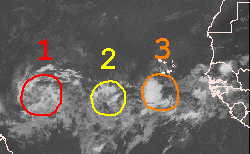
UPDATED: 10:20 am EDT, August 10, 2008 MAJOR ACTIVITY AHEAD FOR NEXT WEEK AND BEYOND The NHC now has two areas of concern on their graphical Tropical Weather Outlook. Both are situated well out in the eastern Atlantic and are moving westward. The western most system is now being designated as 92L which is the first step in the investigation process by the NHC. Some of the computer models show this developing further and in fact, the latest SHIPS model for intensity indicates it will become a hurricane quite quickly. Satellite imagery shows that it is getting better organized so we will want to watch it closely over the next few days. A strong deeply layered zone of high pressure is anchored to the north of the deep tropics and this will almost certainly keep anything that develops from turning north and out to sea for several more days at least. In fact, the long range GFS model has persistently shown one or two large Cape Verde hurricanes moving all the way across the Atlantic and impacting land areas in 10-12 days. While it is not possible for this model to be accurate as to where such hurricanes might track, it is entirely feasible that the model is sensing the development. The GFS is not alone either. The UKMET and the ECMWF all join in "thinking" that we will see development in the eastern Atlantic this coming week. The concern is in the longer range pattern. While a nice protective trough of low pressure in the upper atmosphere has ruled the roost for several weeks (off and on), it looks like we are about to see a pattern change that would place the trough farther back to the west- perhaps over the Mississippi Valley instead of the East Coast. These larger weather features are more reliable to look at in the longer ranges than a relatively small atmospheric feature such as a hurricane. It will be interesting to see how the large scale pattern does indeed evolve over the next week to 10 days. With signs of tropical storm and hurricane formation looming, a lot will depend on when and where future systems will turn northward out of the deep tropics. It is time to make sure you are aware of what is going on each day. People living in the islands of the Caribbean would be first in line for any potential problems. Just keep an eye on things and be ready to act if needed. The hurricane season is ready to get very busy again but we have a great advantage in that we have ample warning time and a wealth of information avaiable from a variety of sources. I'll have another update here this evening. UPDATED: 10:25 am EDT, August 9, 2008 COMPUTER MODELS HINTING AT STORMY FUTURE It is getting towards that time of the season when we will begin seeing one named storm after another. We are not quite there yet but it looks to be coming soon. Several of the global computer models, some of the same ones that have done fairly well in predicting many of this season's previous storms and hurricanes, are now suggesting more development in the eastern Atlantic. It is this clustering of support from several different models that helps to realize what could be real and what is one model's bias towards developing tropical cyclones. So far, the GFS has been consistent in showing rather significant development in about three to four days. It is now joined by the UKMET and the ECMWF just to name a couple of the more reliable models. The good news is that there is nothing close to land on the Atlantic side right now but that is a different story in the east Pacific. In addition to hurricane Hernan, which is well west of Mexico and moving farther away, we have a developing system quite close to the Pacific side of the southeast Mexican coast. It is moving to the WNW and could continue to bring inclement weather to the coast of Mexico until it turns more west with time. Hopefully it will not develop too much while being in such close proximity to Mexico. Yet another system lies between Hernan and the previously mentioned disturbance and it too could gather additional strength as it moves westward. The land areas of the east Pacific have been quite fortunate this season with so much activity forming already and very little impact to land. As we get closer to Fall, we will likely see these systems curve more to the northwest and north as deeper troughs of low pressure impact the steering currents over the east Pacific. For now, there are no major issues to deal with in the Atlanitc or the east Pacific but times are changing, slowly but surely, and next week could see a return to a very active tropics once again. I'll have more here tomorrow. UPDATED: 11:00 am EDT, August 8, 2008 PACIFIC GETS BUSY AS WE WAIT FOR THE NEXT PULSE IN THE ATLANTIC The central and eastern Pacific is about as active as I have seen it in some time. We have TS Kika well to the south of Hawaii and it will remain that way with no appreciable effects being felt there. We also have another disturbance in the central Pacific that is being monitored for development although it looks rather weak this morning. In the east Pacific, hurricane Hernan is tracking westward and towards cooler waters where it will weaken and not bother any land areas. Then there is a strong disturbance near Central America on the Pacific side that should be a depression before too long. It too will move west and away from land. Between that system and Hernan there is yet another tropical disturbance that has potential over the next few days. The really incredible thing is that none of these pose any threat to land areas- amazing! It is all part of the latest MJO pulse coming eastward with its favorable upper level pattern that allows for prolific tropical cyclone formation. We should see this pulse move in to the Atlantic Basin within a week- beginning with the western Caribbean and moving eastward from there. While the favorable MJO pulse is not a guarantee that development will take place, it does help to enhance deep tropical thunderstorms. Right now, the Atlantic, Gulf and Caribbean are tranquil and the weekend looks great. After next week, we should have a lot to talk about aside from the plethora of activity in the Pacific. I'll post updates over the weekend as needed. UPDATED: 9:40 am EDT, August 7, 2008 TONIGHT ON HURRICANETRACK NEWS/TALK: THE SEASON SO FAR AND HOW FAR WE STILL HAVE TO GO Tonight we will "air" our Internet radio program, HurricaneTrack News/Talk. The show begins at 9pm ET right here on the home page. Mike Watkins, Jesse Bass and I will go over the hurricane season to date and discuss the recent forecast updates from Colorado State University and NOAA and why they expect such an active season ahead. We will also answer emails from visitors/listeners- so if you have a question or comment, send it to newstalk@hurricanetrack.com and we will do our best to provide you with an intelligent response during tonight's program. Just tune in to the homepage here at 9pm ET and join us for the hour. If you can't make it, we'll have it archived for you to listen to at a later date. As far as the tropics (Atlantic side)- we are enjoying a short break from the activity. I see nothing to suggest that we will have development during the next five to seven days. It is getting towards that time of the season when prolific development can take place just about anywhere. As for the east Pacific, their next round of named storms has begun with a tropical storm named Hernan. It is expected to become a hurricane as it moves off generally towards the west and away from Mexico. There are currently no other suspect areas in the east Pacific. I will have another update here tomorrow. UPDATED: 8:15 am EDT, August 6, 2008 ONE LAST QUIET PERIOD BEFORE PEAK SEASON ARRIVES Now that Edouard is deep inland over Texas, the tropics are nice and quiet. There are no suspect areas in the Atlantic to be concerned with and that is certainly appreciated. However, it is not likely to last for too long. As we get farther along in the month, we should see a rapid increase in the amount and intensity of storms forming in the Atlantic and east Pacific. This season is simply very favorable for development and there are no signs of that letting up. For us to have had five named storms up to this point, with two of them becoming solid hurricanes, is unsettling. This is not a normal season- we would not have expected that even with the predictions of an active season. Most of the activity was supposed to occur after August 1. The Atlantic became favorable in the thermodynamic sense in early July. Other factors come in to play such as strong upper level winds, Saharan air outbreaks, etc. that have helped to keep things from getting out of control. The signs are clearly there and these next two and half months could be dangerous times for the land areas of the Atlantic Basin. I am not just talking about U.S. interests. The islands of the Caribbean, Bermuda and Mexico are all vulnerable to hurricanes. And, what misses the U.S. could easily impact the Canadian Maritimes. My point is that this hurricane season is different than the last two. I try my best to stick to reality and not jump on the hype band wagon. There is no need for scare tactics- hurricanes are bad enough. While there is obviously no guarantee that we'll see another named storm between now and November 30, I am telling you that there are ominous signs that are rooted in science and meteorology that strongly suggest a very active peak to this hurricane season. What should you do about that? Very simple. Keep aware. Just make sure you know what is going on in the tropics and be ready to act if and when something nasty is headed your way. Maybe we'll get lucky and all of the earlier activty was just a fluke but if not, then people need to be alert and understand what they might be dealing with. We have a quiet period for the next several days- enjoy it but at least be thinking about what you will do if a hurricane, especially a major hurricane, is headed your way. UPDATED: 9:45 am EDT, August 5, 2008 EDOUARD NOW ON THE COAST IN TEXAS AND NOT A MOMENT TOO SOON It waited until the last possible hours before landfall but Edouard made a run at becoming a hurricane. It did not quite make it as top winds were near 65 mph in the stronger rain bands over the water. Now the storm is moving inland over Texas and areas like Houston and Galveston will have a wet and windy day. I have fielded reports from a regular visitor to this site who lives in Beaumont. She says that her power remains on but that some areas obviously are without power. She compares this to last year's Humberto and says it was nothing like that event which was a hurricane upon landfall. So all in all, the 5th storm of the season was not too bad, perhaps just an inconvenience and a bad bech day for the upper Texas coast and SW Louisiana coast. All of the weather will move inland and hopefully bring much needed rain to areas well away from the coast. Will Dallas see any rain from the remnants of Edouard? Hard to say. I'll watch their radar later today and tomorrow. Areas south of Dallas will see some rain and there area flood watches posted. It is now important for inland locations to monitor the future progress of Edouard. I highly recommend going to weather.gov, input your ZIP Code and read the local forecast information. Ex-tropical cyclones can do strange things over east Texas or anywhere for that matter. Just keep aware of the weather coming your way. In a few days, Edouard will be gone. The rest of the tropics are in a lull pattern for about the next week or so. After that, peak season begins to arrive and we'll have to keep our guard up for any potential development just about anywhere from Africa to the Gulf of Mexico. For the next several days, I do not see any trouble spots. I'll have more here early tonight. UPDATED: 11:10 pm EDT, August 4, 2008 EDOUARD CLOSING IN ON TX/LA COASTLINE AS IT STRUGGLES TO GAIN STRENGTH The latest news from the NHC is not too bad concerning Edouard. The storm has turned a little more to the north and could actually make landfall in SW Louisiana instead of the upper Texas coast. You can plainly see the center of the storm on Lake Charles, LA radar even though it is still somewhat lop-sided. Most of the deep thunderstorms are on the northern side of the circulation due to strong southerly winds push said convection northward. It does not appear that the shear will be enough to weaken the storm and there is still a slight chance that Edouard could become a hurricane. Most of the worst weather will be felt within any strong rain bands that move over land. Looking at the radar, if your location looks to within one of these bands, be ready for strong winds and that trademark driving rain that accompanies these storms. The rain will be welcomed in most areas and the storm should move quickly enough to prevent any major flooding. As always, just be cautious if you're out and about in the region. Landfall should take place sometime tomorrow before Noon CT and we will all be watching to see just how strong Edouard gets- or if it weakens. Either way, conditions will not be ideal along the TX/LA coasts but they have seen worse- that much is certain. I'll have more here in the morning. The rest of the tropics are quiet for now with no additional threats developing anytime soon. UPDATED: 5:00 pm EDT, August 4, 2008 NO REAL CHANGE IN STRENGTH FOR EDOUARD Even though TS Edouard has steadily become more organized and typical of a tropical storm, it still lacks that truly deep convection or thunderstorm activity that would lead to intensification. Even so, the air pressure has dropped a little, now down to 1000mb. Winds are still around 45mph but could easily increase if we see deep thunderstorms develop and sustain themselves. The storm is still moving steadily off to the west and should be on shore near Galveston Island before Noon CT tomorrow. The NHC makes an important note on their latest discussion and that is regarding the fact that if Edouard is a strong tropical storm or weak hurricane, it makes little practical difference in the effects felt. If people assume and then plan for a hurricane, then they are prepared. It's that simple. The link below to the hurricane local statements is very useful. Check it out. These are written by the forecasters at the local NWS offices within the areas affected by the storm. For the most specific information available about what to expect, the hurricane local statements cannot be beat. We will keep tracking the storm across the northern Gulf and will have reports here as often as needed. The best news from all of this is that much needed rain is coming for at least some areas of Texas. If we can keep this from getting too strong, then it's a win-win situation. Even the price of oil dropped today in the face of a tropical cyclone moving across an oil-platform rich area of the Gulf. Not bad considering what we have seen in the past... UPDATED: 11:05 am EDT, August 4, 2008 EDOUARD WEAKENS SLIGHTLY AS IT MOVES WESTWARD SOUTH OF THE LOUISIANA COAST Here is a nice radar link that shows most of the Gulf of Mexico. You can see Edouard south of the Louisiana coast and indeed, some rain showers are moving on shore in that region. The storm has weakened some and more importantly, it has not strengthened. There appears to be some attempt at becoming better organized overall but it has a long way to go if it's going to become a hurricane. The NHC says on their latest discussion that the chances of Edouard reaching hurricane intensity are around 20%. So, it looks like a good rain event coming up for portions of Louisiana and then the upper Texas coast. I know folks deep inland, such as those in Dallas, are wishing for some rain, not sure if this will do the trick or not. We'll have to see how far north the storm makes it tomorrow. At least some areas will receive beneficial rains- though they will be heavy at times. Houston is not the best place for handling torrential rains so if you live or work there, be careful. Other than that, the storm should not be too disruptive especially if it does not get much stronger than it is now. We will continue to monitor its progress and I'll have another update here early this evening. UPDATED: 6:15 am EDT, August 4, 2008 TS EDOUARD PUSHING ON WEST TOWARDS LANDFALL IN TEXAS TOMORROW Check out the long range radar loop out of New Orleans. You can plainly see the center of TS Edouard spinning well to the south of the Big Easy. The storm is moving off to the west at around 9 mph now and should reach Texas by perhaps Noon CT tomorrow. It was interesting to note that the NHC was doubting that Edouard was even still a viable storm earlier this morning since a lot of its ogranization had been lost. The main culprit remains strong upper level winds tearing away at the deep thunderstorms that need to develop in order to allow air pressure to fall and the chain reaction to continue. There is still some drier air getting involved with the storm as well- although not as much as yesterday. The overall structure is slightly improved from a few hours ago but Edouard is not rapidly strengthening. The official forecast still shows the storm nearing hurricane intensity before landfall and we need to respect this since we should all be aware of the limitations of intensity forecasts. It would only take 6 to 8 hours of ideal conditions to allow the storm to wrap up and the pressure to drop quickly- thus increasing the winds. Odds are this won't happen but even tropical storms are nothing to mess around with. The one good piece of news is that much needed rain is headed for portions of Texas and this rain should spread inland enough to bring slight relief to the dry, hot weather as of late. We'll continue to watch the storm closely and I'll have updates here throughout the day. The rest of the tropics are fairly tranquil right now with no other organized areas of deep thunderstorms to really be concerned about. UPDATED: 10:45 pm EDT, August 3, 2008 EDOUARD PROMPTS HURRICANE WATCH The 5th named storm of the season, Edouard, has raised quite a ruckus today in the northern Gulf of Mexico. There is enough uncertainty in the intensity forecast that a hurricane watch has been posted for portions of the northwestern Gulf Coast. Right now, the storm looks rather meek with very little deep thunderstorm activity near the center. In fact, the NHC notes that the earlier intensification trend has come to an end. The hope is that this will keep and that Edouard will not get much stronger. There are computer models that show it becoming a hurricane but once again the forecaster at the NHC notes that several of those models were basing future intensification on what was going on earlier. In other words, a lot has changed since earlier this evening and perhaps the intensity models have not quite caught up to Edouard's pause in strengthening. Hopefully that makes sense. Another sign of good news is that there is only a small window of opportunity for the storm to get better organized as dry air in the atmosphere and strong upper level winds continue to exact a toll on the storm. All in all, this does not look to be an explosive situation even though it is certainly getting and will get a lot of attention. However, I caution anyone who lives in the region to remember that intensity forecasting is the area of least skill within the NHC. They do a fine job but it is extremely difficult to model the central core of a tropical cyclone and then figure out how strong it will ultimately get. For that reason, people need to obviously keep well aware of what Edouard is doing throughout the next day or so. Just be aware, act accordingly and use common sense. The rest will take care of itself. I will have more info here early tomorrow morning. UPDATED: 6:05 pm EDT, August 3, 2008 NHC ISSUES SPECIAL ADVISORY AS TD5 QUICKLY BECOMES TS EDOUARD The NHC has issued a special advisory to note that TD5 has now become TS Edouard with top winds of 45 mph. The recon plane flying the mission found these winds in the southeast area of the storm where deeper thunderstorms were. The pressure has also dropped down to 1002 mb. The storm does not look all that impressive on satellite imagery but the NHC notes that it could get close to hurricane intensity before landfall on Tuesday. I'll have a more complete update here later this evening. UPDATED: 5:00 pm EDT, August 3, 2008 TD 5 CONFIRMED IN THE NORTHERN GULF- WATCHES/WARNINGS ISSUED Here is the latest watch/warning info from the NHC: AT 4 PM CDT...2100 UTC...A TROPICAL STORM WARNING IS IN EFFECT FOR THE LOUISIANA COAST FROM THE MOUTH OF THE MISSISSIPPI RIVER WESTWARD TO INTRACOASTAL CITY. A TROPICAL STORM WARNING MEANS THAT TROPICAL STORM CONDITIONS ARE EXPECTED WITHIN THE WARNING AREA WITHIN THE NEXT 24 HOURS. AT 4 PM CDT...2100 UTC...A TROPICAL STORM WATCH IS IN EFFECT WEST OF INTRACOASTAL CITY TO PORT OCONNOR TEXAS. A TROPICAL STORM WATCH MEANS THAT TROPICAL STORM CONDITIONS ARE POSSIBLE WITHIN THE WATCH AREA...GENERALLY WITHIN 36 HOURS. So there you have it. The depression is expected to become a tropical storm and slowly work its way up in strength. The NHC notes that the GFDL model shows this becoming a hurricane before landfall but dismisses this scenario since it is not consistent with other runs of the same model. Generally speaking, conditions for the depression are not ideal and hopefully it will not become a hurricane. The main issue will be rain, some gusty winds and a small storm surge where the winds blow on shore. It looks like the system will be inland over Texas by Tuesday afternoon. There is not much more to say about it right now. We are still seeing the depression in its formative stages and until the stronger upper level winds relax, assuming they do, it will not begin to organize very quickly. I will post an update here near 11pm ET tonight. Check out our tracking map of the depression linked below. We have it plotted on a hi-res sea surface temperature map which is really cool to see. UPDATED: 3:20 pm EDT, August 3, 2008 RECON PLANE IS INVESTIGATING GULF SYSTEM- WE'LL KNOW MORE SOON Even though you can clearly see through visible satellite images that our system in the Gulf of Mexico is trying to push up deep thunderstorms near its center, it is also having a tough time accomplishing that feat. The reason? Strong northerly winds that keep pushing the storms away and not allowing them to stack and then surround the low level center. I say low level center, it looks like it has one on satellite pictures and we'll know for sure soon once we get a report from the Hurricane Hunters who are out there now. Good thing for them it was a short trip from Mississippi (Keelser AFB) to the system. None the less, their on-site info will help to determine for sure if a tropical depression or more has formed. If so, the NHC will have advisories beginning at 5pm ET. The entire mess looks to be moving just south of due west right now and should be inland over the upper Texas coast in about 48 to 60 hours- maybe less. How strong it is once it gets there depends on how much the shear can relax. We will wait and see what the NHC says later this afternoon. I'll have more as soon as the info becomes available. UPDATED: 9:55 am EDT, August 3, 2008 GOOD NEWS SO FAR- GULF SYSTEM HAVING TOUGH TIME GETTING GOING So far, the system we are watching in the northern Gulf of Mexico is having a fairly tough time getting better organized. Dry air being forced in to the system via northerly wind shear is helping to keep the deep thunderstorms from developing a central core over any possible low level center. Until we see that round look to the storms, this will not have much chance to strengthen. None of the computer models show much development either and send the low pressure area westward towards Texas early next week. So perhaps this will end up being a nice rain maker and not much more. The NHC mentions a recon plane being scheduled for today to investigate the system- if that plan holds, then we'll know more about what is going on down at the surface. Right now, it really is just a blob of slowly organizing showers and thunderstorms. Once we get more info from the NHC later today, I'll post an update. The remainder of the tropics features only one other significant area to watch. That area is 99L, the strong tropical wave and surface low that we have tracked since it left Africa early last week. This has a decent chance of becoming a tropical depression before strong upper level winds begin to attack the deep convection and shear the system. I am not sure where this will end up, if it stays weak, it could come farther west and be near the Bahamas in a few days. If it gets stronger, it could turn more north within a deeper steering layer of the atmosphere. We'll keep watching it- odds are it won't amount to much but being that it's August, you never turn your back on these types of systems. I will post more here early this afternoon. font face="arial"> UPDATED: 10:30 pm EDT, August 2, 2008 AUGUST LOOKS TO START OFF ACTIVE WITH GULF THREAT DEVELOPING Here we go- or keep going, as it were. We had a brief lull in activity since Dolly but now things are beginning to heat up once again. The main area of concern for now is a developing low pressure area south of the AL/FL border in the Gulf of Mexico. Deep thunderstorms have fired over what could be a developing low level center. Unfortunately, it is out of radar range for the most part and we cannot see what is really going on at the surface. The NHC notes that pressures are falling across the region, as indicated by the numerous buoys in the Gulf. It looks like we could see a tropical depression form tomorrow and it could strengthen in to a tropical storm beyond that. The track looks to be southwest for now as it ogranizes but a bend back to the west and west-northwest should commence early next week. The GFS computer model shows the system coming inland along the NE Texas coast, other models are farther south. Hopefully this will only be a rain event with some gusty winds. It is very early in the evolution of this system and until we do in fact see a low level center and have aircraft recon data, it is only a guessing scenario as to how strong this could get. Right now, I see nothing in the models to suggest this could become a hurricane- but we never say never with tropical systems close to land. Just pay attention to what's going on and be ready to act if this heads your way. Depending on how developed this actually becomes, Mike Watkins and I may head out as early as tomorrow (Sunday) to position ourselves for a landfall next week. Since we really do not know what we could be dealing with, we are only in the planning stages for now. I'll have more on this system via several updates during the day Sunday. The rest of the tropics are fairly active as well with two well developed tropical waves moving steadily westward. Neither pose a threat to land at the moment and we'll have a lot of time to watch these over the coming days. We are likely entering a period of time where we will see several named storms going one after another. The Atlantic is in this kind of "mood" this year, it seems, and so it is important for people to remain alert as to what is going on out there. No reason to hype it up- it is what it is, the tropics are getting active and it's been a few years since we last saw anything like this. Don't believe that? Consider that this past July was the 3rd most active July for hurricane/tropical storm activity on record. The other two seasons with more activity were 1916 and none other than the infamous 2005 season. So you bet, it is time to take things seriously and be ready for the peak months ahead. We'll stay on top of it all and have updates frequently right here. I'll have more in the morning. UPDATED: 10:10 am EDT, August 2, 2008 GULF OF MEXICO BECOMING A CONCERN There is a cluster of showers and thunderstorms over the north-central Gulf of Mexico this morning that has me concerned about development. It is there due to the remaining energy from a trough of low pressure that moved through farther north and east. That trough is gone now (had little impact on temperatures or dewpoints in the Southeast) but some of its energy has broken off over the north-central Gulf. Sometimes, but not often, these impulses are enough to crank up small tropical cyclones. The GFS model has been off and on with this happening over the next few days. Other models are not showing it much at all. With small systems like this, it can be tough for the models to sniff out the genesis phase and so we will need to monitor things closely over the weekend. The entire weather system should move slowly westward just off the coasts of FL,AL,MS and LA through the remainder of the weekend. I'll keep a close eye on it and post updates as needed. Elsewhere, we have a developing tropical depression, it certainly looks that way, well east of the northern Leeward Islands. Thunderstorm activity has blossomed quite a bit this morning and it would not surprise me to see this become a depression over the weekend. The NHC mentions that it will encounter less favorable winds down the road- so we'll have to see how that pans out. It should continue generally westward as it remains south of a solid Bermuda High anchored over the western Atlantic. It is still several days away from being any threat to land if at all. Obviously, we'll stay on top of this system as well. I'll have more here early this evening. UPDATED: 9:15 pm EDT, August 1, 2008 NO MAJOR ISSUES FROM THE TROPICS THIS WEEKEND Here we are- August 1. This month is when we have seen some historic hurricanes in the past. The good news is that most of those took place towards the end of the month when things are supposed to more active. Although we start to expect an increase in tropical storm formation from here on out, this weekend should be fairly quiet. The only areas to watch are the northern Gulf of Mexico where some showers and thunderstorms have blossomed and 99L- a tropical low that came off of Africa a few days ago. None of these systems appears to be too threatening and any additional development should be slow in coming. If you are boating along the northern Gulf Coast this weekend, be sure to check the marine forecasts from the local NWS in your region. Just go to weather.gov and input your ZIP Code for the latest updates. I'll have more over the weekend as needed. UPDATED: 10:00 am EDT, August 1, 2008 98L MAKING A COME BACK- AS 99L - BUT NO WORRIES, THE WEEKEND WILL BE GREAT We have been watching a tropical wave and associated low pressure area that emerged from Africa a few days ago. When it came off the coast near Dakar and the Cape Verde area, it certainly looked like it was already a tropical depression. However, the deep thunderstorms did not last for more than about 12 hours as the system encountered a more stable environment. The NHC designated it as 99L (it was 98L at first, not sure why it ever changed), the first step in the process of investigating suspect areas of weather in the tropics. Most of the convection died away and only the shell of the low level circulation remained. Since that time, the entire feature has been moving off generally to the west, just south of 20 degrees latitude. Now it is beginning to encounter warmer water temperatures and thus we are seeing a cluster of thunderstorms develop right over the low level center. While the overall circulation is large, the area of convection is not as of yet. Until such time that we see it grow and expand, and remain persistent, it will not develop too much. What is interesting to me is that all of the global computer models show this system moving basically due west for the next several days and, as I mentioned earlier this week, it could end up somewhere around 20N and 60W, give or take a degree or two. We will want to watch this closely as it travels steadily off to the west. The rest of the tropics are quiet and will likely remain that way over the weekend. Computer models suggest a flare of up thunderstorms over the northern Gulf of Mexico early next week as a piece of energy from an exiting trough of low pressure gets left behind near the Gulf of Mexico. Sometimes these can consolidate and become a pure tropical system- we'll see about that. I'll post another update here tonight. UPDATED: 9:50 pm EDT, July 30, 2008 TROPICS SEMI-QUIET BUT ARE ABOUT TO GET BUSY AGAIN AS WE GET READY FOR PEAK SEASON We thought we might see a named storm or at least a depression form earlier today from a strong tropical wave and low pressure area near the west coast of Africa. Time ran out for the system as several negative factors kicked in and diminished the deep thunderstorms for now. We will continue to watch the system as it moves WNW and possibly west over the next five to seven days. It is probably too high in latitude to ever affect the land areas of the western Atlantic- but you never know. The rest of the tropics are quiet for the most part although we are seeing additional areas of convection form from other tropical waves moving across the Basin. Even in the absence of a strong upward motion signal, also known as the MJO, these areas of tropical thunderstorms are managing to form and persist for at least short periods. As we get in to August, especially mid-month onward, we are likely to see quite an increase in named storms again. It is impossible to know where any of these might track or how strong they might become. The bottom line is that July is almost over, it was a very busy month, and the two busiest months still lie ahead. At least for now, the tracking maps will remain blank which is always good news for us coastal dwellers and vacationers to the beaches of the Atlantic Basin. I'll have more on Thursday morning and we'll be back Thursday night with our HurricaneTrack Nes/Talk program at 9pm ET. More on that in the morning.... UPDATED: 3:00pm EDT, July 30, 2008 98L WILL BE INTERESTING TO WATCH OVER THE NEXT WEEK Even though we are sort of between bursts of activity in the Atlantic, that does not mean development cannot take place- it just make take longer to do so. One area to watch over the next several days is a tropical wave and associated weak surface low over the far eastern Atlantic. The NHC has designated it as "98L" in their preliminary classification system of monitoring areas of possible development. All of the computer models show it remaining weak and moving generally westward along or just south of 20 degrees of latitude. With fairly strong high pressure to the north of the system, this seems like a logical track for this system for about the next week. If it indeed remains weak, we could see it near 20N and 60W and from there, we'll have to watch it closely. Otherwise, there are no other areas of organized thunderstorms that seem likely to develop in to anything over the next few days. I'll have another update here later tonight. UPDATED: 10:15 am EDT, July 30, 2008 ANOTHER NAMED STORM FOR JULY? COULD BE CLOSE Just when it appeared all was calm and quiet, this comes along. It is a tropical wave that looks to be well on its way to becoming a tropical depression at any time. Where is it? That satellite photo is of the west coast of Africa and the Cape Verde Islands. The system is between the two areas of land. Amazing. We should not be seeing this kind of development just yet and the fact that we have had it for almost a month now, beginning with Bertha, is even more amazing. The NHC says that this system should move off to the northwest and encounter cooler waters. It should also stay away from the land masses farther west- once it moves past the Cape Verde Islands. So while it is quite a rare event, it is one that continues to send the signal of an active hurricane season. At least the rest of the Atlantic, Caribbean and Gulf of Mexico are fairly quiet today. I will post another update when and if the NHC upgrades the Cape Verde system to a depression. 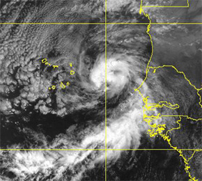 UPDATED: 9:05 am EDT, July 29, 2008 SMALL DISTURBANCE IN THE GULF THE ONLY AREA TO WATCH After a very busy July to date, things have calmed down significantly across the east Pacific and the Atlantic over the last few days. The only area that warrants any concern at all is a small cluster of thunderstorms located south of Louisiana this morning. The NHC does not give it much of a chance of developing and it should move inland later today. It looks to me like it is moving generally WNW along the coast and will continue to bring rather heavy showers and thunderstorms to portions of SE Louisiana throughout the day. Other than that, we are in between periods of favorable conditions and should have a quiet period lasting in to early August. I'll post another update here this evening concerning the disturbance in the Gulf. UPDATED: 10:40 am EDT, July 28, 2008 SIGNALS OF A BUSY SEASON So far, we have seen four named storms in the Atlantic. One of them became major hurricane Bertha which was also the earliest Cape Verde origin storm on record. And we had Dolly just last week which bombed out right before landfall with its central pressure dropping like a rock just off the coast of Texas. Both Dolly and Bertha had their beginnings as strong tropical waves that emerged from Africa. When we throw in Arthur, a weak early June storm and Cristobal, which almost became a hurricane after passing the Outer Banks of NC, then we have indeed seen quite an active season to date- all of this took place before the end of July. There is a reason behind this and in fact, several reasons. We are not seeing the dry, dusty outbreaks of Saharan air this season that overwhelm the eastern Atlantic. Air pressures have been lower across the eastern Atlantic, allowing for more convergence and the easier build-up of tropical thunderstorms. Sea surface temperatures are running above normal in many areas of the Atlantic Basin but not nearly as much as we saw during the 2005 hurricane season. All of these factors, combined with other, more complicated ones, come together as signaling quite a busy season. So far, that is exactly what we have witnessed. What about the next 3 months? We will get an updated outlook from both Colorado State University and NOAA regarding their seasonal forecasts. I would imagine that the overall numbers will come up some to factor in the busy July period. I see no indication that August, September and October will have anything less than what we would normally expect and probably more so than normal. We have almost an entire hurricane season to go in terms of normal climatology. It is over the next few weeks that the averages begin to increase. If you have tracked hurricanes even a little, you probably know about the peak occurring in September. We still have a long way to go. However, over the next week to 10 days, I am hopeful that we will see little activity at all. There are these periods even within active seasons when conditions just aren't all favorable. We are in between favorable conditions right now and it looks like mid-August would be the logical time to expect a return to prolific tropical storm formation. I hope that people will use this time to do things like check their insurance coverage. Make sure your generator is up and running. If not, get it serviced now. Keep your auto in top running condition as your budget will allow. If the need arises for an evacuation of your area, the last thing you want is to be stuck in your broken down auto. These are just some suggestions of things that can be done ahead of the traditional peak of the season which is still weeks away. Whether or not we end up with a so-called hyper-active season matters little. Most hurricanes will likely remain out at sea. They usually do, if not, people wouldn't live along the coast. However, it is reasonable to assume that perhaps a few might actually hit land. If that land is where you live, then you better be ready. Like I say often here, being ready is a state of mind as much as it is taking actual physical precautions. And it is also a matter of how much you can afford in terms of preparedness. Just have some kind of plan as to what you will do if a hurricane, especially a major hurricane, comes your way. We have this down time to make such plans. Let's use it wisely since we know that August and September lie in front of us. I'll have more here tomorrow. UPDATED: 10:35 am EDT, July 26, 2008 TROPICS IN CHECK THIS WEEKEND The tropics are not too active this weekend and should remain that way for the next several days. We are always watching tropical waves as they march across the Atlantic but none appear to be organizing at the moment. A rather stable pattern of generally sinking air (subsidence) should rule most of the Atlantic, Caribbean and Gulf over the next several days with only scattered areas of deep, tropical thunderstorms developing. One such cluster has formed in the northern Gulf of Mexico but none of the models show this hanging around long enough to be of much concern. Other than that, the weekend looks great. Unless anything pops up worth talking about, I'll have another update here on Monday. UPDATED: Noon EDT, July 24, 2008 AFTER DOLLY, WHAT'S NEXT? Now that Dolly is deep inland over Texas, still causing flooding rains no less, what's next for the tropics? Hopefully a nice lull in activity before the next round of named storms begins. We can track with relative success the chances of seeing tropical storm formation based on what is called the Madden-Julian Oscillation. Think of it as a large area of favorable upward motion in the atmosphere- a way to produce deep tropical thunderstorms. When this condition is present, you see a lot of deep convection over the tropics which sends solar radiation back in to space. This is picked up by satellites and registered as outgoing longwave radiation (OLR). When this is lower than normal, then you would expect to see a lot of cloud cover, when it is above normal, then a lot of sunlight is hitting the Earth and being reflected back out in to space, indicating the absence of clouds. What exactly causes this MJO pulse is not completely understood and it does not mean 100% chance of tropical storm formation when it is favorable. We can also see storm formation even during non-favorable periods. In any case, we are entering a period of suppressed convective activity in both the east Pacific and the Atlantic Basin. Sure, there will be blobs of thunderstorms here and there but we should go the next few weeks without seeing three named storms in a row. One might sneak in, you just never know, but hopefully we can emjoy a quiet few weeks before the August/September peak arrives. In fact, the only area to watch right now is a well defined tropical wave just west of the Cape Verde Islands. This does have some potential for development but it should be slow-going. In the east Pacific, we still have TS Genevieve far from the Mexican coast and moving even farther away. No other development is expected in that region either. We will discuss this and hurricane Dolly on tomorrow night's edition of HurricaneTrack News/Talk. The program will be broadcast here on the homepage at 9pm ET. As usual, if you have a question or commment ahead of time, please feel free to send it to: newstalk@hurricanetrack.com and we'll try to answer it during the show. I'll have another post here tomorrow morning. UPDATED: 10:45 pm EDT, July 23, 2008 WHAT A DAY This was just about as busy a day as it can get for this site with plenty of activty going on surrounding the landfall of what was hurricane Dolly. We have been tracking the tropical wave that became Dolly since last week, if not before. It came from Africa and moved across the Atlantic all the while slowly organizing. After a few false starts, the tropical wave finally took shape and became the event that took place today- a hurricane landfall. South Texas received the worst of the weather with hurricane force winds pounding areas like South Padre Island and Brownsville for many hours. Even areas farther south in Mexico, near Matamoros, received hurricane force winds. We know this because of people like Tim Millar. He was there in an instrumented SUV to measure wind and pressure- among other things. His top gust? 119 mph early this morning. It actually happened while he was on LIVE talking with us during an audio broadcast the we provided to visitors of the site. Ground data is very important and Tim's observations will now be a part of hurricane history. Good job! Now Dolly is moving deeper inland. It's odd, as of this writing, the storm looks very much like a hurricane with a clearly defined eye on satellite and radar. They never cease to amaze us. That's why we are glued to the computer monitors and TV screens now more than ever. They are named and even seem to have their own personalities. No one wants to see people hurt or property damaged. But when it happens, Mother Nature shows us who is in control and it's definitely not us. So keep this in mind- while people along the western Gulf of Mexico coastline begin the clean up process, file the insurance claims and share their own stories of how they survived hurricane Dolly, it's all part of living on the coast. Sooner or later, another coastal community will have to deal with another hurricane. Let Dolly serve as a stark reminder that we are deep in to this hurricane season with the traditional peak still to come. Hurricanes can do strange things but we do get advance warning of their impending arrival. Let's make sure we are all ready for lies ahead as we end July and begin the month that saw the likes of Camille, Katrina and Andrew in years past. Apparently the 2008 hurricane season means business- take it seriously and keep aware of what may be coming. We'll continue our part and encourage all to use as many resources as possible. Do that and you will not be taken by surprise. Now, let's all get a good night's sleep and see what Dolly has left behind when the sun comes out tomorrow. Hey, good thing this was not named "Annie". UPDATED: 4:45 pm EDT, July 23, 2008 HURRICANE DOLLY SLOWLY, PAINFULLY MAKING ITS WAY INLAND OVER SOUTH TEXAS- RAIN THREAT IS ENORMOUS Dolly is now just about completely on shore in south Texas- just north of Brownsville. That is where the eye is. However, heavy rains and strong winds extend out well past the eye and these rains are what will likely make news over the next day or two. Since Dolly is moving so slowly, the rain just keeps mounting up. Flooding is a major problem as reported to us by our colleague Tim Millar who is in the area. Intersections have 2 to 3 feet of water in them in some places with typical poor drainage. This will only get worse until Dolly moves far enough away to shut off the tropical rain valve. I will emphasize it once again- if you live in the area or know some one that days, please have them check the hurricane local statements link below for important local information from the NWS. These statements will single out areas that are expected to receive the greatest impact from Dolly. Even areas as far north as SW Louisiana saw rough weather today as a result of Dolly. This is why we say time and again that all hurricanes are dangerous- Dolly is no exception. UPDATED: Noon EDT, July 23, 2008 DOLLY POUNDING THE BORDER AREA OF TEXAS AND MEXICO Hurricane Dolly has shown once again that intensity forecasting still has a long way to go. Winds are now 100 mph as the pressure has dropped all morning long- but hopefully has leveled out now. We have been doing live audio broadcasts here on the homepage which included live information from our friend and colleague Tim Millar of the Cyclone Research Group. Tim is in and around Matamoros, Mexico with a specially equipped SUV complete with a weather station for gathering ground data during the hurricane. We were live when Tim recorded a wind gust to 119 mph and in fact, that observation was indicated in the 11am public advisory from the NHC. Good job there Tim! Ground data is so important during hurricanes and the more, the better. However, it is not something to take lightly and Tim has the experience to know what he is doing. We are going to try to talk with Tim more around 1:30pm ET here on the homepage. Stay tuned... As far as the hurricane and what to expect in the coming hours- well, unfortunately, Dolly has continued to slow down and is really pounding the region with heavy rains and strong winds. There have also been tornado warnings issues for some of the stronger thunderstorms within the rain bands circulating onsore. Even areas as far north as the TX/LA border are receiving much needed rain fall. On the other hand, rain is probably going to be the biggest story out of this when all is said and done. Up to 15 inches is forecast to fall across the Rio Grande Valley and this could spell disaster for people who live along the banks of the river. In addition, storm surge to the north of the eye along with high winds will cause damage- this mostly in Texas, north of Brownsville. And, the longer Dolly sits out there, the longer these rains will fall- further increasing the flood risk. Needless to say, we'll be hoping for a good outcome and will await news reports from the area when Dolly finally moves through. The rest of the Atlantic and east Pacific are of no concern right now. Again, I will have another live audio broadcast here on the homepage around 1:30pm ET. I will be joined by our analyst Mike Watkins as we continue our online coverage of hurricane Dolly. UPDATED: 8:30 am EDT, July 23, 2008 RECON FINDS PRESSURE DOWN TO 967 MILLIBARS The plane investigating Dolly this morning has found the air pressure has dropped significantly to 967 millibars. This is very concerning as it appears the hurricane is undergoing rapid strengthening right up to landfall- a very dangerous situation. I will have more as the morning progresses. UPDATED: 7:00 am EDT, July 23, 2008 SOUTH TEXAS AND NORTHERN MEXICO UNDER THE GUN FROM A STRENGTHENING DOLLY  Hurricane Dolly is clearly getting better organized in the final hours before landfall along the US/MX border. The eye is now visible not only on radar but also on satellite images. The pressure continues to fall, now below 980 millibars, and the wind is increasing. Folks in south Texas and northern Mexico are in for a rough day- no doubt about it. We have a good friend of ours in Mexico, just south of the border, with a vehicle similar to ours that includes an anemometer, pressure sensor and much more. He is Tim Millar of Cyclone Research Group. He just so happened to be on the way to taking his Jeep to Cancun for the season in an effort to pre-position several vehicles this season when Dolly came along. Talk about perfect timing. Tim reports to us just now that winds are out of the NNW at 49 mph sustained with a gust to 61 mph. Pressure where he is now reads 994mb or 29.35 inches of mercury on his barometer. That will continue to fall as Dolly's eye gets closer. We will be talking to Tim LIVE right here on the homepage later this morning. We are looking to get him on around 9am ET and then again around 11am ET. All you have to do is visit the homepage here and his audio stream of our conversation will play live. If you have a question for Tim, send it to: newstalk@hurricanetrack.com and we'll see if we can ask him.
The other big story with Dolly will be the heavy rains that are now falling and will continue to fall over the next few days. That's right, it will take a few days to get this system out of the region as steering currents are slowing even more as Dolly approaches landfall. The Rio Grande Valley is in jeopardy from flash flooding and overall river flooding. I think this will be quite the news story after Dolly is inland. We will certainly hope for the best for the people down there- it could be a rather bad situation. I will post more here around the 9am ET interview with Tim. UPDATED: 11:00 pm EDT, July 22, 2008 HURRICANE DOLLY CLOSING IN ON TX/MX BORDER AREA The outer rain bands of Dolly have been moving on shore in Texas and Mexico for most of the day. The center or eye is now evident on NWS radar out of Brownsville and it is obvious that Dolly has slowed down quite a bit. This poses a problem in that flooding rains along the Rio Grande could be a real issue. I hope that people there are taking precautions and use common sense when dealing with this situation. Dolly should be completely ashore by Noon ET tomorrow but if it slows down even more, this could be delayed. It is worth noting too that areas as far north as SW Louisiana and NE Texas have received rain and are also under a coastal flood advisory. The coastal flooding is due to the long fetch of wind over the Gulf of Mexico driving it enough to push it over coastal roads. It should not be too big of a problem but underscores the vulnerability of that region to wind driven storm surge. The rain was much needed and a little more will fall before all is said and done. We will be hoping to talk to a friend of ours, Tim Millar, who is in Mexico with a special hurricane intercept vehicle sometime during the morning Wednesday. Our time slot is between 10am ET and 11am ET. I will post a Windows Media Player console in the homepage, like we do when we have our radio show, so that all you have to do is visit the page here and listen in. I will phone Tim live and we will talk about conditions where he is as long as the cell phone he is on remains active. Tim will be able to give us live wind readings as well as pressure and other weather data. We appreciate his willingness to rely this info and wish him the best of luck on this mission. When he is done with Dolly, Tim will take his SUV over to Cancun to pre-position it for the remainder of the season. We'll ask him about that tomorrow during our conversation. The rest of the Atlantic is fairly quiet with th exception of Cristobal. However, it is quickly becoming a large ocean storm and losing its warm-core tropical characteristics. We should be saying goodbye to the "C" storm tomorrow. After that, we will only have Dolly to deal with as the rest of the Atlantic should be storm free for a while. Even the east Pacific is not as active with only TS Genevieve out there now and it is moving well away from Mexico. I will have more in the morning as we look forward to the live report from our colleague Tim in Mexico. UPDATED: 5:05 pm EDT, July 22, 2008 RECON FINDS THAT DOLLY IS A HURRICANE- TOP WINDS NOW 75 MPH Dolly is now the 2nd hurricane of the 2008 season. The reconnaissance plane found that winds had reached hurricane force and the pressure down to 986 millibars. This makes Dolly a category one hurricane and of course the second hurricane of the season. So what's next? Well, it looks as if Dolly will continue to slow down, its forward speed is now 10 mph and is likely to slow even more as it approaches the coast. We have already seen rain bands moving on shore along the Texas and Mexico coast lines. More of that is on the way and with it, an increase in winds. The NHC mentions that tropical storm force winds could reach the coast this evening. Tomorrow, the center will arrive and with it, hurricane force winds and a storm surge to the north of where the center makes landfall. Exactly where the center makes landfall is tough to call right now but it looks like it will be close to Brownsville. Either way, most of the worst weather conditions will be felt to the north of the center so even a landfall in Mexico will not keep Texas in the clear. It is also important to note that the NHC mentions the threat of heavy rain from this hurricane and with the slowing motion, these rains will really begin to accumulate. Flooding is likely to be a major issue along the Rio Grande Valley. Once again, I encourage you to visit the link below to the NWS hurricane local statements. Here you will find valuable local information that can help to keep you safe. We'll keep watching the hurricane and should have a live interview with colleague Tim Millar who is in Mexico with a special hurricane intercept vehicle. That interview is slated for tomorrow morning as conditions allow. I will post the exact time in the morning. We might even be able to talk to Tim off and on throughout the day. The live broadcast will be featured right here on the homepage. Stay tuned. I'll have more on the rest of the tropics late tonight. UPDATED: 10:15 pm EDT, July 22, 2008 DOLLY UP TO 70 MPH NOW AS PRESSURE DROPS- HAS ALSO SLOWED DOWN SOME TS Dolly is on its way to becoming a hurricane and should be one later today. The pressure in the center continues to fall and is now down to 991 mb. This is due to the continuous deep thunderstorms that develop around the center. This rapid upward motion of the clouds, called convection, is what helps to lower the air pressure in the center. The lower the pressure, the more the wind picks up- kind of like a drain in a bathtub which has spiral bands like a tropical cyclone. As long as the deep thunderstorms continue, Dolly will strengthen and probably right up until landfall. You can already see the outer bands of Dolly on Brownsville, TX radar. Those bands will reach the coast later today and will be accompanied by an increase in the wind. I am sure too that the Gulf is beginning to get active in terms of waves along the beaches. The NHC is expecting as much as six feet of wind driven storm surge to the north of where Dolly makes landfall. This is important to note since even if the center comes in south of Brownsville, areas to the north for many miles will have a direct onshore flow of wind and thus a rise in water levels. Do not take this for granted, I have a link below to the NWS hurricane local statements which contain excellent information about what conditions are forecast to be in your specific area. Be sure to read these statements in order to better understand what the local impacts could be. It's a great resource and your tax dollars at work. Once Dolly moves inland, and it may do so rather slowly, the threat of rain-induced flooding along the Rio Grande Valley will be a concern. We will have to look at that problem later tomorrow as we get closer to landfall. Hopefully there will be some beneficial rains for parts of Texas from this event without the lethal affects from flooding- we'll keep our fingers crossed. The rest of the Atlantic is busy with TS Cristobal moving out to sea and a new area of interest off the coast of Africa. Even if it develops, I think it will not make it past 50 degrees west longitude as it is already near 16 degrees of latitude. We'll watch it as we always do and I'll post more info here early this evening. UPDATED: 11:50 pm EDT, July 21, 2008 DOLLY TRYING TO GET ORGANIZED OVER THE GULF- HAS SOME HURDLES TO GET THROUGH BUT THAT IS A GOOD THING If you look at a satellite photo of Dolly and the Gulf of Mexico, you would think that the storm is big, bad and powerful. Most of the cloud cover is old cirrus outflow clouds being thrown out by the large anti-cyclone over the Gulf of Mexico. While this is indeed needed to help Dolly intensify, it is not indicative of Dolly being really that large. In other words, the worst of the weather is focused near the developing core of deep thunderstorms where the center is- and as of 11pm ET, that was 23.1N and 92.8W. It is worth nothing that we are seeing a developing core of deep convection and this is usually a sign of lowering air pressures and an increase in wind speeds. Dolly should be a hurricane by later tomorrow if not sooner. The NHC also notes warm and cold eddys in the path of Dolly. These are small features within the Gulf that can help to either provide a deep pool of very warm water or cooler than normal water. Dolly is expected to pass over one of each of these systems and it will be interesting to see how the storm reacts when these transitions occur. Hopefully, Dolly will not have time to really consolidate and become much more than a minimal hurricane. But let me stress this fact: even a minimal hurricane can cause significant damage. Remember, there is wind, storm surge, rain and the threat of tornadoes to deal with. All of these impacts could be present when Dolly arrives in the next day or so. Even a landfall of the center in Mexico will not make for a pleasant day for areas like Brownsville or even Corpus Christi. I have posted a link to an excellent resource from the NWS that I urge people to view. It is the hurricane local statement issued by the local weather service office. It contains much more detailed information on the local impacts expected. Check it out and heed the warnings. That and common sense will help to make this much more tolerable. Cristobal is not going to make it to hurricane intensity, at least I am pretty sure of that. The storm is now moving faster away from the U.S. and should even miss the Canadian Maritimes. Oddly enough, the storm looks like it is going to ride up and over the Bermuda High over the next few days with a turn back to the south. What a strange season for tropical cyclones in the North Atlantic. The rest of the tropics are quiet for now with the exception of the east Pacific. There we still have Fausto and Genevieve- neither of which are of any concern to land masses. I will post more here tomorrow concerning Dolly and the rest of the action in the tropics. UPDATED: 5:10 pm EDT, July 21, 2008 WHERE WILL DOLLY MAKE LANDFALL AND HOW STRONG WILL IT BE WHEN IT GETS THERE? I am sure a lot of people have been asking those questions today. The official word from the NHC keeps Dolly making landfall near Brownsville, Texas some time on Wednesday. They make a point of saying too that other reliable computer models suggest a landfall south of Brownsville- in northeast Mexico. Either way, people in the hurricane watch area should be getting prepared for possible hurricane conditions on Wednesday. There is no reason to try and out guess the forecasters at the NHC and no real way to know exactly where Dolly will make final landfall until it happens. Too often people focus on the lat/lon center position and neglect to remember that a tropical storm or hurricane is a large weather system with far-reaching affects. So even if it does make landfall, the center, in Mexico, people in south Texas will feel the effects. And, depending upon how strong Dolly gets, it could be rather nasty in areas north of where Dolly comes ashore. It is interesting to see how Dolly is trying to organize. The system has been tracked as a strong tropical wave ever since it left Africa many days ago. It tried to form in to a depression near the Windward Islands and then again several times while crossing the Caribbean Sea. We have talked about it on this site every day for at least a week. There is something about this system that has kept it from fully getting its act together which is obviously great news. The question of how strong it will get before landfall seems to depend on whether or not it can truly consolidate its inner core and tighen up the circulation. If it does, and can bundle all that energy available in the Gulf of Mexico, then it should become a solid hurricane. Of course, it might never live up to the potential that is available and that is the outcome we are hoping for. It will be important for people to keep up with how strong Dolly gets as that will have obvious consequences on how much of an impact this has at landfall. As far as us going to Texas- not this time. It's just not feasible for us to leave North Carolina and get to south Texas in time for the landfall. With it only becoming a named storm yesterday, time was just not on our side this go around. However, a good friend of ours will be in the area- Tim Millar from Cycloneresearch.com is en route to Houston via plane now. He actually has a Jeep outfitted with weather equipment already in Texas that he will use to monitor the landfall. We will tap in to Tim's information and will even have him on with us LIVE via telephone during his mission. Stay tuned for updates as we get closer to landfall on Wednesday. We wish Tim the best of luck and for him and his team to stay safe out there! The rest of the tropics feature Cristobal moving away from the U.S. and on out to sea. We also have a strong tropical wave moving off of Africa that should be our next named storm several days from now. This was picked up by the NHC while still inland over western Africa. Otherwise the Atlantic is problem free right now. In the east Pacific we have TS Fausto and TS Genevieve churning in the waters well off the coast of Mexico. Neither system is forecast to affect Mexico directly. Hopefully this will be the last in a long series of named storms for the east Pacific. I'll post more here around 11pm ET. UPDATED: 11:10 am EDT, July 21, 2008 DOLLY THE BIG STORY THIS WEEK We now have a hurricane threat for the United States as well as Mexico. Dolly is expected to become a hurricane as it moves over the warm waters of the Gulf of Mexico. Landfall is now projected to be in south Texas on Wednesday. Dolly is fairly large and trust me when I tell, areas to the north of where Dolly comes in will feel the effects as well. This is potentially a dangerous situation for people in south Texas and northern Mexico. A hurricane watch has been issued (a href="http://www.nhc.noaa.gov/storm_graphics/AT04/refresh/AL0408W+gif/143233W_sm.gif" target="page">click here for watch/warning graphic from the NHC) and it is now time to prepare if you live in the region. The NHC notes that Dolly has a large and sprawling circulation and thus it will affect a rather large area. We will also have to monitor the evolution of the computer model guidance over the next day or two as there are subtle changes that could make a big difference in who receives the worst effects. We are seriously considering heading to Texas to intercept Dolly when it reaches the coast there. We have a wind tower that we can take with us to set up and measure/report wind speeds along the coast. The big question for us is where would we set up? If Dolly comes inland in Kennedy county, there is not much we can do there since more cows than people live there. However, if Dolly is a large hurricane, we could serve reliable wind data and other observations from as far north as Corpus Christi. This is a tough call since it is quite a haul to get from NC to Texas in a short period of time. I'll post more info on what we decide later today. We are also tracking Cristobal which is moving quickly away from the United States. The storm is a little stronger now and just might make it to hurricane intensity before all is said and done. Folks in the Canadian Maritimes should monitor the progress of Cristobal although it looks likely to pass south of there for now. There are no other areas of concern yet but the eastern Atlantic is probably going to get active again as the week progresses. I'll have another update here early this evening. UPDATED: 10:35 pm EDT, July 19, 2008 YOU THINK IT IS BUSY IN THE TROPICS NOW? JUST WAIT UNTIL LATER THIS WEEK We have seen quite a remarkable hurricane season so far for the Atlantic Basin. We are up to four named storms with two of them coming from deep tropical origins (tropical waves originating from Africa). In fact, Bertha, which will affect Iceland of all places as a strong extra-tropical storm, was the earliest known Cape Verde hurricane way back at the beginning of this month. Since then, we have had numerous areas of interest pop up which finally led to Cristobal and now Dolly. As if that weren't enough, the NHC issued a very rare tropical weather outlook tonight that mentioned a very well organized tropical wave STILL OVER AFRICA that could easily develop soon after it gets over the warm waters of the eastern Atlantic. We could have five named storms by the end of July. It has not been this busy this early since 2005- when we finished July with seven total named storms thus far that season. It is hard to think that we will eclipse the historic 2005 season and I am in no way suggesting that. But it is important to note that we are well ahead of any normal pace for this hurricane season. That being said, we have TS Cristobal which has finally tried to fire off some deep thunderstorms. The satellite image of the storm suggests it is really getting its act together. But the local radar out of eastern North Carolina still shows a very lop-sided storm with the deep storms and rain showers well south of the center. None the less, Cristobal is likely to get a little stronger now as it pulls completely away from the Carolina coastline. It should move on out to sea but could come close enough to the Canadian Maritimes to warrant some concern. Folks there should keep an eye on Cristobal as we should know more about its future track by this time tomorrow night. Next we have TS Dolly in the western Caribbean. Dolly should cross the Yucatan and then be positioned in the southern Gulf of Mexico. It is possible that Dolly will become a hurricane- but how strong is way up in the air. We will really want to keep close tabs on Dolly since it is almost a given to hit either northern Mexico or south Texas (or a combo of the two). Any small changes in track could bring it right in to the Texas coast. Of course, we do not want to neglect our friends in Mexico either- for a USA miss is their hit. Bottom line, if you live from Corpus Christi south to areas such as Tampico in Mexico, you will want to know exactly what Dolly is up to each day. There is not a lot of time with this one since it developed just today so please do keep informed and be ready to act as needed. First, we'll have to deal with a landfall along the Yucatan but it should not be too strong with flooding rains and some strong winds being the primary issues. UPDATED: 5:15 pm EDT, July 19, 2008 CRISTOBAL SHOULD REMAIN A NON-ISSUE WHILE WE TURN OUR ATTENTION TO DOLLY I have been along the Outer Banks of NC today with colleagues Jesse Bass and Todd Ferebee. We set up our wind tower at Cape Hatteras and managed to record wind gusts in the low 30s. This was actually expected since TS Cristobal had very few deep thunderstorms with it and what littl it did have wer confined to the southern part of the storm- well offshore. The forecast calls for Cristobal to perhaps strengthen some as it moves northeast near the U.S. East Coast. We'll watch it closely in case it moves in a manner close enough to bring nasty weather to areas north of the Carolinas. Otherwise, Cristobal was not a big deal and brought some much needed rain to many areas of the Carolinas. Now we will focus more on TS Dolly. It is forecast to become a hurricane in the southern Gulf of Mexico but how strong and exactly where it ends up remains to be seen. The computer models favor a northern Mexico final landfall but we will have to wait for another day or two in order to learn more about how the upper air pattern will evolve and what any changes might do to alter Dolly's track. As was mentioned in the latest NHC discussion, the track forecast is fairly well clustered so hopefully there are no suprises down the road. People in the Yucatan, mainland Mexico and even south Texas should follow the progress of Dolly quite closely. That's all I have for now. Todd and I are on our way back from Hatteras and I will need to look over more information and computer model data when I return to my office tonight. Thus- I will post another update here late tonight. UPDATED: Noon EDT, July 20, 2008 WE ARE NOW UP TO FOUR NAMED STORMS IN THE ATLANTIC SO FAR THIS SEASON- DOLLY HAS FORMED IN THE WESTERN CARIBBEAN The NHC has issued a special advisory to indicate that we now have tropical storm Dolly in the western Caribbean Sea. This is the system we have been tracking for several days- even when it moved off of Africa last week. The forecast calls for only modest strengthening as it heads towards and then across the Yucatan and in to the southern Gulf of Mexico. Early indications are that Dolly will head towards northern Mexico though people in south Texas will certainly want to keep an eye on Dolly next week. I will have a complete update on all of the acitivty in the tropics, including yet another very impressive tropical wave emerging from Africa today, later this evening. We are all but wrapped up here on the Outer Banks as the effects from Cristobal are minimal. UPDATED: 10:55 am EDT, July 20, 2008 CRISTOBAL NOT MUCH TO WRITE HOME ABOUT- LITERALLY No one is complaining but TS Cristobal is not really amounting to too much today. It has had a hard time keeping any deep thunderstorms near the center and what little it had, has been displaced. There is something missing in the mix here to get Cristobal to ramp up and that has meant very nice weather for the most part for the Outer Banks of NC- where I am with partners Jesse Bass and Todd Ferebee. We did put up the wind tower and its data can be seen via the link below- along with a live web cam image. We will have this set up for another couple of hours and then roll things up out here as not much is going on. Our attention will shift to the Caribbean system sinc it is likely to have major impacts on land areas in the coming days. I will post more here early this evening. UPDATED: 6:20 am EDT, July 20, 2008 OUR LIVE WEATHER DATA IS UP AND RUNNING AWAITING CRISTOBAL'S ARRIVAL Even though the storm is weak and disorganized, we have made the effort of setting up our wind tower at Cape Hatteras. So far, the weather out here is not bad at all. A few passing rain showers with brief gusty winds is about the extent of it so far. None the less, we do have the tower and its live web cam running via the link below. Check it out. We did mess up getting the direction correct- that comes from being quite tired. The wind is from the southeast for the most part, not the northwest as the display indicates. Other than that, the data and the web cam are working great. I'll have another update on the future track of Cristobal and the rest of the goings on in the tropics early this afternoon. UPDATED: 10:50 pm EDT, July 19, 2008 CRISTOBAL NOT A BIG PROBLEM AS OF YET So far, TS Cristobal is not strengthening too much, if at all. It seems that there is enough dry air in the mid-levels of the atmosphere to help and choke off deep thunderstorm development. Without explosive thunderstorms, the air cannot rise and pressures at the surface lower. The entire chain-reaction process is delicate and it seems that Cristobal is not within prime development conditions. We know how quickly things can change and thus we are en-route to Cape Hatteras to set up our 10-meter wind tower for what ever observations we manage to get from this storm. At the very least, it will be a great field test of our equipment and if the storm does become any stronger and tracks close enough to us, we'll have some excellent data to share with you all. I am working with Jesse Bass and Todd Ferebee on this mission and we will post at least one video report here some time tomorrow. As for the rest of the Atlantic Basin- we are still waiting to see what the tropical wave in the Caribbean Sea is going to do. The NHC says it is likely to become a depression and perhaps even a storm before too much longer. It should track generally towards the Yucatan. From there, we'll have to wait and see but the odds favor northern Mexico for a landfall- but first, let's see if it ever completely organizes and does anything. There are no major issues in the east Pacific even though we keep seeing development after development there. So far, nothing has impacted Mexico too severely and it looks to remain that way in the days to come. We will have more from Cape Hatteras, NC during the day tomorrow- including a link to our live weather data. UPDATED: 5:00 pm EDT, July 19, 2008 PLENTY OF ACTION AND A FIELD MISSION ABOUT TO GET UNDERWAY The big story this weekend is tropical storm Cristobal. Top winds are now 45 mph and it is forecast to keep steadily intensifying over the warm waters of the Gulf Stream. In fact, you can see its track plotted on a very nice hi-res SST map via the link below. You will notice that it tracks right over the Gulf Stream and this should help to ramp it up over the next two days. Folks along the NC Outer Banks are used to such events but this time of year, there are a lot of vacationers out there too- and they might not be so used to seeing weather like this. Hopefully, Cristobal will not become a hurricane but we cannot completely rule that out. I only say that because of what hurricane Alex did in this same general area almost four years ago. Besides, it's better to plan for the worst, right? No matter how strong it gets, we will be out on Hatteras Island by later tonight to set up one of our 10-meter wind towers. Once this is complete, I will post a link where you can watch the live data and a web cam feed to your heart's content. One positive thing about this storm is the much needed rain that has fallen and will continue to fall across many portions of the eastern part of North Carolina. Be careful out there, slick roads will be possible especially in heavy, tropical downpours. And if you have family at the beach, be mindful of rough surf conditions. The storm should generate some nice wave action but remember, water is dangerous and it must be respected. I will post more on Cristobal once I reach Hatteras later tonight. Elsewhere, we have that strong tropical wave in the central Caribbean. I expect that this will eventually devlop but when that time comes is the question of the day! It has been trying, if you will, for several days to get its act together but to no avail. We will want to watch its future progress carefully as people in the western Caribbean and then northern Mexico and possibly south Texas could have to deal with this next week. For now, it is a large feature creating quite a bit of unsettled weather along its track. We'll keep close tabs on it throughout the weekend. The rest of the Atlantic and Gulf are quiet for now but Bertha is still out there but it is racing out in to the North Atlantic- soon to fade away in to what is termed an extratropical storm- and quite a large one at that. The east Pacific is busy with ex-hurricane Elida, hurricane Fausto and a newly developing depression near Guatemala/Mexico. None of these systems poses any major threat to land and should all continue to move westward. I will have more here later tonight! UPDATED: 3:35 pm EDT, July 19, 2008 TS CRISTOBAL GAINING STRENGTH OFF THE CAROLINA COAST The third tropical storm of the season, Cristobal, is slowly gaining intensity off the Carolina coast this afternoon. Latest intensity guidance suggests that this could get close to hurricane strength before all is said and done. It has a long way to go to get there but it is not out of the realm of possibility and is something people need to watch along the Outer Banks. I will have a complete update here around 5pm ET regarding Cristobal and the system in the Caribbean. UPDATED: 10:00 am EDT, July 19, 2008 TD3 EXPECTED TO BECOME A STORM LATER TODAY- BIGGEST IMPACT SHOULD BE FOR NC OUTER BANKS AND WE ARE ALSO WATCHING THE CARIBBEAN The first impact from a tropical cyclone on the United States this hurricane season will be this weekend. In fact, it is occurring right now as the outer rainbands of TD3 are moving inland over southeast North Carolina. We need the rain, that is for sure, but is has been heavy at times and in fact, right out the window of my office, it is pouring as I type. The NHC is thinking that the depression that is causing this will intensify enough to become a tropical storm later today. In fact, the very latest report (8am ET advisory) indicates the depression is up to 35 mph now. Once it hits 40 (technically 39), it will get a name. From there, the questions of how strong can it get and where will it track become quite important. The Gulf Stream is close by and is a great source of fuel for this system. There is considerable dry air in the atmosphere surrounding the depression but if it overcomes that, it may find an opportunity to ramp up fairly quickly. I say this to remind you that intensity forecasts from the NHC are often way off and they readily admit that. Look at Bertha just a couple of weeks ago (funny how it is still out there and I am speaking of it like it has come and gone), that became a category three hurricane when none of the intensity guidance suggested it could ever happen. So people along the NC Outer Banks should simply be very aware of this current system's every move. It looks as though tomorrow and tomorrow night will be the time of closest approach to areas like Morehead City, Beaufort, Ocracoke and Hatteras. We saw what happened with Alex in 2004 and believe me, it is impossible to know for sure what this system will do. It will probably remain a week tropical storm but be prepared for a category one hurricane just in case. Why not? There's nothing to lose by preparedness and everything if you are caught off guard. On that note, Jesse Bass and I will be on the Outer Banks to provide updates and information right here. We will place one of our 10-meter wind towers on Hatteras Island tomorrow and will be able to transmit live weather data and a web cam image to the site. For our Premium Service subscribers, you will be able to join us LIVE as we broadcast the field mission over our streaming video services. If you have been thinking about signing up, this is a great time to see how things work. We will always provide our weather data, live web cam images and other helpful updates free of charge, our Premium Serivces members enjoy LIVE coverage through multiple video cameras, a new set of tracking maps, 30 frame radar and satellite loops and our member message board. It's how we support our own work- so if you're interested in subscribing, just click on the graphic below. Now to the Caribbean system that won't go away. We have been tracking this for several days now and it has been on again, off again in its attempts to become a named storm. Most computer models agree that it will do just that by the time it gets near the Yucatan in a couple of days. No matter, it is certainly a rain maker and people in Jamaica, the Caymans and then the Yucatan should expect squally weather as the tropical wave passes by. It looks to me like this should develop and head in to the southern Gulf of Mexico. How close it gets to south Texas is tough to call right now. If I lived in Corpus Christi or points south, I would certainly want to know where this thing is come Monday morning. Some of the computer models are showing this heading for Texas but others do not. As you know by now, the best bet is to stay informed and be ready to act in case this does become a problem next week. I will have constant updates on all of the systems in the Atlantic. And yes, Bertha is still out there but not for too much longer as it is finally hauling the mail out in to the far reaches of the North Atlantic. The east Pacific remains as active as ever but there is no immediate threat to land from any tropical cyclones right now. I'll have more later today. UPDATED: 11:15 pm EDT, July 18, 2008 TROPICAL DEPRESSION 3 FORMS OFF SOUTHEAST COAST, TROPICAL STORM WATCHES AND WARNINGS ISSUED The NHC has decided to start issuing advisories tonight on the area off the Georgia and South Carolina coast making it the third tropical depression of the season. With that comes tropical storm watches and warnings tonight. The watch area is from north of Edisto Beach, South Carolina to South Santee River. And from Cape Hatteras, North Carolina to Oregon Inlet. Tropical storm warnings have also been issued from South Santee River, South Carolina northward to Cape Hatteras, North Carolina including the Pamlico Sound. The forecaster calls for only a little strengthening over the next few days calling for a tropical storm of about 40mph. Looks like it may stay close enough to the coast plus some dry air my help to keep this a weaker system as the forecaster noted that conditions do not look favorable for rapid or significant strengthening. As far as the track goes, it looks pretty straight forward right off the southeast coast maybe bringing it close enough to make landfall somewhere in eastern North Carolina. The steering currents are weak and the depression should slowly meander northeastward just off the coast or just passing over the Outer Banks. We are still watching the area in the Caribbean as well tonight. Things have not changed much since this afternoon when the NHC told us that recon could not close off a circulation with the system. So for now, it is an area of interest for eveyone along the Caribbean tonight as it continues to push off to the west or west northwest. Bertha is still a hurricane tonight with winds still near 75mph! She is quickly racing northeast into the open Atlantic. UPDATED: 4:55 pm EDT, July 18, 2008 RECON WENT IN TO CARIBBEAN SYSTEM AND DID NOT FIND A DEPRESSION HAD FORMED The NHC issued a statement a little while ago telling us that a recon plane investigated the strong tropical wave in the central Caribbean and found that it was not a tropical depression. The reason- no closed low level center of circulation. Often times we see this happen with large, developing systems. None the less, we will certainly continue to watch how this evolves over the weekend as it could develop just enough at any time to become a depression or even a storm. I'll have more on this and the Southeast system later tonight. UPDATED: 9:05 am EDT, July 18, 2008 FROM THE CAROLINAS TO TEXAS AND MANY POINTS IN BETWEEN, KEEP AN EYE ON THE TROPICS We are going to be in for an interesting several days ahead keeping track of two different systems that could both affect land. And even though Bertha is still out there, it is only an issue for shipping lanes. So here's what we have: 94L- in the Caribbean First of all, just a reminder, the system is termed "94L" as a way to designate it as an area worthy of further investigation by satellite, computer models and even recon planes. The numbering system starts at 90 and goes to 99 and then starts over. We could have several areas of interest at once and so this classification system helps to keep track of what's what. The "L" means it is an Atlantic Basin area of interest. In this case, 94L has been with us for several days since before it passed through the Windward Islands. The NHC has sent the Hurricane Hunters in to the region twice now and have come up just short of finding this to be a tropical depression or storm. However, I think that is about to change today. Conditions in the atmosphere are favorable enough so that this should become a named storm fairly soon. If it does, and it beats out the system off the Georgia coast, it would be named "Cristobal". We will really need to pay attention to its future track as several of the computer models take it off towards the Yucatan Peninsula. Before reaching the Yucatan, we obviously have Jamaica and the Cayman Islands to be concerned with too. We also know all too well how the western Caribbean is when it comes to tropical storms and hurricanes. This system is going to pass ove areas of very high ocean heat content providing plenty of fuel to intensify. The NHC will have another reconnaissance plane in there today and we'll know if this has become a depression or even a tropical storm. Stay tuned! 96L- Southeast coast low pressure area In addition to the Caribbean system, we are also watching closely the evolution of a low pressure area just off the Georgia coast. Showers and thunderstorms are slowly concentrating and pressures are falling. This has all the makings of a slow moving tropical storm if the center stays out over water. And speaking of water, if this moves eastward enough and over the Gulf Stream, it too will be over fairly high ocean heat content. Understand that warm water alone is not always enough- there needs to be a deep layer of this warm water and the Gulf Stream is not only deep, but it is also a constantly moving source of 83-85 degree water. People along the Carolina and Georgia coasts should pay close attention to the progress of this system over the weekend. We don't want any surprises like we saw with hurricane Alex in 2004 which started in this same general area. Depending upon what the Caribbean system does, this could be named either "Cristobal" or "Dolly". Either way, it should track north and perhaps just east of north this weekend and bring off and on tropical downpours to the coastal areas of the Carolinas. Hopefully it will not amount to much more than that. I will post another update here as soon as new information becomes available. UPDATED: 10:35 pm EDT, July 17, 2008 A LOT TO KEEP TRACK OF IN THE DAYS AHEAD The busy 2008 hurricane season will continue to be just that- busy- over the next few days. We are most concerned with two systems- one off the Florida coast and the other in the southeast Caribbean. Neither is a named storm as of yet but both have potential to develop as we get through the weekend. It will be important for people to keep an eye on the tropics over the weekend ahead as conditions can change quickly with these systems. There is nothing new to report tonight (no major changes) but we will certainly be monitoring each of these features very closely. I'll have an update here on Friday morning with a complete look at all of the potential trouble spots in the Atlantic and east Pacific. UPDATED: 11:40 am EDT, July 17, 2008 LOW PRESSURE TRYING TO TAKE SHAPE OFF SOUTHEAST COAST AS WE CONTINUE TO WATCH THE CARIBBEAN- AND YES, BERTHA IS STILL OUT THERE There are several areas of potential development that we are watching today. Here is the rundown... Southeast coast There is a weak area of low pressure just off the GA/FL coasts that is trying to fire deep thunderstorms off to its northeast. The Gulf Stream runs through this area and it is a known hot spot for storms and hurricanes to get going in. Remember Alex and Gaston in 2004? While there is currently no evidence to suggest we are looking at something like those two hurricanes, we will want to monitor this system closely since it is in close proximity to land. Looking at the latest GFS model, the low should track northeast along the Carolina coast over the weekend. Hopefully some much needed rain will come out of it and not much more. We'll see what the NHC says about it later today. 94L- the tropical wave moving in to the eastern Caribbean Yesterday saw quite a bit of activity with the strong tropical wave that was about to move through the Windward Islands. The NHC tasked a recon plane to check it out and they did not find that a tropical depression had formed. The system looks less impressive today and is likely to be slow in any future development- if at all. It should track generally westward over the next few days. 95L- strong tropical wave near Honudras/Nicaragua We also have a very strong tropical wave, likely nearing depression strength, closing in on Central America. This has a chance to develop and could even get a name before moving inland over Honduras and Nicaragua this weekend. The main threat, as usual, will be life-threatening flooding, mudslides and the like from heavy rains. This system poses no threat to the United States. Bertha Yep, still going. No threat to ever come back and hit land- only a shipping concern. Bertha is extending the record for the longest lived July tropical storm and should have three or four more days to do that before it finally goes away. The rest of the Atlantic and Gulf of Mexico are quiet though we are continuing to see strong tropical waves emerge from Africa and enter the pipeline for possible future development. Tonight at 9pm, Mike Watkins, Jesse Bass and I will discuss all of theses systems and much more on HurricaneTrack News/Talk. The program begins at 9pm ET right here on the homepage. We answer listener/visitor emails during each program and if you have a question or comment, send it to: newstalk@hurricanetrack.com and we'll try to get to it tonight. We have already received numerous emails so far and we appreciate the respsonse to past shows. That's 9pm ET tonight right here. I'll have another update this evening. UPDATED: 11:25 pm EDT, July 16, 2008 ACTIVE JULY PATTERN TO CONTINUE BUT AT LEAST NO MAJOR IMPACTS AS OF YET Even with the active pattern that we have been in since the beginning of the month, things have not been bad considering the early category three hurricane. Sure, the weather in Bermuda was not the most pleasant earlier this week but that is nothing compared to a full grown hurricane blasting the island. Indeed, since the end of the 2005 season, the United States has been very fortunate and has escaped major impacts from hurricanes. Obviously other areas such as Central America in 2007, were not as fortunate but overall, we are all doing okay especially since we know how bad things can get. I see nothing on the horizon to suggest that this will change anytime soon but the pattern as a whole looks to remain active for several more days at least. There should be a lull coming up as less favorable upper level conditions set in across the Atlantic Basin and then things really get interesting once we hit mid to late August. For now, we have several areas to watch but none that pose a significant threat to land areas. While I do not know how long this run of luck will last, I do know that sooner or later it will run out- so just stay alert and aware of what's going on in the tropics. Tomorrow night (Thursday night) we will produce our regular Thursday edition of HurricaneTrack News/Talk right here at 9pm ET. I will be joined by colleagues Mike Watkins and Jesse Bass for an hour of interactive discussion on all the goings on in the Atlantic and east Pacific. We will also try to answer several listener/visitor emails as well. If you have a question or comment for us- send it to newstalk@hurricanetrack.com and we'll try our best to provide an intelligent answer for you and our audience. I will have another update around Noon Thursday.... UPDATED: 4:45 pm EDT, July 16, 2008 NO TD FOR NOW This just in from the NHC: AN AIR FORCE RESERVE UNIT RECONNAISSANCE AIRCRAFT HAS JUST COMPLETED ITS MISSION IN THE BROAD AREA OF LOW PRESSURE APPROACHING THE WINDWARD ISLANDS. ALTHOUGH THE SYSTEM HAS A BROAD CIRCULATION... DATA FROM THE AIRCRAFT INDICATE THAT THE SYSTEM LACKS A SINGLE WELL DEFINED CIRCULATION CENTER. IN ADDITION...THUNDERSTORM ACTIVITY ASSOCIATED WITH THE LOW HAS BECOME LESS ORGANIZED THIS AFTERNOON. CONSEQUENTLY...THE SYSTEM IS NOT BEING CLASSIFIED AS A TROPICAL DEPRESSION AT THIS TIME. REGARDLESS...LOCALIZED HEAVY RAINS AND GUSTY WINDS ARE LIKELY IN THE WINDWARD ISLANDS FOR THE NEXT DAY OR SO AS THE SYSTEM MOVES WESTWARD AT 20-25 MPH. ALL INTERESTS IN THE WINDWARD ISLANDS SHOULD CONTINUE TO MONITOR THE PROGRESS OF THIS SYSTEM...SINCE IT COULD BECOME A TROPICAL DEPRESSION AT ANY TIME TONIGHT OR TOMORROW. FOR INFORMATION SPECIFIC TO YOUR AREA...PLEASE CONSULT STATEMENTS FROM YOUR LOCAL WEATHER OFFICE. I'll have another update here later tonight. BUSY HURRICANE SEASON? THAT MIGHT BE AN UNDERSTATEMENT It has been a few years since I have seen a satellite picture as active as this one as far as the tropics go. We have a lot of activity going on this afternoon- so let's get right to it. Bertha Non-issue. Moving slowly away from land areas (though moving southeast now), still a long-lived July tropical storm though. Will move off the tracking maps within a few days. 94L- entering Windward Islands We are waiting to hear what the reconnaissance plane found with the strong tropical wave that is now beginning to pass through the Windward Islands. It does not look as healthy as it did earlier today but it will bring gusty winds, heavy rains and rough seas with it as it traverses the islands of the SE Caribbean. As soon as I hear what the NHC has to say about it, I will post an update. I have also posted a photo sent to me by a visitor to the site who lives in Grenada- right in the Windward Islands. Right now, conditions are not too bad as he tells me that rain and fog have been the norm as of late. As the wave passes through, perhaps we can get more photos (Thanks Mr. Baptiste!) and post them here. System near Florida Next we have a system near and somewhat over Florida that has very little chance of additional development. The NHC mentioned it on their latest outlook and noted that pressures are rising in the region. The good thing is that this weather feature is bringing always needed rain fall to a good deal of the otherwise Sunshine State. That should be all we see from this remnant of the cold front that pushed through the area a few days ago. SW Caribbean tropical wave Another well defined tropical wave has sprung to life in the SW Caribbean Sea. This could become a tropical depression before moving inland over Central America but will bring with it heavy rains that can lead to mudslides and flash flooding for that region. This too originated from Africa several days ago. Eastern Atlantic tropical wave As if all of this were not enough to keep us busy, there is yet another strong tropical wave between Africa and the Lesser Antilles that has to be watched for possible development down the road. With the season being active this far east so early, any well defined system is suspect and has a chance to develop. This is very unusual for this time of year- this far east. There will be a lot to keep track of in the days ahead. East Pacific hurricane and new storm In th eastern Pacific, we still have hurricane Elida and now tropical storm Fausto. Elida is not a concern at all. Fausto should also remain far enough offshore to not bother the Mexican coastline but it will track farher north than Elida has. So all in all, not a bad situation in the East-Pac considering the overall amount of activity we have seen there this year. I will post more info here as soon as I get it. A full update will be online again later tonight as well- and tomorrow night we will have our weekly HurricaneTrack News/Talk program at 9pm ET. Lots to talk about this week for sure!  Photo sent to us from the island of Grenada in the Windward Islands- courtesy of Mr. Baptiste (thanks!) UPDATED: 10:50 am EDT, July 16, 2008 This just came in from the NHC: SATELLITE IMAGES AND SURFACE OBSERVATIONS INDICATE THAT THE AREA OF LOW PRESSURE LOCATED ABOUT 225 MILES EAST OF THE WINDWARD ISLANDS HAS BECOME BETTER-ORGANIZED AND A TROPICAL DEPRESSION COULD BE FORMING. AN AIR FORCE RESERVE HURRICANE HUNTER AIRCRAFT WILL BE INVESTIGATING THIS SYSTEM THIS AFTERNOON TO DETERMINE IF A TROPICAL CYCLONE HAS FORMED. EVEN IF NO DEVELOPMENT OCCURS...LOCALIZED HEAVY RAINS AND GUSTY WINDS ARE POSSIBLE IN THE WINDWARD ISLANDS TODAY AND TONIGHT. ALL INTERESTS IN THE WINDWARD ISLANDS SHOULD MONITOR THE PROGRESS OF THIS SYSTEM...AND FOR INFORMATION SPECIFIC TO YOUR AREA...PLEASE CONSULT STATEMENTS FROM YOUR LOCAL WEATHER OFFICE. I will have more on this developing situation as soon as the recon data gets in... UPDATED: 9:20 am EDT, July 16, 2008 NEW DEPRESSION FORMING EAST OF WINDWARD ISLANDS? WE'LL KNOW LATER TODAY With Bertha no longer an issue, we now focus our attention on the system approaching the Windward Islands. It has become quite a bit better organized overnight and could be well on its way to becoming a tropical depression. We will know for sure later today when the Hurricane Hunters arrive on the scene to investigate further. As the NHC mentions on their latest outlook, regardless of additional development, this system will bring gusty winds with showers and thunderstorms to portions of the Windward and possibly southern Leeward Islands over the next day or so. As soon as we get confirmation of what's going on with this system from the recon plane, I will post an update here. We will also be watching the waters off of the west coast of Florida for potential development, though the chances are low right now. The rest of the Atlantic is fairly quiet- though Bertha is still spinning around out in the ocean as only a hazard to shipping interests. In the east Pacific, hurricane Elida is moving westward and away from Mexico while another depression has formed off the Central American coast. Neither system poses any issues for land areas. I'll have another update early this afternoon.... UPDATED: 11:00 pm EDT, July 15, 2008 BERTHA STILL ON THE MAPS- REST OF TROPICS NOT TOO BAD The NHC mentioned earlier today that Bertha is now the longest lived tropical storm for the month of July. This beat a record set back in 1916. Folks in Bermuda should have a nice day tomorrow as Bertha continues to slowly move farther away. It has been since the first days of the month that we have tracked this system and it looks like several more are coming as Bertha is in no real hurry to head out in to the far reaches of the North Atlantic. As long as it is not affecting land, so be it. The remainder of the tropics are active but with nothing too menacing at the moment. The strong tropical wave situated east of the Windward Islands will move through that region over the next couple of days. The wave passage will bring with it squally weather and rough seas from time to time. There is still some chance that this becomes a tropical depression but apparently the environment in the deep tropics is not as conducive for development as it was several days ago. None the less, we'll obviously watch this disturbance closely since it will likely track in to the eastern Caribbean Sea. Other than that, we will be watching the northeast Gulf of Mexico to see what may happen along the frontal boundary that has come to rest there. So far, only limited deep thunderstorms persists in the waters off of western Florida. We might see a more organized low pressure area form but it would not have a long time to sit and get cranking before coming back onshore. You never say never in the hurricane season- so be aware of this area over the next several days. The east Pacific remains very busy with Elida and another low pressure area developing well southwest of Central America. Neither system is a threat to land areas which is excellent news there. I will post more here later on Wednesday and don't forget, Thursday night, we will have our weekly edition of HurricaneTrack News/Talk at 9PM ET. More on that Thursday... UPDATED: 8:00 am EDT, July 15, 2008 BERTHA FINALLY MOVING AWAY FROM BERMUDA- REST OF TROPICS NOT LOOKING TOO BAD FOR NOW TS Bertha is beginning to move away from Bermuda- enough so that the weather there should improve all day today. Winds will be out of the northwest and skies should slowly clear- although the waters will remain quite rough due to the constant churning from the storm. Folks in Bermuda can finally be rid of this nuisance storm. As for the rest of the tropics, things are not looking too bad right now. There is one main area to watch and that is a strong tropical wave and associated weak surface low well east of the Windward Islands. The NHC is lowering its chances of development which makes sense as it looks rather meek this morning. In fact, some of the very models that predicted this to become quite a system a few days ago now show it as little more than a patch of rain on the maps. Until organized deep thunderstorms can get going, this wave will not develop much. We'll keep an eye on it, sometimes the global models miss these data void areas of the tropical oceans and we have to rely on what we see from satellite and not what the numeric models "think" is going on. In addition to the tropical wave, we will also watch the Gulf of Mexico for potential development off the tail end of the cold front that has sagged in to the region. Old frontal boundaries make for excellent focal points for waves of low pressure and often times lead to tropical storm formation during the hurricane season. Right now, only disorganized clusters of showers and storms dot the Gulf and so far, there are no indications that anything will get going. The east Pacific continues with its run of named storms with hurricane Elida moving steadily off to the west and away from Mexico. And of course there is another disturbance that is slowly organizing to the south and east of Elida which should be the next named storm in the east Pacific. It too should move away from land. So all in all, the situation across the Atlantic and Pacific is not too bad considering how active things have been. I'll post another update here tonight. UPDATED: 7:00 pm EDT, July 14, 2008 BERMUDA PLAGUED BY BERTHA WHILE OTHER FEATURES SLOWLY TAKE SHAPE ELSEWHERE IN THE TROPICS I said in the morning post that it was a good thing that Bertha was not a hurricane- well, it almost is and may be at anytime if enough deep convection can sustain itself around the large center of circulation. Folks in Bermuda have endured quite a lashing from the one time category three hurricane and are more than ready to see it go on by. That is still a day or more away but Bertha will leave the scene- that much is certain. Until that time, strong winds at times, with the off and on squally tropical-type rain shower will continue to bother the island paradise. Our attention is also focused on a strong tropical wave well east of the Windward Islands. This looked like it was off to the races about this time last night but it is taking its time and most of the computer models have abandoned their idea of this developing. I am not sure what to make of that- it is in an area of favorable conditions. Sometimes we just don't know what kicks these things off and why they sometimes seem to just die away in to nothing. We'll obviously keep a close eye on this system as it could flare up at any time with deep thunderstorms and become a tropical depression. We will also be watching the old frontal boundary that has set up along the northeast corner of the Gulf of Mexico. With warm waters and a changing upper air pattern, it wouldn't take much to stir something up in that region. In the east Pacific, there is hurricane Elida moving westward and a new depression likely forming off the west coast of Central America. As mentioned earlier, all of these systems are moving away from land- so that's excellent news for the people along the Mexican and Central American coast lines. Their season has been quite active but no major issues have come from any of the previous storms and hurricanes. I will have more on Tuesday morning concerning all of the activity in the Atlantic and the east Pacific. UPDATED: 10:20 am EDT, July 14, 2008 BERTHA VERY CLOSE TO BERMUDA AS WE AWAIT THE POSSIBILITY OF CRISTOBAL It's a good thing that Bertha is not a hurricane but even as a tropical storm, it is bringing squally conditions to the island this morning. Check out the radar from Bermuda here and you can clearly see the classic spiral rainbands from the storm. Bertha has spent too much time over the general same area and that has helped to weaken it by churning up the waters underneath its circuation. I know the people of Bermuda are probably sick of the storm by now but it will take another couple of days to fully get rid of the system. Even portions of the East and Southeast coasts of the U.S. are experiencing rip currents due to the long period swells associated with Bertha- all of this will subside later this week. Meanwhile, we are watching with great interest a strong tropical wave designated as 94L in the east-central Atlantic. There is strong evidence to suggest that this will become our next named storm some time this week- if not later today. That name will be Cristobal (with an emphasis on the "o") and it should track much farther south than did Bertha. Folks in the Lesser Antilles will want to watch the evolution of this system closely. The NHC does give it a high probability of developing. We shall see- it certainly is unusual to see Cape Verde type storms develop so early in the season. In the east Pacifc, hurricane Elida is tracking away from Mexico and we are watching yet another area of weather off the Pacific Central American coast. Even if it develops, it should move generally westward and away from land as well. The tropics are busy and there is a lot to keep up with. I will post another update early this evening. Note: if you are a Premium Services member, log in and check the homepage. We have something new for you to view today! UPDATED: 6:50 pm EDT, July 13, 2008 BUSY WEEK COMING UP IN THE TROPICS For mid-July, not since the 2005 season will things potentially be so busy in the Atlantic Basin in the week ahead. We are monitoring several areas for possible development and are still tracking TS Bertha near Bermuda. Here is a recap of what we have out there as of this evening: Bertha Even though Bertha is fairly close to Bermuda, it is having a hard time maintaining deep thunderstorm activity which is great news in terms of keeping Bertha from becoming a hurricane again. Any rough or inclement weather associated with the pesky storm will slowly, and I do mean slowly, subside as the storm gradually moves away this week. In the meantime, rough surf conditions and the on and off shower with breezy conditions will continue to be the rule for Bermuda- but it could be a whole lot worst, as it has been in the past. Southeast U.S. development? There are indications that we might get something to develop off the Southeast coast this week as a low pressure area associated with a dying cold front moves over the warm waters of the Gulf Stream and vicinity. Note that dying cold fronts are already focusing mechanisms for showers and thunderstorms and we often times see development along their remnants- and we might see this again over the next five days somewhere off the Southeast coast. Could make for an interesting week ahead and hopefully, some much needed rain will be the only outcome- we'll see. 94L- area east of Windward Islands We also have a strong tropical wave which is getting better organized by the hour situated well east of the Windward Islands. This will likely become a tropical depression tomorrow or Tuesday as it moves generally just north of due west. Folks in the Lesser Antilles will want to keep up with the latest on this system. I think it could be a problem for interests in the Caribbean Sea towards the latter part of next week. It is very rare to have this much early season development from tropical waves this far east in the Atlantic. A true sign that the hurricane season needs to be taken seriously. Elsewhere, the eastern Pacific has its named storm, Elida, which is moving away from Mexico. This one could still become a hurricane before cooler waters halt the intensification process. There is also another area of disturbed weather just off the Central American coast (Pacific side) that could become a depression soon as well. It too should move away from land and not cause too many problems. I will post continuing updates here tomorrow morning. UPDATED: 11:30 am EDT, July 13, 2008 IT IS ONLY JULY, RIGHT? There is a lot going on in the tropics today, enough so that it does not seem like July- and it's just mid-July at that! So here is the run down: Bertha The good news is that Bertha has weakened down to a tropical storm. The fact that it has been sitting over the same area for a couple of days now has meant cooler waters being upwelled by the constant churning and wave-action. Bertha is not expected to regain its former intensity. The bad news is that the storm is forecast to get closer to Bermuda and bring unpleasant, but not too severe, weather to the island. You can monitor the radar from Bermuda by clicking here. It's going to take a few more days, but Bertha will eventually move out of the area. Southeast coast The NHC mentioned on their morning outlook that a weak low pressure area southeast of Charleston could develop further over the coming days. Waters are warm in the area and we've seen numerous storms pop up from old frontal boundaries that persist in this region. We'll see what happens, hopefully if anything does get going, it will scoot off to the northeast and not bother any land areas. 94L- eastern Atlantic tropical wave The computer models have been showing it and now the NHC has mentioned it on their outlook. A strong tropical wave at a fairly low latitude (around 9 north) is in a favorable environment for slow but steady strengthening. The 94L designation has been given to it as a means to identify it against other possible areas of development and to run computer models separate from the global models. I think this system will develop over the next several days and we could have a named storm approaching the Windward and Leeward Islands by late week. It's something to be aware of but not too concerned with just yet. I will post regular updates here with the next one being early this evening. The east Pacific is also very active with one named storm, Elida, and another possible area of development off the Central American coast. Times are busy this season and it looks to remain that way for at least another 10 days or so. After that, we should hit a lull until the main part of the season arrives in mid-August. Again, I'll have more here this evening. UPDATED: 12:45 pm EDT, July 12, 2008 BERTHA GETTING OLD OUT THERE It has been more than a week now since Bertha formed and the hurricane is now getting a little long in the tooth and is becoming a pest. The slow moving category one hurricane is still southeast of Bermuda but close enough to warrant a tropical storm warning for the island. Conditions are not too bad there- you can see a nice radar loop from Bermuda by clicking here. You can see that the bulk of the nasty weather is still well off to the southeast and is not moving too quickly in their direction. The forecast track from the NHC shows that Bertha will hopefully pass the island to the east in about two days. All the while, Bertha should slowly weaken due to cooler ocean waters and other factors that will inhibit additional strengthening. Even once Bertha clears the latitude of Bermuda, it could still be on the maps even a week from now. But at least it is not posing a direct threat to any land areas. Elsewhere, we are watching the east Atlantic for development this coming week. Several of the reliable global computer models suggest that we will see something spin up between Africa and the Windward/Leeward Islands. How soon and how strong remains to be seen. Conditions are favorable in this region and so it would not be surprising at all if we get another named storm from this portion of the Atlantic. The rest of the Atlantic, Gulf and Caribbean are free of any significant issues tropis-wise. In the east Pacific, yet another storm has formed. The NHC is tracking TS Elida well south of the Mexican coastline. Elida is expected to move generally WNW and away from land as it slowly strengthens in to a hurricane before reaching cooler waters much farther offshore. The east Pacific has been active as of late, very active in fact, but the remarkable thing is that none of the systems has had any major impact on Mexico or Central America which is great news. Other than Elida, there is a weak low pressure area south of the Baja but it has basically run out of time as it moves towards cooler waters and a stable atmosphere. I'll have more here on all of the goings on in the tropics tomorrow morning. UPDATED: 10:30 am EDT, July 11, 2008 BERTHA TAKING ITS SWEET TIME TO MOVE ON It looks like we will be tracking hurricane Bertha for several more days- at least. The hurricane is moving fairly slowly to the southeast of Bermuda and is not in any hurry to turn north and get out the picture. That being the case, and its forecast track over the next few days, may warrant a tropical storm watch for Bermuda later today. While it does not like a direct hit from Bertha for Bermuda, it is possible that rainy and windy conditions, along with rough surf, could be an issue. If you have plans to visit Bermuda, by all means keep them. This is not going to be a dangerous situation for tourists or, of course, locals. Just use common sense and avoid any rough surf conditions but don't cancel your trip to the island paradise. The rest of the Atlantic, Caribbean and Gulf of Mexico are quiet for the time being. I think we will see another storm develop somewhere between Africa and the Lesser Antilles within the next five days as several computer models show this scenario. It makes sense too as the region is still within a very favorable pattern for the development of convection or deep thunderstorms. This pattern should persist for another 10 days or so and then move on as we get closer to August. So we'll watch things closely since this season is apparently going to be quite active- we don't want to dismiss any possibilities for additional development. In the east Pacific, there remain two areas of disturbed weather that have some chance of additional growth but nothing that looks too serious. Note: We will be doing our HurricaneTrack News/Talk program again this evening. We shall discuss the history and future prognosis of hurricane Bertha as well as possibilties for even more Atlantic development in the coming days. We'll go on live at 9pm ET right here on the homepage- just visit and listen in. If you have a question for us ahead of time, send it to: newstalk@hurricanetrack.com and if we use it during the show, you might win a FREE WaterBob- a wonderful hurricane preparedness tool. UPDATED: 9:30 pm EDT, July 10, 2008 TROPICS LOOK TO REMAIN BUSY FOR A WHILE Both the Atlantic and the east Pacific look to remain active with tropical activity over the next several days. Of course, we have hurricane Bertha still milling around well to the southeast of Bermuda. Still not sure how close Bertha will track to Bermuda and by now, most people there or who are heading there are aware of the situation. At least Bertha is not expected to become a category three again and in fact, it should weaken over time. We'll keep on top of it until the system is moving on out and away from any land areas, which could take a few days as the weather patterns evolve over the North Atlantic. Elsewhere, we will again be watching west waters west of Africa for possible tropical storm formation over the next three to five days. There are solid indications from the GFS model and the ECMWF model (that's the European global model) that we will see some type of development between Africa and the Lesser Antilles within a week. The possible candidate for such development? A strong, well organized tropical wave which is emerging off of Africa now could be the one that the models are "seeing". If it does happen, we would be up to the "C" storm, Cristobal. We shall see. In the east Pacific, there is one area in particular that shows some potential for become a tropical depression. It is moving generally away from Mexico and Central America so even if it does ramp up, it should not cause any problems for land areas. The western Pacific is very quiet and I mention this because that region is currently in a suppressing phase of what we call the MJO pulse- which is basically a period of time that allows for prolific deep convection or thunderstorms to develop in the tropics. For the last 10 days or so, that period of time has favored the east Pacific and the Atlantic- and thus we have had numerous systems develop between the two basins. This phase should conclude before the end of the month and return again around the middle of August. First, we will see if more storms do in fact develop in the east Pacific and eastern Atlantic to take advantage of these presently favorable conditions. Tomorrow night, we will be LIVE right here on the homepage with a week's end wrap up edition of HurricaneTrack News/Talk. Jesse and I (and possibly our colleague Mike Watkins) will discuss Bertha, its incredible history to date and the possibilities for new development next week in the Atlantic. We will go live at 9pm ET so if you're not out catching a summer blockbuster movie, join us for an hour! I'll have more info here around mid-day Friday. UPDATED: 8:15 am EDT, July 10, 2008 OCEAN SWELLS FROM BERTHA TO REACH PORTIONS OF THE SOUTHEAST AND EAST COASTS TODAY WHILE BERMUDA KEEPS MONITORING THE HURRICANE Well, for all of you surfers out there, Bertha has sent you some waves. I plucked this snippet out of the NWS, Wilmington forecast discussion from this morning: AS OF 3 AM THURSDAY...LONG PERIOD SWELL FROM HURRICANE BERTHA WILL ADD TO THE LOCAL WIND WAVES ACROSS OUR COASTAL WATERS TODAY AND TONIGHT. If you are not aware of it, be sure to visit weather.gov, plug in your ZIP Code and look for the area forecast discussion- in there you will find info on surf conditions all along the Eastern Seaboard. Just be careful out there over the coming days- there is an increased risk of rip currents that often times follows these long period swells- especially during the tide changes. As for Bertha itself, the hurricane is still holding on to 105 mph winds as it slowly moves along near the 60 longitude line. The NHC is keeping the hurricane far enough away from Bermuda so that hopefully there will be little, if any, impact, other than aggravated sea conditions. We will then have to make sure Bertha does not scrape the Canadian Maritimes- some of the model runs were putting the hurricane rather close as it zipped by on its way out in to the far reaches of the North Atlantic. That is still many days away and we'll just have to watch as the upper air pattern takes shape. For now, we should just keep on top of the latest info until Bertha does indeed move on to cold water and a trip across the Big Pond. We will next be watching the east-central Atlantic in the coming days for possible development as several of the global computer models suggest another storm could develop from the next strong tropical wave coming from Africa. There's nothing out there right now to get concerned about, but the season is already showing its ability to spawn tropical storms fairly far to the east for so early. I'll post another update here tonight and we will have another edition of our HurricaneTrack News/Talk program tomorrow night. More on that tomorrow morning.... UPDATED: 10:50 pm EDT, July 9, 2008 NO BIG SURPRISES WITH BERTHA AS OF LATE Except for the incredible intensification the other day, Bertha has not pulled any major surprises on us and it looks to remain that way for the next several days. Of course, we won't know unless there is a surprise. Anyhow, the point is that the forecast track for Bertha is still calling for a sweeping curve away from the U.S. and hopefully away from Bermuda. The island is not completely out of the woods just yet but the signs are pointing to them escaping any major issues from Bertha. One thing that people on Bermuda will notice is an increase in the surf conditions as the swells generated by the hurricane reach the island. Hopefully, for the sake of surfers, these same swells will eventually reach the East Coast of the U.S. I will look in to that and will post my thoughts tomorrow morning on what may lie ahead for the weekend, surf-wise. Other than that, the Atlantic is quiet and we should see it remain that way for the next 3 to 5 days. The east Pacific is becoming active again with a couple of areas to watch. As of now, the NHC gives them both low chances of developing further. As I mentioned, I will have more here in the morning. UPDATED: 11:35 am EDT, July 9, 2008 BERTHA NOT CAUSING ANY PROBLEMS Bertha is still a hurricane and could actually regain some additional intensity before moving over the cooler waters of the North Atlantic. I am again marveled at the fact that we have a Cape Verde hurricane so early in the season. Not sure if you know this, but from what I understand, Bertha was the strongest Atlantic hurricane for the month of July- ever. The Gulf of Mexico has had stronger hurricanes in July, most recently, Dennis in 2005 (quite a bit stronger). But Bertha takes the prize for the Atlantic Ocean at 120 mph. So what's next for Bertha? The official forecast keeps the hurricane moving generally northward with a gradual turn away from North America- and Bermuda. However, people in Bermuda should keep an eye on Bertha just in case it comes closer than forecast. One item to note- higher surf is likely on the way to Bermuda and should arrive within the next day or so. We may see an increase in ocean swells as a result of Bertha along the East Coast of the United States by the weekend. I'll take a closer look at NOAA's Wave Watch model to see what ocean conditions look like down the road. The rest of the tropics are of no concern for the near term with the exception of the east Pacifc where yet another tropical system is trying to develop just off of Mexico. I'll have more tonight. UPDATED: 8:30 pm EDT, July 8, 2008 BERTHA TO HOPEFULLY STEER CLEAR OF ANY LAND AREAS- SO FAR, SO GOOD After the possibility of having to deal with a July hurricane, at least an early July hurricane, it looks like Bertha will indeed stay well out in the Atlantic and not bother any land masses. As we have mentioned since about this time yesterday, Bermuda is the only concern right now but the official forecast keeps Bertha to their east. Still, there is likely going to be a stall of Bertha in the coming days and what it does after that stall will be important- especially for folks living in Bermuda. Even the Canadian Maritimes look safe from this hurricane. We won't ignore it, that's for sure and I will keep updating the site with the latest info as it becomes available. We are in a period where we could see one more storm form somewhere between Africa and the Leeward Islands- so far, there is nothing to suggest that will happen anytime soon. Towards the end of the month, the favorable pattern will exit the Atlantic Basin and we should go in to early August without much fanfare from the tropics. We'll see about that but at least we have not had too much to deal with thus far. As we know all too well, the peak of the season is still a long way off and a bulk of the activity will likely occur between August 15 and October 15. I hope that Bertha serves to remind people that it is hurricane season and to keep aware of what is going on. I'll have more here in the morning. UPDATED: 12:10 pm EDT, July 8, 2008 HURRICANE BERTHA POSES NO THREAT TO LAND AT THIS TIME- MORE DEVELOPMENT POSSIBLE IN A FEW DAYS Hurricane Bertha is not looking as organized as it did yesterday when it suddenly ramped up and became a category three hurricane. Cooler water temps and slightly stonger winds in the upper atmosphere are beginning to weaken the record July hurricane. We have probably seen Bertha at its strongest as water temps only get cooler along the forecast path. And speaking of that path, it looks like almost a certainty now that Bertha will not affect the United States or any islands of the Caribbean. There is still a slight chance that Bermuda could be impacted but even these odds are going down by the hour. It seems as though Bertha will catch a ride in the weakness within the summer-time Bermuda High and escape to high latitudes where it can complete its job of moving heat out of the tropics. All of this while not harming anyone. You see, hurricanes serve a great purpose and as long as they stay away from land, they are of little consequence. Obviously, shipping interests will need to monitor Bertha's future progress but otherwise, we will not have to deal with the season's second named storm. For those wondering about surf conditions- I recommend checking weather.gov, input your ZIP Code, then look for and read the area forecast discussion. It will have excellent coastal information in there including what the seas should be like. I doubt that much more than an increased swell will come from Bertha- it's just too far out to sea and not large enough to develop any large ocean swells. So what comes next? The "C" name is Cristobol. Do not ask me where that came from, I do not know. But that's what it will be. When might we use it? Well, the GFS computer model, which very accurately predicted Bertha, is showing another storm developing within the next week somewhere between Africa and the Leeward Islands- but at a lower latitude than Bertha. There is a series of strong tropical waves moving westward and any one of them could take advantage of the favorable conditions we are currently seeing and develop. So far, nothing is happening but we'll watch the entire Atlantic now since it is apparent that this season will be quite active. I'll have another update tonight. UPDATED: 10:40 pm EDT, July 7, 2008 BERTHA A REMINDER OF HOW INTENSITY FORECASTS NEED IMPROVING The forecasters at the National Hurricane Center will tell you very quickly that their track forecasts are pretty darn good. It's the intensity forecasts that need the most improvement. Case in point: hurricane Bertha. It went from a mere tropical storm last night to a category three hurricane today. This is not a problem out over the vast open waters of the Atlantic. But it was a problem when Charley did something similar just off the SW coast of Florida back in 2004. Sooner or later, people will go to bed with a cat-1 hurricane off shore and wake to a cat-4 about to make landfall. Katrina was close to doing just that in 2005 and I will never forget reading about its incredible rate of intensification in the morning hours of August 28. There is just so much more to learn about what really drives the core of a hurricane. Rapid changes in intensity are nearly impossible to predict- if they weren't, we would not be so surprised each time it happens. So no matter where Bertha ends up, let it be a reminder that A) it is hurricane season and B) these things can change very quickly and that we need to be ready in case one does this close to a major population center. I want to caution you too, that it does not take a cat-1 to cat-4 to cause major loss of life. Hurricane Alex in 2004 went from a tropical storm to a cat-2 in just a few hours and pushed the Pamlico Sound in to Hatteras and Ocracoke along the NC Outer Banks. It does not take a storm rapidly intensifying off of Tampa or Miami to give us real problems. Any coastal city is vulnerable to the sudden ramping up from hurricanes and if this season's Bertha does anythig, let it be to help jump-start our need to remain alert and prepared as the rest of the 2008 hurricane season unfolds. I'll have much more on Bertha Tuesday morning. UPDATED: 4:55 pm EDT, July 7, 2008 HURRICANE BERTHA NOW A CATEGORY THREE Well the 2008 hurricane season is not pulling any punches apparently. We now have not only our first hurricane, but very quickly, our first major hurricane of the season. The NHC has upgraded Bertha to a 115mph category three and it certainly looks impressive on satellite images. The intensity should be steady for the next day or so and then Bertha should slowly weaken as it comes under fire from stronger upper level winds. As for the track, it still looks as though Bertha will remain well off the Southeast coast and away from the northern Leeward Islands and Puerto Rico. About the only land area that could be threatened is Bermuda and folks there should monitor the progress of Bertha. If you have plans to visit the island, keep them, but be mindful that Bertha could have an impact on your weather over the next several days. Hopefully the hurricane will weaken and turn north soon enough to avoid Bermuda completely. We'll just have to wait and see. I have had several emails today asking me about potential waves from Bertha. I will do some research as to what to expect in the coming days along the Southeast U.S. coast- it may be good times ahead for surfers! Beyond that, we'll just have to keep up with the latest info, track forecasts and so forth unti we know what Bertha will ultimately do. Tonight, we are going to have a special edition of HurricaneTrack News/Talk. Jesse, Mike and I will be on LIVE right here on the homepage to discuss Bertha and explain in detail some of the possible outcomes over the next week or so. We'll take your emails and answer questions during the program as well. It begins at 9pm ET and all you have to do is visit the homepage here and the program will play live. If you have a question for us, send it to: newstalk@hurricanetrack.com and if we use it during the program, you just might win a free WaterBob- an excellent hurricane preparedness tool! UPDATED: 7:55 am EDT, July 7, 2008 BERTHA BECOMES A HURRICANE- JUST LIKE IT DID 12 YEARS AGO  On July 7, 1996, Bertha became a hurricane. Now, 12 years later, it has become a hurricane again. All kdding aside, we do have our first hurricane of the 2008 season and it just happens to be the same name used at this point during the 1996 hurricane season. Bertha has winds of 75 mph and it could get stronger. But intensity is not the main issue right now, it's more of "where will Bertha track"? The most likely scenario is a path towards the west for a couple of days and then a sweeping curve back out to sea with Bermuda perhaps being in its path. The NHC does mention that this is not a guarantee and in fact, it is possible that Bertha could stall out later this week- and that could change a lot. Hopefully the straight-forward idea of a typical recurving hurricane, without interaction with land, will indeed take place. It's all going to depend on the timing and strength of weather systems going by to Bertha's north and how they interact with the Bermuda High. We've seen this before and know the drill- we'll just have to wait and see.
Tonight, we are going to have a special edition of HurricaneTrack News/Talk. Jesse, Mike and I will be on LIVE right here on the homepage to discuss Bertha and explain in detail some of the possible outcomes over the next week or so. We'll take your emails and answer questions during the program as well. It begins at 9pm ET and all you have to do is visit the homepage here and the program will play live. If you have a question for us, send it to: newstalk@hurricanetrack.com and if we use it during the program, you just might win a free WaterBob- an excellent hurricane preparedness tool! The east Pacific is now finally void of any depressions or storms and things should calm down there for the time being. I'll post another update here early this evening. UPDATED: 7:20 pm EDT, July 6, 2008 BERTHA GETTING BETTER ORGANIZED AND POISED TO BECOME SEASON'S FIRST HURRICANE Information from the last update from the NHC tells us that Bertha is looking healthier this evening though the storm is not completely lined up in the atmosphere. It takes a vertically aligned structure within a tropical cyclone to allow it to really begin to strengthen. Not until this happens will we see Bertha make its way towards being a hurricane. Water temps are warming along the storm's path and wind shear won't be too strong until perhaps later in the week ahead. What about the path? It looks more and more likely that Bertha will pass between 65 and 70 degrees west longitude and then turn north out to sea. While this is by no means a lock to happen, it seems to be a reasonable conclusion to the Bertha story at this point though it may be that we have to deal with a very slow moving system later next week. There certainly is no solid indication that Bertha will affect the United States but folks in Bermuda should keep an eye on things since that island sits out in the Atlantic quite exposed. There's plenty of time to monitor the progress of Bertha and we'll talk about this on a special edition of HurricaneTrack News/Talk tomorrow night at 9pm ET. Jesse Bass, Mike Watkins and I will give an in-depth look at the past, present and future of the season's second named storm. I'll have more on all this and the latest on the system in the east Pacific tomorrow morning. UPDATED: 11:40 am EDT, July 6, 2008 FUTURE OF BERTHA UNCERTAIN BUT FOR NOW, NOT LOOKING TOO THREATENING Bertha should be a hurricane during the coming week as it continues to move across the Atlantic Ocean. Water temps are getting warmer and warmer underneath the storm and this, coupled with fairly favorable upper level conditions, should allow the storm to strengthen in to a hurricane. The track forecast is still rather fuzzy- especially beyond the five day period. It is quite possible that Bertha could slow down or even stall as the steering currents around it begin to fall apart- leaving Bertha to meander well north of Puerto Rico. I do not see any computer models that take Bertha in to the Southeast U.S. at this time. We know that this could change, but for now, there is not much threat from the season's second named storm. We will obviously need to keep close tabs on how the track forecast evolves and as we well know, there are other land masses to consider- such as Bermuda and the Canadian Maritimes. In the east Pacific, we have TD #5-E which is just off the Mexican coast. The NHC forecasts the depression to become a tropical storm as it remains quite close to the coastline and gradually heads out in to the east Pacific. Folks along the resort areas of Mexico as well as the Baja Peninsula should be ready for rainy and breezy weather over the next few days. At least we are not dealing with a hurricane by any means- and the depression is not forecast to get that strong. I'll post regular updates on Bertha and the Pacific system with the next update coming early this evening. UPDATED: 8:10 pm EDT, July 5, 2008 NEXT WEEK IS HUGE FOR BERTHA AND THE EAST PACIFIC GETS YET ANOTHER TROPICAL DEPRESSION After looking over the available information about tropical storm Bertha, it seems fairly obvious that next week will be the key time period that determines what the outcome with Bertha is. Right now, the storm is moving along over water that is just at the threshold to sustain a tropical cyclone. Over the next few days, those water temps will increase. This, coupled with a decent upper level pattern, should allow Bertha to become a hurricane. We'll see. The track forecast is also huge. If Bertha gets larger and stronger, it will almost certainly feel the effects of weather systems passing by to its north and follow them back out to sea- and away from any land areas. However, there is still a chance that Bertha stays just far enough south to escape the passing traffic, so to speak, and head for the Southeast United States. Of course, other land masses are also potential targets and we will just have to see how things evolve. The different computer models have slightly different solutions that ultimately result in different outcomes down the road. In the east Pacific, we have yet another tropical depression. This time it is close enough to Mexico to warrant tropical storm warnings for a portion of their coastline. The depression is forecast to become a tropical storm and roughly parallel the Mexican coast over the next three to five days. We'll want to monitor this closely and I'll post more info about this system and Bertha on a regular basis. Next update- tomorrow morning. UPDATED: 10:55 am EDT, July 5, 2008 BERTHA NOW FORECAST TO BECOME A HURRICANE- AND GET FAR ENOUGH WEST TO WARRANT SOME CONCERN The NHC is now forecasting Bertha to become the season's first hurricane. Top winds are still 50 mph but should steadily increase as Bertha continues to move generally WNW across the Atlantic. The forecast calls for Bertha to reach category one intensity within the next five days. Remember, intensity forecasting of tropical cyclones is extremely tough and many variables can come in to play that could change things, up or down, significantly. What is of more concern is the track. Bertha is moving along fairly briskly now as high pressure to its north is forcing the storm to pick up forward speed and to maintain a westerly course (slightly north of west). This would place the possible hurricane north of Puerto Rico in roughly five days. From there, folks in Bermuda and the Southeast U.S. coast would certainly want to monitor where Bertha is forecast to track. Right now, it is way too hard to say what might happen beyond the five day NHC forecast. Just remember, the storm/hurricane is not a dot on a map, it is a large weather system and many factors are involved when determining how far west this thing actually gets. I'll have more here this evening. The rest of the tropics are quiet although we might see another depression form in the eastern Pacific. I'll have more on that this evening as well. UPDATED: 8:00 pm EDT, July 4, 2008 ENJOY THE FIREWORKS, NO NEED TO WORRY ABOUT BERTHA ANYTIME SOON After a busy week, especially in the east Pacific, it is time to enjoy the big holiday weekend. Tropical storm Bertha is not going to be an issue for the next several days at least and if at all. While we are seeing signs from the major computer models that Bertha could make it rather far west, it is too soon to even worry about what impacts it might have on any land areas. By Monday morning, we will know a lot more and even though Bertha will be that much closer to land areas, there will still be plenty of time to monitor the situation and react accordingly. For this weekend, enjoy time with friends and family but just be sure to stay safe in what ever plans you have. I'll post more here tomorrow and again on Sunday. UPDATED: 11:30 am EDT, July 4, 2008 BERTHA NOT A PROBLEM OVER THE NEXT FEW DAYS BUT THAT MIGHT NOT BE THE CASE IN A WEEK Tropical storm Bertha is holding its own out in the eastern Atlantic this July 4th holiday. Top winds are near 50 mph and could slowly increase over the next few days. Bertha is moving over less than ideal water temperatures which should be expected considering it is still early July and we rarely see Cape Verde development this early. None the less, the storm is chugging along in the open waters and will not affect land areas over the next five days. There now some indications within the global computer models that Bertha might not turn out to sea as early as once thought. This is not a complete surprise since the wide open Atlantic is nearly void of solid upper air data to help the models initialize what is truly going on in the atmosphere. As a result, it appears that Bertha could come quite a bit farther west than forecasts indicated yesterday. The bottom line is that in a week, we may see Bertha close to land areas and enough so to warrant some concern. Which land areas might be in the path remains to be seen. Remember, we are not just talking about the U.S. here, Bermuda and the Canadian Maritimes are part of the Atlantic Basin too. We will closely monitor the evolution of this westward track change in the models and will have updates here regularly. At least the rest of the Atlantic is free and clear of any tropical issues for the weekend. I'll have more here early tonight. UPDATED: 5:30 pm EDT, July 3, 2008 TROPICS NOT GOING TO PLAY A ROLE IN HOLIDAY PERIOD Even though we have a named storm on the map, it is not going to have any impact on the big 4th of July holiday or the weekend. In fact, there are no indications that tropical development will affect the coastal U.S. or surrounding nations over the next few days. This is obviously great news and hopefully even Bertha will follow a course out in to the open waters of the Atlantic once we get in to next week. The east Pacific still has a pair of named storms- Boris and Douglas- but neither are projected to impact land areas. There might be an additional depression to form over the next few days and it is close enough to land to bring some inclement weather to portions of Mexico, but otherwise there are no real problems in the east Pacific. We will be discussing these topics and more on tonight's edition of HurricaneTrack News/Talk. The program begins live right here at 9pm. All you have to do is visit the homepage and listen in. We'll take emails and phone calls and will also give away another WaterBob during tonight's program. So drop in and listen to our live weekly hurricane news/talk show- that's 9pm ET right here. UPDATED: 7:35 pm EDT, July 1, 2008 WILL BERTHA BE ANOTHER HISTORY MAKER? In 1996, that's 12 years ago, around this same time, a strong tropical wave moved off the African coast. By July 12, it made landfall along the North Carolina coast as a category two hurricane. Before that, it was the earliest Cape Verde type hurricane on record. That record still stands today. However, there is at least a slim chance that we may break that record this season- and with the same name used back in 1996. The NHC is mentioning a strong tropical wave with an associated weak low pressure area just off the African coast. All of the major computer models develop this in to a tropical cyclone- most likely a tropical storm. When that happens and how strong it actually gets will determine if a record is broken or not. It really only matters for statistical purposes since any development would fortunately be way out in the open ocean, not bothering any land areas. I will not speculate on any posssible track of this potential system until it gets named, if ever. There are so many variables and the open oceans are not known for being rich with upper air data, sounding stations and other means of knowing how the atmosphere is behaving. We will just have to wait and see how things shake out. The good news, we have loads of time to do just that. Right now, there is no bad news. In the east Pacific, we are still tracking TS Boris which was once a hurricane. There is also another area of low pressure closer to the Mexican coast that should be at least a depression some time tonight. We will have to see how the track of this system evolves over the coming days since it is already in close proximity to land. I will post more here on Wednesday morning. UPDATED: 11:15 am EDT, July 1, 2008 ATTENTION NOW TURNS TO THE FAR EASTERN ATLANTIC As has been discussed here for a couple of days now, the global computer models have been suggesting the possibility of tropical cyclone formation in the eastern Atlantic this week. Now, it appears that might actually happen. The NHC is listing a suspect area of low pressure associated with a strong tropical wave as "92L". For those who do not know what that means, it is basically a classification system to keep track of areas worthy of further investigation by computer models and satellite images. The numbers go from 90 to 99 and then start over. The "L" is for the Atlantic Basin. So, we now have 92L and indeed it looks rather healthy considering it is only July 1. We typically do not expect development near Africa for at least another month or so. However, water temps are warmer than normal in this area and sea level pressures have been lower than normal- thus contributing to this unusal possibility of development. We'll watch the system closely and see what happens. In the east Pacific, we have hurricane Boris spinning in the open waters well west of Mexico. Boris is not forecast to bother any land areas and it should begin to weaken as it encounters cooler waters and a more stable atmosphere. Of greater concern in the east Pacific is a large area of developing low pressure closer to the Mexican coast. The NHC gives this a high chance of becoming a tropical depression today or tomorrow. Right now it is moving WNW or roughly parallel to the Mexican coast. Hopefully it can steer enough away to not cause too many problems other than some rain showers and slightly higher winds along the coast. We will keep on top of all of these features as July has started out to be quite busy and looks to get even more active in the coming days. I'll post another update early this evening. UPDATED: 11:00 pm EDT, June 30, 2008 EAST PACIFIC REMAINS ACTIVE WHILE WE AWAIT THE ATLANTIC'S TURN For the last several days, we have been tracking the progress of several east Pacific systems, two of which became tropical storms. One of those, Cristina, has died away and is no longer on the maps, so to speak. TS Boris is still out there and looks quite healthy this evening- it would not be surprising to see the NHC upgrade this to the season's first hurricane. On the heels of Boris, there is another area of disturbed weather closer to Mexico that could consolidate and become a tropical depression this week. So far, none of these features are of any threat to land areas. In the Atlantic, all eyes will focus on the waters off the west coast of Africa as a large and robust tropical wave emerges tomorrow and Wednesday. There are several global computer models that want to develop this system in the coming days and send it generally westward. It is highly unusual to see so-called "Cape Verde" development so early in the season but it has happened before- 12 years ago we saw hurricane Bertha form in this area in early July. Will that happen again? Hard to tell. The computer models offer guidance and are not always good at sniffing out true tropical development. Ironically enough, if this tropical wave does develop, it would be named Bertha. First, let's see if it even lives up to what the models suggest and we'll take it from there. I'll have another update around mid-morning Tuesday. UPDATED: 9:40 am EDT, June 30, 2008 JULY HAS POTENTIAL TO START OFF A LITTLE BUSIER THAN JUNE The east Pacific has certainly become busy although there are no hurricanes as of yet in that region. However, we are still tracking tropical storms Boris and Cristina- both of which are moving away from land. There is also another area of disturbed weather closer to the Mexican coastline that we are watching for possible development this week. On the Atlantic side, all is quiet for now but that looks like it could change later in the week as more favorable conditions set in from west to east across the Basin. Several of the global computer models suggest that we will see a tropical wave emerge from Africa and slowly get organized as it treks westward under the influence of a strong area of high pressure to its north. In addition, we may also see a disturbance organize in the southern Gulf of Mexico that could bring moisture northward as the week progresses. All of this is in response to a more favorable upper level pattern that supports deep tropical thunderstorms on a wide scale. We call it the MJO pulse or Madden-Julian Oscillation. It is basically a wave of favorable upward motion that circulates the globe once about every month or so. Sometimes it is quite pronounced, like it is now, others it is hard to define. We can "see" it by using a measure of OLR or outgoing longwave radiation. In short, the more clouds or convection over the tropics, the less outgoing energy escapes the Earth in to space. Less cloudiness equals more outgoing radiation. This current pulse is quite easy to spot and you too can see it on this graphic from the CPC. The green areas are negative anomalies of OLR meaning there is more cloud cover than normal and thus less radiation heading away from the surface of the planet. You'll see that a large and well defined area of upward motion and clouds covers a good deal of the Western Hemisphere now. This is what we will be watching to see whether or not it helps to trigger potential tropical cyclone development in the Atlantic Basin as we get in to early July. With all of that being said, today we are free and clear which is great news. Whether or not this remains the case over the coming week to 10 days remains to be seen. I'll have another update this evening. UPDATED: Noon EDT, June 28, 2008 EAST PACIFIC ACTIVE NOW WITH TWO NAMED STORMS: BORIS AND CRISTINA The favorable upper level pattern in the eastern Pacific has helped to result in two named storms now for that region. The NHC is currently tracking TS Boris and TS Cristina. Both storms are moving away from land and will meet their demise within a few days after moving over cooler waters and a more stable atmosphere. On the Atlantic side, all is quiet though we will be watching the west coast of Africa next week to see if we get development from a series of strong tropical waves about to emerge in to the above-normal waters of the far eastern Atlantic. Upper level conditions are expected to become more favorable and so we will watch things closely. This weekend will be nice so enjoy the beach and stay safe out there! I'll have more here tomorrow morning. UPDATED: 11:35 am EDT, June 27, 2008 THE EAST PACIFIC HAS T.S. BORIS, WHICH IS NO THREAT TO LAND, WHILE THE ATLANTIC IS QUIET The latest pulse of favoarable conditions, also known as the MJO pulse, has proved effective enough to help spawn a new tropical storm in the east Pacific. The NHC is tracking TS Boris with top winds of around 40 mph. The storm is well west of the Mexican coastline and is moving away and poses no threat to land areas. Boris will just be another name on the list for that basin. To the west of Boris is yet another area of showers and thunderstorms that could also develop in to a named storm before it moves in to cooler waters and a more stable atmosphere. So even though the east Pacific is active right now, none of the systems are forecast to affect land. On the Atlantic side, all is quiet with no organized areas of deep thunderstorms to watch right now. As the current MJO pulse moves eastward and in to the Atlantic Basin, we may see activity pick up next week. Some of the longer range computer models suggest an upturn in activity but it will be only early July and we typically do not expect much development just yet. Hopefully that will remain the case but we'll keep an eye on things since next week is a big holiday period. This weekend will be perfect, however, with no threats of tropical storms or hurricanes. UPDATED: 10:40 am EDT, June 26, 2008 SIGNS OF CHANGE IN THE TROPICS- PLUS, HURRICANETRACK NEWS/TALK TONIGHT There are indications now that the east Pacific and eventually the Atlantic are gearing up for some potential action in the coming days. There are actually two areas that the NHC mentions in the east Pacific with one looking like it could become a tropical depression fairly soon. Both areas of disturbed weather should move away from the Mexican coast so even if they do develop, they should stay away from land areas. It looks like an active several days ahead for the east Pacific after a very quiet pattern for a majority of June. The Atlantic is still free of any areas of concern but as we get in to early July, we might see the tropical waves becoming more active way out in the east Atlantic. This is due to a more favorable upper level pattern setting in over the next week- part of what is causing the uptick in activity in the Pacific. Also note that water temps in the eastern Atlantic are warmer than normal for this time of year and that may help to aid in getting something going in early July. We'll see. For now, all is quiet in the Atlantic. Tonight, we continue our weekly program, HurricaneTrack News/Talk. Jesse, Mike and I will discuss the potential for development in the Pacific and what that might mean down the road for the Atlantic. We'll also go over hurricane recon and how the men and women of NOAA and the Air Force Reserves do their amazing work to bring us timely updates on intensity and track info right in the middle of even the worst hurricanes. It all starts at 9pm ET right here on the homepage. If you can't listen live, we'll archive the show for you to catch later. If you have a question for us tonight, send an email anytime to newstalk@hurricanetrack.com. If we use it during the show, we'll send you a free WaterBob! What's that? Check out WaterBob's web site for more infomation. UPDATED: 9:50 pm EDT, June 25, 2008 NEXT DEVELOPMENT AREA: EAST PACIFIC It is looking more and more like we will see a tropical cyclone develop somewhere in the east Pacific. The NHC is calling for a decent chance that slow development will take place over the coming days in the waters off the coasts of Mexico and Central America. The good news is that any such system should move generally away from land. As I mentioned in earlier posts about this region, several computer models are jumping on board with spinning up a storm in the next few days- so we'll have to see if this actually happens. It would certainly make sense as this area is ripe for developing storms and hurricanes this time of year, so nothing unusual or alarming there. We'll keep on top of it and I'll post regular updates here. We will also discuss this topic as well as how the recon planes do their work during hurricanes on tomorrow night's edition of HurricaneTrack News/Talk. That program is at 9pm tomorrow night right here on the homepage. More on that tomorrow morning... UPDATED: 9:30 am EDT, June 25, 2008 EAST PACIFIC THE PLACE TO WATCH As the Atlantic remains nice and quiet, the East Pacific is beginning to shows signs of becoming more active. There are a couple of areas of rather persistent deep convection, or thunderstorm activity, stretched out from near Mexico and Central America, generally westward for several hundred miles. Most of the global computer models suggest that at least one tropical storm will form from this general area of lower air pressure. When that happens and the exact track any potential development would take remains to be seen. The NHC gives the region a low chance of seeing tropical storm formation but I expect those chances to go up once we see something show signs of getting better organized. As I mentioned, the Atlantic Basin remains quiet today with no areas of organized thunderstorms to worry about- at least not developing in to a tropical storm. We will have to monitor the activity in the Pacific as that could be a sign of a pulse of more favorable conditions moving eastward and in to the Atlantic as we get in to early July. For now, however, there's nothing to be concerned with. I'll have another update later tonight. UPDATED: 10:20 am EDT, June 24, 2008 TROPICS QUIET As we close out June, there are no areas of concern to worry about in the Atlantic, Gulf or Caribbean Sea. The east Pacific is also fairly quiet although there is a large area of persistent but disorganized convection well off the coast of Mexico. This region is really the only area to watch as several computer models develop a tropical cyclone within the next few days. Otherwise the quiet pattern will continue as we get ready to enter July- another typically quiet month. Hopefully this July can come and go without much fanfare much like June has to date. I'll post another update here tomorrow morning. UPDATED: 9:20 am EDT, June 23, 2008 JUNE LIKELY TO END QUIET THOUGH THE EAST PACIFIC MAY GET MORE ACTIVE From the looks of things, June should end on a quiet note in the Atlantic. Dry and stable air, strong winds in the upper levels of the atmosphere and a lack of organized areas of deep thunderstorms will keep the first month of the hurricane season from being a memorable one. Things might be a little different in the eastern Pacific as several computer models indicate tropical cyclone formation somewhere off the west coast of Meixco. There is nothing of concern in that region now but we'll see how things progress during the week. UPDATED: 10:05 am EDT, June 20, 2008 ANOTHER NICE WEEKEND AHEAD, FOR THE MOST PART Other than a fairly active tropical wave passing through the eastern Caribbean, the Atlantic and east Pacific are nice and quiet. In fact, this pattern should persist until the end of the month. After the beginning of July, there is an opportunity for more favorable conditions to set up in the east Pacific and western Atlantic as more of a divergent flow aloft sets in. That is to say, right now, conditions do not support wide scale convection or thunderstorm development but that should change during early July. We'll see how that works out- for this weekend, there is virtually no chance of tropical storm formation so enjoy the coastal areas but be safe out there! Local showers and thunderstorms are common this time of year, remember for the latest weather forecasts you can visit Weather.gov, input your Zip Code, and voila! you have excellent local weather information. This site and its connections to local NWS info will come in handy during a hurricane threat too. Enjoy the weekend, I'll have more here on Monday. UPDATED: 8:00 am EDT, June 19, 2008 ACTIVE TROPICAL WAVE MOVING TOWARDS WINDWARD AND LEEWARD ISLANDS A fairly well organized tropical wave is moving steadily across the Atlantic after moving off the coast of Africa several days ago. The area of lower air pressure and associated showers and thunderstorms is not expected to become a tropical storm or anything like that but it will pass through the islands of the eastern Caribbean Sea. The passage of the wave will mean a shift in winds along with a good chance of rain- some of it possibly heavy. These weather phenomenon are quite common during the summer months and we'll see more and more such systems as this summer progresses. Eventually, the atmosphere will be able to support their development in to tropical depressions, tropical storms and hurricanes. Such is not the case with this one, however, but it will bring a change of weather to portions of the Windwards and Leewards ove the next couple of days. The remainder of the tropics are quiet and look to stay that way for at least the next week. I'll have another update tomorrow morning. UPDATED: 2:00 am EDT, June 18, 2008 VIGOROUS TROPICAL WAVE CATCHES OUR ATTENTION While the tropics are mostly quiet with no indications of tropical storm formation anytime soon, there is a healthy tropical wave that has caught our attention. These waves of low pressure move off of Africa and march westward across the Atlantic dozens of times per year. Some develop but most do not. This particular wave of lower air pressure is holding together very well considering it is mid-June and not August. Showers and some thunderstorms have blossomed up from time to time and the overall look to the system is impressive given the time of year. The latest outlook from the NHC suggests that not much will become of this system as the environment surrounding it is not quite ready yet to support additional development. Within a few days, this wave will likely move towards the Windward and Leeward Islands bringing with it squally weather. For now, it's something to keep an eye on- in about 6 weeks, these will really need to be watched. The rest of the tropics are void of any areas of concern. 
UPDATED: 10:00 am EDT, June 16, 2008 SECOND HALF OF JUNE LOOKING NICE IN THE TROPICS So far, so good. We have moved past the mid-point of June without any real troubles from the tropics. As I have mentioned before, this is quite common to see and in fact, it would be very much uncommon if we had multiple named storms and hurricanes during June. So what does the outlook suggest for the coming days and weeks? More of the same: not much going on. Just remember that quiet starts to do not equal quiet ends. We can look to 2004 as a prime example of that. Not one named storm until August 1 when Alex formed. Then, it was off to the races until the end of September that year. Use this time wisely, check up on your insurance to make sure you are adequately covered. Have a generator? Now is the time to start it, run it for a little while, and get it tuned up. No hurricanes is a good thing. But when the quiet comes to an end, make sure you're ready. I'll post more througout the week including information about our technology and equipment that we will be using this season. UPDATED: 9:15 am EDT, June 13, 2008 WEEKEND LOOKS NICE ACROSS THE ATLANTIC AND EAST PACIFIC As we approach the middle part of June, the tropics remain without any issues to speak of. None of the global computer models suggest development anytime soon in either the Atlantic or east Pacific. We'll certainly not see anything over the weekend so if you have plans along the ocean water ways and beaches, enjoy them without any worries of tropical storm formation. I'll have more here on Monday, sooner if needed, but I don't see that as being needed. A good thing. UPDATED: 6:45 am EDT, June 12, 2008 TONIGHT ON HURRICANETRACK NEWS/TALK: ALL ABOUT THE WATER BOB + QUIET TROPICS NORMAL THIS TIME OF YEAR We continue our weekly program tonight with another edition of HurricaneTrack News/Talk. Our guest will be Tony Woodruff who is the inventor of the WaterBob- a fantastic hurricane preparedness tool that solves water storage problems for good. We'll be giving away several during the show so tune in and find out how to win. We will also discuss the season to date and how quiet things are- which is perfectly normal for this time of year. And with that said, things are quiet out there right now in both the east Pacific and the entire Atlantic. The program begins at 9pm ET right here on the homepage. UPDATED: 12:35 pm EDT, June 10, 2008 TEN DAYS IN TO THE HURRICANE SEASON AND ALL LOOKS FAIRLY QUIET Other than an area of showers and thunderstorms situated off the west coast of Mexico, there really is nothing going on in the east Pacific or Atlantic today. The regions are basically within a pattern that does not promote deep convection or thunderstorm activity. This is associated with the progression of what is called the Madden-Julian Oscillation (MJO). At this point in time, a good deal of the Western Hemisphere is simply not conducive to strong upward motion and thus prolific cloud formation. Most of that acticity is centered near the Indian Ocean and SW Pacific where we should see an increased potential for tropical cyclone formation over the coming days. So while the heat is an issue across much of the East, tropical troubles are not. Even the weather off of Mexico should improve by the weekend. I'll have more here tomorrow. UPDATED: 6:15 pm EDT, June 9, 2008 WESTWARD MOVING DISTURBANCE IN THE EAST PACIFIC NEXT CANDIDATE TO BECOME NAMED STORM We are currently watching a fairly well organized area of showers and thunderstorms just off the west coast of Mexico. The NHC gives it a decent chance of developing as the entire system moves generally westward- and away from the Mexican coast. Until it can get far enough way, there is still a chance for heavy rain and some gusty winds along coastal areas such as Manzanillo. The weather should improve across the region as the week progresses and there are no other areas of concern either. The Atlantic is very quiet and should remain that way for several more days at least. I'll have more here in the morning. UPDATED: 9:30 am EDT, June 9, 2008 DEVELOPMENT OF TROPICAL STORM POSSIBLE OFF WEST COAST OF MEXICO The only area of concern this week is situated off the west coast of Mexico in the eastern Pacific. The NHC mentions it on their latest outlook and satellite pictures do show a fairly well organized area of showers and thunderstorms. The main inhibiting factor for development is its proximity to land. If the broad area of low pressure moves farther out over the water, then we'll likely see it become a tropical depression or even a tropical storm. However, the opposite will hold true if it manages to drift inland over mainland Mexico. Either way, the potential for some very heavy tropical rainfall will exist for areas like Acapulco, not the best of days for a visit or cruise. We'll keep an eye on the situation and I'll have another update here early this evening. The remainder of the tropics are nice and tranquil. UPDATED: 9:30 am EDT, June 6, 2008 AS HEAT RISES IN THE EAST, AT LEAST THERE ARE NO TROPICAL TROUBLES Wow, it sure is hot here along the East Coast- highs today in many areas will reach the mid to upper 90s. Feels like August outside. One thing that is not like August is activity in the tropics. The weekend looks to be free and clear of any threats for tropical storm formation for either the Atlantic or east Pacific. In fact, I see nothing within the global computer models that we look at to suggest that we'll see any development over the next week to 10 days. This is quite normal for June, even in a year of expected above normal activity. So enjoy the weekend and I'll have more here on Monday. UPDATED: 12:15 pm EDT, June 5, 2008 TONIGHT ON HURRICANETRACK NEWS/TALK: THE CSU FORECAST AND WHAT IT MEANS- ALSO, ALMA AND ARTHUR, A TALE OF TWO BASINS We are going to do our weekly program, HurricaneTrack News/Talk, tonight at 10pm ET. It's a little later than normal but I have a hurricane preparedness forum to attend and will not be available until after 9pm ET. So, we'll move things back an hour. Jesse and I will host tonight's show and we'll discuss the latest CSU hurricane forecast of 15/8/4 and what it all means for you. In addition, we'll talk about tropical storms Alma and Arthur and how the two were somewhat connected. Finally, we'll take a look at the current state of the tropics and what may or may not be brewing down the road. Tune in to the homepage for the show- it begins at 10pm ET tonight. UPDATED: 8:45 am EDT, June 4, 2008 LOTS OF CLOUDS AND SHOWERS BUT NO TROPICAL STORMS OR HURRICANES There is quite a bit of cloudiness extending from the extreme southern Bahamas, Cuba, Puerto Rico and the Dominican Republic westward across the Caribbean and in to the east Pacific. This general pattern has been in place since about this time last week. While it did spawn tropical storms Alma and Arthur, there are no indications that we'll see additional development anytime soon. Hopefully this pattern will break and we can get sunny skies to return to the region. The remainder of the Atlantic and east Pacific is quiet and looks to stay that way for at least the next five to seven days. If you live in the Brunswick county, North Carolina area, like I do, then tomorrow evening I invite you to join several local and state experts during the 2nd annual Hurricane Preparedness Forum. It is going to take place at the Odell Williamson Auditorium on the Brunswick Community College Supply campus. I will be in attendance to speak about hurricane effects and some of the technology that we use for studying hurricanes at landfall. The forum begins at 6:30pm and runs until 9pm. For more information call 910-253-4376. UPDATED: 7:30 am EDT, June 3, 2008 UNSETTLED WEATHER REMAINS NEAR CENTRAL AMERICA Ever since the birth of tropical storms Alma in the east Pacific and then Arthur in the western Caribbean, a persistent area of low pressure has taken up residence near the coast of Central America. Right now, the NHC says that there is a well defined surface low pressure center just off the coast of Mexico in the Pacific. This feature has potential to become a tropical depression pretty much anytime. However, just like Alma, this system will likely head inland before developing too much further. The threat of heavy rains will remain until this general low pressure pattern at the surface can clear out. On the Atlantic side, showers and thunderstorms are not quite as concentrated but do remain in place from the Greater Antilles (Cuba, Dominican Republic) westward to the Yucatan and in to the Pacific. There are no signs that anything will develop out of this and until this entire pattern changes, the unsettled weather will rule. I'll have another update early this evening. UPDATED: 8:30 am EDT, June 2, 2008 TROPICS MOSTLY QUIET ON THIS 2ND DAY OF JUNE After a short-lived tropical storm to open the season, Arthur, we are now back to having a mostly quiet pattern in the east Pacific and Atlantic. Keep in mind that most hurricane seasons, whether predicted to be active or not, have a quiet June and July. It usually takes a while for the atmosphere to calm down enough to allow for the kind of tropical storm and hurricane formation that we see in August, September and October. Still , it is hurricane season and we'll certainly keep up with any potential developments- right now, there are none. UPDATED: 7:35 pm EDT, June 1, 2008 LIVE TONIGHT! HURRICANETRACK NEWS/TALK 2008 HURRICANE SEASON KICK-OFF SHOW At 8pm ET tonight, we'll be live right here on the homepage with a special edition of HurricaneTrack News/Talk. We will go a full two hours with guests such as Dr. Jack Beven from the National Hurricane Center, Stan Goldenberg from NOAA's Hurricane Research Division. In addition, we'll talk with Cyclone Research Group's Tim Millar about his extraordinary plans of studying hurricanes this season. And finally, if you ever wanted to know about generator maintenance, now's your chance. Our own expert, James Lewis, will stop in for some hurricane season advice that you can use! We'll also give away a WaterBob during the program (what's that? listen in to find out) and read listener emails and take phone calls. Check it out right here at 8pm ET. UPDATED: 10:10 am EDT, June 1, 2008 TS ARTHUR STILL OVER THE YUCATAN BRINGING HEAVY RAINS TO THE REGION As of early this morning, the NHC was still tracking tropical storm Arthur over the land areas of the Yucatan Peninsula. While the storm's center is plotted over land, the strong winds (40 mph) that have kept this a tropical storm are being felt only over the open water east of Belize. Without the effects of land friction, wind over the water can considerably higher. The good news is that Arthur should slowly spin down and lose its ability to generate strong winds and deep thunderstorms. This will take a day or two more perhaps and thus the threat of flooding rains will continue in the area. The rest of the tropics, on both the Atlantic east Pacific side, are quiet today- the start of the Atlantic hurricane season. Join us tonight right here on the homepage for our special hurricane season kick-off show. It's a special edition of our weekly HurricaneTrack News/Talk. We have several guests lined up to talk about a variety of topics related to hurricanes and how to prepare for them. We will also have a great give away during the program and look forward to taking your phone calls and emails. For more info on the program, check out the link below. The show begins at 8pm ET tonight. UPDATED: 6:10 pm EDT, May 31, 2008 ARTHUR LEADS OFF THE HURRICANE SEASON WHICH IS ABOUT TO OFFICIALLY BEGIN Even though tomorrow is the official start to the 2008 Atlantic hurricane season, weather knows no calendars. Former Pacific storm, Alma, which crossed over Central America, has sort of morphed in to TS Arthur. The remnants of Alma lead to the development of Arthur even though the true low level center of Alma dissipated yesterday. While it is interesting to have this pre-season development, it likely means very little as far as the rest of the hurricane season goes. We might tack on an extra named storm but that's probably about it. Arthur is expected to cross the southern Yucatan Peninsula tomorrow and cross the extreme southern Bay of Campeche before making a final landfall in Mexico. As I have mentioned before lately concerning this system, the main threat will be rain and possible flooding. Of course, Arthur poses no issues for the United States. With tomorrow being the start of the hurricane season, we are going to have a special edition of our weekly talk show, HurricaneTrack News/Talk. We have several interesting and informative guests lined up in an effort to bring our audience closer to understanding more about hurricanes and how to prepare for them. We begin the program LIVE at 8pm ET right here on the homepage. We will have a special give away during the show and encourage your phone calls and emails. For more information on how to do that, visit the link below. I'll have another update on Arthur and the rest of the tropics tomorrow morning. UPDATED: 1:10 pm EDT, May 31, 2008 UPDATE: NHC NOW TRACKING T.S. ARTHUR Well, that did not take long. I just did my mid-day update and now the NHC is issuing advisories on what is now the season's first tropical storm. Even though the official start is not until tomorrow, it gets the first name on the 2008 list. Time has already run out for Arthur to get much stronger as it is moving inland over Belize right now. This will not allow Arthur to tap in to the warm waters surrounding the Yucatan but once it pops out the western side tomorrow, there is a chance it could re-strengthen some. This is shown in the official NHC forecast with a final landfall in Mexico there after, as a weak tropical storm. This poses no threat to the U.S. coast but people in the northwest Caribbean, Yuctan area and across the Bay of Campeche are in for a wet few days. I'll have more on Arthur tonight. UPDATED: 12:40 pm EDT, May 31, 2008 ATLANTIC HURRICANE SEASON TRYING GET STARTED EARLY The National Hurricane Center has issued several special statements since yesterday regarding the remnants of what was once east-Pacific tropical storm Alma. The reason? Those remnants moved across Central America and in to the waters of the western Caribbean Sea. Since that time, showers and thunderstorms associated with the low pressure center have become more concentrated and persistent. The low is now inland over the Yucatan Peninsula and is just on the threshold of becoming a tropical depression. There is a chance that will happen tomorrow once low level circulation reaches the warm waters of of the Bay of Campeche. Not to worry though, the system should remain weak and only pose a rain threat. However, this rain is heavy at times and we should all be aware of the issues associated with too much rain fall. Thus far, there appears to be no threat to the United States from this system with fairly strong high pressure to the north, the low will likely be forced westward and in to mainland Mexico. We'll keep on top of it with regular updates- next one will be early this evening. The rest of the tropics are of little concern right now. Program note: Our weekly Internet radio show, HurricaneTrack News/Talk, will be produced on Sunday night, June 1, to coincide with the official start of the Atlantic hurricane season. I have posted a list of the latest scheduled guests in the HurricaneTrack News/Talk link below. The show will be from 8pm to 10pm ET. Tune in right here to the hompage Sunday evening and the show will play automatically. UPDATED: 10:10 pm EDT, May 30, 2008 REMNANTS OF ALMA NOW IN THE GULF OF HONDURAS- PROMPTS NHC TO ISSUE SPECIAL STATEMENT TS Alma made landfall along the Pacific coast of Nicaragua yesterday and died out fairly quickly. However, the remnant low level circulation is apparently in tact enough to have emerged in to the Gulf of Honduras- technically part of the Atlantic Basin. Deep convection, or showers and thunderstorms, have developed enough to warrant a special tropical disturbance statement from the National Hurricane Center. They mention the low pressure area but quickly point out that the low pressure center should move back over the southern Yucatan soon enough to prevent much in the way of re-intensification. None the less, the threat of heavy rains will persist across the region for several more days as the entire, elongated trough of low pressure slowly festers in place. We'll have to keep an out for development although none of the computer models that forecast such are showing signs of that in the near future. I will post another update on this situation around mid-day Saturday. UPDATED: 11:05 pm EDT, May 29, 2008 ALMA MADE HISTORY Check this out from the 11pm EDT TS Alma discussion from the NHC: ALMA IS THE FIRST TROPICAL STORM...IN THE AVAILABLE RECORDS...TO MAKE LANDFALL ON THE PACIFIC COAST OF CENTRAL AMERICA. IT ALSO MADE LANDFALL FARTHER EAST THAN ANY PREVIOUS EASTERN PACIFIC TROPICAL CYCLONE...AND WAS THE FIRST TO DO SO ON THE PACIFIC COAST OF NICARAGUA. Wow. Only one named storm in to the east-Pac season and we're already re-writing the history books. No matter, Alma should weaken and slowly die away but not before heavy rains continue for the region. We'll hear of news reports I am sure that flooding was rampant in some areas but hopefully loss of life was avoided. All of us will keep our fingers crossed but since we know that tropical cyclones in this region, with all of the mountains and such, can cause tremendous loss of life, we'll be prepared for possible bad news. At least the remainder of the tropics are quiet for the time being. I'll have more here tomorrow morning. UPDATED: 5:10 pm EDT, May 29, 2008 ALMA MAKING LANDFALL IN NICARAGUA THOUGH EXTREME RAINS WILL CONTINUE FOR DAYS TS Alma had an eye-like feature for most of the day today. It almost became a hurricane but time ran out and kept that from happening. That is the good news. The bad news is that very heavy rains will continue over the region for the next several days as the fairly large moisture field of Alma slowly winds down. All we can do is hope for the best as the torrents of rain flood the mountains with huge amounts of fresh water. We've seen this before with other tropical cyclones, hopefully this event will not be too bad. We'll see. The remainder of the tropics, in both the Atlantic and east Pacific, are quiet. I'll have another update here late tonight. UPDATED: 11:45 am EDT, May 29, 2008 TS ALMA FORMS IN THE PACIFIC JUST OFF THE COAST OF NICARAGUA The NHC is now issuing advisories on the first tropical storm of the east Pacific hurricane season. Alma, as it is called, is close to Nicaragua and should move inland over Central America within the next day or so. The satellite image shown below is impressive for a tropical storm. None the less, Alma will not have a lot of time to strengthen but that is the least of the concerns for the affected region. The major issue will be flooding from the torrential rains that are falling and those that are yet to come. The slow movement of the storm means that lives are in grave danger especially in the mountains of the region. The forecast track keeps Alma and its remnants inland but we'll have to see if the circulation survives enough or migrates over to the western Caribbean Sea. This is not unheard of but is also not expected from this system, at least not yet. I'll post another update on Alma early this evening. UPDATED: 11:00 pm EDT, May 28, 2008 EAST PACIFIC FIRST OUT OF THE GATE WITH TD #1-E It's official now, the NHC is issuing advisories on TD 1-E in the eastern Pacific (hence the "E"). I have placed a link to the public advisory from the NHC below and this outlines all of the watch/warning info for portions of Central America. The big issue with this depression, and it could be quite a problem, is rain. The NHC mentions the possibility of 20 inches of rainfall impacting areas such as Costa Rica and Nicaragua- however, a great deal of southern Central America could see copious amounts of rain from this system. The forecast track takes the depression inland fairly soon and dissipates it before too long. Hopefully this will not be a major event for the people in the region though I cannot stress enough how much of an impact rain alone can have- especially where there are mountains with people living on them. I'll have an update on the season's first east Pacific depression around mid-morning Thursday. UPDATED: 8:15 pm EDT, May 28, 2008 NHC MAY BEGIN ADVISORIES ON SYSTEM OFF THE WEST COAST OF COSTA RICA/NICARAGUA The low pressure area that we have been tracking for several days now off the west coast of southern Central America is getting quite close to becoming a true tropical cyclone. The first stage in that process is a tropical depression with winds up to 38 mph. It might be only a matter of hours now until we see that happen with this weather feature. As usual with weak tropical systems, heavy rains and their contributions to life-threatening flooding will be the main issue for people in the region. Anyone planning a trip to the resort areas of Mexico, on the Pacific side, need not worry about this system- it will stay farther south. We'll need to monitor the entire region, including the western Caribbean, as there is quite a lot of disturbed weather right now covering a large area. For our Premium Service members, be sure to log in and check out the 30 frame satellite loop that we have set up. It is incredible to see almost a half day's worth of satellite pictures with this area of interest very prominent within the animation. We are nearing the Atlantic hurricane season and if you have not logged in for some time, you may do so below and to the left. If you are not a member yet, then read more about what we have to offer for our subscribing members. I'll keep posting regular updates here on the Pacific system and whether or not it makes it to being the first depression of the east-Pacific season. UPDATED: 7:00am EDT, May 28, 2008 TROPICAL DEPRESSION POSSIBLE IN WATERS OFF OF CENTRAL AMERICA- ON THE PACIFIC SIDE The large area of general low pressure, clouds and showers that we have been watching for several days now is slowly getting better organized. The NHC says this morning that it could become a tropical depression as it moves (drifts) off to the east or even northeast. This system will be a big rain maker for portions of southern Central America, spreading north in to areas like Belize and the Yucatan. It is also possible that the system could "jump" the land mass and emerge in the SW Caribbean Sea where it could either be or become a tropical depression/storm. Most of the long range computer models keep the entire area very unsettled over the next 10 days or so with plenty of moisture and accompanying heavy rains quite prevalent. We'll stay on top of it and I'll post updates here as more information becomes available. The rest of the east Pacific and Atlantic are quiet as of now. UPDATED: 5:20pm EDT, May 27, 2008 EAST PACIFIC SHOWING SIGNS OF TROPICAL CYCLONE DEVELOPMENT The NHC with their new graphical tropical weather outlook is showing a medium chance, anywhere from 20% to 50%, of development from a disturbance off the coast of southern Central America. This region has seen an increase in deep thunderstorm activity today and some signs of increased organization. This comes as we have noticed several of the global computer models trying to develop something in this region. The main threat right now will be heavy rains in the vicinity of the broad low pressure area. If anything does develop, it is likely to be fairly slow for the time being. We'll watch it closely and I'll post updates here as needed. UPDATED: 6:40 am EDT, May 27, 2008 COMPUTER MODELS HINT AT DEVELOPMENT, BUT WHICH BASIN? We are seeing signs from several of the global computer models that suggest tropical storm formation later this week. The question is: which basin? Some of the models develop a low pressure area in the SW Caribbean and move it towards the Yucatan and keep it rather weak. Other models develop a similar feature but on the Pacific side. The good news is that nothing appears too threatening at the moment and it is just something to keep an eye on since we are virtually at the time of year when such things warrant our attention anyway. We'll keep up with the latest and while there is some disturbed weather surrounding southern Central America, off of both coasts, there is nothing organized as of yet. UPDATED: 9:40 am EDT, May 26, 2008 TIME TO START MONITORING THE CARIBBEAN SEA Even though the Atlantic hurricane season does not officially begin until June 1, there is at least some possibility now of seeing development down in the Caribbean Sea later this week. Water temps are plenty warm in the region and we are starting to see showers and thunderstorms cluster around both coasts of Central America. Several computer models develop a low pressure area deep in the SW Caribbean in about the next five days. Because this portion of the Atlantic Basin is climatologically favored this time year, meaning that we would expect to see development here and not out near Africa, we will watch the area closely. I'll post regular updates right here throughout the week (and the hurricane season). Meanwhile, it is National Hurricane Preparedness Week and I encourage you to visit the NHC's preparedness section on their web site. I have linked to it below. No matter your level of hurricane awareness and preparedness, it's always good to brush up and do all you can to be ready this hurricane season. UPDATED: 9:35 am EDT, May 23, 2008 TROPICS NOT AN ISSUE THIS WEEKEND The east Pacific hurricane season began on May 15 and thus far there are no signs of development. Obviously, the Atlantic hurricane season is still more than a week away but it is possible to have tropical storm formation outside of the season. At least for the upcoming holiday weekend I see nothing to suggest that we will have any issues from either basin. Some of the longer range computer models suggest a more active period coming up later next week centered around Central America in either the Pacific or the Atlantic- or both. This would not be surprising considering the time of year we are in and a more favorable upper level pattern setting up in the coming days. For now, enjoy the weekend with friends and family! I'll have more here on Monday- sooner if needed. UPDATED: 9:20 am EDT, May 22, 2008 NOAA HURRICANE OUTLOOK TO BE DISCUSSED ON HURRICANETRACK NEWS/TALK The NOAA annual hurricane season outlook is scheduled to be released this morning. One of the team members responsible for compiling the outlook is Dr. Stan Goldenberg from the NOAA/AOML Hurricane Research Division. His work has been a part of the outlook for several years now and we are proud to announce that Dr. Goldenberg will join us on our weekly program, HurricaneTrack News/Talk, to brief us on what could possibly lie ahead for the 2008 hurricane season. The program begins at 9pm ET right here on the homepage. We will also have Dr.Goldenberg back with us NEXT week, on the 29th, as part of our longer pre-hurricane season special (more about that later). If you have a question for our guest ahead of time, feel free to send us an email and we'll bring it up during the program. We are pleased to have such a distinguished scientist with us on the cusp of yet another hurricane season. Tropics quiet The east Pacific remains tranquil today with no threats of development seen anytime soon. As we approach next week end, upper level conditions should be more conducive for development off the coast of Mexico. The Atlantic hurricane season begins June 1 and thus far, there are no solid indications that we'll see any pre-season development. UPDATED: 9:05 am, May 19, 2008 HURRICANE PREPAREDNESS WEEK BEGINS NEXT WEEK AS THE ATLANTIC HURRICANE SEASON DRAWS NEAR Next week is National Hurricane Preparedness Week. The NHC has a nice section of their web site dedicated to this important awareness period. I have posted a link to it below. It's almost that time of year again and beginning June 1, we'll have at least six months of having to keep close tabs on tropical activity. It's a new year and a new hurricane season, the past two have no bearing on what this one will be like. If you are new to a coastal area and have no idea what the "hurricane thing" is all about, then your assignment is to begin learning! Check out the NHC site link below and become educated- that's a great first step. The east Pacific hurricane season has already begun and so far, there are no organized areas of convection (showers and thunderstorms) to worry too much about. I suspect though that within the next 10 days or so we'll see some activity brew in that region as more favorable conditions begin to set in. This is nothing out of the ordinary and is actually expected about this time each year. For now, things are quiet. UPDATED: 4:20 pm, May 15, 2008 TONIGHT ON HURRICANETRACK NEWS/TALK: DR. STEVE LYONS We have a great edition of HurricaneTrack News/Talk planned for tonight. Our guest will be Dr. Steve Lyons who is the well-known voice of reason from The Weather Channel. Dr. Lyons' expertise in hurricanes, their science and their impacts have made him a trusted resourse for several years at The Weather Channel. Many people may not know this, but Dr. Lyons came from the National Hurricane Center to take the job in Atlanta for TWC. We'll talk with him about that move and much more tonight beginning at 9pm ET. We are also very pleased to announce our very first promotion during the program. We are going to give away a Water Bob during tonight's program. What is Water Bob? Check out the link below for a video introduction to this innovative solution to hurricane planning needs. Listen in during tonight's program to learn how you can win one for your home. Again, that's 9pm ET right here on the homepage- all you have to do is tune in and listen.
EAST PACIFIC HURRICANE SEASON BEGINS TOMORROW AS FLORIDA PREPARES FOR THE ATLANTIC HURRICANE SEASON I am in Ft. Lauderdale this week attending the 22nd annual Florida Governor's Hurricane Conference. While state and regional first responders and disaster officials plan their strategies for the next Florida hurricane, the season arrives tomorrow for interests in the east Pacific. We will stay on top of any developments in that region and will post reports right here. The NHC will begin issuing their daily outlooks for the east Pacific beginning tomorrow morning. As I mentioned, I am in Florida as part of the hurricane conference here. As usual, there are dozens of exhibitors in the expo hall area showcasing everything from the latest in window protection to America's Emergency Network. We see a lot of the same people and products year after year and I am always on the lookout for something that is either innovative or can really be of help to people- or both. I found just such a product today. It's called Water Bob and is an excellent solution to the need of storing large quantities of water for a hurricane emergency. I have a video of the product and its creator linked below. Check it out. I was very impressed and wanted to share this extremely practical product with our visitors. In fact, we are going to have Water Bob's inventor, Tony Woodruff, on HurricaneTrack News/Talk in the coming weeks to further discuss this great product. Speaking of our weekly radio show, tomorrow night (Thursday night), we will have Dr. Steve Lyons from The Weather Channel as our guest. The program begins at 9pm ET and we will entertain your emails and phone calls during the hour-long show. For more information about HurricaneTrack News/Talk, including links to past programs, just click the link below.
BUSY WEEK COMING UP: FLORIDA HURRICANE CONFERENCE, DR. STEVE LYONS ON OUR RADIO SHOW AND THE START OF THE EAST PACIFIC HURRICANE SEASON Next week is a busy one for us as we draw closer to the start of the Atlantic hurricane season. I am heading to Florida for the annual hurricane conference in Ft. Lauderdale. This is one of the better hurricane conferences around and I am looking forward to being able to hear from the top experts in hurricane science and preparedness. I'll also produce our weekly program, HurricaneTrack News/Talk, while in south Florida. That's the great thing about the Internet- as no matter where I am, the show can go on. Next week's guest is Dr. Steve Lyons from The Weather Channel. That's Thursday night at 9pm ET right here on the homepage. And quite by coincidence, Thursday is the kick off to the east Pacific hurricane season. Theirs begins a little earlier than does the Atlantic and we will be on top of any developments in either basin. Then, it's on to the 2008 Atlantic hurricane season. We have a lot to offer our visitors this year and I will discuss those details more after next week. UPDATED: 11:00 a.m., May 7, 2008 IS YOUR GENERATOR READY FOR HURRICANE SEASON? FIND OUT TONIGHT ON HURRICANETRACK NEWS/TALK Hurricane season begins in just a few weeks. If you own a generator or are thinking about purchasing one then tonight's edition of HurricaneTrack News/Talk is a don't-miss. Our small engine expert, James Lewis, will be our guest during the program and he will offer his insight and advice concerning generators and other small, gasoline powered engines- including chainsaws. If you have ever wondered why your generator wouldn't start or are concerned about how long gas can sit before it goes bad, then by all means tune in tomorrow night. We begin at 9pm ET and will take phone calls and answer listener emails during the program. We'll also discuss the recent Myanmar cyclone and why it was such a tragic event. UPDATED: 4:00pm, May 5, 2008 MYANMAR, ON THE NORTHEAST SIDE OF THE BAY OF BENGAL, DEVASTATED BY POWERFUL CYCLONE Hurricanes, typhoons and cyclones are all the same thing: tropical cyclones. The difference is their basin or which ocean they form in. Of course, in the Southern Hemisphere, they are typically called cyclones with winds that rotate clockwise. In the Bay of Bengal, they are termed cyclones and a powerful one struck Myanmar over the weekend. You have no doubt heard about this on the news and it appears that the worst is yet to come in terms of human suffering. Myanmar is located in the northeast corner of the infamous Bay of Bengal, just to the east of Bangledesh- a region where we more often hear of tragic cyclones striking. This particular cyclone was probably similar to a category four hurricane in the Atlantic. It was well organized and has left a trail of death and destruction in its path. As the days and weeks pass, we'll learn more about the toll that it has taken on the region- hopefully relief efforts can get underway immediately without political interferences. This event is a stark reminder that no matter the name, tropical cyclones are deadly, even in 2008. UPDATED: 11:50 am, May 1, 2008 HURRICANE SEASON JUST AROUND THE CORNER- LET'S MAKE SURE WE HAVE LEARNED FROM THE PAST Hard to believe, but it's May 1 already. That means the Atlantic hurricane season is just a month away now. With so much hype the last two seasons and very little impact to U.S. interests, it may seem to many that preparing for the worst is getting old. I think so long as we can learn from past experiences such as the recent 2004 and 2005 seasons, that we can move in a progressive direction instead of backwards. Indeed, more people live in hurricane prone areas now than ever. Many of those people have no idea what to expect, especially if a major hurricane were to strike their community. There are many resources out there to help you become familiar with hurricanes and how to deal with them. Later this month, National Hurricane Preparedness Week will take place as an effort to really raise awareness of this annual problem. My best advice right now is that if you are not sure what this whole hurricane thing is all about, start reading. There are numerous books out there. I recommend the one from Bryan Norcross, linked below in recommended reading. If you want a hurricane manual, that is it! There are also books on hurricane history but do not let past history dictate what you might do in a future hurricane. Learning from past mistakes is different than thinking you know what a future hurricane will do based on how one "acted" in the past (think Camille v. Katrina). As far as web resources go, the National Hurricane Center has a great awareness and preparedness section- visit them at nhc.noaa.gov. You may also be interested in OneStorm.org, a site geared towards developing a hurricane plan from scratch. What's nice is none of these sites are trying to sell you anything. The product is your safety and well being. Being in touch with the weather is important. Hurricanes give us plenty of warning (usually) and thus not being prepared is hard to fathom, yet it happens season after season. We're about to do it all over again and there's no way to know with any certainty what is to come. Now is the time to get educated, develop a plan and be ready by staying informed. We'll help as much as we can and should one of the visitors from the tropics come calling, we'll roll out some of the best online hurricane coverage available anywhere.
UPDATED: 4:10 pm EDT, April 23, 2008 AS SEASONS BEGIN TO CHANGE, YOU CAN GET A LOOK AT OUR CAPABILITY Today and Tuesday will feature what will probably be a significant severe weather outbreak across a good deal of the Deep South. Even though we are a hurricane website, we do have interests in these areas and feel that you need to be aware of the dangerous weather potential. On that note, be sure to stay on top of the latest from your local NWS office- simply visit Weather.gov and put in your ZIP Code for that critical local information. I bring this up too because as the seasons change towards Spring, more violent weather will certainly come our way. While we want to make sure people are aware of this, it also gives us an opportunity to test out some of our equipment that we normally use in hurricanes. Just such an event is likely for later today and through tonight. According to the Storm Prediction Center, there is a considerable threat of severe weather in areas such as Louisiana and Mississippi. We have a weather station and live web cam set up in Pascagoula thanks to our past relationship with Lowe's and the cooperation of the Jackson County Emergency Management Agency. Many of you already visit our page with the live data displayed on it- but for those who are unaware, I encourage you to check it out. We installed a state-of-the-art RM Young anemometer to measure wind speeds and a Davis weather station to record other weather parameters. In addition, the folks at the Jackson County EOC have added a high-end camera that sweeps 360 degrees every few minutes- giving us a look at the city- not just one angle. All of this combines to present an incredible wealth of live weather data and a near-live picture. Of more importance is the data logging system that we wrote for this project. While the display interface on the web page will give us instant readings, our log of data gives us a look at the trends over time. That is one thing that I am very proud to offer, completely free of charge here, to our visitors. Live weather data is great but the true science can be advanced with time-series logging of that data. You will find it on our weather data pages. So, during Monday's severe weather outbreak, I invite you to monitor our Pascagoula, MS station as it will give you a true real-time test as to the capabilities that it will have during the hurricane season. The direct link to that page is listed below. And, if you live in the region or have friends and family that do, please make sure they are keenly aware of the severe weather potential for today, tonight and then again on Tuesday. We may be all about hurricanes- but with the level of danger that I see with this weather system, it is too important to leave unannounced. I'll have another update here on Wednesday morning. UPDATED: 10:30 pm EST, February 24, 2008 GETTING READY FOR THE HURRICANE SEASON With less than 100 days to go until the hurricane season begins, there is much work to be done here and certainly across the coastal regions of the United States. We are working every day on a variety of new products and services to launch this hurricane season. One such product is our new Internet show HurricaneTrack News/Talk, a radio-style talk show that will debut on Wednesday, March 5. We kicked around some ideas for a start time and have settled on 9pm ET. This will give everyone time to eat dinner, catch up with family and then tune in for the hour-long hurricane news and information show. I will be joined by Jesse Bass, Mike Watkins and call-in guests each week to discuss all things tropics. We did a test last week and it went very well. We'll have one more this week just to make sure we are all set for the official launch on March 5. A few days before the first show, I'll post the email address for the show and I encourage people to send in questions or topics that they want to hear about. In addition, we have a line open for you to call in as well and talk to us "on the air". And, as I mentioned, we will have guests each week with our first being Jim Reed. His most recent book Storm Chaser: A Photographer's Journey is excellent and will be part of our discussion that night. Jim is also a veteran of many hurricanes and will share his thoughts on that subject as well. We are looking forward to an exciting night as we do something a little different for 2008. I would also like to mention our new Premium Services section where you can subscribe annually to a suite of new products that we are developing just for our subscribers. This includes our successful live streaming video feature. To learn more about our Premium Services, just click the link below. So far, the response has been great considering the time of year it is and the state of the economy. A big THANKS goes out to all of our new subscribers. We obviously hope to add many more throughout the year and feel confident that you will find great value in our new products. I will post more here around the first of March as we prepare to fire up our first "radio show" on the 5th. Until then, now is a good time to review your home and business insurance. With hurricane season a little over three months off, NOW is the time to make sure everything is in order financially. Use this time to meet with your insurance company even if by phone. The more you know about how that process works now, the better prepared you will be should you ever need to file a claim after any major event- hurricanes or not.
UPDATED: 10:00 am EST, February 11, 2008 SOMETHING NEW COMING IN MARCH On Wednesday, March 5 at 8pm ET, we will launch our very first "radio show". It will run for one hour each and every Wednesday night from there after. The show, called HurricaneTrack News/Talk, will cover a variety of hurricane related topics. I will share hosting duties with Jesse Bass and Mike Watkins. We will offer the show free of charge right here on the homepage and all you have to do is listen. But- there is more to it than that! You will be able to call in, send email questions and be a part of the show. In addition to having audience participation, we will have guests on the show from time to time. In fact, our very first guest will be Jim Reed- the author of Storm Chaser: A Photographer's Journey (see link below in 'recommended reading'). Jim has a great personality and even greater stories to share with us. You will be able to phone in and talk to Jim with us. We tested things out over the weekend and were very pleased with the results. It is amazing what you can do with the Internet these days and this new show will be a testament to that. I'll post more about it as we get closer to the "air date" in March. Don't worry, if you cannot listen live, we will archive the show in WMV format for you to listen to anytime. I will also post a link to the show's email address soon for you to send in your questions. We'll answer them live during the show. UPDATED: 11:15 am EST, February 1, 2008 TODAY MARKS THE START OF OUR NEW MEMBER SERVICES Today, we officially launch our new subscription-based member services. We have decided to call it, well, Premium Services. It is exactly what the name implies and will be a major step towards enhancing HurricaneTrack.com and building our future. We already have our new member forum/message board up and running and are working on other features that will roll out in time for the 2008 hurricane season. These features include:
NOTE TO EXISTING SUBSCRIBERS: be sure to log in and sign up at our new message board/forum area. That is up and running now and will be a great aspect of our new Premium Services. Sign up is easy, once you log in to the member area, click on the forums link and follow the sign in procedures. Thanks for your support! We look forward to the season ahead and having you with us. UPDATED: 7:05 am EST, January 14, 2008 NEW MEMBER SERVICES COMING TO HURRICANETRACK.COM In 2005 we launched our first subscription based service in the form of live streaming video of our hurricane missions. We built the service around this innovative capability and it did very well. Now we are expanding our member services to include much more than just live video during our missions. Subscribers to our member services will gain several one-of-a-kind features. We feel strongly that serving our loyal supporters through not only quality live feeds, but also via a suite of exclusive products, developed soley for HurricaneTrack.com, will add value to our package. Over the coming years, we will look more and more to subscribing members to support our work. It only makes sense as we have evolved from being primarily supported by business and industry to being supported more and more by those who visit the site on a regular basis. Before I get in to the particulars of what we will offer this season, let me make one thing very clear: all of our regular updates, preparedness info and live weather data will remain free of charge for the public to access. Only the premium content such as our live video feeds and the additional products that we are developing now will be reserved for paying members. Why take away what has made us what we are? We will not do that. We are only adding to an already proven method of raising the money that it takes to do this work year in and year out. If you do not want it, no problem, the same HurricaneTrack.com that has been around for almost a decade will still be here- free of charge. That being said, here is what we have in development for those who want to take it to the next level...
Be sure to check back in a couple of weeks- we will roll out the new service in pieces and will have it ready to go before June 1. As always, if you have any questions, feel free to send me an email. I'll post more here on February 1. UPDATED: 12:01 am EST, January 1, 2008 Next Update: January 14 THE END OF SOMETHING SPECIAL, THE BEGINNING OF NEW AND EXCITING OPPORTUNITIES Welcome to the new and somewhat different HurricaneTrack.com! Happy New Year, too! Now, settle in- we have a lot to discuss. As you probably have noticed, the homepage has a new look to it. I like to change things around a bit every couple of years and it was time for those changes once again. As we begin 2008, we have some new features to share with you that will help to keep the site on the cutting-edge of hurricane news, reporting and education. First, we have some business to tend to. Since 2001, Lowe's Home Improvement stores has been our major financial sponsor. Unfortunately, due to budget cuts, that run has come to an end. Lowe's has decided not to sponsor our work for 2008. It was not an easy decision for them to make and let me tell you, we are both very proud of our accomplishments over the past six years. I have nothing but fond memories of working with Lowe's and their support has allowed us to impact the lives of many people in a positive manner. From the hurricane readiness tours to the annual tracking maps and our Mississippi weather stations project, Lowe's was there for us year in and year out. Things change and it is now time to move forward without their financial support; but this leads to new opportunties for the future. At about the same time that Lowe's signed on with us in 2001, Sprint took notice as well. And, ever since, we have had quite the privilege of being supported both financially and through the use of the latest Sprint equipment. We are honored to announce that we will be working with Sprint throughout 2008 and look forward to showcasing their technology as we use it to accomplish what was impossible just a few years ago. Sprint powers our remote field operations as well as our Storm Case cam units that we use to stream live video during hurricanes. We will be working on even more innovative ways to put their network to use in a manner that will ultimately serve the public. Working for the people One of the biggest joys that I get out of doing this work is to know that people appreciate it. It's not just me, either. As our regular visitors know, I work with several other people in our education projects and field work. There's Jesse Bass, Eddie Smith, Mike Watkins, Todd Ferebee, James Lewis and Jonathan Myers. We all collaborate and work through phone calls, emails and online discussions as to how to best present information or perform our field work better. I am just the editor and front man, so to speak. Someone has to be the lead and by default, it is me. However, my support crew is awesome and we have worked for several years together to educate and inform. We receive emails from all over the world telling us how much our efforts are appreciated. I save these emails and realize that they mean that people are paying attention. Once in a while we get an email from someone who thinks we are only here to scare people about hurricanes. Those emails are extremely rare but are expected as being in the public eye as we are, people need to vent from time to time- we understand. We take our work seriously and thoroughly enjoy the impact that our work has had on millions of people since the late 1990s. In 2008, that will continue. Subscribers: the key to our future In 2005, I launched our very first subscription-based pay-service. It was to cover expenses related to streaming live video of our hurricane field missions. We had no choice since live media content is expensive to produce and the popularity of this site meant that we had to have some control over it- or else it would crash. Since that remarkable year, we have worked to perfect our methods of delivering live video from our vehicles as well as from remote cameras that we place out in even the most extreme conditions. As we prepare for the 2008 season, we will be offering a much more robust package of features for our subscribers than just live video. We feel that with the annual support of paying subscribers, support that will grow over the years, we can eventually become 100% self-sufficient and fund our own work. We are not there yet but you can help. In the weeks ahead, I will announce our new and improved subscription service that will include several major enhancements that you will not find on any other web site. If we are going to ask people to pay for our services, we intend to deliver. I can assure you, what we will have to offer is going to exceed your expectations! I believe that if we can develop a strong and loyal subscriber base that grows each year, we can continue our work indefinitely. For those of you who are current subscribers, thank you! Many have been with us since day one in 2005 and we will fill you in first and foremost about our coming improvements. I do want to say that we will never change our basic public service of providing up to date information, commentary and educational material. Only our newly developed premium content will be within the subscriber portion of the site. I think that you will be very impressed with what we will have to offer as it will go far beyond our ability to stream live video. Stay tuned! Closing thoughts on this New Year's Day The last 10 years have been remarkable for me and those who I have worked with. Who knew that this little hobby site for me to post my thoughts about impending hurricane threats would become what it is today? Now I realize that we're no "Google" by any stretch but in the niche world of hurricane related websites, we have come a long way and have had phenomenal support over the years. Our goal will always be to provide easy to understand hurricane related information without hyping it up anymore than it has to be. Hurricanes are bad news enough, we don't need to add to the anxiety by putting our spin on them (no pun intended). We will report the facts and provide links to the best most accurate information that we can. Being informed is critical in winning the battle against hurricanes. There are many sources of news and info out there, HurricaneTrack.com is a part of that pool and we hope to stand out above the rest for our own unique reasons. While we have all enjoyed having two seasons with very little impact to the United States, we know all too well that the hurricanes will come again. As I mention many times throughout the year, the forecast numbers mean nothing for your town. The odds are always remote that a hurricane will impact you. But when it does happen, especially when a severe hurricane comes your way, you had better know what to do. We will provide our expertise in this area and encourage you to learn from as many sources as possible. You know which ones are reliable and which ones are not. We are always open to suggestions and sincerely appreciate hearing from people. Some of our best emails state only "thank you". You're welcome. Have a great 2008 and check back with us from time to time. We have a lot to look forward to and a lot of work to do- June 1, 2008 will be here before we know it! |